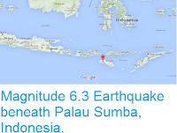
The Pusat Vulkanologi dan Mitigasi Bencana Geologi (Center for Vulcanology and Geological Disaster Mitigation) has raised the alert level around Mount Lewotolo, a stratovolcano (cone-shaped volcano made up of layers of ash and lava) on the north part of Lembata Island, one of the Lesser Sunda Islands of Indonesia. The volcano has been producing low levels of emissions since the beginning of August 2017, with small plumes rising as much as 600 m above the summit of the 1423 m volcano. On Monday 9-Tuesday 10 October a series of small earthquakes were recorded between 10 and 30 km beneath the volcano, with the largest event having a Magnitude of 4.9, and triggering a series of small rockfalls that have damaged several homes. Seismic activity beneath volcanoes can be significant, as they are often
caused by the arrival of fresh magma, which may indicate that a volcano
is about to undergo an eruptive episode, and people living within 2 k of the volcano have been evacuated as a precaution.
The approximate location of Mount Lewotolo. Google Maps.
Lembata sits on the northern part of the Timor Microplate; a small
fragment of crust caught between the Banda Sea Plate to the north and
the Australian Plate to the south. Both these other plates are
subducting beneath the Timor Plate, and as they sink into the Earth,
melted by the friction and the heat of the planets interior. Some of
this melted material then rises through the overlying plate, fuelling the
volcanoes of Flores, Timor and the neighbouring islands.
The subduction zones beneath the Timor Microplate. Hamson (2004).
See also...
Follow Sciency Thoughts on Facebook.


