Barren Island, an uninhabited volcanic island belonging officially to
India's Andaman Islands (making it India's only active volcano), began erupting on, or shortly before, 25 September 2018, when the Middle InfraRed Observation of Volcanic Activity (MIROVA) monitoring system, which uses data from the Moderate-Resolution Imaging Spectroradiometer (MODIS) system on the Terra (EOS AM) and Aqua (EOS PM) satellites detected a thermal anomaly on the northwest flank of the cone, interpretted as a recent lava flow. Since then images from the Sentinal Satetellite system have shown lava flows reaching the sea on the island, and a visit to the volcano by a boat from tour company Andaman Aquaholics has directly witnessed this flow.
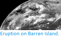
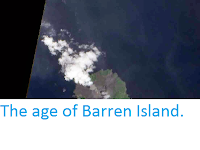
Eruption on Barren Island on 23 October 2018, as imaged by the Sentinal Satellite system. European Space Agency.
Barren Island is about 100 km to the east of the main Andaman Island group and about 450 km west of the coast of southern Myanmar. The island is about 3 km in diameter and rises 354 m above sea level. It is the only active volcano in the region, though it forms part of a group with a number of dormant volcanoes including Narcondam Island and Alcock and Sewell seamounts.
Lava flow on Barren Island on 20 October 2018. Andaman Aquaholics.
The
volcanoes sit on the Burma (or Burmese) Plate, a small tectonic plate
underlying the Andaman Islands, part of the eastern Indian Ocean and the
western part of Sumatra. To the west of the Andaman Islands this plate
is being subducted beneath the Indian Plate, but to the east the
situation is more complex. The Burma Plate is being pushed northward
relative to the Eurasia and the Sunda Plate (which underlies eastern
Sumatra, Java, southern Southeast Asia, most of Borneo and the western
Philippines) by the northward movement of the Indian Plate, but there is
an area of seafloor spreading beneath the Andaman Sea (separating the
Andaman Islands from Southeast Asia), which in turn causes stresses
within the Burma Plate, leading to a zone of faulting upon which the
volcanic islands and seamounts are situated.
(Left) The movement of the Burma and surrounding plates. Sheth et al. (2011) (Right) Tectonic stresses within and around the Burma Plate. Renjith (2013).
See also...
Follow Sciency Thoughts on Facebook.


