Sunday, 29 January 2017

Siamogale melilutra: A new species of Otter from the Late Miocene of Yunnan Province, China.

Otters, Lutrinae, are medium-to-large, semi-aquatic members of the Weasel Family, Mustelidae, found across Eurasia and the Americas. They have a fossil record dating back to the Middle Miocene, though many fossil specimens assigned to the group are highly fragmentary, making it difficult to distinguish them from Badgers, Melinae, which are closely related and similar in size.

In a paper published in the Journal of Systematic Palaeontology on 22 January 2017, a team of scientists led by Xiaoming Wang of the Department of Vertebrate Paleontology at the Natural History Museum of Los Angeles County, the Division of Paleontology at the American Museum of Natural History and the Institute of Vertebrate Paleontology and Paleoanthropology of the Chinese Academy of Sciences, describe a new species of Otter from the Late Miocene Shuitangba Lignite Beds of Yunnan Province, China.

The new species is placed in the genus Siamogale, which has previously been described from the Middle Miocene of Thailand, given the specific name  melilutra, meaning 'Badger-Otter', it showing a number of traits intermediate between the two groups. The species is described from a partially crushed skull, which has most of the component bones present and in  approximately the right relative positions, but has been disarticulated by the pressure that crushed it. A number of other specimens are referred to the species, including portions of skulls, jawbones and some isolated limb bones.

Cranium of Siamogale melilutra  from Shuitangba, in (A) right lateral, and (B) dorsal views. Wang et al. (2017).

The skull is 205 mm in length, but allowing for the fact that it has been crushed, Wang et al. reconstruct it having been 196 mm in length in life. Siamogale melilutra shows a number of Badger-like characters, particularly in the structure of the molars and the absence of a sharply narrowed postorbital region of the neurocranium, but a greater number of Otter-like characters, such as a short rostrum and large infraorbital canal, ventral extension of the mastoid process beyond the level of the auditory meatus, the mastoid process separated by a broad shelf from the paroccipital process, an anterior position of inion relative to the lambdoid crest, a straight zygomatic arch, robust and short premolars with strong cingula, a short forth premolar and a square first premolar.

Digitally restored cranium of Siamogale melilutra from Shuitangba, plus a separate right mandible (in C only). (A) Ventral, (B) dorsal, (C) right lateral, (D) anterior oblique, (E) posterior and (F) anterior views. Wang et al. (2017).

See also...

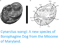
http://sciencythoughts.blogspot.co.uk/2016/12/machairodus-horribilis-new-excepionally.htmlhttp://sciencythoughts.blogspot.co.uk/2016/08/cynarctus-wangi-new-species-of.html
http://sciencythoughts.blogspot.co.uk/2016/04/understanding-role-of-bears-in-enabling.htmlhttp://sciencythoughts.blogspot.co.uk/2016/04/a-haplocyonine-amphicyonid-from-early.html
http://sciencythoughts.blogspot.co.uk/2016/04/lycaon-pictus-african-hunting-dogs.htmlhttp://sciencythoughts.blogspot.co.uk/2015/11/possible-sexual-dimorphism-in-late.html
Follow Sciency Thoughts on Facebook.

Saturday, 28 January 2017

Rhagovelia caudata & Rhagovelia bisinuata: Two new species of Riffle Bug from Vietnam.

Riffle Bugs, Veliidae, are small, aquatic, carnivorous Hemipteran Insects related to Water Striders. members of the genus Rhagovelia are found around the world, though they are at their most diverse in the Indo-Australian region, with 30 species known on each of the Philippines, Borneo, Sulawesi, and New Guinea. However a much lower diversity has been recorded on the nearby Southeast Asian mainland, with eight species recorded in Thailand, five in Peninsula Malaysia, four in Vietnam, two in Laos and none in Cambodia, though this may be due to limited recording in these areas rather than a lower diversity.

In a paper published in the Raffles Bulletin of Zoology on 27 December 2016, Nguyễn Xuân Quýnh and Trần Anh Đức of the Department of Invertebrate Zoology at the Hanoi University of Science describe two new species of Rhagovelia from Vietnam.

The first new species is named Rhagovelia caudata, where 'caudata' refers to orange markings found on the abdomens of both sexes. The species was found in Nghe An, Dien Bien, Lai Chau, Ha Giang, Phu Tho, and Thanh Hoa provinces. These Bugs are small, with males reaching 2.47–2.75 mm and females reaching 2.66–3.00 mm. They are black in colour, with orange-brown and yellow markings.

Rhagovelia caudata, (1) male, (2) female. Nguyễn & Trần (2016).

The second new species is named Rhagovelia bisinuata, where 'bisinuata' refers  to the parameres of the males (part of the reproductive apparatus) which are sinuate (wavy) in form. The species was found in Nghe An, Lao Cai, Ha Giang, Vinh Phuc, Phu Tho, and Ha Tinh provinces. Males of this species reach 3.00–3.35 mm in legth and females 3.05–3.50 mm. The Bugs are black in colour, with yellow and brown markings.

Rhagovelia bisinuata, (3) male, (4) female. Nguyễn & Trần (2016).

See also...

http://sciencythoughts.blogspot.co.uk/2016/07/hairy-cicadas-from-middle-jurassic.htmlhttp://sciencythoughts.blogspot.co.uk/2016/02/monecphora-broomfieldi-monecphora.html
http://sciencythoughts.blogspot.co.uk/2015/10/dysmicoccus-lavandulae-lavender.htmlhttp://sciencythoughts.blogspot.co.uk/2015/04/a-new-species-of-leafhopper-from-yunnan.html
http://sciencythoughts.blogspot.co.uk/2015/04/restharrow-dwelling-aphid-from-france.htmlhttp://sciencythoughts.blogspot.co.uk/2015/02/sixteen-new-species-of-scale-insects.html
Follow Sciency Thoughts on Facebook.

Magnitude 2.4 Earthquake in Argyll & Bute, Scotland.

The British Geological Survey recorded a Magnitude 2.4 Earthquake at a depth of about 11 km about 2 km to the southwest of the village of Lephinmore in Argyll and Bute, Scotland, at about 4.35 pm GMT on Tuesday 24 January 2017. This was not a major event, and presented no threat to human life or property, but was felt locally. This was followed by a second Earthquake with a Magnitude of 1.4 in approximately the same area slightly less than 24 hours later, which was also felt.

The approximate location of the 24 January 2017 Lephinmore Earthquake. Google Maps.

Earthquakes become more common as you travel north and west in Great Britain, with the west coast of Scotland being the most quake-prone part of the island and the northwest of Wales being more prone  to quakes than the rest of Wales or most of England.

The precise cause of Earthquakes in the UK can be hard to determine; the country is not close to any obvious single cause of such activity such as a plate margin, but is subject to tectonic pressures from several different sources, with most quakes probably being the result of the interplay between these forces.

Britain is being pushed to the east by the expansion of the Atlantic Ocean and to the north by the impact of Africa into Europe from the south. It is also affected by lesser areas of tectonic spreading beneath the North Sea, Rhine Valley and Bay of Biscay. Finally the country is subject to glacial rebound; until about 10 000 years ago much of the north of the country was covered by a thick layer of glacial ice (this is believed to have been thickest on the west coast of Scotland), pushing the rocks of the British lithosphere down into the underlying mantle. This ice is now gone, and the rocks are springing (slowly) back into their original position, causing the occasional Earthquake in the process. 

(Top) Simplified diagram showing principle of glacial rebound. Wikipedia. (Bottom) Map showing the rate of glacial rebound in various parts of the UK. Note that some parts of England and Wales show negative values, these areas are being pushed down slightly by uplift in Scotland, as the entire landmass is quite rigid and acts a bit like a see-saw. Climate North East.

Witness accounts of Earthquakes can help geologists to understand these events, and the structures that cause them. If you felt the 24 January quake, or were in the area but did not (which is also useful information) then you can report it to the British Geological Survey here, or if you felt the 25 January  or were in the area but did not (which is also useful information) then you can report it to the British Geological Survey here.

See also...

http://sciencythoughts.blogspot.co.uk/2016/03/magnitude-13-earthquake-off-west-cost.htmlhttp://sciencythoughts.blogspot.co.uk/2015/12/magnitude-14-earthquake-on-kintyre.html
http://sciencythoughts.blogspot.co.uk/2015/06/magnitude-14-earthquake-off-isle-of.htmlhttp://sciencythoughts.blogspot.co.uk/2015/04/magnitude-15-earthquake-in-argyll-and.html
http://sciencythoughts.blogspot.co.uk/2015/03/magnitude-14-earthquake-on-isle-of-mull.htmlhttp://sciencythoughts.blogspot.co.uk/2015/03/magnitude-10-earthquake-close-to-holy.html
Follow Sciency Thoughts on Facebook.

Homes abandoned after landslide in San Mateo County, California.

Three homes have had to be abandoned after a landslide at La Honda in San Mateo County, California this week. Home owners started to notice cracks in walls on Monday 23 January 2017, which grew during the next two days, till the road beneath the properties buckled on Wednesday 25 January. The properties have been red tagged (declared unsafe for habitation) by local authorities, leaving the homeowners unclear as to their future.

One of the properties in La Honda, California, that has been declared unsafe following a landslide this week. Aaron Kinney/Bay Area News Group.

The La Honda area is notoriously prone to landslips, which have apparently been happening for the last few thousand years, despite the overall relief of the area being  quite low. These typically involve blocks of topsoil moving downslope after rainfall events, rather than deeper rock-events triggered by the state's complex seismic situation.

This week's incident happened after several weeks of heavy rainfall and winter storms that have affected much of California, with almost a meter of rain having fallen in the La Honda area already this month, and states of emergency being declared in 50 of the state's 58 counties. Landslides are a common problem after severe weather events, as excess pore water pressure can overcome cohesion in soil and sediments, allowing them to flow like liquids. Approximately 90% of all landslides are caused by heavy rainfall.

 Road below the houses damaged by the January 2017 La Honda landslip. Josie Lepe/Bay Area News Group.

California has been battered by a succession of Pacific storms this winter, bringing widespread flooding and triggering a number of landslip and subsidence events. This is due to exceptionally high temperatures over the Pacific Ocean off the coast of the state this year due to a La Niña weather system over the southern Pacific; ocean storms form due to heating of air over the sea, as the air is heated the the air pressure drops and the air rises, causing new air to rush in from outside the forming storm zone. If this zone is sufficiently large, then it will be influenced by the Coriolis Effect, which loosely speaking means the winds closer to the equator will be faster than those further away, causing the storm to rotate, clockwise in the northern hemisphere and anticlockwise in the southern hemisphere.

Whilst the high winds associated these storms is extremely dangerous, the real danger from such storms is often the flooding. Each millibar drop in air pressure can lead to a 1 cm rise in sea level, and large storms can be accompanied by storm surges several meters high. This tends to be accompanied by high levels of rainfall, caused by water picked up by the storm while still at sea, which can lead to flooding, swollen rivers and landslides; which occur when waterlogged soils on hill slopes lose their cohesion and slump downwards, over whatever happens to be in their path.

 The approximate location of the January 2017 La Honda landslip. Google Maps.

The La Niña weather system is the opposite of the El Niño weather system, in which unusually cold surface temperatures spread across the equatorial Pacific from the upwelling zone on the South American coast. This traps warm water from the western Pacific, preventing it from spreading east and warming the central Pacific. This leads to lower evaporation over the (cooler) east Pacific, leading to low rainfall on the west coast of South America, and higher evaporation over the (warmer) west Pacific, leading to higher rainfall over East and Southeast Asia and northern Australia.

 The effects of a La Niña weather system in December-February. NOAA.

This also leads to a breakdown in surface circulation in the North Pacific, which generally rotates clockwise, so that the same body of water stays off the coast of California, where it is constantly warmed by the Sun, leading to high levels of evaporation and onshore winds that bring high rainfall and flood events to the state.

The effect of the La Niña weather system on the weather of North America. NOAA.

See also...

http://sciencythoughts.blogspot.co.uk/2015/05/magnitude-41-earthquake-in-napa-county.htmlhttp://sciencythoughts.blogspot.co.uk/2015/04/magnitude-36-earthquake-in-contra-costa.html
http://sciencythoughts.blogspot.co.uk/2015/03/woman-killed-in-cliff-collapse-at-point.htmlhttp://sciencythoughts.blogspot.co.uk/2014/08/over-150-injured-after-earthquake-in.html
http://sciencythoughts.blogspot.co.uk/2014/01/magnitude-45-earthquake-in-northern.htmlhttp://sciencythoughts.blogspot.co.uk/2013/10/magnitude-26-earthquake-in-northeast.html
Follow Sciency Thoughts on Facebook.

Wildfires kill at least eleven in Chile.

At least eleven people, including at least five fire fighters and two police officers, have died in a series of wildfires sweeping across central and southern Chile in the last week. Around 230 000 km² of forests have been destroyed in about a hundred different fires, which have encroached on cities such as Constitucion and Valparaiso, though the worst fires have affected rural areas in O'Higgins and El Maule regions. Chile has been sent additional fire-fighting teams by France, Russia, the United States and Peru, with teams from Mexico and Colombia expected to join them later this week.

Homes being destroyed by wildfires in Valparaiso, Chile. Rodrigo Garrido/Reuters.

Chile typically suffers a long dry summer, which can lead to fires on the country's grasslands and forests, and this year's summer has been exceptionally dry, due to a developing La Niña weather system over the southern Pacific, which brings drier conditions in Peru and Chile, however authorities in Chile have speculated that some of the fires may have been deliberately set.

The remains of the town of Santa Olga, which was largely destroyed by the fires. CNN.

The La Niña weather system is the opposite of the El Niño weather system, in which unusually cold surface temperatures spread across the equatorial Pacific from the upwelling zone on the South American coast. This traps warm water from the western Pacific, preventing it from spreading east and warming the central Pacific. This leads to lower evaporation over the (cooler) east Pacific, leading to low rainfall on the west coast of South America, and higher evaporation over the (warmer) west Pacific, leading to higher rainfall over East and Southeast Asia and northern Australia.

The effects of a La Niña weather system in December-February. NOAA.

See also...

http://sciencythoughts.blogspot.co.uk/2016/12/magnitude-76-earthquake-on-south-coast.htmlhttps://blogger.googleusercontent.com/img/b/R29vZ2xl/AVvXsEhTu2yRzzLWnUksznZM59kU_xA0mJH93fIn1R7jCS7K2yslaijg1fiIMKvqPYgBl0NGHoF250WDrYabV2Wq2PDPAV2nP55bIuwdeRFf6K-muZhxEpJ_YNxCyTqXU1QI1QoAOB-fSbnUYi8/s200/Magnitude+5.5+Earthquake+in+central+Chile..png
http://sciencythoughts.blogspot.co.uk/2015/11/magnitude-68-earthquake-in-central-chile.htmlhttp://sciencythoughts.blogspot.co.uk/2015/10/eruption-on-mount-lascar-northern-chile.html
http://sciencythoughts.blogspot.co.uk/2015/10/eruption-on-mount-copahue.htmlhttp://sciencythoughts.blogspot.co.uk/2015/09/fourteen-confirmed-deaths-after.html
Follow Sciency Thoughts on Facebook.

Asteroid 2017 BR5 passes the Earth.

Asteroid 2017 BR5 passed by the Earth at a distance of 811 000 km (2.11 times the average distance between the Earth and the Moon, 0.54% of the average distance between the Earth and the Sun), slightly before 5.30 am GMT on Sunday 22 January 2017. There was no danger of the asteroid hitting us, though had it done so it would have presented no threat. 2017 BR5 has an estimated equivalent diameter of 5-18 m (i.e. it is estimated that a spherical object with the same volume would be 5-18 m in diameter), and an object of this size would be expected to explode in an airburst (an explosion caused by superheating from friction with the Earth's atmosphere, which is greater than that caused by simply falling, due to the orbital momentum of the asteroid) in the atmosphere between 40 and 25 km above the ground, with only fragmentary material reaching the Earth's surface.

The calculated orbit of 2017 BR5. Minor Planet Center.
 three days after
2017 BR5 was discovered on 25 January 2017 (eight days before its closest approach to the Earth) by the Defense Advanced Research Projects Agency's Space Surveillance Telescope. The designation 2017 BR5 implies that it was the 142nd asteroid (asteroid R5) discovered in the second half of January 2017 (period 2017 B).

2017 BR5 is calculated to have a 833 day orbital period and an elliptical orbit tilted at an angle of 5.39° to the plain of the Solar System that takes it from 0.89 AU from the Sun (i.e. 89% of the average distance at which the Earth orbits the Sun) to 2.57 AU from the Sun (i.e. 257% of the average distance at which the Earth orbits the Sun, considerably more than at which the planet Mars orbits the Sun). It is therefore classed as an Apollo Group Asteroid (an asteroid that is on average further from the Sun than the Earth, but which does get closer). This means that the asteroid has occasional close encounters with the Earth, with the last having occurred in February 1949.

See also...

http://sciencythoughts.blogspot.co.uk/2017/01/asteroid-265482-2005-ee-passes-earth.htmlhttp://sciencythoughts.blogspot.co.uk/2017/01/asteroid-438955-2010-ln14-passes-earth.html
http://sciencythoughts.blogspot.co.uk/2017/01/asteroid-2017-as4-passes-earth.htmlhttp://sciencythoughts.blogspot.co.uk/2017/01/comet-c2016-u1-neowise-reaches.html
http://sciencythoughts.blogspot.co.uk/2017/01/fireball-over-arkhangelsk-region-of.htmlhttp://sciencythoughts.blogspot.co.uk/2017/01/osterplana-065-unique-meteorite-from.html
Follow Sciency Thoughts on Facebook.