
The China Earthquake Networks Center recorded a Magnitude 6.9 Earthquake at a depth of about 10 km, in Menyuan County, Qinghai Province, at about 1.45 am local time on Saturday 8 January 2022 (about 5.45 pm on Friday 7 January, GMT). This event was felt across much of northwest China; there are no reports of any damage or casualties at this time, although emergency rescue teams were mobilised in Qinghai and Gansu provinces as a precaution.

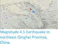
The approximate location of the 8 January 2022 Qinghai Province Earthquake. USGS.
Qinghai Province lies on the northeast of the Tibetan Plateau, a vast
upland created by the impact of India and Eurasia; Earthquake on the Tibetan
Plateau is due to the impact of India into Eurasia to the south. The Indian
Plate is moving northwards at a rate of 5 cm per year, causing it to
impact into Eurasia, which is also moving northward, but only at a rate
of 2 cm per year. The collision of the Indian and Eurasian plates has
led to the formation of the Himalayan Mountains, the Tibetan Plateau,
and the mountains of southwest China, Central Asia and the Hindu Kush. The 32 highest
mountains in the world are on the Plateau (the 33rd, Tirich Mir, is in
the nearby Hindu Kush, Afghanistan). India is still moving northwards,
but Eurasia is unable to do the same, resulting in an unusual degree of
folding and uplift. This has resulted in numerous faults running
east-west across the plateau, with sections being forced eastward into
China.

See also...


Follow Sciency Thoughts on Facebook.
Follow Sciency Thoughts on Twitter.