
The British Geological Survey recorded
a Magnitude 2.6 Earthquake at a depth of about 8 km off the east coast of Knapdale, in Argyll and Bute, Scotland, slightly before 7.20 pm British Summertime (slightly before 6.20
GMT) on Sunday 29 April 2017. This was followed by a second event with a Magnitude of 2.5 in roughly the same place at about 7.15 am British Summertime (about 6.15 am GMT) on Tuesday 2 May. These were not major events, and
presented no threat to human
life or property, but were felt in Tarbert, Achahoish, Ardrishaig, Minard, Clachan, Tayvallich, Srondoire, Lochgilhead, Portavadie, Colintraive, Isle of Gigha and Dunoon.

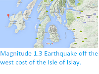
The approximate location of the 29 April & 5 May 2018 Knapdale Earthquaked. Google Maps.
Earthquakes
become more common as you travel north and west in Great Britain, with
the west coast of Scotland being the most quake-prone part of the island
and the northwest of Wales being more prone to quakes than the rest of
Wales or most of England.
Britain
is being pushed to the east by the expansion of the Atlantic Ocean and
to the north by the impact of Africa into Europe from the south. It is
also affected by lesser areas of tectonic spreading beneath the North
Sea, Rhine Valley and Bay of Biscay. Finally the country is subject to
glacial rebound; until about 10 000 years ago much of the north of the
country was covered by a thick layer of glacial ice (this is believed to
have been thickest on the west coast of Scotland), pushing the rocks of
the British lithosphere down into the underlying mantle. This ice is
now gone, and the rocks are springing (slowly) back into their original
position, causing the occasional Earthquake in the process.


(Top) Simplified diagram showing principle of glacial rebound. Wikipedia.
(Bottom) Map showing the rate of glacial rebound in various parts of
the UK. Note that some parts of England and Wales show negative values,
these areas are being pushed down slightly by uplift in Scotland, as the
entire landmass is quite rigid and acts a bit like a see-saw. Climate North East.
Witness
accounts of Earthquakes can help geologists to understand these events,
and the structures that cause them. If you felt the 29 April quake, or were in
the area but did not (which is also useful information) then you can
report it to the British Geological Survey here, or if you felt the 2 May event, or were in
the area but did not (which is also useful information) then you can
report it to the British Geological Survey here.
See also...


Follow Sciency Thoughts on Facebook.