Showing posts with label Fracking. Show all posts

Sunday, 16 October 2016

Selenium, arsenic and molybdenum in the Bowland Shale and related deposits in England, Wales and Ireland.

The Bowland Shale and other Carboniferous shale deposits in England, Wales and Ireland have received considerable interest from hydrocarbons exploration companies in recent years, due to the high levels of natural gas held within the deposits, which companies hope to exploit using hydraulic fracturing (fracking) a controversial technology which involves blasting the rock with high pressure water, chemicals and sand in order to fracture the rock and release the gas trapped within it. This technology has driven a boom in the gas industry in the US, but has been linked to a number of environmental problems, including the release of harmful trace elements such as arsenic and selenium from the shale deposits, which have in some cases then entered aquifers or other natural water sources. The organic geochemistry and radionuclide flux of the Bowland Shale have been studied, but to date no study has been made of the trace element geochemistry of these deposits, despite the fact that permits to exploit the gas have been issued, and a moratorium on the practice in one English county (Lancashire) has been overturned by the UK Government.

In a paper published in the journal Applied Geochemistry on 12 December 2015, John Parnell and Connor Brolly of the School of Geosciences at the University of Aberdeen, Sam Spinks, also of the School of Geosciences at the University of Aberdeen and of the CSIRO Mineral Resources Flagship at the Australian Resources Research Centre, and Stephen Bowden, also of the School of Geosciences at the University of Aberdeen, describe the results of a study of the Selenium, arsenic and molybdenum contents of the Bowland Shale of England and Wales and related deposits in Ireland, and the implications of this for the hydraulic fracturing industry and the wider environment.

Selenium is essential to animals and plants, but at higher levels becomes toxic. In humans, when consumed at levels higher than about 400 μm per day, selenium is neurotoxin and a carcinogen and can cause diabetes. Excess selenium in the environment has been linked to other fossil fuels, with problems recorded close to coal storage facilities, coal burning industries and oil refineries. In Ireland instances of selenium toxicity in farm animals have occurred where soils directly overlying black shale deposits have had raised levels of the metal due to leaching, and wells in parts of France have been abandoned after it was revealed that the water was enriched with selenium after coming into contact with black shale deposits. Further more hydraulic fracturing of the Barnett Shale in Texas has been directly linked to raised levels of selenium in local groundwater. Incidents of raised selenium in groundwater after hydraulic fracturing have also been reported in parts of Montana and the American southeast.

Arsenic is a more familiar toxin, and is found in many minerals, particularly sulphur compounds. Trace levels of arsenic are again important to animal life, but at higher levels it is extremely toxic, and is a major source of groundwater toxicity in many parts of the world. Raised arsenic levels in groundwater extracted from wells in Texas has also been reported following hydraulic fracturing of the Barnett Shale.

Molybdenum is another metalic element found in a range of minerals. It is essential to the metabolic processes of nitrogen-fixing Bacteria and essential to all multi-cellular life-forms at low levels, but again becomes toxic at higher levels. As with selenium, incidents of molybdenum toxicity have been recorded in Irish livestock grazing on soils directly overlying black shale deposits.

Parnell et al. examined 42 samples of shale taken from the Bowland and related shale deposits at seventeen sites, seven in England, one in Wales, one on the Isle of Man, and eight in Ireland. These were milled and treated with perchloric, nitric, hydrofluoric and hydrochloric acids to remove as much water from the samples as possible, then analysed by inductively coupled plasma-mass spectrometry to determine the trace element levels.

 Map of central British Isles, showing outcrop of Namurian rocks, region of Ordovician volcanic basement, sampled localities in Bowland Shale Formation, and localities for Se/As-rich oil residues. A, Altmush; B, Ballybunion; D, Dunshaughlin; E, Edale; H, Holywell; K, Killadysert; L, Co. Leitrim (Glenfarne, Thur Mountain); M, Poyllvaaish, Isle of Man; P, Pendle Hill and Earby; R, Walmsley Bridge; S, Loughshinny; T, Trough of Bowland; V, Lisdoonvarna; W, Whalley and Wiswell. Parnell et al. (2015).

The Carboniferous shale deposits of the UK and Ireland were found to have an average selenium level of 20.5 parts per million, with younger parts of the deposits having lower levels than older parts. This compares with average selenium levels in oil shales of about 13 parts per million; notably the Cretaceous black shales of Montana have average selenium levels of about 10 parts per million and the Cretaceous black shales of the souheasern United States only about 1 part per million, yet hydraulic fracturing of both has been linked to unsafe levels of selenium in groundwater.

Molybdenum levels in the shales were also notably high, with levels ranging from 20 to 70 parts per million, with one exception in the samples from Ballybunion in County Kerry, where levels reached 155 parts per million. In the case of molybdenum there appeared to be no correlation between molybdenum levels and the age of the deposits, though there is a correlation between molybdenum levels and organic carbon levels; this relationship has previously been recorded in the Barnett Shale of Texas, but the British and Irish shales show consistently far higher molybdenum levels than those from Texas.

Arsenic levels were also consistently higher in the British and Irish shales than in other shales studied, reaching a maximum of 52 parts per million in samples from Lancashire, with almost all samples exceeding the 8-9 parts per million typical of the Barnett Shale, hydraulic fracturing of which has again been linked to dangerously high arsenic levels in groundwater.

Parnell et al. strongly suspect that the high levels of selenium, molybdenum and arsenic in the Carboniferous black shales of Great Britain and Ireland are related to the Ordovician volcanic arc which cuts through the centre of the deposits and which would have been an important source of water run-off when the deposits were forming. Layers of tuff (volcanic ash) within the shale beds also suggest that the deposits may also have been subject to occasional bouts of fresh volcanic input as they were forming. Volcanic rocks and ash falls are known to be important sources of trace metals.

The presence of high levels of these elements in the Carboniferous shales of Britain and Ireland is of great concern if plans to exploit these shales go ahead, particularly as the elements are present at much higher levels than they are in American deposits where these elements have caused environmental problems. In theory a repeat of any such problems could be avoided with a sufficiently tight regulatory and monitoring system, but, particularly in the UK, it is unclear if the political will to implement this exists.

See also...
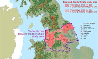
http://sciencythoughts.blogspot.co.uk/2013/06/the-british-geological-survey-reports.htmlThe British Geological Survey reports on Shale Gasses in the Bowland-Hodder Unit. Shale gasses have become an economically important source of hydrocarbons in the early twenty-first century, as other reserves have run low...
http://sciencythoughts.blogspot.co.uk/2012/04/report-recommends-fracking-should-be.htmlReport recommends Fracking should be allowed to continue in the UK.              Fracking, or Hydraulic Fracturing, is a process by which water, sand and chemicals are forced into buried sediments in order to shock them into...
http://sciencythoughts.blogspot.co.uk/2011/11/fracking-linked-to-earthquakes-in.htmlFracking linked to earthquakes in Lancashire, northeast England.                                           On Wednesday this week (2 November 2011) a report commissioned by petrochemical exploration company Cuadrilla Resources concluded that...
Follow Sciency Thoughts on Facebook.

Friday, 24 April 2015

Evaluating the role of hydraulic fracturing in causing the 2013-2014 Azle, Texas, Earthquakes.


In November 2013-January 2014 the United States Geological Survey recorded a series of 27 Earthquakes to the north of Azle and Reno in northeast Texas, the largest two of these events had Magnitudes of 3.6 and were widely felt across the region. This compares to one single recorded Earthquake in the previous 150 years in the area, and was widely linked to the practice of hydraulic fracturing (fracking) which has been used in the Newark East Gas Field since 2008. Geologists have known that hydrocarbons extraction can lead to seismic movements since at least the 1960s, and hydraulic fracturing, which involves blasting impermeable rocks with high pressure water, chemicals and sand to free oil and gas has been connected to a rise in Earthquake activity in Texas and other parts of the US. However correlation does not necessarily imply causation, and while in some cases fracking has been associated with a rise in seismic activity, in other instances the method has failed to produce any such affect. This has led many within the industry have strenuously denied that any connection between fracking and earthquakes, particularly as no mechanism by which the process could be causing the events has been established.

In a paper published in the journal Nature Communications on 21 April 2015, Matthew Hornbach and Heather DeShon of the Huffington Department ofEarth Sciences at Southern Methodist University, William Ellsworth of the United States Geological Survey, Brian Stump and Chris Hayward of the Huffington Department of Earth Sciences at Southern Methodist University, Cliff Frohlich of the Institute for Geophysics at the The University of Texas at Austin, Harrison Oldham, also of the Huffington Department of Earth Sciences at Southern Methodist University, Jon Olson of the Department of Petroleum and Geosystems Engineering at The University of Texas at Austin, Beatrice Magnani and Casey Brokaw, again of the Huffington Department of Earth Sciences at Southern Methodist University and James Luetgert, also of the United States Geological Survey, discuss the causes of the 2013-14 Azle Earthquakes, and the likelihood that these quakes were caused by hydrocarbons extraction in the region.

The study area forms part of the Fort Worth Basin, and is underlain by the deeply buried Newark East Fault Zone within the basement crystalline rocks (i.e. ancient volcanic rocks, underlying all sedimentary units in the basin), which comprises a primary fault dipping to the northwest at an angle of ~66˚-70˚, and a shallower conjugate fault dipping to the southeast at an angle of ~70˚-80˚. However there is no reason to believe that there has been any activity on this fault zone for millions of years. Only a single Earthquake had been recorded in the region prior to 2008 (and this is regarded as a somewhat unreliable record), and while there are some surface features in the region that appear to have been caused by ancient Earthquakes, they appear to be related to karstification (limestone being dissolved by percolating water) in the Ellenburger Aquifer.

The area has also been subject to increased changes in water level, both within Eagle Mountain Lake, a large local reservoir, and the shallow Trinity Aquifer. Both of these had suffered sharp drops in water level prior to the onset of seismic activity, and such changes have been linked to Earthquakes on other areas. However both of these are very shallow sources of geologic stress, and could not have caused significant pressure changes at the depths of the 2013-14 Earthquakes.

Natural and anthropogenic stress changes that may trigger earthquakes in the Azle area. Several natural and anthropogenic (man-made) factors can influence the subsurface stress regime resulting in earthquakes. Natural stress changes that promote earthquakes include intraplate stress changes related to plate tectonics and natural water table or lake levels variations caused by changing weather patterns or water drainage patterns with time, and in some instances (not pictured) the advance or retreat of glaciers. Anthropogenic stress changes that promote earthquakes include human generated changes to the water table (including dam construction) and industrial activities involving the injection or removal of fluids from the subsurface. The figure is not to scale. Hornbach et al. (2015).

Hydraulic fracturing is carried out from two wells in the area. Both pump fluids into the hydrocarbons-bearing deposits in bursts, then pump out a mixture comprising both the injected fluids and the desired hydrocarbons. The process generates a considerable amount of briny wastewater, which is disposed of by injection into the underlying Ellenburger Salt-water Aquifer. No correlation was found between pumping times and seismic activity, implying that the process was not directly causing the events.

However Hornbachet al. found that the closeness of the pumping activity to the inclined Principle Newark East Fault resulted in a situation that while the majority of the extraction was occurring to the northwest of the fault, the wastewater was being injected on the opposite, southeastern side of the fault, despite originating at the same point on the surface. This resulted in a steady increase in pressure across the fault zone, from the onset of drilling in 2008, which eventually expressed itself as a series of Earthquakes in 2013-14, as the fault moved to accommodate the changes in pressure.

Modelled pressure changes in the Ellenburger caused by injection and production. Map view of modelled excess pressures at a depth of ~2,500m for May 2009 (a), January 2010 (b), January 2011 (c) and December 2013 (d,e). The model uses average monthly reported water injection rates and the Dupuit–Theim equation to estimate bottom-hole pressure values. Pressure above hydrostatic averages 0.58MPa for injector well #1 and 0.28MPa for injector well #2 during injection.Ellenburgerpermeability is assumed constant at 5 ´ 10-14m2; boundary conditions are open along the side and closed at the top and bottom. We apply an average rate of brine production based directly on reported Texas Railroad Commission G-10 waterproduction values for the 70 largest water producing production wells in the region. The images show the system before injection (a) through the onset of seismicity (e). Black lines, the Newark East Fault Zone location at the top of the Ellenburger Formation; red squares, injector locations; pink arrows, approximate location of two large brine production wells that are located both near the faults and near reported earthquakes swarms within the Ellenburger (grey circles with white outlines). Note that the most significant amount of brine removal occurs along the fault trend (a). Hornbach et al. (2015).

This study therefore for the first time establishes a direct connection between the process of hydraulic fracturing and seismic activity in the Fort Worth Basin, and in addition establishes a method by which the industry could be seen to be directly causing Earthquake events. However by demonstrating how the events were being caused it also creates the potential to avoid such problems in future, through a better understanding of how the process is impacting the regional geology.

See also…

http://sciencythoughts.blogspot.co.uk/2014/05/magnitude-31-earthquake-in-snyder.htmlMagnitude 3.1 Earthquake in Snyder County, Texas.                                                                          The United States Geological Survey recorded a Magnitude 3.1 Earthquake at a depth of 4.5 km, roughly 7 km north of the city of Snyder in Scurry County..

http://sciencythoughts.blogspot.co.uk/2013/12/two-magnitude-33-earthquakes-in-parker.htmlTwo Magnitude 3.3 Earthquakes in Parker County, Texas.                                                        The United States Geological Survey recorded a Magnitude 3.3 Earthquake at a depth of 5 km, in northeastern Parker County, Texas, roughly 30 km...

Follow Sciency Thoughts on Facebook.

Saturday, 14 March 2015

Three workers killed by explosion on oil rig in Upton County, Texas.

Three workers have died following an explosion at an oil rig near Rankin in Upton County, Texas, on Tuesday 10 March 2015. The men have been named as Rojelio Salgado and Arturo Martinez Senior. and Arturo Martinez Junior, who are all understood to have been members of a single family, and to have been employed by Mason Well Service Ltd to carry out work on the Parsley Energy owned well. A fourth man working at the site was initially reported to have been injure, but is now understood to be unhurt. The incident is being investigated by the Upton County Sheriff's Office and Occupational Safety and Health Administration.

Fire at an oil rig in Upton County, Texas, following an explosion on 10 March 2015. Everything Glubbock.

The men are descried as having been part of a 'pulling unit', a work crew charged with removing tubing or drilling equipment from inside a borehole. Such teams are typically called in when there is an obvious problem with a well, such as a visible leak or a sudden drop in pressure at the wellhead. Since explosions at oil wells are typically caused when pressure overwhelms equipment at a well, it is likely that on this occasion the removal of equipment from within the drill-bore led also to the removal of a some form of obstruction within the well, leading to a sudden release of pressure.

The approximate location of the 10 March 2015 Upton County oil well explosion. Google Maps.

The oil wells of Upton and neighbouring counties of Texas access oils from the Permian Basin of Texas and New Mexico. These form part of the Mid-Continent Oil Producing Area, which was responsible for much of the US's oil production during the first half of the twentieth century. The Basin is now considered to be depleted, but still has known reserves of about 4 871 million barrels (774 400 000 m³) of oil, which are increasingly exploited by hydraulic fracturing, or fracking, a method which involves blasting subterranean strata with bursts of high pressure water and chemicals to break up rocks in order to free hydrocarbons, and other injection well drilling methods, techniques which involve pumping liquids into oil or gas bearing rocks to displace the hydrocarbons and make it easier to extract. These techniques have attracted criticism from many groups, as they are considered environmentally destructive, use large amounts of water and have been linked to increased seismic activities in areas where they are used.

The Permian Basin of Texas and New Mexico. Wikipedia.

See also...

Magnitude 3.1 Earthquake in Snyder County, Texas.
The United States Geological Survey recorded a Magnitude 3.1 Earthquake at a depth of 4.5 km, roughly 7 km north of the city of Snyder in Scurry...

Two killed by explosion at Texas drilling rig.
Two workers have been killed by an explosion at a drilling rig in an oilfield near Orla in Loving County, Texas, slightly before 8.00 am local time on Wednesday 30 April 2014. Nine other workers were treated for cuts and lacerations caused by flying shrapnel from the...

Cleanup operation underway in San Antonio, Texas, after fuel spill affects river.
A cleanup operation is underway in San Antonio, Texas, after aviation fuel spilled from a refinery reached a creek connected to the San Antonio River. The incident happened at the Calumet Specialty Products Partners refinery, at about 9.30 am on Saturday 12 April...


Follow Sciency Thoughts on Facebook.

Tuesday, 24 February 2015

Minor damage caused by Magnitude 5.0 Earthquake in Castilla-La Mancha region of Spain.

The United States Geological Survey recorded a Magnitude 4.0 Earthquake at a depth of 12 km, about 25 km to the southeast of the town of Tomelloso in the Castilla-La Mancha region of Spain slightly after 5.15 pm local time (slightly after 4.15 pm GMT) on Monday 23 February 2015. There are no reports of any injuries associated with this event, but it was felt over much of southern and central Spain, and there are a number of reports of minor damage to buildings.

The approximate location of the 23 February 2015 Castilla-La Mancha Earthquake.Google Maps.

Earthquakes are unusual in central Spain, and the event has been linked locally to the practice of oil extraction by hydraulic fracturing ('fracking'), which has been allowed in the area and which is known to have caused minor Earthquakes in other regions. Hydraulic fracturing, and other forms of injection well drilling, involve pumping high pressure water or other fluids into strata, which can lead to increased stress and lubrication upon faults in the area. However both the depth and the magnitude of this event suggest that fracking is unlikely to have been the cause on this occasion; a depth of 12 km is much deeper than that at which oil extraction occurs in the area, and while fracking has been attributed as a cause for quakes slightly over Magnitude 4.0 in the past (which can cause damage and occasionally injuries), the scale upon which Earthquakes is measured is logarithmic, so that a Magnitude 5.0 quake involves the release of ten times as much energy as a Magnitude 4.0 quake, which does not completely rule out fracking as a cause but suggests that if it is then this is a novel event not encountered before.

The quake is more likely to be related to Spain's location on the Iberian Peninsula and the natural tectonic stresses encountered there. Iberia is located on the extreme southwest of the Eurasian Plate, close to the margin with Africa, which is pushing into Europe from the south. At the same time there is a lesser area of geological expansion beneath the Bay of Biscay, pushing Iberia southwards. This leads to considerable tectonic stress in southern Spain, leading in turn to the occasional Earthquake.

See also...

The United States Geological Survey recorded a Magnitude 4.2 Earthquake at no significant depth roughly 30 km of the coast of the Province of...


Slightly after 7.05 am local time (which is GMT) on Thursday 8 August 2013, the United States Geological Survey recorded a Magnitude 4.2 Earthquake at a depth of 10 km, roughly 8 km off the north coast of Morocco...


On Thursday 10 January 2012, slightly before 12.30 am local time (slightly before 11.30 pm on Wednesday 9 January 2012, GMT), the United States Geological Survey recorded a Magnitude 3.5 Earthquake, at...


Follow Sciency Thoughts on Facebook.

Friday, 22 August 2014

Assessing the risks of cement casing failure at oil and gas wells in Pennsylvania.

Like other areas of the US, Pennsylvania has seen an increase in oil and gas production in recent years, driven by the expanded targeting of shale gas deposits using hydraulic fracturing (blasting water and chemicals into shale beds at high pressure to break up the shale and release any trapped gas) and directional drilling (drilling in any other direction than straight down; drill bores into shale gas beds often penetrate horizontally along the deposits for some distance). As in other areas this expansion has met with some concern, with residents of Pennsylvania particularly worried about the leakage of methane gas from wells into water supplies and the atmosphere. Methane is often cited as a more environmentally friendly fuel than coal, since burning it produces less of the greenhouse gas carbon dioxide, however methane is itself a powerful greenhouse gas, and if it leaks from wells into the atmosphere at even low levels then any environmental benefits of burning gas over coal are rapidly lost.

A drill rig at Roullette in Potter County, Pennsylvania, targeting the Marcellus Shale. Laurie Barr/Wikimedia Commons.

Raised methane levels have been found both in aquifers from which drinking water is drawn and in the atmosphere close to gas wells in Pennsylvania, strongly suggesting that there is a link between the methane levels and the drilling. One of the most likely ways in which this can happen is loss of integrity along the well bore due to failure of the cement casing, allowing methane to migrate along the borehole, into other strata or the atmosphere. Current regulations in Pennsylvania allow for low pressure leaks to be monitored and periodically bled off, but require that higher pressure leaks must be repaired, or if this is not possible the well must be permanently plugged; however such plugging, while likely to prevent further loss of gas from the wellhead into the atmosphere, may still allow subsurface migration of methane into other strata (including aquifers).

Clearly this makes the rate of failure in drill well cement casings in Pennsylvania a matter of great interest, however most previous studies of such well casings have concentrated on the structural integrity of offshore wells, with little direct relevance to the wells of Pennsylvania, other than the general observation that wells drilled during periods of rapid expansion in the industry are more likely to have problems, as are wells which are drilled in directions other than vertical. 

Data on the monitoring of structural integrity at wells in Pennsylvania is not publically available, however records Notices of Violations issued by the Pennsylvania Department of Environmental Protection are, and several studies on well integrity in the state have used these notices to try to estimate the rate of drill casing integrity failure there.

In a paper published in the Proceedings of the National Academy of Sciences of the USA on 30 June 2014, Anthony Ingraffea of the School of Civil and Environmental Engineering at Cornell University and Physicians, Scientists, and Engineers for Healthy Energy, Martin Wells of the Department of Statistical Sciences at Cornell University, Renee Santoro, also of Physicians, Scientists, and Engineers for Healthy Energy and Seth Shonkoff, again of Physicians, Scientists, and Engineers for Healthy Energy as well as the Department of Environmental Science, Policy, and Management at the University of California, Berkeley, describe the results of a study of the complete inspection records issued by the Pennsylvania Department of Environmental Protection for wells spudded (the spud date of a well is the day on which drilling begins) between 2000 and 2012.

Ingraffea et al. observe that Notices of Violation do not give a complete record of all leaks at well heads, as the inspection agency may not issue such a notice at a well where cement casing failure has been detected but remedial action is being taken by the drill operator, and that accessing the full inspection records for the wells should help to detect problems not identified by studies of Notices of Violation alone. They also not that problems with older wells are more likely to have been detected than problems with newer wells, as the older wells will have been inspected more times since their spud date, giving a better understanding of the full lifetime history of the well, and that many unconventional wells in Pennsylvania have been dug during a fairly recent boom, leading to a combination of two known high risk factors (wells dug during periods of rapid expansion within the industry and wells which deviate from the vertical) with shorter inspection records where problems are unlikely to have been detected.

Ingraffea et al. found that a total of 1.9% of all wells spudded in Pennsylvania between 2000 and 2012 suffered a loss of integrity. They further found that unconventional wells (i.e. wells targeting shale gas) were roughly six times as likely to suffer problems as conventional wells. The highest incidence of failure occurred in the northeast region of the state (Bradford, Cameron, Clinton, Lycoming, Potter, Sullivan, Susquehanna, Tioga, Wayne, and Wyoming counties) in wells targeting the Marcellus Shale spudded before 2009, with a failure rate of 9.84%. They further noted that wells drilled in the same area since 2009 had a failure rate of 9.18%, despite having a shorter inspection record (although wells spudded in 2012, which had an inspection record of less than 12 months when the study was carried out did have a significantly lower failure rate).

Map showing the extent and thickness of the Marcellus Shale beneath New York, Pennsylvania, Ohio and Virginia. Note the shale is thickest in the northeast. Marcellus Connection

The oldest unconventional well in the study was spudded in 2002, and unconventional wells remained a relatively small part of the industry in Pennsylvania until 2009. The rate of inspection also increased in 2009, with 76% of wells inspected in their first year prior to 2009, and 88.7% of wells inspected in their first year subsequently, which may partly account for the high rate of detected failure in post-2009 wells.

Wells in the northeastern counties were more prone to problems than wells in other areas, with 266 well failures recorded in the region, 52% of the total for the state. Within the northeastern region unconventional wells were 8.5 times more likely to have structural integrity problems than conventional wells. Unconventional wells in the northeastern counties had a 20% chance of problems within the first 3-4 years of operation, rising to 40% by year 7.

See also…


The United States Geological Survey recorded a Magnitude 3.4 Earthquake at a depth of 3.5 km in...


Fracking, or Hydraulic Fracturing, is a process by which water, sand and chemicals are forced into buried sediments in order to shock them into releasing trapped...


It emerged this week that hydraulic fracturing (fracking) has been in regular use in the oil fields of the Santa Barbara Channel off the coast of California since the late 1990s. There has been a moratorium on new drill...


Follow Sciency Thoughts on Facebook.

Tuesday, 24 December 2013

Two Magnitude 3.3 Earthquakes in Parker County, Texas.

The United States Geological Survey recorded a Magnitude 3.3 Earthquake at a depth of 5 km, in northeastern Parker County, Texas, roughly 30 km to the northwest of Forth Worth, slightly after 11.30 am local time (slightly after 5.30 pm GMT) on Sunday 22 December 2013. This was followed by a second quake with the same Magnitude, at a depth of 6.5 km and roughly 1 km to the north, slightly after 7.10 am local time (slightly after 1.10 pm GMT) on Monday 23 December. There are no reports of any damage or casualties relating to these events, though both were felt throughout the Fort Worth and Dallas areas.

The approximate locations of the 22 & 23 December 2013 Parker County Earthquakes. Google Maps.

Northern Texas has suffered a string of Earthquakes over the last two months, which some residents have linked to injection well drilling, (pumping liquids into oil or gas bearing rocks to displace the hydrocarbons and make it easier to extract), a process that has been linked to increased seismic activity in parts of the US and Europe. The Railroad Commission of Texas, which has responsibility for regulating the oil and gas industries in Texas, and pointing out that many of these quakes have occurred in areas where injection well drilling does not occur.

Northern Texas is affected by seismic activity on the Balcones, Mexia, Talco and Meers Fault systems, although not all of the recent quakes have been close to any of these structures, and any increase in seismic activity is likely to be viewed with concern by people living in the area. Several observers have noted that the much of the recent activity has been associated with the Barnett Shale, which underlies the Dallas and Fort Worth area, and which has become a focus for the natural gas industry in recent years. The Barnett Shale is considered to be a 'tight' reservoir (i.e. it does not give up its gas easily) and has largely been worked by the hydraulic fracturing (fracking) method, a form of injection well drilling that involves blasting liquids into a hydrocarbon-bearing formation at high pressure in order to break up the rock structures and release the gas, a process which has caused particular concern to environmentalists, who link the methodology not only to Earthquakes, but also to pollution of aquifers and excess use of water (a major concern in dry areas such as Texas).

The Texas Railroad Commissioner, David Porter, is to address a public meeting on the subject at Azle High School in Azle, in Tarrant County, Texas, at 5.00-7.00 pm on 2 January 2014, where local residents are likely to raise concerns. The Mayor of Azle, Alan Brundrett, has asked the commission to look specifically into the causes of Earthquakes affecting the town.

Witness accounts of quakes can help geologists to understand these events and the rock structures that cause them. If you felt these quakes (or if you were in the area but did not, which is also useful information) you can report it to the USGS here (for the 22 December event) or here (for the 23 December event).


Follow Sciency Thoughts on Facebook.
Saturday, 23 November 2013

Five workers injured in explosion at natural gas facility in Wyoming.

Five workers were injured in an explosion at an Encana Oil & Gas operated storage facility in the Jonah Basin Gas Field 55 km south of Pinedale in Sublette County, Wyoming, at slightly before 10.20 am local time (slightly before 7.20 pm GMT) on Friday 22 November 2013. One was airlifted to the University of Utah Medical Center by helicopter in what is described as a critical condition. Three were taken by ambulance to Pinedale Clinic, from where one was flown to the  University of Utah Medical Center and another was airlifted to the Eastern Idaho Regional Medical Center, while the third was treated and discharged. The final worker was taken from the scene of the accident to the Rock Springs Hospital, according to the Sublette County Sheriff's Department.

Areal photograph of the Jonah Basin Gas Field. A Land Out Of Time.

The precise cause of the incident is not clear at this time, though it is understood that maintenance work involving welding was being undertaken at the site prior to the incident The blaze was brought under control by firefighters and allowed to burn out, subsiding by 1.00 pm local time. A nearby drilling rig was unaffected by the incident.An investigation into the cause of the incident will now be carried out by the Occupational Safety and Health Administration.

The Jonah Basin Gas Field has been in operation since the mid-1990s. It is considered to be one of the US's richest shale gas fields, containing (at the time of discovery) around 300 000 million m³ of gas beneath a surface area of 85 km³. The gas is trapped within a series of stacked lenticular deposits of fluvial (river) origin, between about 1.5 and 2.5 km beneath the surface, and is obtained by using hydraulic fracturing (fracking) to break up the shale beds in which the shale beds in which the gas is held.

The approximate location of the 22 November 2013 Sublette County gas explosion. Google Maps.

Friday, 4 October 2013

Environment America reports on fracking in the USA.

Fracking, or Hydraulic Fracturing, is a process by which water, sand and chemicals are forced into buried sediments in order to shock them into releasing trapped hydrocarbons, which can then be extracted for commercial use. This has proved highly controversial with environmentalists, who accuse the process of causing Earthquakes, polluting groundwater, and using large amounts of fresh water.

Environment America is a federation of state-based, citizen-funded environmental advocacy organizations, which both engages in grassroots activities such as letter writing campaigns and organizing public meetings and more academic projects such as commissioning research into environmental issues. 

On Thursday 3 October 2013 the group published a report entitled Fracking by Numbers, which examines the environmental impact of the industry across the US, and makes a number of recommendations as to how both state and federal governments should regulate the industry. The report was authored by Elizabeth Ridlington of the Frontier Group (a US environmental thinktank) and John Rumpler of the Environment America Research & Policy Center.

Fracking is known to be taking place in 17 US states, with permits for over 800 000 wells having been granted since 2005 (how many of these have or will be developed is less clear). The industry is keen to expand into a number of other states.

Plays (areas where hydrocarbons are thought or known to accumulate) currently being exploited by the hydraulic fracturing industry, and those currently being targeted for future exploitation. Riddlington & Rumpler (2013).

Hydraulic fracturing has been widely associated with the contamination of both ground and drinking water. This can occur in a number of ways, including the direct leaking or spillage of chemicals used in the fracking process, well blowouts (in which drilling operations encounter unexpected pockets of pressurized gas, typically resulting in an explosion at the wellhead), migration of methane or other material from the reserve to aquifers and long term migration of wastewater at or beneath the surface (water used in the fracking is not typically returnable to normal use, having been contaminated both by chemicals added to it during the fracking process and from within the well). 743 such incidents have been reported in New Mexico, 340 in Colorado and 161 in Pennsylvania.

The process of pumping used water into strata deep below the surface, typically beds from which liquids have previously been extracted is considered particularly hazardous, due to the potential failure of subsurface structures which can result in contaminated water migrating to aquifers unseen, and the risk of changing the pressure within, and therefore mechanical properties of, these beds, which has been linked to an upsurge in seismic activity in a number of places. A number of incidents of the failure of water storage plants at the surface are also sighted, as well as several of frackers deliberately (and illegally) discharging contaminated water into the environment.

An open waste pit storing contaminated water from a hydraulic fracturing operation near Summit, Pennsylvania. The use of such pits is prohibited in most industries in the US, but fracking is currently exempt from such legislation. Riddlington & Rumpler (2013).


Fracking has also been linked to the creation of water shortages in a number of areas. The industry uses a large volumes of water and, as noted above,  this is seldom suitable for other purposes once it has been used. This creates a conflict of interest with other water users, which has left fames and communities without water in Texas and New Mexico. There have also been reports of frackers illegally draining water from natural sources which (in theory) were subject to legal protection.

The industry has also been widely associated with atmospheric pollution, both via the venting of gasses being extracted and fumes from chemicals used in the process. A number of volatile aromatic compounds have been recorded at or around sites where hydraulic fracturing occurs. Workers at sites have also been found to be found to be suffering from silicosis (miners lung), a disease in which silica particles (sand), which the body cannot expel, build up in the lungs, inhibiting breathing.

A number of health clinics in Pennsylvania have also reported patients showing signs of exposure to toxic substances, who refused to leave names and paid in cash. Public health officials suspect these may be employees in the hydraulic fracturing industry afraid to leave details in case it affects their jobs.

The industry is also associated with air pollution on a wider scale, including the production of large volumes of nitrogen oxides, which are a significant factor in smog formation, and significant emissions of greenhouse gasses. Natural gas (methane) has widely been promoted as a 'bridge fuel', something to use until better renewable sources become available which is less polluting than oil or coal. However methane is a powerful greenhouse, and studies have suggested that significant amounts of the gas extracted by hydraulic fracturing is lost to the atmosphere, one study in Utah indicating over 11% of the total gas was lost in this way, making the process considerably more polluting than coal, even before losses later in the supply chain, and the effects of carbon dioxide produced by burning the gas are taken into account.

Methane storage tanks, which can be a source of leeks adding to the industries environmental footprint. Riddlington & Rumpler (2013).

Fracking also has a notable effect on the landscape, with the process requiring a large area be flattened and cleared of vegetation to permit access of drilling equipment, as well as an extensive network of supporting roads etc., often in areas that have either been agricultural or completely unused by humans. This has obvious aesthetic implications, but also creates severe problems for wildlife, leading habitat fragmentation and reducing the area available to bird and mammal species that need large territories for successful reproduction. Companies are known to be seeking to expand their activities into a number of US National Parks, as well as other significant and iconic wilderness areas.

Wells and roads on the Jonah Gas Field in Wyoming. Riddlington & Rumpler (2013).

The industry also places considerable costs on local communities, which may not receive any benefits in return. The industry uses large vehicles, that will have a heavy impact on local roads that may not have been built to handle such traffic, and in many areas the arrival of the industry has been linked to a dramatic upsurge in traffic accidents. The arrival of large numbers of temporary workers in an area can place considerable strain on areas such as housing, often requiring increased investment to support the needs of local populations. There is also a danger of the industry leaving post-extraction environmental costs to local communities; this is in theory illegal, but in practice the companies involved can be liquidated in a number of ways, leaving shareholders with profits and local agencies with the cleanup bill.

The report makes a number of recommendations for both state and federal governments.

At state level the report recommends that state governments ban the process, or where it is already in use impose an immediate moratorium. Where states are not willing to do this they should allow cities, towns and counties to do so. States should also specifically ban the disposal of waste from the industry within their borders, to avoid becoming dumping grounds for waste created elsewhere.

At federal level it recommends the closing of a number of loopholes in environmental legislation that exempt the industry from regulations that other industries are bound by, particularly those relating to the disposal of hazardous waste, the protection of water supplies, the protection of national parks and other wilderness areas and the storage of wastewater in open pits. It also recommends that tighter financial assurance regulations be put in place, to prevent companies leaving cleanup costs to local communities.

See also Secret fracking off the coast of CaliforniaThe British Geological Survey reports on Shale Gasses in the Bowland-Hodder UnitGeological Society of London to host a public meeting on Shale Gas extractionReport recommends Fracking should be allowed to continue in the UK and Fracking linked to earthquakes in Lancashire, northeast England.

Follow Sciency Thoughts on Facebook.

Friday, 27 September 2013

Magnitude 2.8 Earthquake in Oklahoma County, Oklahoma.

The United States Geological Survey recorded a Magnitude 2.8 Earthquake at a depth of 5.4 km roughly 23 km northeast of Oklahoma City, slightly after 0.15 am local time (slightly after 5.15 am GMT) on Thursday 26 September 2013. This is a small quake, unlikely to cause any damage or casualties, but was felt across a wide area of central Oklahoma County.

The approximate location of the 26 September 2013 Oklahoma County Earthquake. Google Maps.

Oklahoma is naturally prone to Earthquakes, particularly in the southwest of the state, near the Meers Fault Zone, but since 2009 has suffered a sharp increase in the number of small quakes in the central and northeast parts of the state. While most of these quakes have been quite small, a few have been large enough to potentially cause problems, and any unexplained increase in seismic activity is a cause for concern. 

In a paper published in the journal Geology on 26 March 2013, a team of geologists led by Katie Keranen of the ConocoPhillips School of Geology and Geophysics at the University of Oklahoma linked one of the largest of these quakes, a Magnitude 5.7 event in November 2011 which caused damage locally and was felt across 17 states, to the practice of pumping liquids (usually brine) into injection wells, which is common in the hydrocarbons industry and used to displace oil or gas, which can then be extracted from nearby extraction wells (where this is done in bursts at pressure to intentionally break up rock it is called hydraulic fracturing, or fracking). Significantly they suggested that the practice could lead to quakes years or even decades after the actual injection.

Witness accounts of quakes can help geologists to understand these events and the rock structures that cause them. If you felt this quake (or if you were in the area but did not, which is also useful information) you can report it to the USGS here.


Follow Sciency Thoughts on Facebook.

Monday, 23 September 2013

Magnitude 2.7 Earthquake in Okfuskee County, Oklahoma.

The United States Geological Survey recorded a Magnitude 2.7 Earthquake at a depth of 5.0 km, roughly 1 km to the southeast of the Oknoname Reservoir in Okfuskee County, Oklahoma, slightly after 3.05 pm local time (slightly after 8.05 pm GMT) on Sunday 22 September 2013. This is not a large quake, and is unlikely to have caused any damage or casualties, but is was probably felt locally.

The approximate location of the 22 September 2013 Okfuskee County Earthquake. Google Maps.

Oklahoma is naturally prone to Earthquakes, particularly in the southwest of the state, near the Meers Fault Zone, but since 2009 has suffered a sharp increase in the number of small quakes in the central and northeast parts of the state. While most of these quakes have been quite small, a few have been large enough to potentially cause problems, and any unexplained increase in seismic activity is a cause for concern. 

In a paper published in the journal Geology on 26 March 2013, a team of geologists led by Katie Keranen of the ConocoPhillips School of Geology and Geophysics at the University of Oklahoma linked one of the largest of these quakes, a Magnitude 5.7 event in November 2011 which caused damage locally and was felt across 17 states, to the practice of pumping liquids (usually brine) into injection wells, which is common in the hydrocarbons industry and used to displace oil or gas, which can then be extracted from nearby extraction wells (where this is done in bursts at pressure to intentionally break up rock it is called hydraulic fracturing, or fracking). Significantly they suggested that the practice could lead to quakes years or even decades after the actual injection.

Witness accounts of quakes can help geologists to understand these events and the rock structures that cause them. If you felt this quake (or if you were in the area but did not, which is also useful information) you can report it to the USGS here.


Follow Sciency Thoughts on Facebook.

Magnitude 2.9 Earthquake in Payne County Oklahoma.

The United States Geological Survey recorded a Magnitude 2.9 Earthquake at a depth of 5.0 km roughly 2 km to the northeast of the town of Ripley in Payne County, Oklahoma, slightly after 11.35 pm local time on Saturday 21 September 2013 (slightly after 4.35 am on Sunday 22 September GMT). This is not a large quake, and is highly unlikely to have caused any damage or injuries, though a number of people reported feeling it in the north of Payne County.

The approximate location of the 21 September 2013 Payne County Earthquake. Google Maps.

Oklahoma is naturally prone to Earthquakes, particularly in the southwest of the state, near the Meers Fault Zone, but since 2009 has suffered a sharp increase in the number of small quakes in the central and northeast parts of the state. While most of these quakes have been quite small, a few have been large enough to potentially cause problems, and any unexplained increase in seismic activity is a cause for concern. 

In a paper published in the journal Geology on 26 March 2013, a team of geologists led by Katie Keranen of the ConocoPhillips School of Geology and Geophysics at the University of Oklahoma linked one of the largest of these quakes, a Magnitude 5.7 event in November 2011 which caused damage locally and was felt across 17 states, to the practice of pumping liquids (usually brine) into injection wells, which is common in the hydrocarbons industry and used to displace oil or gas, which can then be extracted from nearby extraction wells (where this is done in bursts at pressure to intentionally break up rock it is called hydraulic fracturing, or fracking). Significantly they suggested that the practice could lead to quakes years or even decades after the actual injection.

Witness accounts of quakes can help geologists to understand these events and the rock structures that cause them. If you felt this quake (or if you were in the area but did not, which is also useful information) you can report it to the USGS here.


Follow Sciency Thoughts on Facebook.

Monday, 16 September 2013

Magnitude 2.5 Earthquake in Van Buren County, Arkansas.

The United States Geological Survey recorded a Magnitude 2.5 Earthquake at a depth of 900 m in southern Van Buren County, Arkansas, slightly after 0.35 am local time (slightly after 5.35 am GMT) on Sunday 15 September 2013. This is a fairly small quake, and is unlikely to have caused any damage or injuries, but it was felt as far away as Conway, 35 km to the south.

The approximate location of the 15 September 2013 Arkansas Earthquake. Google Maps.

Central Arkansas has been suffering an ongoing series of Earthquakes that began in August 2010, and which collectively are referred to as the Guy-Greenbrier Earthquake Swarm. This has been linked to the use of Hydraulic Fracturing (Fracking) in the area, not directly by the process itself (which involves water, sand and chemicals are forced into buried sediments at considerable pressure in order to shock them into releasing trapped hydrocarbons, is often linked to Earthquakes), but by the practice of pumping waste water from the process into deep wells. 

The process was banned in the area in 2011, following recommendations from the United States Geological Survey, and two oil companies operating in the region, Chesapeake Energy and BHP Billiton reached an out of court settlement with local residents who claimed their homes had been affected by quakes caused by the process in August 2013.

Witness accounts of quakes can help geologists to understand these events and the rock structures that cause them. If you felt this quake (or if you were in the area but did not, which is also useful information) you can report it to the USGS here.


Follow Sciency Thoughts on Facebook.