Showing posts with label Fruili Earthquake.. Show all posts

Saturday, 4 July 2020

Magnitude 4.6 Earthquake beneath Big Island Hawai'i.

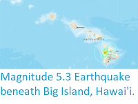
The United States Geological Survey recorded a Magnitude 4.6 Earthquake at a depth of 7.0 km beneath the eastern part of Big Island, Hawaii, at about 11.20 pm local time on Thursday 2 July 2020 (about 9.30 am on Friday 3 July GMT) . This was a large quake for Hawaii, and was felt across the entire of Big Island, as well as on the neighbouring islands of Maui, Kaho'olawe, Lāna'i, Moloka'i, O'ahu, and Kaua'i, though there are no reports of any injuries or damage associated with this event.

The approximate location of the 2 July 2020 Big Island Earthquake. USGS. 

The islands of Hawaii have formed as a result of hotspot volcanism, with the hotspot currently located under Big Island, Hawai'i, and each of the other islands being the result of previous activity from the same hotspot, with the oldest Islands in the northwest and newest in the southeast. A volcanic hotspot is an area where magma from deep inside the Earth is welling up through the overlying plate (in this case the Pacific) to create volcanism at the surface. Volcanoes move as they erupt, swelling as magma enters their chambers from bellow, then shrinking as that magma is vented as lava. The movements of a group of volcanoes close to one another can place considerable strain on layered rocks, and the islands of Hawai'i, and in particular Big Island, are very prone to Earthquakes, though these tend to be small and frequent rather than large, rare and destructive.

The position of the Hawai'i Hotspot relative to the islands of Hawai'i. Joel Robinson/USGS/Wikimedia Commons.

Witness accounts of quakes can help geologists to understand these events and the rock structures that cause them. If you felt this quake (or if you were in the area but did not, which is also useful information) you can report it to the USGS here

See also...

https://sciencythoughts.blogspot.com/2019/11/hawaiian-man-dies-after-falling-into.htmlhttps://sciencythoughts.blogspot.com/2019/05/californian-man-killed-by-shark-off.html
https://sciencythoughts.blogspot.com/2019/04/magnitude-53-earthquake-beneath-big.htmlhttps://sciencythoughts.blogspot.com/2018/07/tourists-injured-after-lava-bomb.html
https://sciencythoughts.blogspot.com/2018/05/hawaiian-man-injured-by-lava-bomb-from.htmlhttps://sciencythoughts.blogspot.com/2018/05/eruption-on-mount-kilauea-hawaii-leads.html
Follow Sciency Thoughts on Facebook.

Monday, 25 July 2011

Torino (Turin) rocked by mild earthquake; 25 July 2011.

Just after 2.30 pm local time the northern Italian town of Turin was rocked by a small earthquake. No casualties are reported, but some there was some damage to houses and other buildings, phone lines were briefly cut and train services around the city were suspended while engineers ascertained that the tracks were safe.

Earthquake Location
Map showing the location of the quake, from the United States Geological Survey.

The epicenter of the quake (point on the ground directly above the centre of the quake) appears to have been about 22 km northwest of the city, with the quake occurring at a depth of between 5 and 25 km. The quake lasted about 20 seconds, and had a magnitude of between 4.3 and 4.8 on the Richter Scale; not really severe, but quite alarming. The quake was felt across a wide area of Piedmont (the north-easternmost province of Italy, of which Turin is the capital) and south-western France.

Italy is among the most earthquake-prone countries in Europe, though the Piedmont area is not particularly noted in this respect. The country has a complex geology. Part of the country is located on the European Plate, and part on the Apulian (or Adriatic) Plate; a micro-plate that broke away from northern Africa during the Cretaceous, and is now sandwiched between the African and European Plates, being pushed further into Europe by the northward movement of Africa. The borders of the Apulian Plate form the Apennine Mountains of central Italy, the Southern Alps and the Dinaric Alps (on the Balkan Peninsula).
The Apulian Plate, sandwiched between Africa and Europe.


This has given Italy a history of Earthquakes that dates back to classical times, with some major quakes taking place in the north. Until the late twentieth century these often lead to major loss of life and widespread destruction, as few buildings were earthquake-proofed and there was little infra-structure to deal with the aftermath of natural disasters.

In 1976 a magnitude 6.4 earthquake hit the Friuli region on the Slovenian border, killing 989 people, injuring 2400 and making 157 000 homeless. This lead to the creation of the Dipartimento della Protezione Civile, the Italian agency responsible for predicting, preventing, mediating and clearing up after major disasters. (This was also the only major earthquake that I have ever been involved in, at the age of seven).


Italian language documentary about the 1976 Friuli Earthquake.