Showing posts with label Haiti. Show all posts

Wednesday, 7 June 2023

Four dead following Magnitude 4.9 Earthquake in Haiti.

The United States Geological Survey recorded a Magnitude 4.9 Earthquake at a depth of 10.0 km roughly 9 km to the northeast of the commune of Les Abricots on the northern side of the Tiburon Peninsula, Haiti, slightly after 5.10 am local time (slightly after 9.10 am GMT) on Tuesday 6 June 2023. Four people are known to have died following this event, and injuring more than 25, including several children. Three of the deceased are reported to be members of the same family, killed when their house collapsed. 

The approximate location of the 6 June 2023 Haiti Earthquake. USGS.

Haiti forms the western part of the island of La Hispaniola, in the Greater Antilles. The island has a complex geological structure, with parts of it lying on three different tectonic plates, and two plate margins running east-to-west across the island. The northernmost part of the island lies on the North American Plate. This is divided from the Gonâve Microplate by the Septentrional Fault Zone, which runs through Rio San Juan, along the north coast of the Dominican Republic and the Tiburon Peninsula of Haiti, then across the Windward Passage and along the south coast of Cuba. The Gonâve Microplate is moving east relative to the North American Plate, pushed by the Mid-Cayman Spreading centre to the west of Jamaica. To the south the Gonâve Microplate is separated from the Caribbean Plate by the Enriquilo-Plantain Garden Fault Zone, which runs across Southern Haiti and the Dominican Republic. To the west the fault runs through central Jamaica. The Caribbean Plate is rotating clockwise, effectively moving east relative to the Gonâve Microplate.

Plate movements and fault zones around the Gonâve Microplate. Mike Norton/Wikimedia Commons.

See also...

Follow Sciency Thoughts on Facebook.

Follow Sciency Thoughts on Twitter.


Saturday, 17 December 2022

Major Cholera outbreak in Haiti contributes to ongoing Humanitarian crisis.

Haiti is experiencing a resurgence of Cholera, with the outbreak initially reported on 2 October 2022 after more than three years with no reported cases of the disease, according to a press release issued by the World Health Organization on 13 December 2022. The epidemic appears to be evolving rapidly, and spreading to all parts of the country. There is also an ongoing complex humanitarian crisis that is rapidly deteriorating due to gang violence, socio-political conflicts, insecurity, fuel shortages, and economic instability. This has resulted in limited access to healthcare and essential services, including water, food, sanitation, and supply services. This situation makes the population of Haiti highly vulnerable to the ongoing Cholera outbreak.

Between 2 October and 6 December 2022, a cumulative total of 13 672 suspected Cholera cases, including 283 deaths (giving a case fatality rate of 2.05%) have been reported by the Haiti Ministry of Public Health and Population from all ten departments in the country. Eighty-six percent of all reported cases (11 751 people) have been hospitalised. The Ouest Department accounts for the highest percentage (89%) of suspected cases (12 112 individuals). Of the 13 672 suspected Cholera cases reported, 59% are male and the most affected age groups are children aged 1 to 4 years (19%), followed by adults aged 20 to 29 years (15%) and 30 to 39 years (15%).

A total of 1193 confirmed cases have been reported. Three departments account for 94% of these: Ouest (79% or 943 cases), Centre (13% or 156 cases), and Artibonite (2% or 28 cases). Laboratory confirmation was by rapid diagnostic test and stool culture was done for identification of Vibrio cholerae. Of the confirmed Cholera cases with available information, 57% (680) are male and the most affected age groups are those aged 1 to 4 years (19%) followed by 30 to 39 years (15%) and 5 to 9 years (14%).

Geographical distribution of suspected cholera cases (n=13 276) reported in Haiti, 29 September to 6 December 2022. Haiti Ministère de la Santé Publique et de la Population/World Health Organization.

By November 2022, a total of 368 suspected cases, including 14 confirmed cases and 14 deaths had been reported from the Port-au-Prince Prison. These cases are included among the cases reported in the Department of Ouest. Additionally, on 21 November 2022, the Ministry of Public Health of the Dominican Republic it had reported two confirmed imported cases of Cholera, both from Haiti.

Cholera was first reported in Haiti in October 2010. Nationally, a total of 820 000 cases of cholera including 9792 deaths were reported between October 2010 and February 2019. The last confirmed case in this outbreak was reported in January 2019 in I’Estère in the Artibonite Department of Haiti. The country did not report a single case of Cholera in the three years from January 2019 to January 2022. The current outbreak is also occurring in the context of a complex Humanitarian crisis that is exacerbating the burden of disease and hindering response measures.

Number of suspected Cholera cases (13 672) reported in Haiti from 2 October to 6 December 2022. Haiti Ministère de la Santé Publique et de la Population/World Health Organization.

Cholera is an acute enteric infection caused by ingesting the Bacterium Vibrio choleraea Gram-negative, comma-shaped Gammaproteobacteria, related to other pathogenic Bacteria such as Yersinia pestis (Bubonic Plague), and Esherchia coli (food poisoning), which present in contaminated water or food. It is mainly linked to insufficient access to safe drinking water and inadequate sanitation. It is an extremely virulent disease that can cause severe acute watery diarrhoea resulting in high morbidity and mortality, and can spread rapidly, depending on the frequency of exposure, the exposed population and the setting. Cholera affects both children and adults and can be fatal if untreated.

SEM image of Vibrio cholerae Bacteria. Kim et al. (2000).

The incubation period is between 12 hours and five days after ingestion of contaminated food or water. Most people infected with Vibrio cholerae do not develop any symptoms, although the Bacteria are present in their faeces for 1-10 days after infection and are shed back into the environment, potentially infecting other people. Among people who develop symptoms, the majority have mild or moderate symptoms, while a minority develop acute watery diarrhoea with severe dehydration. Cholera is an easily treatable disease. Most people can be treated successfully through prompt administration of oral rehydration solution.

Cholera can be endemic or epidemic. A Cholera-endemic area is an area where confirmed Cholera cases were detected during the last three years with evidence of local transmission (cases are not imported from elsewhere). A Cholera epidemic can occur in both endemic countries and in non-endemic countries. Uninfected dead bodies have never been reported as the source of epidemics.

The consequences of a humanitarian crisis – such as disruption of water and sanitation systems, or the displacement of populations to inadequate and overcrowded camps – can increase the risk of Cholera transmission, should the Bacteria be present or introduced.

A multi-sectoral approach including a combination of surveillance, improving access to clean water, sanitation, and hygiene promotion, rapid access to treatment, risk communication and community engagement and oral Cholera vaccines is essential to control cholera outbreaks and to reduce deaths.

The current cholera outbreak in Haiti, combined with the ongoing crisis related to gang violence, social unrest, and insecurity, has strained the health system’s response capacity. The overall risk for this outbreak in Hispaniola is assessed as very high, due to the current socio-economic situation, ongoing humanitarian crisis, food insecurity and poor health conditions are affecting a large proportion of the population, leaving them vulnerable to the risk of Cholera infection and recurrence of Cholera, the limited access of the general population to safe drinking water and to sanitation facilities, the violence and insecurity prevalent in many parts of Haiti, which leaves the public health system and international partners with limited human resources, reducing the capacity to respond to the crisis, and the lack of access to fuel and insecurity lead to difficulties to import supplies and challenges to access the affected areas.

These challenges further increase the risk of undetected cases and delayed response efforts. The insecurity and access to fuel hinders the population's access to health care, leading to delayed treatment and potentially severe outcome. Considering the magnitude and widespread nature of the Cholera epidemic that is ongoing in Haiti, in conjunction with the complex Humanitarian crisis the country is currently facing, the limited resources to control the epidemic, as well as the constant migration flows towards the Dominican Republic, the risk in Hispaniola is assessed as very high.

See also...

Follow Sciency Thoughts on Facebook.

Follow Sciency Thoughts on Twitter.


Tuesday, 25 January 2022

Magnitude 5.3 Earthquake beneath the Tiburon Peninsula, Haiti.

The United States Geological Survey recorded a Magnitude 5.1 Earthquake at a depth of 10.0 km roughly 4 km to the south of the commune of Anse-à-Veau on the northern side of the Tiburon Peninsula, Haiti, slightly after 8.15 am local time (slightly after 1.15 pm GMT) on Monday 24 January 2022. Two people are reported to have died in the incident, with dozens more injured and damage reported to hundreds of buildings. The initial event was followed by a number of significant aftershocks, including a Magnitude 5.1 Earthquake 50 minutes after the initial quake.

 
 The approximate location of the 24 January 2022 Haiti Earthquake. USGS.

Haiti forms the western part of the island of La Hispaniola, in the Greater Antilles. The island has a complex geological structure, with parts of it lying on three different tectonic plates, and two plate margins running east-to-west across the island. The northernmost part of the island lies on the North American Plate. This is divided from the Gonâve Microplate by the Septentrional Fault Zone, which runs through Rio San Juan, along the north coast of the Dominican Republic and the Tiburon Peninsula of Haiti, then across the Windward Passage and along the south coast of Cuba. The Gonâve Microplate is moving east relative to the North American Plate, pushed by the Mid-Cayman Spreading centre to the west of Jamaica. To the south the Gonâve Microplate is separated from the Caribbean Plate by the Enriquilo-Plantain Garden Fault Zone, which runs across Southern Haiti and the Dominican Republic. To the west the fault runs through central Jamaica. The Caribbean Plate is rotating clockwise, effectively moving east relative to the Gonâve Microplate.
 
Plate movements and fault zones around the Gonâve Microplate. Mike Norton/Wikimedia Commons.
 
See also...


Follow Sciency Thoughts on Facebook.

Follow Sciency Thoughts on Twitter.


Tuesday, 26 September 2017

Fifty nine confirmed deaths as Hurricane Maria sweeps across the Caribbean.

Fifty nine people have now been confirmed dead and a further thirty three are still missing after Hurricane Maria swept across the Caribbean this week. The hurricane hit the island of Dominica at about 9.35 pm local time on Monday 18 September 2017 as a Category Five tropical storm when it hit the Leeward Islands, with sustained winds in excess of 250 km per hour and gusts considerably stronger. The storm is known to have killed 27 people here, with another 27 still missing, and caused widespread devastation, with widespread flooding and many of the island's buildings destroyed.

Damage in Roseau, Dominica, following the passage of Hurricane Maria. Cetus News.

The storm passed to the southwest of the Leeward Islands, but still caused widespread problems there. The island of Guadeloupe was hit by winds in excess of 160 kilometres per hour and waves over six meters high, which led to two fatalities from a fishing boat off the island and widespread damage to buildings and farmland. The storm was also felt in the Lesser Antilles, with the island of Martinique hit by a storm surge, high winds and rains, which have caused extensive damage to crops and buildings and injured two people.

 Flooding on Guadeloupe on 19 September 2017, following the passage of Hurricane Maria. Frank Phazian/AP.

The storm hit Puerto Rico as a Category Four storm, with winds in excess of 210 km per hour and larger gusts. The storm caused widespread flooding on the island, including damage to a number of dams. Several coastal communities have been totally or nearly totally destroyed, and at least 24 people have died, with three people still missing on the island.

Damage to the Guajataca Dam in Puerto Rico, following the passage of Hurricane Maria. Alvin Baez/Reuters.

The storm passed to the northeast of the Dominican Republic, causing flooding and landslides that killed two people and destroyed around 110 homes. In neighbouring Haiti a further three people were killed. The Storm passed across the island of Saint Croix in the US Virgin islands,causing flooding and damage to buildings, and resulting in one fatality (due to a heart attack).

Flooding in the Dominican Republic on 20 September 2017. Erika Santlices/AFP/Getty Images.

Tropical storms are caused by the warming effect of the Sun over tropical seas. As the air warms it expands, causing a drop in air pressure, and rises, causing air from outside the area to rush in to replace it. If this happens over a sufficiently wide area then the inrushing winds will be affected by centrifugal forces caused by the Earth's rotation (the Coriolis effect). This means that winds will be deflected clockwise in the northern hemisphere and anti-clockwise in the southern hemisphere, eventually creating a large, rotating Tropical Storm. They have different names in different parts of the world, with those in the northwest Atlantic being referred to as hurricanes.

 The path and strength of Hurricane Irma. Thick line indicates the past path of the storm (till 9.00 pm GMT on Tuesday 26 September 2017), while the thin line indicates the predicted future path of the storm, and the dotted circles the margin of error at six and twelve hours ahead. Colour indicated the severity of the storm. Tropical Storm Risk.

Despite the obvious danger of winds of this speed, which can physically blow people, and other large objects, away as well as damaging buildings and uprooting trees, the real danger from these storms comes from the flooding they bring. Each drop millibar drop in air-pressure leads to an approximate 1 cm rise in sea level, with big tropical storms capable of causing a storm surge of several meters. This is always accompanied by heavy rainfall, since warm air over the ocean leads to evaporation of sea water, which is then carried with the storm. These combined often lead to catastrophic flooding in areas hit by tropical storms.

See also...

http://sciencythoughts.blogspot.co.uk/2017/09/magnitude-46-earthquake-to-northeast-of.htmlhttp://sciencythoughts.blogspot.co.uk/2017/09/hurricane-irma-kills-forty-two-in.html
http://sciencythoughts.blogspot.co.uk/2017/09/hurricane-irma-leaves-widespread.htmlhttp://sciencythoughts.blogspot.co.uk/2017/08/magnitude-48-earthquake-to-north-of.html
http://sciencythoughts.blogspot.co.uk/2017/05/shipping-warning-issued-after-eruption.htmlhttp://sciencythoughts.blogspot.co.uk/2017/03/magnitude-45-earthquake-to-north-of-st.html
Follow Sciency Thoughts on Facebook. 

Thursday, 7 September 2017

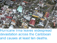
Hurricane Irma leaves widespread devastation across the Caribbean and causes at least ten deaths.

Ten people have now been confirmed dead on Caribbean islands hit by Hurricane Irma this week, with it likely that many more deaths are yet to be reported due to the extensive damage the storm has caused. Eight people are known to have died on the French half of the Island of St Martin, where the storm is reported to have levelled 95 % of all buildings. On the island of Barbuda about 90% of buildings have been flattened and a two-year-old child has been reported dead, while one death has been confirmed on the British island of Anguilla.

Damage left by Hurricane Irma on the Dutch part of the island of St Martin. Gerben Van Es/AFP/Getty Images.

Hurricane Irma was a Category 5 storm when it passed over the islands, with sustained winds in excess of 250 km per hour and gusts considerably stronger.  After passing over Barbuda, St Martin and Anguilla the storm swept across the British and US Virgin Islands, where it is likely to have caused further, as yet unreported, fatalities, then to the north of Peurto Rico, the Dominican Republic and Haiti, and is currently heading towards the Bahamas and Florida, where authorities have organised mass evacuations.

The path and strength of Hurricane Irma. Thick line indicates the past path of the storm (till 3.00 pm GMT on Thursday 7 September 2017), while the thin line indicates the predicted future path of the storm, and the dotted circles the margin of error at six and twelve hours ahead. Colour indicated the severity of the storm. Tropical Storm Risk.

Tropical storms are caused by the warming effect of the Sun over tropical seas. As the air warms it expands, causing a drop in air pressure, and rises, causing air from outside the area to rush in to replace it. If this happens over a sufficiently wide area then the inrushing winds will be affected by centrifugal forces caused by the Earth's rotation (the Coriolis effect). This means that winds will be deflected clockwise in the northern hemisphere and anti-clockwise in the southern hemisphere, eventually creating a large, rotating Tropical Storm. They have different names in different parts of the world, with those in the northwest Atlantic being referred to as hurricanes.

 Damage caused by Hurricane Irma on the French part of the island of St Martin. Rinsy Xing/AFP/Getty Images.

Despite the obvious danger of winds of this speed, which can physically blow people, and other large objects, away as well as damaging buildings and uprooting trees, the real danger from these storms comes from the flooding they bring. Each drop millibar drop in air-pressure leads to an approximate 1 cm rise in sea level, with big tropical storms capable of causing a storm surge of several meters. This is always accompanied by heavy rainfall, since warm air over the ocean leads to evaporation of sea water, which is then carried with the storm. These combined often lead to catastrophic flooding in areas hit by tropical storms.

See also...

http://sciencythoughts.blogspot.co.uk/2017/08/magnitude-48-earthquake-to-north-of.htmlhttp://sciencythoughts.blogspot.co.uk/2017/05/shipping-warning-issued-after-eruption.html
http://sciencythoughts.blogspot.co.uk/2017/03/magnitude-45-earthquake-to-north-of-st.htmlhttp://sciencythoughts.blogspot.co.uk/2016/12/magnitude-59-earthquake-off-coast-of.html
http://sciencythoughts.blogspot.co.uk/2016/10/hurricane-matthew-batters-haiti.htmlhttp://sciencythoughts.blogspot.co.uk/2015/08/tropical-storm-erika-kills-at-least-25.html
Follow Sciency Thoughts on Facebook.

Tuesday, 4 October 2016

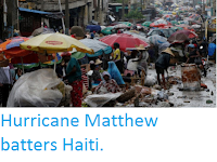
Hurricane Matthew batters Haiti.

One person has been confirmed dead and many more3 are unnaccounted for after Hurricane Matthew swept across Haiti on Monday 3 October 2916, The single cinfirmed fatality occured in the town of Port Salut, where a man described as too ill to be evacuated was swept away when a storm surge hit his home, but it is feared that many more could have died in remote communities on the west coast of the country. The country has reported extensive flooding, with the worst occuring around the towns of Les Cayes and Tiburon, where at least one major landslide has also been recorded. Landslides are a common problem after severe weather events, as excess pore water pressure can overcome cohesion in soil and sediments, allowing them to flow like liquids. Approximately 90% of all landslides are caused by heavy rainfall.

Raifall in Port-au-Prince during as Hurricane Matthew passed over Haiti on Monday 3 October 2016. Carlos Garcia Rawlins/Reuters.

Matthew was classed as a Catagory Four storm at the time when it hit Haiti (i.e. a storm with sustained winds in excess of 181 kilometers per hour), making it the most powerfull storm to make landfall in thre Caribbean for almost a decade, and is reported to have brought with it windspeeds of up to 230 kilometers per hour, as well as over a meter of  rianfall and significant storm surges. Around 340 000 people were evacuated from low-lying areas of Haiti ahead of the storm, and about 13 000 people from the neighbouring Dominican Republic. Evacuations are currently underway in Cuba, where the storm is expected to make landfallwithin the next 24 hours.

Floodwaters near Port-au-Prince during as Hurricane Matthew passed over Haiti on Monday 3 October 2016. Reuters.

Tropical storms are caused by the warming effect of the Sun over tropical seas. As the air warms it expands, causing a drop in air pressure, and rises, causing air from outside the area to rush in to replace it. If this happens over a sufficiently wide area then the inrushing winds will be affected by centrifugal forces caused by the Earth's rotation (the Coriolis effect). This means that winds will be deflected clockwise in the northern hemisphere and anti-clockwise in the southern hemisphere, eventually creating a large, rotating Tropical Storm. They have different names in different parts of the world, with those in the northwest Atlantic being referred to as hurricanes.

Despite the obvious danger of winds of this speed, which can physically blow people, and other large objects, away as well as damaging buildings and uprooting trees, the real danger from these storms comes from the flooding they bring. Each drop millibar drop in air-pressure leads to an approximate 1 cm rise in sea level, with big tropical storms capable of causing a storm surge of several meters. This is always accompanied by heavy rainfall, since warm air over the ocean leads to evaporation of sea water, which is then carried with the storm. These combined often lead to catastrophic flooding in areas hit by tropical storms.

See also...

http://sciencythoughts.blogspot.co.uk/2016/09/tropical-storm-hermine-makes-landfall.htmlTropical Storm Hermine makes landfall in Florida.                                                      Tropical Storm Hermine made landfall close to...
http://sciencythoughts.blogspot.co.uk/2015/08/tropical-storm-erika-kills-at-least-25.htmlTropical Storm Erika kills at least 25 in the Caribbean.                                                       At least 36 people are known to have died and over 50 more are...
http://sciencythoughts.blogspot.co.uk/2012/10/hurricane-sandy-causes-devastation-in.htmlHurricane Sandy causes devastation in Jamaica.                                               Hurricane Sandy, the eighteenth named tropical storm in the Caribbean this season, struck Jamaica five miles east of the capitol, Kingston, arriving from the...
Follow Sciency Thoughts on Facebook.