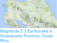
The United States Geological Survey recorded
a Magnitude 5.3 Earthquake at a depth of 19.1 km, on the northern Nicoya Peninsula in Guanacaste Province, Costa Rica, slightly after 1.40 am
local time (slightly after 7.40 pm GMT) on Friday 1 September 2017. There are no reports of
any damage or casualties associated with this event, but it was felt
across much of western Costa Rica.
The approximate location of the 1 September 2017 Nicoya Peninsula Earthquake. USGS.
Costa
Rica lies on the southern margin of the Caribbean Plate; to the south
of the country the Cocos Plate, which underlies part of the eastern
Pacific Ocean) is being subducted under the Middle American Trench,
passing under Central America as it sinks into the Earth's interior.
This is not a smooth process, and the plates often stick together until
the pressure builds up enough to force them to shift suddenly, causing
Earthquakes. As the Cocos Plate sinks deeper if is partially melted by
the friction and the heat of the Earth's interior. Some of the melted
material then rises up through the overlying Caribbean Plate, fuelling
the volcanoes of Central America.
Diagram showing the passage of the Cocos Plate beneath Costa Rica (not to scale). Carleton College.
Witness
accounts of Earthquakes can help geologists to understand these events,
and the structures that cause them. The international non-profit
organisation Earthquake Report is interested in hearing from people who may have felt this event; if you felt this quake then you can report it to Earthquake Report here.
See also...
Follow Sciency Thoughts on Facebook.


