
The United States Geological Survey
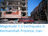
recorded a Magnitude 4.6 Earthquake at a depth of 10.0 km in Diyala Province, Iraq, close to the border with Iran, slightly after 11.15 pm local time (slightly after 8.15 pm
GMT) on Friday 26 January 2018. The event was felt in Baghdad, but there are no reports of any damage or casualties.

The approximate location of the 26 January 2018 Diyala Province Earthquake. USGS.
Iran is situated on the northern margin of the Eurasian Plate.
Immediately to the north lies the Arabian Plate, which is being pushed
northward by the impact of Africa from the south. This has created a
zone of faulting and fold mountains along the northesst border of the
country, known as the Zagros Thrust Belt. This compressing the rock layers close to the
surface and creates frequent Earthquakes, some of which can be very
large.

The movement of the Arabian Plate and extent of the Zagros Thrust Belt. Rasoul Sorkhabi/Geo ExPro.
Witness
accounts of Earthquakes can help geologists to understand these events,
and the structures that cause them. The international non-profit
organisation Earthquake Report is interested in hearing from people who may have felt this event; if you felt this quake then you can report it to Earthquake Report here.
See also...


Follow Sciency Thoughts on Facebook.