
The United States Geological Survey recorded
a Magnitude 5.3 Earthquake at a depth of 53.5 km roughly 49 km to the southeast of the towm of KImbe in West New Britain Province, Papua New Gunea, slightly after 1.45 am local time on Wednesday 12 February 2020 (slightly after 3.45 pm on Tuesday 11 February GMT). The event triggered a number of landslides, including one in Kimbe that killed a young couple and their child while all three were sleeping in their home.

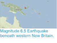
The aproximate location of the 12 February 2020 West New Britain Earthquake. USGS.
New Britain is located on the South Bismarck Plate, north of the Solomon Sea Plate, which is being subducted beneath it. The plates do not pass over one-another smoothly, but constantly stick together then break apart as the pressure builds up, causing Earthquakes in the process.

The subduction of the Solomon Sea Plate beneath New Britain. Oregon State University.
Witness
accounts of Earthquakes can help geologists to understand these events,
and the structures that cause them. The international non-profit
organisation Earthquake Report is interested in hearing from people who may have felt this event; if you felt this quake then you can report it to Earthquake Report here.
See also...


Follow Sciency Thoughts on Facebook.