Showing posts with label Alaskan Peninsula. Show all posts

Sunday, 16 July 2023

United States Geological Survey issues tsunami warning following Earthquake off the Alaska Peninsula.

The Alaska Earthquake Centre recorded a Magnitude 7.2 Earthquake at a depth of 32.6 km, to the south of the Alaska Peninsula, slightly before 10.50 pm on Saturday 15 July 2023, Alaskan Standard Time (slightly before 6.50 am on Sunday 16 July GMT). There are no reports of any damage or casualties associated with this event, but people have reported feeling it as far away as Anchorage, and the United States Geological Survey has issued a tsunami warning, due to the magnitude and shallow nature of the event.

The approximate location of the 15 July 2023 Alaska Earthquake. USGS.

Alaska lies on the North American Plate, with the Pacific Plate underlying the ocean to the south. The Aleutian Trench runs along much of the south coast of Alaska, with the Pacific Plate being subducted beneath this and passing under Alaska as it sinks into the Earth. Off the coast of southeast Alaska the Pacific and North American Plates pass one-another horizontally, with the Pacific Plate moving northward and the North American to the south (a transform plate margin). This is not a smooth process, and the plates frequently stick together, then break apart as the pressure builds up, causing Earthquakes.

How the subduction of the Pacific Plate beneath the North American Plate fuels the volcanoes of Alaska. Alaska Volcano Observatory.

Earthquakes along subductive margins are particularly prone to causing tsunamis, since these often occur when the overlying plate has stuck to the underlying plate, being pulled out of shape by its movement.. Eventually the pressure builds up to far and the overlying plate snaps back, causing an Earthquake and a tsunami. 

Simplified graphic showing tsunami generation along a convergent margin.NASA/JPL/CalTech.

Witness accounts of quakes can help geologists to understand these events and the rock structures that cause them. If you felt this quake (or if you were in the area but did not, which is also useful information) you can report it to the United States Geological Survey here.

See also...

Follow Sciency Thoughts on Facebook.

Follow Sciency Thoughts on Twitter.


Tuesday, 20 October 2020

Magnitude 7.5 Earthquake to the south of the Alaskan Peninsula.

The Alaska Earthquake Centre recorded a Magnitude 7.5 Earthquake at a depth of 30 km, about 156 km to the south of Perryville on the Alaskan Peninsula, slightly before 12.55 pm local time (slightly before 8.55 pm GMT) on Monday 19 October 2020. There are no reports of any damage or casualties associated with this event, but people have reported feeling it over a wide area of southern Alaska, and a tsunami warning was issued by the National Tsunami Warning Center, citing the possibility of a tsunami over a metre high reaching the Alaskan coast, although witnesses on the shore report that two such waves were seen, one reaching a maximum height of 60 cm, the other about 45 cm.

 
The approximate location of the 19 October 2020 Alaska Earthquake. USGS.

Alaska lies on the North American Plate, with the Pacific Plate underlying the ocean to the south. The Aleutian Trench runs along much of the south coast of Alaska, with the Pacific Plate being subducted beneath this and passing under Alaska as it sinks into the Earth. Off the coast of southeast Alaska the Pacific and North American Plates pass one-another horizontally, with the Pacific Plate moving northward and the North American to the south (a transform plate margin). This is not a smooth process, and the plates frequently stick together, then break apart as the pressure builds up, causing Earthquakes.

  
How the subduction of the Pacific Plate beneath the North American Plate fuels the volcanoes of Alaska. Alaska Volcano Observatory.

Earthquakes along subductive margins are particularly prone to causing tsunamis, since these often occur when the overlying plate has stuck to the underlying plate, being pulled out of shape by its movement.. Eventually the pressure builds up to far and the overlying plate snaps back, causing an Earthquake and a tsunami. 

 
Simplified graphic showing tsunami generation along a convergent margin.NASA/JPL/CalTech.

Witness accounts of quakes can help geologists to understand these events and the rock structures that cause them. If you felt this quake (or if you were in the area but did not, which is also useful information) you can report it to the United States Geological Survey here.

See also...


Follow Sciency Thoughts on Facebook.

Follow Sciency Thoughts on Twitter. 


Wednesday, 22 July 2020

Magnitude 7.8 Earthquake off the south coast of the Alaskan Peninsula.

The United States Geological Survey recorded a Magnitude 7.8 Earthquake at a depth of 28.0 km, off the south coast of the Alaskan Peninsula, slightly after 10.10 pm local time on Tuesday 21 July 2020 (slightly after 6.10 am on Wednesday 22 July GMT). There are no reports of any damage or casualties associated with this event, but people have reported feeling it over a wide area of southern Alaska, and a tsunami warning was initially issued.

The approximate location of the 21 July 2020 Alaska Earthquake. USGS.

Alaska lies on the North American Plate, with the Pacific Plate underlying the ocean to the south. The Aleutian Trench runs along much of the south coast of Alaska, with the Pacific Plate being subducted beneath this and passing under Alaska as it sinks into the Earth. Off the coast of southeast Alaska the Pacific and North American Plates pass one-another horizontally, with the Pacific Plate moving northward and the North American to the south (a transform plate margin). This is not a smooth process, and the plates frequently stick together, then break apart as the pressure builds up, causing Earthquakes.

Model of the subduction of the Pacific Plat beneath the North American Plate along the southern coast of Alaska and the Aleutians. USGS.

Earthquakes along subductive margins are particularly prone to causing tsunamis, since these often occur when the overlying plate has stuck to the underlying plate, being pulled out of shape by its movement.. Eventually the pressure builds up to far and the overlying plate snaps back, causing an Earthquake and a tsunami. 

 Simplified graphic showing tsunami generation along a convergent margin.NASA/JPL/CalTech.

Witness accounts of quakes can help geologists to understand these events and the rock structures that cause them. If you felt this quake (or if you were in the area but did not, which is also useful information) you can report it to the United States Geological Survey here. 

See also...

https://sciencythoughts.blogspot.com/2020/06/alaska-volcano-observatory-raises-alert.htmlhttps://sciencythoughts.blogspot.com/2020/01/eruption-on-mount-shishaldin-alaska.html
https://sciencythoughts.blogspot.com/2019/09/magnitude-52-earthquake-in-matanuska.htmlhttps://sciencythoughts.blogspot.com/2018/12/magnitude-70-earthquake-near-anchorage.html
https://sciencythoughts.blogspot.com/2018/03/eruption-on-mount-cleveland-alaska.htmlhttps://sciencythoughts.blogspot.com/2017/11/eruptive-activity-on-great-sisken-island.html
Follow Sciency Thoughts on Facebook.

Sunday, 13 November 2016

Magnitude 5.2 Earthquake beneath the Alaskan Peninsula.

The United States Geological Survey recorded a Magnitude 5.2 Earthquake at a depth of 11.4 km about 106 km to the northeast of Chignik Lake on the Alaskan Peninsula, slightly after 12.50 pm local time (slightly after 9.50 pm GMT) on Saturday 12 November 2016. There are no reports of any damage or casualties associated with this event, but people have reported feeling it locally.
 
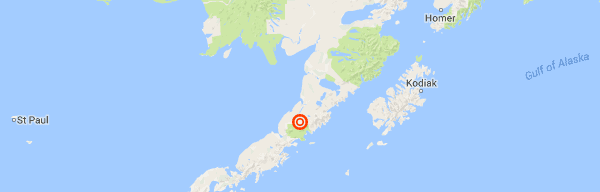
The approximate location of the 12 November 2016 Alaskan Peninsula Earthquake. Google.
 
Alaska lies on the North American Plate, with the Pacific Plate underlying the ocean to the south. The Aleutian Trench runs along much of the south coast of the Alaskan Peninisula and te Aleutian Islads, with the Pacific Plate being subducted beneath this and passing under Alaska as it sinks into the Earth. The 4 January quake occurred in the far southeast of the state; east of the extent of the Aleutian Trench. Off the coast of southeast Alaska the Pacific and North American Plates pass one-another horizontally, with the Pacific Plate moving northward and the North American to the south (a transform plate margin). This is not a smooth process, and the plates frequently stick together, then break apart as the pressure builds up, causing Earthquakes.

Subduction of the Pacific Plate beneath the North American Plate fueling earthquakes and volcanism on the Alaskan peninsula. Alaska Volcano Observatory.
 
Witness accounts of quakes can help geologists to understand these events and the rock structures that cause them. If you felt this quake (or if you were in the area but did not, which is also useful information) you can report it to the USGS here.
 
See also...

http://sciencythoughts.blogspot.co.uk/2016/08/magnitude-38-earthquake-rattles.htmlhttp://sciencythoughts.blogspot.co.uk/2016/07/landslide-deisplaces-about-150-000.html
http://sciencythoughts.blogspot.co.uk/2016/03/eruption-on-mount-pavlof-causes-severe.htmlhttp://sciencythoughts.blogspot.co.uk/2014/06/eruptions-on-mount-pavlof-on-alaskan.html
http://sciencythoughts.blogspot.co.uk/2014/05/magnitude-55-earthquake-in-northwest.htmlhttp://sciencythoughts.blogspot.co.uk/2013/09/magnitude-70-earthquake-in-aleutian.html


Follow Sciency Thoughts on Facebook.

Tuesday, 29 March 2016

Eruption on Mount Pavlof causes severe disruption to flights over Alaska.

Mount Pavlof, a 2.5 km high stratovolcano (cone-shaped volcano made up of layers of ash and lava) on the Alskan Peninsula, underwent a significant eruption slightly before 4 pm local time on Sunday 27 March 2016, producing an ash column 11.3 km high that drifted 650 km to the northeast. There are no reports of any ashfalls affecting local communities (which are mostly to the southwest of the volcano), however the ash cloud has cut across flight paths over Alaska, causing severe disruption to flights, as planes cannot safely approach such clouds. People in the area have also reported seeing lava fountains on the volcano. This is the first major eruption on Pavlof since November 2014.

Ash column over Mount Pavlof at about 7.00 pm on 27 March 2016. Colt Snapp/Twitter.

Pavlof is located between Cold Bay and Pavlof Bay near the tip of the Alaskan Peninsula. It has several active vents on its north and east flanks, it's remoteness and inaccessibility meaning that it is usually hard to tell from exactly which of these an individual eruption is occurring. Pavlof is considered to be one of America's most active volcanoes, and though it is located in a remote spot with no settlement close by, it still presents a serious threat to air-traffic.

 The approximate location of Mount Pavlof. Google Maps.

Volcanic ash is extremely hazardous to aircraft in a number of ways. At its most obvious it is opaque, both visually and to radar. Then it is abrasive, ash particles physically scour aircraft, damaging components and frosting windows. However the ash is most dangerous when it is sucked into jet engines, here the high temperatures can melt the tiny silica particles, forming volcanic glass which then clogs engine. When this happens the only hope the aircraft has is to dive sharply, in the hope that cold air passing through the engine during the descent will cause the glass to shatter, allowing the engine to be restarted. Obviously this is a procedure that pilots try to avoid having to perform.

The volcanoes of the Alaskan Peninsula and Aleutian Islands are fed by magma rising from the Pacific Plate, which is being subducted beneath the North American Plate to the south along the Aleutian Trench. As the subducting plate sinks into the Earth it is subjected to enormous heat and pressure, causing more volatile minerals to melt. These then rise through the overlying North American plate as magma, fueling the Alaskan volcanoes.

How the subduction of the Pacific Plate beneath the North American Plate fuels the volcanoes of Alsaska. Alaska Volcano Observatory.

See also...

http://sciencythoughts.blogspot.co.uk/2014/06/eruptions-on-mount-pavlof-on-alaskan.htmlEruptions on Mount Pavlof, on the Alaskan Peninsula.                                                  Mount Pavlof, a 2.5 km high stratovolcano began erupting on Saturday 31 May 2014, for the first time since the preceding September, according to the Alaska Volcano Observatory. This...
http://sciencythoughts.blogspot.co.uk/2013/09/magnitude-70-earthquake-in-aleutian.htmlMagnitude 7.0 Earthquake in the Aleutian Islands.                                                         The United States Geological Survey recorded a Magnitude 7.0 Earthquake at a depth of 33.5 km to the south of the Andreanof...
http://sciencythoughts.blogspot.co.uk/2013/08/eruption-on-mount-veniaminof.htmlEruption on Mount Veniaminof. Mount Veniaminof, an Alaskan volcano which has been experiencing low level activity since June, erupted suddenly on Friday 30 August, sending a column of ash 4.8 km into the air, according to the Alaska Volcano Observatory. There is no direct danger to anybody...
Follow Sciency Thoughts on Facebook.
 

Tuesday, 3 June 2014

Eruptions on Mount Pavlof, on the Alaskan Peninsula.

Mount Pavlof, a 2.5 km high stratovolcano began erupting on Saturday 31 May 2014, for the first time since the preceding September, according to the Alaska Volcano Observatory. This was initially detected as a sharp rise in temperature in thermal satellite images, and was later confirmed by observations from a pilot who reported an ash plume rising 2.0-2.5 km above the summit of the volcano and drifting to the north. Incandescent glowing was seen in the crater of Pavlof overnight between Saturday 31 May and Sunday 1 June, and a 3.5 km ash plume seen over the volcano in the morning, which drifted about 40 km on the wind. A small lava flow was spotted on the north flank of the volcano, along with what appeared to be several small lahars (floods of ash-laden water). On Monday 2  June an ash column was observed rising 6.7 km above the summit and drifting about 80 km to the east, and considerable seismic (Earthquake) activity was recorded around the volcano.

Eruption on Mount Pavlof, Alaska, on 2 June 2014. Christopher Diaz/northernXposed Photography/Alaska Volcano Observatory.

Pavlof is located between Cold Bay and Pavlof Bay near the tip of the Alaskan Peninsula. It has several active vents on its north and east flanks, it's remoteness and inaccessibility meaning that it is usually hard to tell from exactly which of these an individual eruption is occurring. Pavlof is considered to be one of America's most active volcanoes, and though it is located in a remote spot with no settlement close by, it still presents a serious threat to air-traffic.

The approximate location of Mount Pavlof. Google Maps.

Volcanic ash is extremely hazardous to aircraft in a number of ways. At its most obvious it is opaque, both visually and to radar. Then it is abrasive, ash particles physically scour aircraft, damaging components and frosting windows. However the ash is most dangerous when it is sucked into jet engines, here the high temperatures can melt the tiny silica particles, forming volcanic glass which then clogs engine. When this happens the only hope the aircraft has is to dive sharply, in the hope that cold air passing through the engine during the descent will cause the glass to shatter, allowing the engine to be restarted. Obviously this is a procedure that pilots try to avoid having to perform.

The volcanoes of the Alaskan Peninsula and Aleutian Islands are fed by magma rising from the Pacific Plate, which is being subducted beneath the North American Plate to the south along the Aleutian Trench. As the subducting plate sinks into the Earth it is subjected to enormous heat and pressure, causing more volatile minerals to melt. These then rise through the overlying North American plate as magma, fueling the Alaskan volcanoes.

How the subduction of the Pacific Plate beneath the North American Plate fuels the volcanoes of Alsaska. Alaska Volcano Observatory.

See also...


The United States Geological Survey recorded a Magnitude 7.0...


Mount Veniaminof, an Alaskan volcano which has been experiencing low level activity since June, erupted suddenly on Friday 30 August, sending a column of ash 4.8 km into the air...


Mount Pavlof, an active volcano on the Alaska Peninsula, which has been erupting intermittently since mid-May 2013, underwent a sharp...

Follow Sciency Thoughts on Facebook.