Showing posts with label Herefordshire. Show all posts

Sunday, 24 November 2019

Two metal-detectorists gaoled for theft of Viking Hoard.

Two metal-detectorists have been gaoled for the theft of material from a Viking Hoard found buried on a farm in Herefordshire, England. George Powell, 38, of Newport, and Layton Davies, 51, of Pontypridd, discovered the Hoard on private land near Leominster in June 2015, but failed to report the find to either the landowner or the authorities (as required by English law), instead choosing to break the hoard up and sell it privately. For this Powell was given a ten year sentence, and Davies was gaoled for eight-and-a-half years. A third defendent, coin dealer Simon Wicks, 56, was gaoled for five years, while sentencing was defered on a second coin dealer, Paul Wells, 60, who fell ill during the trial.

Recovered material from the Herefordshire Hoard, including jewellery and an ingot dating from the 5th to 9th centuries, including a ring and a small crystal ball held by strips of gold that would have been worn as a pendant. British Museum.

The law in England requires that finds of buried treasure should be reported to the local coroner within fourteen days, and that the coroner should in turn report it to the British Museum, who will arrange for it to be valued by appropriate experts, a process that prevents valuable artifacts and archaeological finds being lost to the country. Payments can be made to both the finder and the landowner, with the finders typically receiving about half the value of the find.

A bracelet with a Dragon's head from the Herefordshire Hoard. PA.

The Hoard is thought to have been buried by a member of the Great Viking Army in either 878 or 879, at which time the army was in retreat from the Saxon forces of King Alfred the Great. The Hoard is thought to have contained about 300 Anglo Saxon coins, included two rare 'Two Emperors', believed to depict King Alfred the Great of Wessex and Ceolwulf II of Mercia, based upon images found upon Davies' mobile phone by West Mercia Police, but only 31 were recovered. A number of items of jewelry were also found, including a ring, a Dragon arm bracelet, a small crystal ball pendant, and a silver ingot.

Coins from the Herefordshire Hoard. West Mercia Police.

See also...

https://sciencythoughts.blogspot.com/2019/11/france-begins-to-return-artefacts.htmlhttps://sciencythoughts.blogspot.com/2019/07/london-auction-house-sells-busk-of.html
https://sciencythoughts.blogspot.com/2019/03/federal-bureau-of-investigations-seeks.htmlhttps://sciencythoughts.blogspot.com/2019/03/mummified-body-parts-seized-at-cairo.html
https://sciencythoughts.blogspot.com/2019/02/metropolitan-museum-of-art-in-new-york.htmlhttps://sciencythoughts.blogspot.com/2019/01/tunnel-collapse-kills-three-treasure.html
Follow Sciency Thoughts on Facebook.

Wednesday, 31 July 2019

Sollasina cthulhu: A new species of Ophiocistioid Echinoderm from the Silurian Herefordshire Lagerstätte.

The living Echinoderm groups Echinoidea (Sea Urchins) and Holothuroidea (Sea Cucumbers) are united into the larger group Echinozoa, allong with an extinct group, the Ophiocistioidea, which first appeared in the Ordovician and died out in the Triassic. The Ophiocistioids shared some traits seem in modern Echinozoans, such as complex jaw apparatus of the Sea Urchins and the body-wall skeleton mostly reduced to small spicules of the Sea Cucumbers, with traits uniquely their own, most notably a dome-shaped body similar to half the test of a Sea Urchin, with five ambulacra on the outside, radiating out from a mouth at the centre, each of which ends with three enlarged, tentacle-like tube feet. Because of the easily fragmented nature of the skeletons of these Echinoderms, they are only found in deposits with exceptional preservation.

In a paper published in the journal Proceedings of the Royal Society Series B Biological Sciences on 10 April 2019, Imran Rahman of the Oxford University Museum of Natural History, Jeffrey Thompson of the Department of Earth Sciences at the University of Southern California, Derek Briggs of the Department of Geology and Geophysics and Yale Peabody Museum of Natural History at Yale University, David Siveter of the School of Geography, Geology and the Environment, at the University of Leicester, Derek Siveter also of the Oxford University Museum of Natural History, and of the Department of Earth Sciences at the University of Oxford, and Mark Sutton of the Department of Earth Sciences and Engineering at Imperial College London, describe a new species of Ophiocistioid Echinoderm from the Silurian Herefordshire Lagerstätte of England.

The Herefordshire Lagerstätte comprises a large number of small (at most centimetres) organisms from the Middle Silurian (about 425 million years ago). The organisms are preserved in three dimensions within calcareous nodules within a layer of volcaniclastic sediments (i.e. a volcanic ashfall in a marine environment), many of which can only be accessed using computerised tomography or similar scanning techniques. Brachioods, Polychaete Worms, Gastropods, Aplacophorans, Chelicerates, Marrellomorphs, Mandibulates, Barnacles, Phyllocarids, Ostracods, Starfish and Sponges have all been found in the Herefordshire Lagerstätte; together these are known as the Herefordshire Biota.

The new species is placed in the genus Sollasina, and given the specific name cthulhu, in reference to the tentacled monster from the writings of HP Lovecraft. The species is described from thirteen fossils, all preserved three-dimensionally as calcite void-fill in calcareous concretions. One exceptionally well-preserved specimen was selected for detailed study by physical–optical tomography. The specimen was cut into seven pieces, serially ground at 30 μm intervals, and the exposed surfaces were imaged using a Leica digital camera attached to a Wild binocular microscope. The resulting sets of slice images were digitally reconstructed as a three-dimensional (3-D) virtual model using the SPIERS software suite.

Sollasina cthulhu. (a)–(m) Virtual reconstructions (stereo-pairs), (n), (o) specimen in rock. (a) Oral view. (b) Lateral view. (c) Aboral view. (d) Non-peristomial tube foot (unpaired). (e) Non-peristomial tube foot (paired). (f) Peristomial tube feet. (g) Oral view showing the peristome, madreporite and gonopore (peristomial tube feet omitted). (h) Oral view showing the madreporite and gonopore (peristomial tube feet removed). (i) Aboral view showing the periproct. (j) Lateral view showing plating in the interambulacral area containing the madreporite and gonopore (tube feet removed). Interambulacral plates are shown in green. (k) Oral view showing ambulacral plating at the margin of the theca (tube feet removed). (l) Oral view showing the internal ring (all other features transparent). (m) Aboral view showing ambulacral plating at the margin of the theca (tube feet removed). (n) Section through the theca showing the tube feet. (o) Section through the theca showing the internal ring. Abbreviations: cp, circular pore; go, gonopore; ir, internal ring; jp, jaw plates; ma, madreporite; pe, peristome; pr, periproct; pt, peristomial tube feet; st, small adoral non-peristomial tube foot; tf, non-peristomial tube feet; ut, unpaired non-peristomial tube feet. In k and m, perradial plates are shown in purple, adradial plates in red, and interambulacral plates in green. Scale bars: (a)-(c), (l ) 5 mm; (d), (e), (g), (k), (l), (n), (o) 2 mm; (f), (h), (i), (j), (m) 1 mm. Rahman et al. (2019).

Sollasina cthulhu has a theca approximately 15 mm in diameter and pentagonal in outline, with thin, imbricate plates. The oral (lower) surface is slightly concave; the aboral (upper) surface is partly collapsed, but was presumably convex in life. The oral surface of the theca consists of five wide ambulacral areas, composed of columns of perradial and adradial plates, which alternate with five narrow interambulacral areas. The aboral surface of the theca consists of numerous irregularly arranged plates. The peristome occupies the middle of the oral surface. It is subcircular in outline and approximately 6 mm in diameter. Five thick, rhomboidal, interradially positioned plates form the jaw apparatus, which occupies about half the peristome diameter. 

In each ambulacral area, the plates are divided into one central column of six alternating perradial plates and two lateral columns of four adradial plates each. There are nine plated tube feet within each ambulacral area. The first pair is located within the peristome, close to the outer edge of the jaw apparatus. These peristomial tube feet are covered in tiny plates and are smaller than the other tube feet, measuring approximately 3 mm in length and 0.8 mm in diameter. The other tube feet are located outside the peristome, occurring as three slightly offset pairs, with an additional solitary tube foot at the aboral end of each ambulacral area. The non-peristomial tube feet increase in size aborally (reaching a maximum of approximately 14 mm in length and 2 mm in diameter), with the exception of the unpaired tube foot which is shorter than its adoral neighbour. Within one of the ambulacral areas, the most adoral of the tube feet outside the peristome is much smaller than all others . The tube feet are preserved hollow. They consist of thin plates arranged in longitudinal rows, overlapping distally. There are at least eight rows of about 20–30 plates each in the paired tube feet and four rows of about 13 plates each in the unpaired ones.

Reconstruction of Sollasina cthulhu. Elissa Martin/Division of Invertebrate Paleontology/Yale Peabody Museum of Natural History in Rahman et al. (2019).

See also...

https://sciencythoughts.blogspot.com/2019/01/epitomapta-simentalae-new-species-of.htmlhttps://sciencythoughts.blogspot.com/2019/01/diadema-setosum-invasive-alien-sea.html
https://sciencythoughts.blogspot.com/2019/01/understanding-how-carbon-from-kelp.htmlhttps://sciencythoughts.blogspot.com/2019/01/acanthaster-solaris-using-environmental.html
https://sciencythoughts.blogspot.com/2019/01/sertulaster-keslingi-and-delicaster.htmlhttps://sciencythoughts.blogspot.com/2018/12/linguaserra-triassica-new-species-of.html
Follow Sciency Thoughts on Facebook.

Friday, 23 November 2018

Spiricopia aurita: A Cylindroleberidid Ostracod from the Silurian Herefordshire Lagerstätte with well-preserved gills.

Ostracods are small Crustaceans with a bivalved body plan; their body is sandwiched laterally between two large valves, with the animal using its legs to generate a current through the shell, enabling it to feed, and in many cases swim (check). Ostracods are small (seldom much over a millimetre) and can be very abundant, making them common fossils in many deposits. They also often have distinctive shell ornamentation, enabling the identification of species from valves alone, and are both fast-evolving and sensitive to a range of environmental conditions, making them useful in both biostratigraphy (dating rocks using fossils) and palaeoenvironmental reconstruction. 

Due to their small size most Ostracods can satisfy their oxygen needs by simple diffusion from their surface to their tissues, with bigger species (larger than about 3 mm) supplementing this with a simple circulatory system. Only a single group of Ostracods, the Cylindroleberidids have taken this a step further and developed gills to aid the acquisition of oxygen, typically having seven pairs. Ostracods in general have a good fossil record, but this is largely of their hard shells only, with very few examples known with their soft tissues preserved, and correspondingly few with gills, all from the Silurian Herefordshire Lagerstätte.

In a paper published in the journal Biology Letters on 7 November 2018, David Siveter of the School of Geography, Geology and the Environment at the University of Leicester, Derek Briggs of the Department of Geology and Geophysics, and Yale Peabody Museum of Natural History at Yale University, Derek Siveter of the University Museum of Natural History, and the Department of Earth Sciences at the University of Oxford, and Mark Sutton of the Department of Earth Sciences and Engineering at Imperial College London describe a new Cylindroleberidid Ostracod from the Herefordshire Lagerstätte with well-preserved gills.

The Herefordshire Lagerstätte comprises a large number of small (at most centimetres) organisms from the Middle Silurian (about 425 million years ago). The organisms are preserved in three dimensions within calcareous nodules within a layer of volcaniclastic sediments (i.e. a volcanic ashfall in a marine environment), and can only be accessed using computerised tomography scanning techniques. Brachioods, Polychaete Worms, Gastropods, Aplacophorans, Chelicerates, Marrellomorphs, Mandibulates, Barnacles, Phyllocarids, Ostracods, Starfish and Sponges have all been found in the Herefordshire Lagerstätte; together these are known as the Herefordshire Biota.

The specimen is described as a new species under the name Spiricopia aurita, where ‘Spiricopia’ means ‘abundance of the breath of life’, in reference to its gills, and ‘aurita’ means ‘having ears’ in reference to the shape of its posterodorsal lobes. The specimen is 7500 μm in length, 2950 μm high and 3200 μm wide, with two pairs of antennae, a broad, flat mandible, seven pairs of limbs and five pairs of gills.
 
(a)–(g), (i)–(l) Spiricopia aurita: ‘virtual’ reconstructions (a), (c)–(g): stereo-pairs). (a) Right lateral view. (b) Anterior view. (c) Right lateral view, valves omitted. (d)–(g) Inner right gill lamellae. (i) Posterior view. (j) Ventral view. (k) Valve ornament. (l) Dorsal view. (h) Holocene Cylindroleberidid Leuroleberis surugaensis, gill lamella. Scale bars: (a)–(i), (l) 2.5 mm; (k) 1.3 mm. a1, first antenna; a2ba, a2ex, basipod and exopod of second antenna; a7, seventh limb; as, adductorial sulcus; cm, contact margin; ec, epibranchial canal; fu, furca; g1–5, gill lamellae; hc, hypobranchial canal; is, isthmus; le, lateral eye; li, ligament; lv, left valve; maba, limb base of mandible; mr, marginal ridge; mx1en, endopod of first maxilla; mx2ep, epipod of second maxilla; pg, posterior gape; pl, posterodorsal lobe; ri, rostral incisure; ro, rostrum; rv, right valve. Siviter et al. (2018). 

See also...

https://sciencythoughts.blogspot.com/2018/05/rosaliella-svalbardensis-new-species-of.htmlhttps://sciencythoughts.blogspot.com/2017/09/cypria-lacrima-new-species-of-candonid.html
https://sciencythoughts.blogspot.com/2017/03/cascolus-ravitis-leptostracan.htmlhttps://sciencythoughts.blogspot.com/2014/11/a-new-species-of-ostracod-from.html
https://sciencythoughts.blogspot.com/2014/09/a-new-species-of-freshwater-ostracod.htmlhttps://sciencythoughts.blogspot.com/2014/04/three-dimensional-soft-tissue.html
Follow Sciency Thoughts on Facebook.

Tuesday, 13 November 2018

Magnitude 2.3 Earthquake near Leominster in Herefordshire, England.

The British Geological Survey recorded a Magnitude 2.3 Earthquake at a depth of 14 km, about 2 km to the east of the town of Leominster in Herefordshire, England, slightly after 11.05 pm GMT on Monday 12 November 2018. This quake is not large enough to have caused any damage or injuries, but may have been felt locally.
 
The approximate location of the 12 November 2018 Leominster Earthquake. Google Maps.
 
Earthquakes become more common as you travel north and west in Great Britain, with the west coast of Scotland being the most quake-prone part of the island and the northwest of Wales being more prone  to quakes than the rest of Wales or most of England. However, while quakes in southern England are less frequent, they are often larger than events in the north, as tectonic pressures tend to build up for longer periods of time between events, so that when they occur more pressure is released.
 
The precise cause of Earthquakes in the UK can be hard to determine; the country is not close to any obvious single cause of such activity such as a plate margin, but is subject to tectonic pressures from several different sources, with most quakes probably being the result of the interplay between these forces.
 
Britain is being pushed to the east by the expansion of the Atlantic Ocean and to the north by the impact of Africa into Europe from the south. It is also affected by lesser areas of tectonic spreading beneath the North Sea, Rhine Valley and Bay of Biscay. Finally the country is subject to glacial rebound; until about 10 000 years ago much of the north of the country was covered by a thick layer of glacial ice (this is believed to have been thickest on the west coast of Scotland), pushing the rocks of the British lithosphere down into the underlying mantle. This ice is now gone, and the rocks are springing (slowly) back into their original position, causing the occasional Earthquake in the process.
 
   (Top) Simplified diagram showing principle of glacial rebound. Wikipedia. (Bottom) Map showing the rate of glacial rebound in various parts of the UK. Note that some parts of England and Wales show negative values, these areas are being pushed down slightly by uplift in Scotland, as the entire landmass is quite rigid and acts a bit like a see-saw. Climate North East.
 
Witness accounts of Earthquakes can help geologists to understand these events, and the structures that cause them. If you felt this quake, or were in the area but did not (which is also useful information) then you can report it to the British Geological Survey here. 
 
See also...
 
https://sciencythoughts.blogspot.com/2016/03/magnitude-24-earthquake-near-bromyard.htmlhttps://sciencythoughts.blogspot.com/2015/02/magnitude-21-earthquake-near-bromyard.html
https://sciencythoughts.blogspot.com/2014/08/magnitude-11-earthquake-in-southwest.htmlhttps://sciencythoughts.blogspot.com/2014/05/magnitude-18-earthquake-in.html
https://sciencythoughts.blogspot.com/2013/10/magnitude-10-earthquake-in-southern.htmlhttps://sciencythoughts.blogspot.com/2013/04/earthquake-in-herefordshire.html
Follow Sciency Thoughts on Facebook.

Tuesday, 28 March 2017

Cascolus ravitis: A Leptostracan Crustacean from the Silurian Herefordshire Lagerstätte.

Leptostracan Crustaceans are small, filter feeding Arthropods found from the intertidal zone to the abyssal ocean plains, though most are found at depths of less than 200 m. They are a small group, with less than 50 known extant species and a very limited fossil record. However, they are considered to be the most primitive, and therefore earliest appearing, members of the Malacostra, the wider group that also includes major Crustacean groups such as the Decapods, Amphipods and Isopods, making their evolutionary history very interesting to palaeobiologists.

In a paper published in the Proceedings of the Royal Society Series B: Biological Sciences on 22 March 2017, David Siveter of the Department of Geology at the University of Leicester, Derek Briggs of the Department of Geology and Geophysics and Yale Peabody Museum of Natural History at Yale University, Derek Siveter of Earth Collections at the University Museum of Natural History in Oxford and the Department of Earth Sciences at the University of Oxford, Mark Sutton of the Department of Earth Sciences and Engineering at Imperial College London and David Legg, also of the Department of Earth Sciences at the University of Oxford, describe a new species of Leptostracan Crustacean from the Silurian Herefordshire Lagerstätte.

The Herefordshire Lagerstätte comprises a large number of small (at most centimetres) organisms from the Middle Silurian (about 425 million years ago). The organisms are preserved in three dimensions within calcareous nodules within a layer of volcaniclastic sediments (i.e. a volcanic ashfall in a marine environment), and can only be accessed using computerised tomography scanning techniques. Brachioods, Polychaete Worms, Gastropods, Aplacophorans, Chelicerates, Marrellomorphs, Mandibulates, Barnacles, Phyllocarids, Ostracods, Starfish and Sponges have all been found in the Herefordshire Lagerstätte; together these are known as the Herefordshire Biota.

The new species is named Cascolus ravitis, in honour of naturalist and broadcaster David Attenborough; Cascolus derived from the Latin for dweller in a fortified building (the Middle English meaning of Attenborough), while ravitis derives from Ratae (the Latin name of Leicester, where Attenborough grew up), vita (Latin for life) and commeatis (Latin for messenger). It is described from a single specimen 8.9 mm in length, preserved within a calcareous nodule in three dimensions with soft tissue intact, following serial grinding at 20 μm intervals and reconstruced as a three dimensional model using the SPIERS software suite which enables reconstruction and analysis of tomographic (serial image) datasets, such as those obtained from serial-grinding of specimens, or from CT scanning.

 Holotype of Cascolus ravitis, exoskeleton and soft parts (OUMNH C.29698): (a–u) ‘virtual’ reconstructions (a,b,f,h–k,m–u are stereo-pairs); (v) specimen in rock. The exact boundary between structures such as body and limbs, as indicated by colour changes, is somewhat arbitrary. (a) Dorsal view. (b) Ventral view. (c) Anterior part of head, appendages omitted, ventral view. (d ) Posterior part of trunk, appendages omitted, ventral view. (e) Right lateral view. (f ) Part of trunk, dorsal view. (g) Head and most of the trunk, appendage 1 omitted, posterodorsal view. (h) Head with appendages and trunk segments 1 and 2 with appendages omitted; ventral view. (i) Anteroventral view. ( j ) Limb base and proximal part of antennules, right ventral oblique view. (k) Antennae, right anteroventral oblique view. (l ) Anterolateral view. (m,n) Mandible, left limb: posterior oblique (m) and right anteroventral oblique (n) views. (o) Maxillula, left limb, posterior oblique view. ( p) Sternites 3–6, anteroventral view, appendages omitted. (q) Maxilla, left limb, posterior oblique view. (r–t) Trunk appendage 2, left limb: gnathobase (r) and complete limb (s) posterior oblique views; and inner proximal part of endopod (t) posterior oblique medial view. (u) Trunk appendage 5, left limb, posterior oblique view. ai, axial inflation; as?, apodous segments?; ba, basipod; bi, bell-shaped inflation; e1, e2, epipods; en, endopod; ex, exopod; f1–f3, flagella; fu, furrow; hi, indentation in anterior margin of the head shield; gn, coxal gnathobase; h1–h5, head appendages; hr, half-ring of trunk tergite; ie, inflation adaxially forward of each eye (‘eye ridge’); la, labrum; lb, limb base; no, node; or, occipital ring; pa, precoxal area; pe, pedunculate eye; t1–t9, trunk appendages; te, end of the trunk, masked by extraneous matter; tr, trunk; tu, tubercle(s). Numbers refer to trunk segments and trunk tergites/sternites as appropriate. Arrows in (m-o, t) indicate podomere boundaries. Arrow in (s,u) indicates a spine/seta. Scale bars: (a–q), (s–v) are 0.5 mm; (r) is 0.1 mm. Siviter et al. (2017).

Cascolus ravitis has a head with five pairs of appendages and a head shield, followed by nine limb-bearing segments then two (probably) limbless segments. The head shield is smooth and elongate, with a ridge running between the eyes. All limbs except the first are biramous (split in two).

See also...

http://sciencythoughts.blogspot.co.uk/2016/12/iphiculus-eliasi-new-species-of.htmlhttp://sciencythoughts.blogspot.co.uk/2016/10/rosagammarus-minichiellus-not-amphipod.html
http://sciencythoughts.blogspot.co.uk/2016/05/decapod-crustaceans-from-tarioba-shell.htmlhttp://sciencythoughts.blogspot.co.uk/2015/01/a-new-species-of-icriocarcinid-crab.html
http://sciencythoughts.blogspot.co.uk/2014/11/a-new-species-of-ostracod-from.htmlhttp://sciencythoughts.blogspot.co.uk/2014/07/ghost-shrimps-from-oligocene-and.html
Follow Sciency Thoughts on Facebook.

Monday, 21 March 2016

Magnitude 2.4 Earthquake near Bromyard in Herefordshire, England.

The British Geological Survey recorded a Magnitude 2.4 Earthquake at a depth of 4 km, about 2 km to the west of the town of Bromyard in Herefordshire, England, at about 8.30 am GMT on Friday 18 March 2016. This quake is not large enough to have caused any damage or injuries, but may have been felt locally.

 The approximate location of the 18 March 2016 Bromyard Earthquake. Google Maps.

Earthquakes become more common as you travel north and west in Great Britain, with the west coast of Scotland being the most quake-prone part of the island and the northwest of Wales being more prone  to quakes than the rest of Wales or most of England. However, while quakes in southern England are less frequent, they are often larger than events in the north, as tectonic presures tend to build up for longer periods of time between events, so that when they occur more pressure is released.

The precise cause of Earthquakes in the UK can be hard to determine; the country is not close to any obvious single cause of such activity such as a plate margin, but is subject to tectonic pressures from several different sources, with most quakes probably being the result of the interplay between these forces.

Britain is being pushed to the east by the expansion of the Atlantic Ocean and to the north by the impact of Africa into Europe from the south. It is also affected by lesser areas of tectonic spreading beneath the North Sea, Rhine Valley and Bay of Biscay. Finally the country is subject to glacial rebound; until about 10 000 years ago much of the north of the country was covered by a thick layer of glacial ice (this is believed to have been thickest on the west coast of Scotland), pushing the rocks of the British lithosphere down into the underlying mantle. This ice is now gone, and the rocks are springing (slowly) back into their original position, causing the occasional Earthquake in the process.

(Top) Simplified diagram showing principle of glacial rebound. Wikipedia. (Bottom) Map showing the rate of glacial rebound in various parts of the UK. Note that some parts of England and Wales show negative values, these areas are being pushed down slightly by uplift in Scotland, as the entire landmass is quite rigid and acts a bit like a see-saw. Climate North East.


Witness accounts of Earthquakes can help geologists to understand these events, and the structures that cause them. If you felt this quake, or were in the area but did not (which is also useful information) then you can report it to the British Geological Survey here.

See also...

http://sciencythoughts.blogspot.co.uk/2015/02/magnitude-21-earthquake-near-bromyard.htmlMagnitude 2.1 Earthquake near Bromyard in Herefordshire, England.                     The British Geological Survey recorded a Magnitude 2.1 Earthquake at a depth of 4 km, about 1 km to the...
http://sciencythoughts.blogspot.co.uk/2014/08/magnitude-11-earthquake-in-southwest.htmlMagnitude 1.1 Earthquake in southwest Herefordshire, England.                               The British Geological Survey recorded a Magnitude 1.1 Earthquake at a depth of 7 km in southwestern Herefordshire, England, slightly before 10.00 pm...
http://sciencythoughts.blogspot.co.uk/2014/05/magnitude-18-earthquake-in.htmlMagnitude 1.8 Earthquake in Herefordshire, western England.                                          The British Geological Survey recorded a Magnitude 1.8 Earthquake at a depth of 16 km about 20 km west of Hereford, England, slightly before 11.20 pm...
 
 
Follow Sciency Thoughts on Facebook.

Friday, 27 February 2015

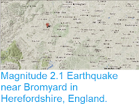
Magnitude 2.1 Earthquake near Bromyard in Herefordshire, England.

The British Geological Survey recorded a Magnitude 2.1 Earthquake at a depth of 4 km, about 1 km to the north of Bromyard in Herefordshire, England, at about 1.25 pm GMT on Wednesday 25 February 2015. This quake is not large enough to have caused any damage or injuries, but may have been felt locally.

The approximate location of the 25 February 2015 Bromyard Earthquake. Google Maps.

Earthquakes become more common as you travel north and west in Great Britain, with the west coast of Scotland being the most quake-prone part of the island and the northwest of Wales being more prone  to quakes than the rest of Wales or most of England. However, while quakes in southern England are less frequent, they are often larger than events in the north, as tectonic presures tend to build up for longer periods of time between events, so that when they occur more pressure is released.

The precise cause of Earthquakes in the UK can be hard to determine; the country is not close to any obvious single cause of such activity such as a plate margin, but is subject to tectonic pressures from several different sources, with most quakes probably being the result of the interplay between these forces.

Britain is being pushed to the east by the expansion of the Atlantic Ocean and to the north by the impact of Africa into Europe from the south. It is also affected by lesser areas of tectonic spreading beneath the North Sea, Rhine Valley and Bay of Biscay. Finally the country is subject to glacial rebound; until about 10 000 years ago much of the north of the country was covered by a thick layer of glacial ice (this is believed to have been thickest on the west coast of Scotland), pushing the rocks of the British lithosphere down into the underlying mantle. This ice is now gone, and the rocks are springing (slowly) back into their original position, causing the occasional Earthquake in the process.

(Top) Simplified diagram showing principle of glacial rebound. Wikipedia. (Bottom) Map showing the rate of glacial rebound in various parts of the UK. Note that some parts of England and Wales show negative values, these areas are being pushed down slightly by uplift in Scotland, as the entire landmass is quite rigid and acts a bit like a see-saw. Climate North East.

Witness accounts of Earthquakes can help geologists to understand these events, and the structures that cause them. If you felt this quake, or were in the area but did not (which is also useful information) then you can report it to the British Geological Survey here.

See also...

The British Geological Survey recorded a Magnitude 2.0 Earthquake at a depth of 4 km, about 1.5 km to the north of Blaengarw in Bridgend, South Wales, slightly...


The British Geological Survey recorded a Magnitude 1.8 Earthquake at a depth of 15 kn, slightly to the northwest of Gloucester in southwest England, at about 7.20...

The British Geological Survey recorded a Magnitude 1.9 Earthquake at a depth of 6 km, about 1 km to the east of...


Follow Sciency Thoughts on Facebook.