
The United States Geological Survey
recorded a Magnitude 6.5 Earthquake at a depth of about 12.1 km roughly 160 km offshore of the city of Ferndale in Humboldt County, California,
slightly
before 6.50 am local time (slightly before 2.50 pm GMT) on Thursday 8 December 2016. There
are no reports of any damage or injuries relating to
this quake, but people have reported feeling it along the West Coast of America from Seattle in the north to San Diego in the south, and inland as far as western Nevada.

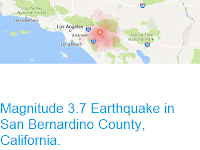
The approximate location of the 8 December 2016 Californian offshore Earthquake. USGS.
California
is extremely prone to Earthquakes due to the presence of the San
Andreas Fault, a tectonic plate margin that effectively bisects the
state. The west of California, including Santa Barbara and Los Angeles,
is located on the Pacific Plate, and is moving to the northwest. The
east of California, including Fresno and Bakersfield is on the North
American Plate, and is moving to the southeast. The plates do not move
smoothly past one-another, but constantly stick together then break
apart as the pressure builds up. This has led to a network of smaller
faults that criss-cross the state, so that Earthquakes can effectively
occur anywhere.
However the 8 December 2016 Earthquake occurred on the Mendocino Fracture Zone, which is connected to the San Andreas Fault, but which separates the Gorda Plate (a remnant
part of the ancient Farallon Plate, which formerly underlay part of
the eastern Pacific, and which has now been largely subducted beneath
North America) to the north from the Pacific Plate to the south. The Mendocino Fracture Zone is a Transform Plate Boundary, with the Gorda Plate moving eastward relative to the Pacific Plate, before being subducted beneath the North Amercan Plate. Along this boundary the rocks of the two plates continuously stick together, then become stressed as the motion of the two plates draws them apart. This stress builds up until the rocks are forcibly snapped apart, which we experience as Earthquakes.

Motion along the Murray Fracture Zone and neighbouring tectonic blocks and faults. USGS.
Witness accounts of quakes can help geologists to understand these events and the rock structures that cause them. If you felt this quake (or if you were in the area but did not, which is also useful information) you can report it to the USGS here.
See also...


Follow Sciency Thoughts on Facebook.