
The United States Geological Survey recorded
a Magnitude 4.7 Earthquake at a depth of 10.0 km roughly 4 km northwest of
the city of San Diego in Carabobo State, Venezuela, slightly
before 4.45 am local time (slightly before 8.45 am GMT) on Friday 27 April 2018. There are no reports of any
casualties associated with this event, though the quake was felt over a large area, with
people reporting feeling it across much of northeast Venezuela, and some superficial damage to buildings has been reported.

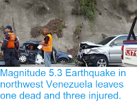
Damage to a building in northern Venezuela following the 27 April 2018 Earthquake. La Patilla.
The southern margin of the Caribbean Plate lies just off the northern coast of Venezuela, this is
moving eastward compared to the South American Plate, upon which most of Venezuela sits. This is not a smooth process, the two plates
constantly stick together, then break apart as the pressure builds up,
causing Earthquakes in the process.

The approximate location of the 27 April 2018 Carabobo Earthquake. Google Maps.
Witness
accounts of Earthquakes can help geologists to understand these events,
and the structures that cause them. The international non-profit
organisation Earthquake Report is interested in hearing from people who may have felt this event; if you felt this quake then you can report it to Earthquake Report here.
See also...


Follow Sciency Thoughts on Facebook.