Showing posts with label Transform Fault. Show all posts

Sunday, 2 February 2025

Magnitude 6.2 Earthquake off the west coast of Sumatra.

The Indonesian Meteorological, Climatological, and Geophysical Agency recorded a Magnitude 6.2 Earthquake at a depth of about 29 km, off the West coast of Aceh Province, Sumatra, Indonesia slightly after 6.00 pm Western Indonesian Time (slightly after 11.00 am GMT) on Tuesday 31 January 2025. There have been no reports of any damage or casualties following this event, but people have reported feeling  tremors  across Aceh Province and parts of North Sumatra.

The approximate location of the 31 January 2025 Aceh Province Earthquake. USGS.

The Indo-Australian Plate, which underlies the Indian Ocean to the west of Sumatra, is being subducted beneath the Sunda Plate, a breakaway part of the Eurasian Plate which underlies Sumatra and neighbouring Java, along the Sunda Trench, passing under Sumatra, where friction between the two plates can cause Earthquakes. As the Indo-Australian Plate sinks further into the Earth it is partially melted and some of the melted material rises through the overlying Sunda Plate as magma, fueling the volcanoes of Sumatra.

The Subduction zone beneath Sumatra. NASA/Earth Observatory.

This does not happen at a 90° angle, as occurs in the subduction zones along the western margins of North and South America, but at a steeply oblique angle. This means that as well as the subduction of the Indo-Australian plate beneath the Sunda, the two plates are also moving past one-another. This causes rifting within the plates, as parts of each plate become stuck to the other, and are dragged along in the opposing plate's direction. The most obvious example of this is the Sumatran Fault, which runs the length of Sumatra, with the two halves of the island moving independently of one-another. This fault is the cause of most of the quakes on the island, and most of the island's volcanoes lie on it.

The movement of the tectonic plates around Sumatra. NASA/Earth Observatory.

See also...

Monday, 13 March 2017

Magnitude 5.1 Earthquake in the Bago Region of Myanmar.

The United States Geological Survey recorded a Magnitude 5.1 Earthquake at a depth of 10 km about 33 km to the southeast  of the town of Tharyarwady in the Bago Region of Myanmar, slightly before 8.50 pm local time (slightly before 2.20 pm GMT) on Monday 13 March 2017. There are no reports of any damage or injuries following this event, though a large number of people have reported feeling it around the city of Yangon, as well as as far away as northern Thailand.

The approximate location of the 13 March 2017 Tharyawady Earthquake. USGS.

Myanmar is an area fairly prone to Earthquakes; much of the country lies on the Burma Plate, a small tectonic plate caught between  the Eurasian Plate to the northeast, the Indian Plate to the west and southwest and the Sunda Plate to the southeast. As these larger plates move together the Burma Plate is being squeezed and fractured, with a major fault line, the Kabaw Fault, having formed across much of the north of the country, along which the Burma Plate is slowly splitting. Most Earthquakes in the region are caused by movement on this fault.

Witness accounts of Earthquakes can help geologists to understand these events, and the structures that cause them. The international non-profit organization Earthquake Report is interested in hearing from people who may have felt this event; if you felt this quake then you can report it to Earthquake Report here.

See also...
 
http://sciencythoughts.blogspot.co.uk/2016/12/lanslide-at-myanmar-jade-mine-may-have.html
http://sciencythoughts.blogspot.co.uk/2017/02/nine-killed-in-landslide-at-myanmar.html

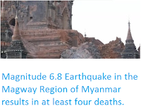
http://sciencythoughts.blogspot.co.uk/2016/08/magnitude-68-earthquake-in-magway.html
http://sciencythoughts.blogspot.co.uk/2016/11/myanmar-jade-mine-struck-by-possible.html
http://sciencythoughts.blogspot.co.uk/2015/12/landslide-kills-at-least-five-at-mine.html
http://sciencythoughts.blogspot.co.uk/2016/05/landslide-at-myanmar-jade-mine-kills-at.html

Follow Sciency Thoughts on Facebook.

Sunday, 20 October 2013

Eruptions on Barren Island.

NASA's MODIS (Moderate Resolution Imaging Spectroradiometer) system, mounted on the Terra (EOS AM) and Aqua (EOS PM) satellites, detected a hotspot developing over the Baren Island Volcano in the Andaman Islands over the period 10-16 October 2013. On 15 October an image taken at visual wavelengths by the Terra Satellite appeared to show a volcanic plume over the island, and the Indian Navy confirmed that a surveillance plane had spotted smoke and lava on the island. On 17 October the Darwin Volcanic Ash Advisory Center issued a warning to aviation of an ash column rising 3.6 km above the island and drifting to the northwest.

A previous eruption on Barren Island. Wikimapia.

Barren Island is an uninhabited volcanic island belonging officially to India's Andaman Islands (making it India's only active volcano), though it is about 100 km to the east of the main Andaman Island group and about 450 km west of the coast of southern Myanmar. The island is about 3 km in diameter and rises 354 m above sea level. It is the only active volcano in the region, though it forms part of a group with a number of dormant volcanoes including Narcondam Island and Alcock and Sewell seamounts.

The approximate location of Barren Island. Google Maps.

The volcanoes sit on the Burma (or Burmese) Plate, a small tectonic plate underlying the Andaman Islands, part of the eastern Indian Ocean and the western part of Sumatra. To the west of the Andaman Islands this plate is being subducted beneath the Indian Plate, but to the east the situation is more complex. The Burma Plate is being pushed northward relative to the Eurasia and the Sunda Plate (which underlies eastern Sumatra, Java, southern Southeast Asia, most of Borneo and the western Philippines) by the northward movement of the Indian Plate, but there is an area of seafloor spreading beneath the Andaman Sea (separating the Andaman Islands from Southeast Asia), which in turn causes stresses within the Burma Plate, leading to a zone of faulting upon which the volcanic islands and seamounts are situated.

The movement of the Burma and surrounding plates. Sheth et al. (2011).

Tectonic stresses within and around the Burma Plate. Renjith (2013).


Follow Sciency Thoughts on Facebook.

Monday, 24 December 2012

Earthquake beneath the eastern Black Sea.

On Sunday 23 December 2012, slightly after 5.30 pm local time (slightly after 1.30 pm GMT) the United States Geological Survey recorded a Magnitude 5.5 Earthquake 10 km beneath the eastern Black Sea, roughly 35 km off the coast of Georgia. This is a fairly large quake for the area, but this far offshore is unlikely to have caused any damage or casualties. The quake was felt in Georgia, Turkey and Russia.

The location of the 23 December Earthquake. Google Maps.

The Black Sea is largely upon the Eurasian Plate, as are Georgia and Russia. Turkey, however, lies on a separate plate, the Anatolian Plate. This is being pushed to the west by the northward movement of the Arabian Plate, which is in turn being pushed by the African Plate, further to the south. This creates as zone of faulting along the northern part of Turkey, the North Anatolian Fault Zone, as the two plates are pushed past one-another (transform faulting). This is not a simple process, as the two plates constantly stick together, then break apart as the pressure builds up, leading to Earthquakes, which can be some distance from the actual fault zone.

How the movement of the Arabian Plate causes movement on the North Anatolian Fault Zone. Université Montpellier 2.

This northward movement of the African and Arabian Plates also causes folding and uplift in the Caucasus Mountains, which separate Georgia from Russia. Again this is not a smooth process, with the rocks sticking together, then moving sharply as the pressure builds up enough to break them appart, which can also lead to Earthquakes in the region.


Follow Sciency Thoughts on Facebook.

Monday, 22 October 2012

Central California shaken by Earthquake.

On Saturday 20 October at 11.55 pm, local time (6.55 am on Sunday 21 October, GMT), the United States Geological Survey recorded a Magnitude 5.3 Earthquake at a depth of 9.4 km in Monterey County, central California, roughly 27 km east of King City, or 147 km southeast of San Hose. Earthquakes this large and this shallow are potentially dangerous, even in an area well prepared for seismic activity such as California, and the USGS estimates that a quake of this size in central California has a 24% chance of causing fatalities. Fortunately on this occasion no serious damage or injuries were reported, but people reported feeling the quake from San Francisco to Bakersfield.

Map showing the location of the 20 October Earthquake. Google Maps.

The quake took place directly on the San Andreas Fault, which bisects California from north to south and which separates the Pacific Plate to the west from the North American Plate to the east. The San Andreas is a slip-strike (or transform) fault, the two plates are moving past one another horizontally, the Pacific Plate moving northward and the North American Plate to the south.

Map showing the major fault zones of California. California Geological Survey.

The fault runs off the coast of California at Cape Mendocino, continuing under the sea until it meets the Mendocino Fracture Zone. To the north of this the fault becomes a subduction zone, with the Gorda Plate fragment, a chunk of the ancient and now largely subducted Juan de Fuca Plate.

Map showing the progress of the San Andreas Fault to the north, where it becomes the Gorda Plate subduction zone. Humbolt State University.

To the south the San Andreas Fault grades into the Imperial Fault Zone, a more complex area of slip-strike faulting, which in turn grades into the Gulf of California Rift Zone, a developing divergeant plate margin that develops southward into the East Pacific Rise, separating the Rivera, Cocos and Nazca Plates to the west from the North American, Caribbean and South American Plates to the east. 

The San Andreas Fault develops into the East Pacific Rise to the south. Imperial College London.


Follow Sciency Thoughts on Facebook.

Sunday, 29 July 2012

Major Earthquake shakes New Ireland & New Britain.

On Sunday 29 July 2012, slightly after 6.00 am local time (slightly after 8.00 pm on Saturday 28 July, GMT) the Papuan islands of New Ireland and New Britain were shaken by an Earthquake 20 km east of the southern coast of New Ireland, recorded by the United States Geological Survey as measuring 6.6 on the Richter Scale and occurring at a depth of 66.7 km, and by Geoscience Australia as measuring 6.5 on the Richter Scale and occurring at a depth of 91 km. 

This is fairly deep, and deeper Earthquakes are less likely to cause problems at the surface, as much of their energy is absorbed by the intervening rocks, but this is also a fairly large quake, so it still has the potential to cause harm. Geoscience Australia calculate that much of southern New Ireland is at risk of damage from this quake, and the United States Geological Survey estimate that there is a 30% risk of the quake causing fatalities, though neither damage nor casualties have been reported at the time of writing. No tsunami warning has been issued for this event.

The location of the 29 July 2012 Earthquake, and the areas likely to have felt the strongest shaking. Damage to buildings is a possibility within the inner circle, and the quake would have been felt within the outer circle. USGS.

New Ireland lies on the North Bismarck Plate, one of a group of microplates caught in the collisional zone between the Pacific and Australian Plates. New Britain lies on the South Bismarck Plate, another of these microplates. The 29 July Earthquake appears to have occurred on one of a number of transform faults (faults where two tectonic blocks are moving past one-another horizontally) between these two microplates that cross eastern New Britain and southern New Ireland. This faulting is caused by an area of rifting (movement apart by two tectonic plates, with new crust being formed between them) to the north of New Britain and west of New Ireland, which is pushing the eastern part of the South Bismarck Plate southward with regard to the North Bismark Plate.

Simplified map of the microplates to the east of Papua New Guinea. Oregon State University.


Follow Sciency Thoughts on Facebook.

Sunday, 8 July 2012

Earthquake in the Dominican Republic.

On Saturday 7 July 2012, slightly after 4.30 pm local time (slightly after 8.30 pm GMT), an Earthquake occurred in the Dominican Republic close to the border with Haiti, about 3 km south of the town of Pescaderia, at a depth of 19.9 km, according to the United States Geological Survey, who measured the  quake as 5.1 on the Richter Scale. This is large enough and shallow enough to have the potential to cause problems for people living nearby, but there are no reports of any damage or casualties on this occasion.

Map of the island of Hispaniola showing the location of the 7 July 2012 Earthquake; the black line is the national border between Haiti to the west and the Dominican Republic to the east. The purple lines represent transform faults, where two tectonic plates are moving past one-another, and the green lines represent convergent plate margins, where one tectonic plate is being subducted beneath another. USGS.

The Island of Hispaniola, on which the Dominican Republic and Haiti sit, is on the collision zone between the Caribbean and North American Plates. The northernmost part of the island is located on the North American Plate, the middle of the island is on the Gonâve Microplate, and the southern part of the island on the Caribbean Plate. The 7 July Earthquake occurred on the boundary between the Gonâve Microplate and the Caribbean Plate, which is both a transform plate, with the plates moving past one another, and a subduction zone with the Caribbean Plate sinking beneath the Gonâve Microplate. This fault continues to the west, running through the center of Jamaica, and to the east, running to the south of Puerto Rica. On the North of the island a similar fault occurs where the North American Plate is being subducted beneath the Gonâve Microplate. This fault extends to the west along the south coast of Cuba, and east to the north of Puerto Rica. 

Map showing the boundaries between the Caribbean and neighboring plates. Hispaniola is north of the word 'Plate'. Purdue University

Tectonic plates do not move smoothly past one another, but continuously stick as the rocks adhere together then break apart when the pressure builds up. This makes the island of Hispaniola extremely prone to Earthquakes, some of which have been extremely destructive. In January 2010 a massive Earthquake in southern Haiti killed an estimated 316 000 people and made over a million homeless.


Follow Sciency Thoughts on Facebook.

Wednesday, 11 April 2012

Indian Ocean shaken by a series of major Earthquakes.

At 2.38 pm local time (8.38 am GMT) on Wednesday 11 April 2012 the north-east Indian Ocean was shaken by an Earthquake 435 km southwest of the northern tip of Sumatra, recorded by the United States Geological Survey as measuring 8.6 on the Richter Scale and occurring at a depth of 22.9 km. This was followed by three major aftershocks, the first measuring 6.0 on the Richter Scale and happening at 9.28 am, a second at 10.01 which measured 5.3 on the Richter Scale, then at 10.24 am a quake measuring 5.4. Then at 10.43 the area was shaken by a second major quake, measuring 8.2 on the Richter Scale, at a depth of 16.4 km. Since then there have been (at the time of writing, eight hours after the initial shock) 14 quakes in the area measuring in excess of 5.0 on the Richter Scale.

Map showing the area of the 11 April quakes. Squares represent the location of Earthquakes, larger squares for larger quakes, red more recent than blue, yellow square represent quakes earlier in the week. The red line is the Sunda Trench, the large island at the bottom right is Sumatra. USGS.

There are not any reports of major damage or casualties at this time, but there have been reports of power outages and panic in Sumatra, and minor damage as far away as Kolkata (Calcutta). If no casualties do emerge then the initial quake may have been the most powerful quake ever recorded that did not cause any casualties. A tsunami warning was issued for the nations of the Indian Ocean, but in the event no major wave occurred; the network of buoys used to monitor such waves in the Ocean did record a small tsunami event, but the wave reached only 80 cm in height when it reached Sumatra.

The Indo-Australian Plate is being subducted beneath the Sunda Plate (a breakaway part of the Eurasian Plate) in the Sunda Trench, passing under Sumatra, where friction between the two plates can cause Earthquakes. As the Indo-Australian Plate sinks further into the Earth it is partially melted and some of the melted material rises through the overlying Sunda Plate as magma, fueling the volcanoes of Sumatra.

Diagram showing the passage of the Indo-Australian Plate beneath Sumatra. Virtual Upper Mantle of the Earth.

This does not happen at a 90° angle, as occurs in the subduction zones along the western margins of North and South America, but at a steeply oblique angle. This means that as well as the subduction of the Indo-Australian plate beneath the Sunda, the two plates are also moving part one-another. This causes rifting within the plates, as parts of each plate become stuck to the other, and are dragged along in the opposing plate's direction. The most obvious example of this is the Sumatran Fault, which runs the length of Sumatra, with the two halves of the island moving independently of one-another. This fault is the cause of most of the quakes on the island, and most of the island's volcanoes lie on it.

The Indo-Australian Plate encounters the Sunda Plate at an oblique angle, passing it as well as being subducted beneath it.

The 11 April quakes occurred considerably to the west of the Sunda Fault, and appears to have been caused by two parts of the Indo-Australian Plate moving past one-another horizontally. Such a quake would not generally cause a tsunami event, as there is little vertical movement to generate waves. Most major tsunamis are caused by subduction movement, or submarine landslides, which do cause considerable vertical displacement.


Follow Sciency Thoughts on Facebook.

Wednesday, 27 July 2011

Earthquakes in the Gulf of California, 26 July 2011.

Just before 11.45 am local time a magnitude 5.9 earthquake struck 10 km beneath the Gulf of California (Sea of Cortez). This was followed by a magnitude 4.3 earthquake slightly before 1.00 pm, then a magnitude 5 quake at 1.40, then a magnitude 4 quake just before 9.45 pm. The quakes occurred roughly 125 NE of La Paz in Baja California State and 100 km SE of Los Mohis in Sinaloa State, Mexico, on the San Andreas Fault. There are no reports of any casualties, and no tsunami warning has been issued.


Map showing the location of the quakes (blue squares) and the San Andreas Fault (red line) in the Gulf of Mexico. From the United States Geological Survey

The San Andreas Fault runs along the length of the Gulf of Mexico, then northward through the US state of California. It is a transform, or strike slip fault caused by two plates (in this case the Pacific and the North American) moving past one another. Faults of this type are not particularly prone to causing tsunamis, but can trigger submarine landslides, which are a tsunami hazard. The main danger from this series of quakes is that by releasing pressure on one part of the fault, they increase it on another; thus the danger of a significant quake in the (populous) US State of California will have now increased.

The San Andreas Fault lies on the border between the north-moving Pacific Plate and the south-moving North American Plate.

The Gulf of Mexico is an extensional basin running along the southern part of the San Andreas Fault. The basin runs on-land as the Imperial Valley of Southern California; for this reason the southern part of the San Andreas Fault is sometimes known as the Imperial Fault. Extensional basins occur where two plates move apart from one-another, in this case the Pacific and North American. Potentially the Gulf of California could one day evolve into a new ocean, though this is not guaranteed, most extensional basins stop expanding before this happens.

See also Torino (Turin) rocked by mild earthquake, Earthquake on the Krygyzstan/Uzbekistan Border and Earthquakes on Sciency Thoughts YouTube.