
The United States Geological Survey
recorded a Magnitude 4.7 Earthquake at a depth of 10 km off the coast of southwest
Oaxaca State in southern Mexico slightly before 8.55 pm local time on
Saturday 4 June 2016 (slightly before 1.55 am on Sunday 4 June
GMT). There are no reports of any damage or casualties arising from this
quake, but it was a moderately large event and people have reported feeling in the port of Puerto Escondido.

The approximate location of the 4 June 2016 Oaxaca Earthquake. Google Maps.
Southern
Mexico is located on the southernmost part of the North American Plate.
To the south, along the Middle American Trench, which lies off the
southern coast off Mexico, the Cocos Plate is being subducted under the
North American Plate, passing under southern Mexico as it sinks into the
Earth. This is not a smooth process, and the plates frequently stick
together then break apart as the pressure builds up, causing Earthquakes
on the process.
Witness
accounts of Earthquakes can help geologists to understand these events,
and the structures that cause them. The international non-profit
organization Earthquake Report is interested in hearing from people who may have felt this event; if you felt this quake then you can report it to Earthquake Report here.
See also...
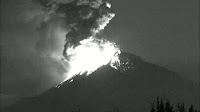 Eruption on Mount Popocatépetl. Mount Popocatépetl in southern Mexico underwent a major eruption on
Monday 18 April 2016, producing a column of ash rising 3 km above the
summit and throwing incandescent material (glowing hot rocks...
Eruption on Mount Popocatépetl. Mount Popocatépetl in southern Mexico underwent a major eruption on
Monday 18 April 2016, producing a column of ash rising 3 km above the
summit and throwing incandescent material (glowing hot rocks... Flights cancelled after eruption on Mount Colima. Several flights from airports in Mexico have been canceled following an
eruption on Mount Colima on Wednesday 18 November 2015. The eruption...
Flights cancelled after eruption on Mount Colima. Several flights from airports in Mexico have been canceled following an
eruption on Mount Colima on Wednesday 18 November 2015. The eruption... Eruption on Mount Popocatépetl. The Mexican National Centre for Disaster Prevention reported a series of
eruptions on Mount Popocatépetl on Tuesday 20 October 2015, beginning
at about 2.00 pm local time, the largest of which produced an ash...
Eruption on Mount Popocatépetl. The Mexican National Centre for Disaster Prevention reported a series of
eruptions on Mount Popocatépetl on Tuesday 20 October 2015, beginning
at about 2.00 pm local time, the largest of which produced an ash...
Follow Sciency Thoughts on Facebook.