Monday 30 September 2019

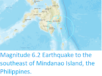
Magnitude 6.4 Earthquake to the southeast of Mindanao Island, the Philippines.

The Philippine Institute of Volcanology and Seismology recorded a Magnitude 6.4 Earthquake at a depth of 63 km about 80 km off the southeast coast of Mindanao Island, Philippines, slightly 3.00 pm local time(slightly after 2.00 am GMT) on Sunday 29 September 2019. There are no reports of any damage or casualties associated with the event, but it was felt across the southern Philippines and central Indonesia.

 The approximate location of the 29 September 2019 Mindanao Earthquake. USGS.

The geology of the central Philippines is Complex. The west of Mindanao Island is located on the Banda (or Sunda) Microplate, and the east on the Philippine Plate, which is being subducted beneath the Sunda (or Banda) Microplate along the central part of the island. Immediately to the east of the Island the Pacific Plate is being subducted along the Philippine Trench, and passes beneath eastern Mindanao as it sinks into the Earth. This is not a smooth process, an the plates constantly stick together then break apart again as the pressure builds up, resulting in Earthquakes.

 Subduction beneath the Philippines. Yves Descatoire/Singapore Earth Observatory.

Witness accounts of Earthquakes can help geologists to understand these events, and the structures that cause them. The international non-profit organisation Earthquake Report is interested in hearing from people who may have felt this event; if you felt this quake then you can report it to Earthquake Report here.

See also...

https://sciencythoughts.blogspot.com/2019/06/magnitude-62-earthquake-to-southeast-of.htmlhttps://sciencythoughts.blogspot.com/2018/12/magnitude-70-earthquake-to-southeast-of.html

https://sciencythoughts.blogspot.com/2018/02/landslides-and-flooding-kill-five-as.htmlhttps://sciencythoughts.blogspot.com/2018/01/landslides-kill-six-in-philippines.html
https://sciencythoughts.blogspot.com/2017/12/flash-flood-destroys-village-on.htmlhttps://sciencythoughts.blogspot.com/2017/05/magnitude-69-earthquake-off-south-coast.html
Follow Sciency Thoughts on Facebook.

How a changing climate is changing rainfall patterns and vegetation cover in the dry Sahel Region of Africa.

The Sahel Drylands spread across Africa to the south of the Sahara from Senegal in the west to Sudan in the east. The area suffered a series of severe draughts in the 1970s and 80s, but since then rainfall increased in both frequency and intensity, resulting in a steady greening of the area observed in satellite images. This increase in rainfall can be directly linked to rising global temperatures, with warmer air over the Atlantic Ocean leading to higher levels of evaporation there, and subsequently higher rainfall over Africa. However, the Sahel region is not a completely homogeneous environment, but rather is made up of a patchwork of dry grassland and woodland environments, which are likely to react to changing rainfall regimes in different ways, differences which may be beyond the capacity of satellites to detect without long-term terrestrial observation data for comparison, something which is absent in much of the region.

In a paper published in the journal Communications Biology on 23 April 2019, Martin Brandt of the Department of Geosciences and Natural Resource Management at the University of Copenhagen, Pierre Hiernaux of the Pastoralisme Conseil, Kjeld Rasmussen, also of the Department of Geosciences and Natural Resource Management at the University of Copenhagen, Compton Tucker of NASA's Goddard Space Flight Center, Jean-Pierre Wigneron of Interactions Sol Plante Atmosphère at the INRA Nouvelle-Aquitaine-Bordeaux Centre, Abdoul Aziz Diouf of the Centre de Suivi Ecologique, Stefanie Herrmann of Agricultural and Biosystems Engineering, at the University of Arizona, Wenmin Zhang, again of the Department of Geosciences and Natural Resource Management at the University of Copenhagen, Laurent Kergoat of Geosciences Environnement Toulouse at the Observatoire Midi-Pyrénées, Cheikh Mbow of START International Inc., Christin Abel, again of the Department of Geosciences and Natural Resource Management at the University of Copenhagen, Yves Auda also of Geosciences Environnement Toulouse at the Observatoire Midi-Pyrénées, and Rasmus Fensholt, once again of the Department of Geosciences and Natural Resource Management at the University of Copenhagen, present the results of a study of vegetation in the Sahel which used ground obsevation data from the fields sites run by the Centre de Suivi Ecologique in the Ferlo Region of north-central Senegal for comparison with satellite data.

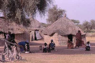
The Ferlo Region covers much of northern Senegal, and has an extremely arid climate with a nine-month dry season when the climate is driven by dry winds from the Sahara and a rainy season that lasts from July to September, when moister air from the Gulf of Guinea brings irregular rainfall. The the Centre de Suivi Ecologique has routinely collected ecological data in the region since 1987, using a consistent methodology over more than three decades and measuring both woody and herbaceous vegetation properties over a series of 1 km transects.

A village in the Ferlo Region of Senegal. Hôtel Cap Saint-Louis.

Brandt et al. used field data from the Ferlo to derive simple and reproducible metrics of vegetation composition, which was divided into above-ground herbaceous mass and woody plant foliage mass, across the Sahel, which was then compared to rainfall data. Rainfall was divided into core rainfall, which fell during the usual rainy season, and early/late rainfall, which fell outside of it.

The largest increases in rainfall measured across most of the Sahel were in early/late rainfall (i.e. rainfall that fell outside the typical rainy season), and this corresponded in most places to an expansion in woody plant foliage mass. Brandt et al.theorise that perennial woody plants were better able to utilise this out-of-season rain as most of the herbaceous plants have a very short growing season, starting their life cycle with the onset of the rains and finishing it as the rains end, with little potential to increase the length of their growing season.

Trends for the Sahel (1992–2012). (a) Vegetation optical depth estimated herbaceous mass trends. (b) Vegetation optical depth estimated woody foliage (trends. Significant (p less than
0.05) trends are shown in dark green and red, insignificant trends (p greater than 0.05) are shown in light red and green. (c) Areas where the slope in rainfall (early and late rains) is larger than the slope in rainfall (core wet-season rains) are shown in blue colour. d Pearson correlation between annual
Vegetation optical depth 90% and pixel-wise fitted sinusoidal term (1st harmonic). (e) Core wet-season rainfall  trend. (f) Early and late rainfall trend. Brandt et al. (2019).

Significant increases in above-ground herbaceous mass were mostly located in the Ferlo and the northern Sahel of Mali. Areas with a significant increase in woody plant foliage mass are observed across the entire Sahel; notably in Senegal, Chad, eastern Niger and large parts of Mali. Decreases in both above-ground herbaceous mass and woody plant foliage mass were observed in western Niger and around Lake Chad, with no obvious relationship with rainfall, pointing towards other, rainfall independent causes (for example land management). 

See also...

https://sciencythoughts.blogspot.com/2019/09/around-thirty-feared-to-have-died-in.htmlhttps://sciencythoughts.blogspot.com/2019/09/seven-cofirmed-deaths-from-yellow-fever.html
https://sciencythoughts.blogspot.com/2019/08/rioting-closes-burkino-fasso-mine-after.htmlhttps://sciencythoughts.blogspot.com/2019/07/sinomonas-gamaensis-new-species-of.html
https://sciencythoughts.blogspot.com/2019/02/plagues-of-locusts-from-sudan-and.htmlhttps://sciencythoughts.blogspot.com/2018/12/investigating-ancient-iron-works-of.html
Follow Sciency Thoughts on Facebook.

Sunday 29 September 2019

Warning issued to bathers after large number of Portuguese Man 'o War found on beach in County Cork, Ireland.

A warning has been issued to bathers after a large number of Portuguese Man 'o War, Physalia physalis, were found washed up on Ballydonegan Beach in County Cork, Ireland, on Saturday 28 September 2019. People are being urged to be wary of both the animals themselves, and any detached tentacles, as the venom of the species is particularly potent, and can occasionally kill Humans, though children and pets are thought to be more at risk than adults.

A group of Portuguese Man 'o War on Ballydonegan Beach in County Cork, Ireland, on Saturday 28 September 2019. Sue Swansborough/Cork Beo.

Portuguese Man o' War are colonial Siphonophores only distantly related to true Jellyfish, Scyphozoa, though commonly referred to as such. Their bodies are made up of thousands of individual zooids, each with their own sting, tentacles and digestive system. New zooids are formed by budding from other members of the colony, but remain attached to these to form a single colony. Each year a generation of specialist sexual zooids (gonozoids) is produced which produce eggs and sperm, with fertilised eggs going on to form new colonies. These animals are anchored to the sea surface by a highly modified zooid which forms an air sack, filled with a mixture of carbon monoxide defused from the zooid and nitrogen, oxygen and argon from the atmosphere, which are brought into the sack through osmosis.

Portuguese Man o' War produce an extremely strong venom, for both capturing food and defending the colony, and which is capable of causing extremely painful stings, and sometimes death, in Humans, for which reason people are advised to be extremely cautious on beaches where these animals wash up, not just of entire animals but also detached tentacles, which are less visible but still capable of stinging.
See also...
https://sciencythoughts.blogspot.com/2019/01/physalia-physalis-thousands-stung-by.htmlhttps://sciencythoughts.blogspot.com/2018/10/tourists-stung-by-jellyfish-on-phuket.html
https://sciencythoughts.blogspot.com/2018/08/portuguese-man-o-war-sting-more-than-50.htmlhttps://sciencythoughts.blogspot.com/2018/03/bathers-warned-after-portugese-after.html
https://sciencythoughts.blogspot.com/2018/02/warning-issued-to-bathers-after-large.htmlhttps://sciencythoughts.blogspot.com/2013/10/two-new-species-of-siphonophore-from.html
Follow Sciency Thoughts on Facebook.

Asteroid 2019 SG1 passes the Earth.

Asteroid 2019 SG1 passed by the Earth at a distance of about 849 000 km (2.21 times the average  distance between the Earth and the Moon, or 0.57% of the distance between the Earth and the Sun), slightly before 9.10 pm GMT on Sunday 22 September 2019. There was no danger of the asteroid hitting us, though were it to do so it would not have presented a significant threat. 2019 SG1 has an estimated equivalent diameter of 6-17 m (i.e. it is estimated that a spherical object with the same volume would be 6-17 m in diameter), and an object of this size would be expected to explode in an airburst (an explosion caused by superheating from friction with the Earth's atmosphere, which is greater than that caused by simply falling, due to the orbital momentum of the asteroid) in the atmosphere between 38 and 25 km above the ground, with only fragmentary material reaching the Earth's surface.

 The calculated orbit of 2019 SG1. JPL Small Body Database.

2019 SG1 was discovered on 20 September 2019 (two days before its closest encounter with the Earth) by the University of Arizona's Mt. Lemmon Survey at the Steward Observatory on Mount Lemmon in the Catalina Mountains north of Tucson. The designation 2019 SG1 implies that the asteroid was the 31st object (asteroid G1 - in numbering asteroids the letters A-Y, excluding I, are assigned numbers from 1 to 24, with a number added to the end each time the alphabet is ended, so that A = 1, A1 = 25, A2 = 49, etc., which means that G1 = 7 + (24 X 1) = 31) discovered in the second half of September 2019 (period 2010 S).

2019 SU2 has a 1398 day orbital period and an eccentric orbit tilted at an angle of 2.32° to the plane of the Solar System, which takes it from 0.74 AU from the Sun (i.e. 74% of he average distance at which the Earth orbits the Sun) to 4.15 AU from the Sun (i.e. 415% of the average distance at which the Earth orbits the Sun, and more that twice as far from the Sun as the planet Mars). It is therefore classed as an Apollo Group Asteroid (an asteroid that is on average further from the Sun than the Earth, but which does get closer).
 
See also...
 
http://sciencythoughts.blogspot.com/2019/09/asteroid-2019-su2-passes-earth.htmlhttps://sciencythoughts.blogspot.com/2019/09/fireball-meteor-over-east-anglia.html#
https://sciencythoughts.blogspot.com/2019/09/asteroid-504800-2010-co1-passes-earth.htmlhttps://sciencythoughts.blogspot.com/2019/09/asteroid-2019-rt3-passes-earth.html
https://sciencythoughts.blogspot.com/2019/09/fireball-meteor-over-northern-germany.htmlhttps://sciencythoughts.blogspot.com/2019/09/asteroid-2019-rb2-passes-earth.html
Follow Sciency Thoughts on Facebook.

Diplocynodon hantoniensis: An Alligatoroid Crocodylian from the Late Eocene of southern England.

Alligatoroids first appear in the fossil record during the Late Cretaceous, and by the beginning of the Palaeocene can already be divided into Alligatorines (modern Alligators, plus fossil species more closely related to them than to modern Caimans), Caimanines (modern Caimans, plus fossil species more closely related to them than to modern Alligators), and 'Basal Alligatoroids' (fossil species more closely related to modern Alligators and Caimans than to modern Crocodiles, but less closely relared to them than they are to one-another). The genus Diplocynodon is currently known from the late Palaeocene to the middle Miocene of western Europe, with nine recognised species. Alligatoroid remains from the Late Eocene Headon Hill Formation at Hordle Cliff on the coast of Hampshire, southern England, were first described in 1844 by Searles Wood, who described them as 'Alligator hantoniensis', with subsequent specimens described by the Marchioness of Hastings, Sir Richard Owen, who considered the specimens to be Crocodiles rather than Alligators and renamed them Crocodilus hastingsiae in honour of the Marchioness of Hastings, and Auguste Pomel, who recognised the species as belonging to the genus Diplocynodon and retained Wood's species name, making the species Diplocynodon hantoniensis. Many more specimens have been discovered from the Headon Hill Formation since the nineteenth century, but the species has not been redescribed for over a century and a half.


Diplocynodon hantoniensis is known only from partial and disarticulated remains, with most of the post-cranial skeleton unknown, so the precise size of the living animals is unknown. However the species is known to have a dorsal skull length of  up to 375 mm and a snout length of up to 255 mm, as well as a maximum recorded skull width of 227 mm (Rio et al. do not interpret this data, but it probably suggests an maximum size of about three metres for the species). 

The skull of Diplocynodon hantoniensis ( specimen NHMUK OR 30392) in dorsal (A), (B) and (C), (D) ventral view. Abbreviations: amp, scar for musculus adductor mandibulae posterior; bo, basioccipital; ch, choana; en, external naris; fr, frontal; itf, infratemporal fenestra; jg, jugal; lac, lacrimal; mef, median eustacian foramen; mx, maxilla; na, nasal; ob, orbit; oc, occlusal pit; pmx, premaxilla; pf, prefrontal; po, postorbital; qd, quadrate; qj, quadratojugal; so, supraoccipital; sq, squamosal; stf, supratemporal fenestra. Scale bar is 10 cm. Rio et al. (2019).

Diplocynodon hantoniensis is broad snouted compared to other members of the genus, with square nostrils, and a deep notch slightly behind the nostril, something present in modern Alligators but absent from most members of the genus Diplocynodon. The species has highly variable cranial ornamentation, which is typical for the genus. The ectopterygoid bone of the upper jaw extends forward, parallel to the maxillary alveoli (groove in which the teeth of the upper jaw sit), but is separated from it by the maxilla, similar to the situation in modern Caimans, whereas in other species of Diplocynodon  the ectopterygoid contacts the posterior part of the maxillary alveoli. 

 
Articulated skull and mandibles of Diplocynodon hantoniensis (specimen NHMUK OR 30393) in dorsal (A), (B) and lateral (C), (D) view. Abbreviations: art, articular; dt, dentary; emf, external mandibular fenestra; en, external naris; fr, frontal; itf, infratemporal fenestra; jg, jugal; lac, lacrimal; mx, maxilla; na, nasal; ob, orbit; pmx, premaxilla; pf, prefrontal; pof, preotic foramen; po, postorbital; qd, quadrate; qj, quadratojugal; so, supraoccipital; sq, squamosal; stf, supratemporal fenestra; su, surangular. Scale bar is 5 cm. Rio et al. (2019).

All premaxillary and anterior maxillary teeth of Diplocynodon hantoniensis are conical and lingually curved, with smooth carinae (ridges), and commonly preserve faint longitudinal striations. Carinae occur on the medial and lateral edges of the anteriormost premaxillary teeth, but on the anterior and posterior edges of all other premaxillary and maxillary teeth. Posteriorly, the maxillary teeth become shorter, more globular and less lingually curved, though never becoming blunt as they retain modest carinae and pointed tips.

The dentition of Diplocynodon hantoniensis. (A)–(C) Specimen NHMUK OR 25166 in anteroventral view (A), anterolateral view, showing the premaxilla–maxilla transition (B) and lateral view showing the posterior maxillary dentition (C). (D) Specimen NHMUK OR 30317, isolated tooth from the anterior region of the dentition in mesial view; (E) – (F) unregistered isolated teeth from the posterior region of the dentition in labial view. All scale bars are 2 cm. Rio et al. (2019).

In all extant alligatorids, the squamosal and parietal bones have a large sutural contact on the posterior wall of the supratemporal fenestra (opening in the skull of Diapsids above and behind the eye), anterior to the orbitotemporal canal, whereas in other living Crocodylians the quadrate bone widely separates the squamosal and parietal, forming the floor of the orbitotemporal foramen (part of the eye socket). Diplocynodon hantoniensis was found to have an intermediate condition, in which the squamosal approaches the parietal, but a narrow wedge of the quadrate separates them, something previously seen in one other species of Diplocynodon, Diplocynodon ratelii, from the Late Eocene to Early Miocene of the Massif Central of France (which was also the first species assigned to the genus Diplocynodon).

Rio et al. carried out a series of cladistic analysis (computerised analysis of relationships within the group based entirely upon shared common features rather than assumed relationships) using the TNT (Tree analysis using New Technology) software package. This consistently suggested that the genus Diplocynodon is valid (i.e. consists entirely of species more closely related to one-another that to anything else) and that Diplocynodon hantoniensis should be placed within this species, though one other species currently placed within the genus, Diplocynodon riograndensis, should probably be excluded from the genus.

A number of fossils from Europe and North America have previously been assigned to Diplocynodon hantoniensis, but Rio et al. do not feel that any of these are genuine members of the species. A single tooth and a keeled dorsal osteoderm from the early Eocene Nanjemoy Formation of Stafford County, Virginia is considered by Rio et al. to be insufficient for specific or even generic identification, and from an indeterminate Crocodylian. Five cranial fragments, a fragment of the retroarticular process and two isolated teeth from the late Eocene of Mormont in the canton of Vaud, western Switzerland, has none of the diagnostic features of either the species Diplocynodon hantoniensis or the genus Diplocynodon, so Rio et al. regard it as an indeterminate Alligatoroid. An anterior dentary fragment, a lacrimal, fragments of a left and right angular, teeth, portions of two femora and numerous osteodermal and vertebral fragments, from the early Oligocene ‘Melanian Clay’ of Altenburg IV quarry at Borken, in Hesse, central Germany, show features that allow it to be assigned to the genus Diplocynodon but not to a specific species, as does relatively complete skull from early Oligocene sediments in the Razac-d’Eymet commune in Dordogne, south-western France.

See also...

https://sciencythoughts.blogspot.com/2019/09/malaysian-woman-killed-by-crocodile.htmlhttps://sciencythoughts.blogspot.com/2019/06/isisfordia-molnari-new-species-of.html
https://sciencythoughts.blogspot.com/2019/06/crocodiles-killed-in-solomon-islands.htmlhttps://sciencythoughts.blogspot.com/2019/05/crocodile-kills-boy-in-maharashtra.html
https://sciencythoughts.blogspot.com/2019/04/cricosaurus-bambergensis-new-species-of.htmlhttps://sciencythoughts.blogspot.com/2019/03/gujarat-man-wakes-to-find-crocodile.html
Follow Sciency Thoughts on Facebook.

Saturday 28 September 2019

Magnitude 1.9 Earthquake in Shropshire, England.

The British Geological Survey recorded a Magnitude 1.9 Earthquake at a depth of about 7 km, roughly 20 km to the northeast of the city of Shrewsbury in Shropshire, England, slightly after 1.10 am British Summertime (slightly after 0.10 am GMT) on Thursday 26 September 2019. There are no reports of any damage or injuries associated with this event, and nor would they be expected from such a small event, though may have been felt in the area.
 
The approximate location of the 26 September 2019 Shropshire Earthquake. Google Maps.
 
Earthquakes become more common as you travel north and west in Great Britain, with the west coast of Scotland being the most quake-prone part of the island and the northwest of Wales being more prone  to quakes than the rest of Wales or most of England. However, while quakes in southern England are less frequent, they are often larger than events in the north, as tectonic pressures tend to build up for longer periods of time between events, so that when they occur more pressure is released.
 
The precise cause of Earthquakes in the UK can be hard to determine; the country is not close to any obvious single cause of such activity such as a plate margin, but is subject to tectonic pressures from several different sources, with most quakes probably being the result of the interplay between these forces.
 
Britain is being pushed to the east by the expansion of the Atlantic Ocean and to the north by the impact of Africa into Europe from the south. It is also affected by lesser areas of tectonic spreading beneath the North Sea, Rhine Valley and Bay of Biscay. Finally the country is subject to glacial rebound; until about 10 000 years ago much of the north of the country was covered by a thick layer of glacial ice (this is believed to have been thickest on the west coast of Scotland), pushing the rocks of the British lithosphere down into the underlying mantle. This ice is now gone, and the rocks are springing (slowly) back into their original position, causing the occasional Earthquake in the process. 
 
(Top) Simplified diagram showing principle of glacial rebound. Wikipedia. (Bottom) Map showing the rate of glacial rebound in various parts of the UK. Note that some parts of England and Wales show negative values, these areas are being pushed down slightly by uplift in Scotland, as the entire landmass is quite rigid and acts a bit like a see-saw. Climate North East.
  
Witness accounts of Earthquakes can help geologists to understand these events, and the structures that cause them. If you felt this quake, or were in the area but did not (which is also useful information) then you can report it to the British Geological Survey here.   
 
See also...
 
https://sciencythoughts.blogspot.com/2019/08/magnitude-14-earthquake-in-cheshire.htmlhttps://sciencythoughts.blogspot.com/2019/07/sollasina-cthulhu-new-species-of.html
https://sciencythoughts.blogspot.com/2018/12/monsoon-forest-building-at-chester-zoo.htmlhttps://sciencythoughts.blogspot.com/2018/11/spiricopia-aurita-cylindroleberidid.html
https://sciencythoughts.blogspot.com/2018/11/magnitude-23-earthquake-near-leominster.htmlhttps://sciencythoughts.blogspot.com/2018/03/magnitude-12-earthquake-in-shropshire.html
Follow Sciency Thoughts on Facebook.