Monday 30 November 2015

Woman killed by Himachal Pradesh landslide.

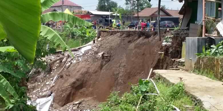
A woman has died following a landslide close to the village of Chuwang in Jinnaur District, Himachal Pradesh, on Sunday 29 November 2015. She has been identified as Ganga Devi, a teacher from the village, who was reportedly hit by the landslide while on her way to work. Her body has yet to be found.

The approximate location of the 29 November 2015 Chuwang landslide. Google Maps.

Mountainous areas of Himachal Pradesh (which is most of the state) are notoriously prone to landslides, particularly during the monsoon season, which lasts from July to September, when very high rainfall levels can trigger many such events. Landslides are a common problem after severe weather, as excess pore water pressure can overcome cohesion in soil and sediments, allowing them to flow like liquids. Approximately 90% of all landslides are caused by heavy rainfall.

However November is generally considered a dry month in Himachal Pradesh, and this years has been drier than usual, with many areas experiencing little or no rainfall. Instead this incident has is the latest in a series of events that has been associated by local people with the construction of hydroelectric dams in the area, with claims that irresponsible mountain-cutting and blasting have triggered a number of landslips in the area, several of them fatal.

See also...

http://sciencythoughts.blogspot.co.uk/2014/06/possible-volcanic-eruption-in-himachal.htmlPossible volcanic eruption in Himachal Pradesh State, India.                                       A report in the Times of India on 6 June 2014 has documented a possible volcanic eruption in the Kangra District of Himachal Pradesh State, India. The...
http://sciencythoughts.blogspot.co.uk/2013/11/magnitude-44-earthquake-in-himachal.htmlMagnitude 4.4 Earthquake in Himachal Pradesh, India.                                              The United States Geological Survey recorded a Magnitude 4.4 Earthquake at a depth of 38.2 km, roughly 9 km north of the town of Gagret in western...
http://sciencythoughts.blogspot.co.uk/2013/10/three-killed-by-himachal-pradesh.htmlThree killed by Himachal Pradesh landslide. Three people were killed by a landslide to the north of Beas Kund (the source of the River Beas) in Himachal Pradesh at about 3.30 pm local time (about 10.00 am GMT) on Friday 11 October 2013. Two of the...
Follow Sciency Thoughts on Facebook.

Asteroid 2015 VE65 passes the Earth.

Asteroid 2015 VE65 passed by the Earth at a distance of 18 410 000 km (47.9 times the average distance between the Earth and the Moon, or 12.3% of the average distance between the Earth and the Sun), slightly after 4.10 pm GMT on Monday 23 November 2015. There was no danger of the asteroid hitting us, though had it done so it would have presented a genuine threat. 2015 VE65 has an estimated equivalent diameter of 36-110 m (i.e. a spherical body with the same mass would be 36-110 m in diameter), and an object towards the upper end of this range would pass through the atmosphere and directly impact the ground with a force of about 55 megatons (about 3235 times the explosive energy of the Hiroshima bomb), causing devastation over a wide area and creating a crater over 1.3 km across, and resulting in global climatic problems that could last for years or even decades.
 
 The calculated orbit of 2015 VE65. JPL Small Body Database.
 
2015 VE65 was discovered on 7 November 2015 (16 days after its closest approach to the Earth) by the University of Arizona's Mt. Lemmon Survey at the Steward Observatory on Mount Lemmon in the Catalina Mountains north of Tucson. The designation 2015 VE65 implies that the asteroid was the 1630th object (object E65) discovered in the first half of November 2015 (period 2015 V).
 
2015 VE65 has a 462 day orbital period and an eccentric orbit tilted at an angle of 19.3° to the plane of the Solar System that takes it from 0.78 AU from the Sun (i.e. 78% of the average distance at which the Earth orbits the Sun, and slightly outside the orbit of Venus) to 1.56 AU from the Sun (i.e. 156% of the average distance at which the Earth orbits the Sun, slightly more than the distance at which Mars orbits the Sun). It is therefore classed as an Apollo Group Asteroid (an asteroid that is on average further from the Sun than the Earth, but which does get closer).
 
See also...
 
http://sciencythoughts.blogspot.co.uk/2015/11/asteroid-2015-wp2-passes-earth.htmlAsteroid 2015 WP2 passes the Earth.     Asteroid 2015 WP2 passed by the Earth at a distance of 229 800 km (0.6 times the average distance between the Earth and the Moon, or 0.16% of the average distance between the Earth and the Sun; but 575.4 times as far from the Earth as the International...
http://sciencythoughts.blogspot.co.uk/2015/11/asteroid-2015-vv2-passes-earth.htmlAsteroid 2015 VV2 passes the Earth.      Asteroid 2015 VV2 passed by the Earth at a distance of 6 623 000 km (17.2 times the average distance between the Earth and the Moon, or 4.43% of the average distance between the Earth and the Sun), slightly after 10.30  pm on Wednesday 18 November 2015...
http://sciencythoughts.blogspot.co.uk/2015/11/asteroid-2015-vd105-passes-earth.htmlAsteroid 2015 VD105 passes the Earth. Asteroid 2015 VD105 passed by the Earth at a distance of 2 777 000 km (7.22 times the average distance between the Earth and the Moon, or 1.86% of the average distance between the Earth and the Sun), slightly before 4.25 pm on Monday 16 November...
Follow Sciency Thoughts on Facebook.


Evidence of Shark predation on Whale bones from the Early Pliocene of South Africa.

Despite extending for almost 2000 miles, the west coast of South Africa is home to relatively few fossil-producing marine deposits. Two sites that are particularly productive are the Miocene-Pliocene deposits at Duinefontein and Langebaanweg, which have produced material attributed to a variety of different Whales and Sharks as well as Teleost Fish, other Marine Mammals and Birds, which are helping scientists to develop an understanding of the environment and ecological relationships present on the west South African Coast at that time.

In a paper published in the South African Journal of Science on 27 November 2015, Romala Govender of the Natural History Department at the Iziko Museums of South Africa, describes a series of fragmentary Whale bones from Duinefontein which show score marks attributed to the actions of Sharks.

The material comes from the Shark Tooth Bed at Duinefontein which is thought to be about 5 million years old, making it early Pliocene, and is extremely fragmentary, as well as showing wear signs consistent with having been roled on a beach prior to its eventual burrial, all of which prevents assignation of the bones to any particular Whale. The Shark Tooth Bed, as well as producing numerous Shark Teeth has produced a variety of Fish, Mammals and Birds, though most of the material is fragmentary; the bed is thought to have been laid down behind a barrier spit that was overtopped by spring tides or storm events, it has been suggested that it may even be a tsunami deposit.

The Cetacean (Whale) material from this site comprises vertebral centra, tympanic bullae, periotics, isolated teeth and cranial fragments. Several of the fragments, particularly those from the cranium and jaws, show score marks and patterns of groves consistent with a Shark having bitten down upon the bone then pulled backwards, a method of feeding common in the modern Great White Shark, Carcharodon carcharias.

 (a) CF2 bite marks on the lateral surface of cranial fragment (SAMPQMB-D-1342) (arrow 1, arrow 2). (b) CF2 bite mark on ventral surface of SAMPQMB-D-1342. (c) B1 bite mark on the lateral surface of a mandibular fragment (SAMPQMB-D-1182). (d) B2 bite mark on the small cranial fragment (SAMPQMB-D-1339) (arrow). (e) B2 bite mark on cranial fragment (SAMPQMB-D-1340) (inset close-up of damage). (f) B2 bite mark on the lateral surface of cranial fragment (SAMPQMB-D-1342) (inset close-up of damage). Govender (2015).

Such bite marks around the head are typical of Sharks feeding on dead Whales, which tend to concentrate their efforts around the head, where preferred food items such as the tongue are found, though this does not preclude the Whale having died as a result of a Shark attack. The exact nature of the attacker cannot be determined from the material, though it would have been a Shark with non-serated teeth such as a Great White, a species that specializes in this sort of feeding and the which numerous teeth of have been found at Duinefontein (and which is still present on the same area of coast today). Other Sharks known to have been present on the west South African Coast during the Early Pliocene include Mako Sharks, Isurus sp. and Cosmopolitodus hastalis, Ragged Tooth Sandtigers, Carcharias tarsus, Megalodon Carcharodon megalodon, and possibly Lemon Shark Negaprion brevirostris.

See also...

http://sciencythoughts.blogspot.co.uk/2015/07/carcharocles-megalodon-did-megashark.htmlCarcharocles megalodon: Did the Megashark get bigger over time?                                    The largest Shark ever to live was Carcharocles megalodon, which reached sizes of about eighteen meters and survived from the Middle Miocene until the end of the Pliocene. This was formerly thought to...
The deepest evolutionary split in the jawed vertebrates (Gnathostomes) is that between the Sharks (Chondrichthyes) and Bony Fish (Osteichthyes), with all terrestrial vertebrates forming a subgroup within...
The Main Devonian Field outcrops on the northwestern East European Platform in Estonia, Latvia, Lithuania, northern Belarus...


Follow Sciency Thoughts on Facebook.

Sunday 29 November 2015

Cattle killed by eruption on Mount Telica, Nicaragua.

Mount Telica, an active volcano in northwest Nicaragua, underwent an eruptive episode on Sunday 22 November 2015, with two rapid explosions reported shortly after 8.45 am, which threw fragments of rock up to 900 m from the crater, resulting in the deaths of several cattle grazing in the area. The nearest community, Agua Fría, has been evacuated as a precaution, and communities as far as 30 km from the volcano have reported ash falls and the Washington Volcanic Ash Advisory Center reported an ash column rising 2.4 km above Mount Telica and drifting about 100 km to the west.

Villagers inspect a Cow killed by a rock thrown from Mount Telica in Nicaragua on Sunday 22 November 2015. Viva Nicaragua.

Nicaragua is located on the southern edge of the Caribbean Plate, which underlies Central America as well as the Caribbean Sea. To the south the Cocos Plate, which underlies part of the eastern Pacific, is being subducted beneath the Caribbean Plate along the Middle American Trench, passing under Central America as it is sinks into the Earth. As it is subducted the Cocos Plate is being partially melted by the heat of the planet's interior and the friction caused by its dragging under the Caribbean Plate, producing liquid magma, which then rises through the overlying plate fueling the volcanoes of Central America.

Diagrammatic representation of the Cocos Plate passing beneath the Central American Plate, showing how it fuels the volcanoes of Central America. VCS Mining.

See also...

http://sciencythoughts.blogspot.co.uk/2014/10/one-dead-after-central-american.htmlOne dead after Central American Earthquake.                                                  The United States Geological Survey recorded a Magnitude 7.3 Earthquake at a depth of 40 km, roughly 67 km offshore of the Nicaraguan coastal resort...

http://sciencythoughts.blogspot.co.uk/2014/08/five-workers-still-missing-following.htmlFive workers still missing following landslide at Nicaraguan gold mine.                           Twenty three miners have been rescued after a landslide trapped them underground at the Bonanza Mine in Northern Nicaragua on Thursday 28...
http://sciencythoughts.blogspot.co.uk/2014/04/at-least-23-injured-after-magnitude-61.htmlAt least 23 injured after Magnitude 6.1 Earthquake strikes Nicaragua.                     The United States Geological Survey recorded a Magnitude 6.1 Earthquake at a depth of 13 km on the northern shore of Lago de Managua in Nicaragua, slightly before 5.30 pm local time (slightly before 11.30...
Follow Sciency Thoughts on Facebook.


Magnitude 5.5 Earthquake in Sagaing Region, Myanmar.

The United States Geological Survey recorded a Magnitude 5.5 Earthquake at a depth of 22 km about 50 km to the north of Monywa in the Sagaing Region, Myanmar, slightly before 3.05 pm local time (slightly before 8.35 am GMT) on Friday 27 November 2015. There are no reports of any casualties arising from this event,but damage to numerous pagodas (religious shrines) has been reported in the area.

Damage to a pagoda in Sagaing Region, Myanmar, following the 27 November 2015 Earthquake. Earthquake Report.

Northern Myanmar is an area fairly prone to Earthquakes Much of Myanmar lies on the Burma Plate, a small tectonic plate caught between  the Eurasian Plate to the northeast, the Indian Plate to the west and southwest and the Sunda Plate to the southeast. As these larger plates move together the Burma Plate is being squeezed and fractured, with a major fault line, the Kabaw Fault, having formed across much of the north of the country, along which the Burma Plate is slowly splitting. Most Earthquakes in the region are caused by movement on this fault.

 The approximate location of the 27 November 2015 Sagaing Earthquake. Google Maps.

Witness accounts of Earthquakes can help geologists to understand these events, and the structures that cause them. The international non-profit organization Earthquake Report is interested in hearing from people who may have felt this event; if you felt this quake then you can report it to Earthquake Report here.

See also...

http://sciencythoughts.blogspot.co.uk/2015/11/hundreds-feared-dead-following.htmlHundreds feared dead following landslide at Myanmar jade mine                                     One hundred and five people have now been confirmed dead and over a hundred are still thought to be missing following a landslide at a jade mine at Hpakant in Kachin State, Myanmar on Saturday 21 November 2015...
http://sciencythoughts.blogspot.co.uk/2015/10/landslide-injures-four-in-magwe-region.htmlLandslide injures four in Magwe Region, Myanmar.                                                    Four people have been injured following a landslide at the Ayeyarwady Bridge in the Magwe Region of Myanmar on Thursday 15 October. The incident happened at about 10.00 am local time on the Minbu...
http://sciencythoughts.blogspot.co.uk/2015/06/eruption-on-barren-island.htmlEruption on Barren Island.                   The Darwin Volcanic Ash Advisory Center issued a warning to aviation after an ash column was spotted over Barren Island, an active volcano in the Andaman Islands, by the Japan Meteorological Agency's MTSAT-2 satellite on Saturday 6 June 2015. The ash column rose about 3 km above the volcano and drifted about 35 km to the east. Observations in infra-red also spotted a hotspot on the island, which may indicate hot lava on...
Follow Sciency Thoughts on Facebook.


Flooding and winter storms thought to have killed at least fouteen in Texas, Oklahoma and Kansas.

At least fourteen people are thought to have died as flooding and winter storms battered Texas, Oklahoma and Kansas on Friday 27 November 2015. Eight deaths have been reported in flooding in northern Texas, while four have died in road accidents associated with wet conditions in Kansas and two in Oklahoma.At least three people are thought to have died in flash floods that swept vehicles from roads in Dallas, with two further deaths in Johnson County and one in Tarrant County. All four deaths in Kansas have been described as 'single vehicle incidents'. Details of other fatalities are not available at this time.

 Car caught in a flash flood at Garland in Dallas, Texas. USA Today.

Many areas of Texas are facing severe disruption to transport networks as roads are closed due to flooding and many rail services have been cancelled. Flooding has also caused many businesses to close in the area; schools and government services are not reporting closures at this time, but this is largely because most are closed for the Thanksgiving Holiday anyway. Many areas are also reporting overflowing sewage systems due to the floods, which will add to clean-up costs and may lead to public health problems. In Oklahoma around 83 000 people are reported to be without power after high winds toppled trees onto power lines.

 Flooding at Deer Creek in Fort Worth, Texas, on 27 November 2015. AP.

The flooding has been widely linked to the El Niño weather system currently affecting the Pacific Ocean, a phenomenon that typically brings high levels of rainfall to the southwest United States, starting around the beginning of December, although this year the area has been suffering floods since the middle of October. More specifically the flooding is likely to have been directly caused by moisture associated with Hurricane Sandra, a tropical storm which largely petered out before making landfall on the Pacific coast of Mexico, bein downgraded to a Tropical Depression on Saturday 28 November 2015, but which will nevertheless have raised the atmospheric water content severely. The relationship between the two events is difficult to determine; more tropical storms would be expected in the east Pacific late in the year during El Niño periods, but it is not possible to say that any particular storm was directly caused by the weather pattern.

Downed power lines in Yukon, Oklahoma, on Saturday 28 November 2015. News 9.

The El Niño is the warm phase of a long-term climatic oscillation affecting the southern Pacific, which can influence the climate around the world. The onset of El Niño conditions is marked by a sharp rise in temperature and pressure over the southern Indian Ocean, which then moves eastward over the southern Pacific. This pulls rainfall with it, leading to higher rainfall over the Pacific and lower rainfall over South Asia. This reduced rainfall during the already hot and dry summer leads to soaring temperatures in southern Asia, followed by a rise in rainfall that often causes flooding in the Americas and sometimes Africa. Worryingly climatic predictions for the next century suggest that global warming could lead to more frequent and severe El Niño conditions, extreme weather conditions a common occurrence.

 Predicted changes to North American weather patterns during an El Niño event. NWS/NCEP Climate Prediction Center/NOAA.

Tropical storms are caused by the warming effect of the Sun over tropical seas. As the air warms it expands, causing a drop in air pressure, and rises, causing air from outside the area to rush in to replace it. If this happens over a sufficiently wide area then the inrushing winds will be affected by centrifugal forces caused by the Earth's rotation (the Coriolis effect). This means that winds will be deflected clockwise in the northern hemisphere and anti-clockwise in the southern hemisphere, eventually creating a large, rotating Tropical Storm. They have different names in different parts of the world, with those in the northwest Atlantic and northeast Pacific being referred to as hurricanes.

 The path and strength of Hurricane Sandra. Thick line indicates the past path of the storm (till 3.00 pm GMT on Saturday 28 November 2015), while the thin line indicates the predicted future path of the storm, and the dotted circles the margin of error at six and twelve hours ahead. Colour indicated the severity of the storm. Tropical Storm Risk.


Despite the obvious danger of winds of this speed, which can physically blow people, and other large objects, away as well as damaging buildings and uprooting trees, the real danger from these storms comes from the flooding they bring. Each drop millibar drop in air-pressure leads to an approximate 1 cm rise in sea level, with big tropical storms capable of causing a storm serge of several meters. This is always accompanied by heavy rainfall, since warm air over the ocean leads to evaporation of sea water, which is then carried with the storm. These combined often lead to catastrophic flooding in areas hit by tropical storms.

See also...

http://sciencythoughts.blogspot.co.uk/2015/10/hurricane-patricia-most-severe-storm.htmlHurricane Patricia: The most severe storm ever recorded causes widespread flooding but relatively few casualties.                   Hurricane Patricia formed as a tropical depression over the eastern Pacific Basin in mid-October 2015, before increasing rapidly in intensity on 22 October... 

http://sciencythoughts.blogspot.co.uk/2015/10/flash-flooding-brings-chaos-to-south.htmlFlash flooding brings chaos to South California.                                                     Many areas of southern California are recovering after a series of thunderstorms caused flash flooding across parts of Los Angeles, San Luis Obispo, Santa...

http://sciencythoughts.blogspot.co.uk/2015/08/tropical-storm-erika-kills-at-least-25.htmlTropical Storm Erika kills at least 25 in the Caribbean.                                                     At least 36 people are known to have died and over 50 more are...
Follow Sciency Thoughts on Facebook.


Saturday 28 November 2015

Ancestor of all modern Snakes more likely to have been a burrower than a swimmer.

Snakes are one of the most successful groups of living vertebrates, with over 3000 living species found in all but the very coldest environments on Earth. Modern snakes exhibit a wide range of habitat preferences, from totally marine species to species found entirely in the treetops, but it is thought that the earliest members of the group were either burrowers of swimmers, lifestyles which have led to limb-reduction and loss in a variety of other groups.
 
The most reliable way to assess the lifestyle of a modern Snake is to examine the trunk-to-tail ratio, i.e. the number of trunk and tail vertebrae it possesses. At first sight this would seem a useful tool to palaeontologists studying the origin of the group, as vertebrae are the most robust bones in the body of a Snake, with excellent potential to enter the fossil record. However in order for this analysis to be used all of the vertebrae of an individual snake have to be preserved, which is a very rare occurrence, making most known fossil Snakes useless for this purpose.

In a paper published in the journal Science Advances on 27 November 2015, Hongyu Yi of the School of Geosciences at the University of Edinburgh and the Divisionof Paleontology at the American Museum of Natural History and MarkNorell, also of the Division of Paleontology at the American Museum of Natural History, discuss the results of a study which examined the inner ear bones of Dinilysia patagonica, a Cretaceous fossil Snake thought to have been closely related to the last common ancestor of all living Snakes, though not actualy ancestral to such Snakes itself, as well as those of a variety of living Snakes, Lizards and Amphisbaenians (limbless Squamates which lost their limbs separately to the Snakes).

Ear bones are a potential good indicator of the habitat the medium in which an animal is living as solid ground, liquid water and gaseous air all reflect sound waves in different ways, so that in order to achieve good hearing (and most Snakes have very good hearing) the earbones of the Snake should reflect the environment in which it lives.

Yi and Norell found that in burrowing Squamates the vestibule is enlarged and almost spherical, the formamen ovale enlarged and the semicircular canals very slender. This was not seen in aquatic or above-ground dwelling Squamates, though some ground dwelling Snakes that burrow as a defense mechanism did have enlarged vestibules.

(A) Snake skulls in right lateral view, showing that the inner ear (orange) locates inside the braincase and opens to the stapes (blue) in the middle ear. Ear and skull models are not to scale. (B) Inner ear of Laticauda colubrina, an aquatic species. (C) Ptyas mucosa, terrestrial generalist (D) Xenopeltis unicolor, a burrowing species. Yi & Norell (2015).

The inner ear of Dinilysia patagonica was found to conform closely to the burrowing form with an enlarged and almost spherical vestibule, enlarged formamen ovale and slender semicircular cannals. This suggests that this species was extremely likely to have been a burrower, suggesting that this was the ancestral ecological preference for Snakes. A cladistic analysis of Snake evolution (computerised analysis of relationships within the group based entirely upon shared common features rather than assumed relationships) also suggested tha trait was ancestral within the Snakes, with the earliest derived groups allexclusively or predominantly burrowing and terrestrial or aquatic lifestyles arrising as specializations within several groups. This held true even when Mosasaurs, a group of Mesozoic Marine Reptiles thought to have been closely related to Snakes, were added into the matrix.

 
 The braincase and inner ear of Dinilysia patagonica. (A) Braincase of Dinilysia patagonica, showing the right otic region in lateral view. (B) X-ray CT model of Dinilysia patagonica, with the inner ear highlighted in blue. (C) Bony inner ear of Dinilysia patagonica. FO, foramen ovale; LR, lagenar recess; SC, semicircular canal; V, vestibule. Scale bars, 5 mm. Yi & Norell (2015).

See also...

Many small tropical and subtropical islands are thought to have impoverished faunas, due to extinctions of local animals caused by human activity, notably habitat modification and the introduction of exotic...


http://sciencythoughts.blogspot.co.uk/2013/08/giant-fossil-sea-snakes-from-early.htmlGiant fossil Sea Snakes from the early Eocene of Morocco.                                     The Sea Snake Palaeophis maghrebianus was first described by Camille Arambourg from the early Eocene phosphate beds of Morocco in 1952, though like many fossil Snakes it has been known only from...
http://sciencythoughts.blogspot.co.uk/2013/06/a-fossil-snake-from-cretaceous-of-brazil.htmlA fossil Snake from the Cretaceous of Brazil. Snakes are generally accepted to have appeared and diversified during the Mesozoic, though their fossil record is not extensive. This is due to their lightly mineralized, easily disarticulated skeletons, which...
Follow Sciency Thoughts on Facebook.
 

Landslide believed to have killed one person in West Java, Indonesia.

One person is missing and believed to be dead following a landslide that hit the Karangmukti Subdistrict at about 3.30 pm local time on Wednesday 25 November 2015. The event destroyed a commercial premises (variously described as a restaurant or drug store in local media), two cars and a motorbike. Four people were initially reported missing, but three have subsequently been found. There is thought to be little hope of recovering anyone alive from the debris at this stage.

The scene of a landslide at Karangmukti in West Java on Wednesday 25 November 2015. Istimewa.

Landslides are a common problem in Java, particularly in the rainy season, which lasts from October till April, and can result in an annual rainfall in excess of 4000 mm in parts of West Java. Landslides are a common problem after severe weather events, as excess pore water pressure can overcome cohesion in soil and sediments, allowing them to flow like liquids. Approximately 90% of all landslides are caused by heavy rainfall. This problem has been made worse in West Java as expanding populations has led to people farming higher on hillslopes, in an area where soils tend to be volcanic in action and poorly consolidated (i.e. lack much cohesion), making them more prone to landslides.
 

The approximate location of the 25 November 2015 Karangmukti landslide. Google Maps.

See also...

http://sciencythoughts.blogspot.co.uk/2015/07/indonesian-airports-closed-by-volcanic.htmlIndonesian airports closed by volcanic activity on Mount Raung, East Java.                Authorities in Indonesia have been forced to close several airports in East Java and Bali following a series of eruptions on Mount Raung, an active volcano...
Four people have been confirmed dead and another nine are missing following an explosion on a...
http://sciencythoughts.blogspot.co.uk/2015/03/twelve-confirmed-deaths-in-javanese.htmlTwelve confirmed deaths in Javanese landslide.
Twelve people have been confirmed dead following a landslide that hit the village of Tegal Panjang in Sukabumi District in West Java at about 10.30 pm local time on Saturday 28 March 2015. No further...


Follow Sciency Thoughts on Facebook. 
 
Karangmukti subdistrict

Asteroid 2015 WP2 passes the Earth.

Asteroid 2015 WP2 passed by the Earth at a distance of 229 800 km (0.6 times the average distance between the Earth and the Moon, or 0.16% of the average distance between the Earth and the Sun; but 575.4 times as far from the Earth as the International Space Station and 11.4 times as distant as the satellites that transmit GPS signals), slightly before 1.45 am on Friday 20 November 2015. There was no danger of the asteroid hitting us, though had it done so it would have presented only a minor threat. 2015 WP2 has an estimated equivalent diameter of 2.6-5.7 m (i.e. it is estimated that a spherical object with the same volume would be 2.6-5.7 m in diameter), and an object of this size would be expected to explode in an airburst (an explosion caused by superheating from friction with the Earth's atmosphere, which is greater than that caused by simply falling, due to the orbital momentum of the asteroid) in the atmosphere more than 40 km above the ground, with only fragmentary material reaching the Earth's surface.

 
The calculated orbit of 2015 WP2JPL Small Body Database. 

2015 WP2 was discovered on 21 November 2015 (the day after its closest approach to the Earth) by the University of Arizona's Mt. Lemmon Survey at the Steward Observatory on Mount Lemmon in the Catalina Mountains north of Tucson. The designation 2015 WP2 implies that the asteroid was the 65h object (object P2) discovered in the first second half of November 2015 (period 2015 W).
 
2015 WP2 has a 605 day orbital period and an eccentric orbit tilted at an angle of 1.58° to the plane of the Solar System that takes it from 0.77 AU from the Sun (i.e. 77% of the average distance at which the Earth orbits the Sun, and slightly outside the orbit of Venus) to 2.03 AU from the Sun (i.e. 203% of the average distance at which the Earth orbits the Sun, considerably more than the distance at which Mars orbits the Sun). It is therefore classed as an Apollo Group Asteroid (an asteroid that is on average further from the Sun than the Earth, but which does get closer). 2015 WP2 also has occasional close encounters with the planet Mars, with the next predicted in April 2021.
 
See also...
 
http://sciencythoughts.blogspot.co.uk/2015/11/asteroid-2015-vv2-passes-earth.htmlAsteroid 2015 VV2 passes the Earth.      Asteroid 2015 VV2 passed by the Earth at a distance of 6 623 000 km (17.2 times the average distance between the Earth and the Moon, or 4.43% of the average distance between the Earth and the Sun), slightly after 10.30  pm on Wednesday 18 November 2015...
http://sciencythoughts.blogspot.co.uk/2015/11/asteroid-2015-vd105-passes-earth.htmlAsteroid 2015 VD105 passes the Earth. Asteroid 2015 VD105 passed by the Earth at a distance of 2 777 000 km (7.22 times the average distance between the Earth and the Moon, or 1.86% of the average distance between the Earth and the Sun), slightly before 4.25 pm on Monday 16 November...
http://sciencythoughts.blogspot.co.uk/2015/11/asteroid-2015-vu65-passes-earth.html Asteroid 2015 VU65 passes the Earth.    Asteroid 2015 VU65 passed by the Earth at a distance of 2 009 000 km (5.23 times the average distance between the Earth and the Moon, or 1.34% of the average distance between the Earth and the Sun), slightly before 10.05  pm on Saturday 14...
  

Follow Sciency Thoughts on Facebook.