Saturday 30 June 2018

Sewage spill leads to closure of Dallas Lake to leasure users.

Authorities in Dallas have closed the White Rock Lake, in the north of the city, to leisure users after a contractor accidentally ruptured a sewage main, leading to around 3.8 million litres of sewage entering the White Rock Creek, which feeds into the lake. The sewage has so far been prevented from entering the lake by a series of booms across the creek, but the lake has been closed to users as a precaution, and it is unclear how the sewage will be recovered.

Leisure boats sitting unused on White Rock Lake in Dallas following a sewage spill. CBS DFW.

As well as the obvious dangers to health presented by sewage, which is likely to contain a variety of Bacteria and other micro-organisms harmful to Human health, sewage provides a source of nutrients which can lead to eutrophication and the rapid growth of blooms of Algae, Bacteria or other micro-organisms, which absorb oxygen from the water leading Fish and other aquatic organisms to asphyxiate.

See also...

http://sciencythoughts.blogspot.com/2018/06/seven-dead-in-mexico-flooding.htmlhttp://sciencythoughts.blogspot.com/2018/02/sinkhole-opens-up-in-williamson-country.html
http://sciencythoughts.blogspot.com/2017/09/jogger-and-truck-fall-into-sinkhole-in.htmlhttp://sciencythoughts.blogspot.com/2017/08/hurricane-harvey-causes-at-least-three.html
http://sciencythoughts.blogspot.com/2017/07/sinkhole-swallows-car-in-el-paso-texas.htmlhttp://sciencythoughts.blogspot.com/2016/12/chemical-spill-leaves-corpus-christi.html
Follow Sciency Thoughts on Facebook.

Livestock killed and airport damaged as Dakar, Senegal, hit by dust storm.

Several planes and a terminal building have been damaged at Blaise Diagne International Airport in Dakar, Senegal, and local communities have recorded a number of livestock deaths after the city was hit by a dust storm this week, bringing with it winds of up to 90 kilometres per hour, and near zero visibility.

The approximate location of the June 2018 Dakar duststorm. Google Maps.

The dust storm is thought to have been caused by a weather phenomenon called a haboob, which occurs when thunderstorms, or forming thunderstorms, collapse, causing a rapid downdraught of air. Thunderstorms are caused by heating of the land or water surface by the sun, causing air to expand, and thus rise, this causes more air to be drawn in to fill the gap, which is in turn heated and rises, repeating the process and creating a cycle. However under some circumstances the air at the top of this column does not move away, but forms an air package in the upper atmosphere which cools in place, then collapses back down to the ground creating a cool downdraught. As this typically happens in desert areas, it can stir up a great deal of dry sediment when it reaches the ground, creating potentially harmful dust and sand storms. This process is generally associated with the interior of deserts such as the Sahara, but in this case appears to have hit the Senegalese coastal city as a storm formed around the onset of the local rainy season, possibly due to exceptionally hot conditions in the area this year, which could have caused updraughts over a wider area, preventing air from escaping from the top of the storm system.

See also...

http://sciencythoughts.blogspot.com/2017/08/hundreds-dead-after-mudslide-in-sierra.htmlhttp://sciencythoughts.blogspot.com/2017/07/landslide-kills-at-leat-three-at-guinea.html
http://sciencythoughts.blogspot.com/2016/05/paenibacillus-dakarensis-new-species-of.htmlhttp://sciencythoughts.blogspot.com/2016/01/sierra-leone-reports-new-case-of-ebola.html
http://sciencythoughts.blogspot.com/2015/11/evidence-for-sexual-transmission-of.htmlhttp://sciencythoughts.blogspot.com/2014/11/eruption-on-mount-fogo-cape-verde.html
Follow Sciency Thoughts on Facebook.

Fireball over southern Russia.

Witnesses across southern Russia reported seeing a bright fireball meteor (a shooting star brighter than Venus) on Thursday 21 June 2018, according to the International Meteor Organization. The object apparently exploded over Lipetsk Oblast (Lipetsk State) at about 4.15 am local time, but witnesses have reported seeing it from as far away as Moscow. The object is estimated to have exploded with a force of about 3.2 kt TNT (roughly a fifth of the explosive power of the Hiroshima bomb), which suggests an object less than five metres across exploding more than 40 km above the ground.

Fireball meteor over Lipetsk Oblast on 21 June 2018. Катаклизмы и катастрофы природы./Youtube.

Fireball meteors are  typically caused by pieces of rock burning up in the atmosphere, but can be the result of man-made space-junk burning up on re-entry. Objects of this size probably enter the Earth's atmosphere several times a year, though unless they do so over populated areas they are unlikely to be noticed. They are officially described as fireballs if they produce a light brighter than the planet Venus.  

The brightness of a meteor is caused by friction with the Earth's atmosphere, which is typically far greater than that caused by simple falling, due to the initial trajectory of the object. Such objects typically eventually explode in an airburst called by the friction, causing them to vanish as an luminous object. However this is not the end of the story as such explosions result in the production of a number of smaller objects, which fall to the ground under the influence of gravity (which does not cause the luminescence associated with friction-induced heating).

These 'dark objects' do not continue along the path of the original bolide, but neither do they fall directly to the ground, but rather follow a course determined by the atmospheric currents (winds) through which the objects pass. Scientists are able to calculate potential trajectories for hypothetical dark objects derived from meteors using data from weather monitoring services.

See also...

http://sciencythoughts.blogspot.com/2018/06/fireball-meteor-over-belgium.htmlhttp://sciencythoughts.blogspot.com/2018/06/meteorites-found-in-yunnan-province.html
http://sciencythoughts.blogspot.com/2018/06/asteroid-2018-la-impacts-earth.htmlhttp://sciencythoughts.blogspot.com/2018/04/the-lyrid-meteor-shower.html
http://sciencythoughts.blogspot.co.uk/2018/03/fireball-over-olympic-penninsula.htmlhttp://sciencythoughts.blogspot.co.uk/2018/01/fireball-meteor-over-michigan-causes.html
Follow Sciency Thoughts on Facebook.

Magnitude 6.0 Earthquake off the coast of Jalisco State, Mexico.

The United States Geological Survey recorded a Magnitude 6.0 Earthquake at a depth of 24.8 km, approximately 44 km off the coast of Jalisco State, Mexico, slightly before 4.00 am local time on Saturday 30 June 2018 (slightly before 11.00 pm on Friday 29 June, GMT). There are no reports of any damage or casualties associated with this event, it was felt inland as far as Guadalajara.

The approximate location of the 30 June 2018 Jalisco Earthquake. USGS.

Mexico is located on the southernmost part of the North American Plate. To the south, along the Middle American Trench, which lies off the southern coast off Mexico, the Cocos Plate is being subducted under the North American Plate, passing under southern Mexico as it sinks into the Earth. This is not a smooth process, and the plates frequently stick together then break apart as the pressure builds up, causing Earthquakes on the process.

The Cocos Plate is thought to have formed about 23 million years ago, when the Farallon Plate, an ancient tectonic plate underlying the East Pacific, split in two, forming the Cocos Plate to the north and the Nazca Plate to the south. Then, roughly 10 million years ago, the northwesternmost part of the Cocos Plate split of to form the Rivera Plate, south of Beja California.

 he position of the Cocos, Nazca and Rivera Plates. MCEER/University at Buffalo.

In a paper published in the Journal of Geophysical Research, in 2012, a team led by Igor Stubailo of the Department of Earth and Space Sciences at the University of California Los Angeles, published a model of the subduction zone beneath Mexico using data from seismic monitoring stations belonging to the Mesoamerican Seismic Experiment, the Network of Autonomously Recording Seismographs, the USArray, Mapping the Rivera Subduction Zone and the Mexican Servicio Sismologico Nacional.

The seismic monitoring stations were able to monitor not just Earthquakes in Mexico, but also Earthquakes in other parts of the world, monitoring the rate at which compression waves from these quakes moved through the rocks beneath Mexico, and how the structure of the rocks altered the movement of these waves.

Based upon the results from these monitoring stations, Stubailo et al. came to the conclusion that the Cocos Plate was split into two beneath Mexico, and that the two plates are subducting at different angles, one steep and one shallow. Since the rate at which a plate melts reflects its depth within the Earth, the steeper angled plate melts much closer to the subduction zone than the shallower angled plate, splitting the Trans-Mexican Volcanic Belt into sections above the different segments of the Cocos Plate, and causing it to apparently curve away from the subduction zone.

Top the new model of the Cocos Plate beneath Mexico, split into two sections (A & B) subducting at differing angles. (C) Represents the Rivera Plate, subducting at a steeper angle than either section of the Cocos Plate. The Split between the two has been named the Orozco Fracture Zone (OFZ) which is shown extended across the Cocos Plate; in theory this might in future split the Cocos Plate into two segments (though not on any human timescale). Bottom Left, the position of the segments on a map of Mexico. Darker area is the Trans-Mexican Volcanic Belt, orange circles are volcanoes, brown triangles are seismic monitoring stations, yellow stars are major cities. Bottom Right, an alternative model showing the subducting plate twisted but not split. This did not fit the data. Stubailo et al. (2012).
  
Witness accounts of Earthquakes can help geologists to understand these events, and the structures that cause them. The international non-profit organisation Earthquake Report is interested in hearing from people who may have felt this event; if you felt this quake then you can report it to Earthquake Report here.

See also...

http://sciencythoughts.blogspot.com/2018/06/seven-dead-in-mexico-flooding.htmlhttp://sciencythoughts.blogspot.com/2018/02/magnitude-72-earthquake-in-oaxaca-state.html
http://sciencythoughts.blogspot.com/2018/02/landslide-destroys-almost-hundred-homes.htmlhttp://sciencythoughts.blogspot.com/2017/11/striking-miners-killed-in-clash-with.html
http://sciencythoughts.blogspot.com/2017/11/increase-in-volcanic-activity-on-mount.htmlhttp://sciencythoughts.blogspot.com/2017/09/magnitude-61-earthquake-in-oaxaca-state.html
Follow Sciency Thoughts on Facebook.

Macrocheles kekensis: A new species of Macrochelid Mite from Hungary.

Macrochelid Mites are large, soil dwelling Mites in the Order Parasitiformes, which are usually predatory rather than parasitic in nature, feeding on Insects or other Mites, though some species are found in association with Beetles or Flies.

In a paper published in the journal ZooKeys on 19 June 2018, Jenő Kontschán of the Plant Protection Institute of the Hungarian Academy of Sciences describes a new species of Macrochelid Mite from Szabolcs-Szatmár-Bereg County in eastern Hungary.

The new species is placed in the genus Macrocheles and given the specific name kekensis, meaning 'from Kék' the village where the specimens from which the species is described were discovered. The species is described from three female specimens, collected from a Scarab Beetle, Hoplia hungarica. These range from 440 μm to 460 μm in length and from 280 μm to 310 μm in width, and are oblong in shape with a reticulate pattern (pattern resembling a network) on their carapaces and a covering of fine hairs.

Macrocheles kekensis, female. (1) Dorsal view of body. (2) Ventral view of body (without legs and gnathosoma, only the coxae illustrated). Kontschán (2018).

See also...

http://sciencythoughts.blogspot.com/2018/01/yoshiobodes-camerunensis-rugocepheus.htmlhttp://sciencythoughts.blogspot.co.uk/2016/11/porttrombidium-gedanense-mite-from.html
http://sciencythoughts.blogspot.co.uk/2016/08/aulonastus-similis-new-species-of-quill.htmlhttp://sciencythoughts.blogspot.co.uk/2016/05/laelaspis-natanziensis-new-species-of.html
http://sciencythoughts.blogspot.co.uk/2015/01/a-new-species-of-ixodid-tick-from.htmlhttp://sciencythoughts.blogspot.com/2018/01/yoshiobodes-camerunensis-rugocepheus.html
Follow Sciency Thoughts on Facebook.

Flooding kills at least five in Kumasi, Ghana.

Five people are known to have died, and another one is missing after flooding in the Ghanaian city of Kumasi on Thursday 28 June 2018. The flooding occurred following several hours of heavy rain in the area associated with the West African Rainy Season, which has been particularly severe this year due to high temperatures over the Gulf of Guinea, leading to more water evaporating from the sea surface, and therefore more falling on land.

Flooding in the Ghanaian city of Kumasi on 28 June 2018. Ghana Web.

June falls in the middle of the rainy season in Kumasi, with the city receiving an average of 218 mm of rain during the month. West Africa has a distinct two season climatic cycle, with a cool dry season during the northern winter when prevalent winds blow from the Sahara to the northeast, and a warm rainy season during the northern summer when prevalent winds blow from the Atlantic Ocean to the southwest. These warm winds from the Atlantic are laden with moisture, which can be lost rapidly when the air encounters cooler conditions, such as when it is pushed up to higher altitudes, such as the Kwahu Plateau, which Kumasi lies upon the southern fringe of.

 Rainfall and prevalent winds during the West African dry and rainy seasons. Encyclopedia Britanica.

See also...

http://sciencythoughts.blogspot.com/2018/04/poaching-in-kakum-conservation-area-of.htmlhttp://sciencythoughts.blogspot.com/2017/10/unsustainable-chocolate-production.html
http://sciencythoughts.blogspot.com/2014/05/at-least-three-dead-following.htmlhttp://sciencythoughts.blogspot.com/2013/12/the-origin-of-bosumtwi-impactor.html
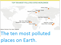
http://sciencythoughts.blogspot.com/2013/11/the-ten-most-polluted-places-on-earth.html
Follow Sciency Thoughts on Facebook.

Landslide kills four in Arunachal Pradesh.

Four people have died in a landslide in the Lower Siang District of Arunachal Pradesh on Friday 29 June 2018. The incident happened at about 2.30 pm local time when a large boulder struck a minibus carrying twenty members of the Indo-Tibetan Border Police. In addition to the four fatalities, eight other passengers were injured, with two being described as being in a serious condition.

The remains of an Indo-Tibetan Border Police vehicle hit by a boulder during a landslide in Arunachal Pradesh on 29 June 2018. Press Trust of India.

The incident is the latest in a series of such events in the state associated with heavy rains caused by the summer monsoon. Landslides are a common problem after severe weather, as excess pore water pressure can overcome cohesion in soil and sediments, allowing them to flow like liquids. Approximately 90% of all landslides are caused by heavy rainfall. Arunchal Pradesh has a monsoon season that begins around the end of April or beginning of May and ends around September, bringing 2-4000 mm of rain to the region each year.

Monsoons are tropical sea breezes triggered by heating of the land during the warmer part of the year (summer). Both the land and sea are warmed by the Sun, but the land has a lower ability to absorb heat, radiating it back so that the air above landmasses becomes significantly warmer than that over the sea, causing the air above the land to rise and drawing in water from over the sea; since this has also been warmed it carries a high evaporated water content, and brings with it heavy rainfall. In the tropical dry season the situation is reversed, as the air over the land cools more rapidly with the seasons, leading to warmer air over the sea, and thus breezes moving from the shore to the sea (where air is rising more rapidly) and a drying of the climate. This situation is particularly intense in South Asia, due to the presence of the Himalayas. High mountain ranges tend to force winds hitting them upwards, which amplifies the South Asian Summer Monsoon, with higher winds leading to more upward air movement, thus drawing in further air from the sea.

 Diagrammatic representation of wind and rainfall patterns in a tropical monsoon climate. Geosciences/University of Arizona.

See also...

http://sciencythoughts.blogspot.com/2017/07/flooding-kills-at-least-seventy-three.htmlhttp://sciencythoughts.blogspot.com/2017/07/fourteen-feared-dead-after-landslide-in.html
http://sciencythoughts.blogspot.com/2016/04/sixteen-dead-after-landslide-in.htmlhttp://sciencythoughts.blogspot.com/2013/09/magnitude-45-earthquake-in-arunachal.html
Follow Sciency Thoughts on Facebook.