Showing posts with label Megaliths. Show all posts

Friday, 30 July 2021

Interpretting the Neolithic Mustatils of northwestern Arabia.

The northwestern part of the Arabian Peninsula was, until fairly recently, believed to have been largely uninhabited until the onset of the Iron Age, in the twelfth century BC. However, recent research has suggested that the area may have been inhabbited for much longer, by peoples with unique cultural identities not seen elsewhere. This research has identified thousands of stone structures across northwestern (and other parts of) Arabia, which have become collectively known as the 'Works of Old Men', and which date from the Middle Holocene (6500-2800 BC) onwards. These structures come in a range of forms, including burrial cairns, tower tombs, 'pendant' tombs, megalithic structures, monumental Animal traps (or 'kites'), and a variety of open-air structures.

One of the forms of open-air structure commonly found in the region is the mustatil (مستطيل), large rectangular structures ('mustatil' is Arabic for 'rectangle'), which comprise two long, parallel walls 20-640 m in length, with two short walls or platforms making up the other sides of the rectangle. Additional dividing long walls are sometimes present, giving the structures the appearance of a European farm gate; they were originally termed 'Gates', but this description has been dropped as it was somewhat confusing. Around 1000 of these structures have now been discovered, scattered across an area of about 200 000 km², between latitudes of 22.989° and 28.064° north and longitudes of between 36.875° and 42.700° west, with the highest concentrations in AlUla and Khaybar counties.

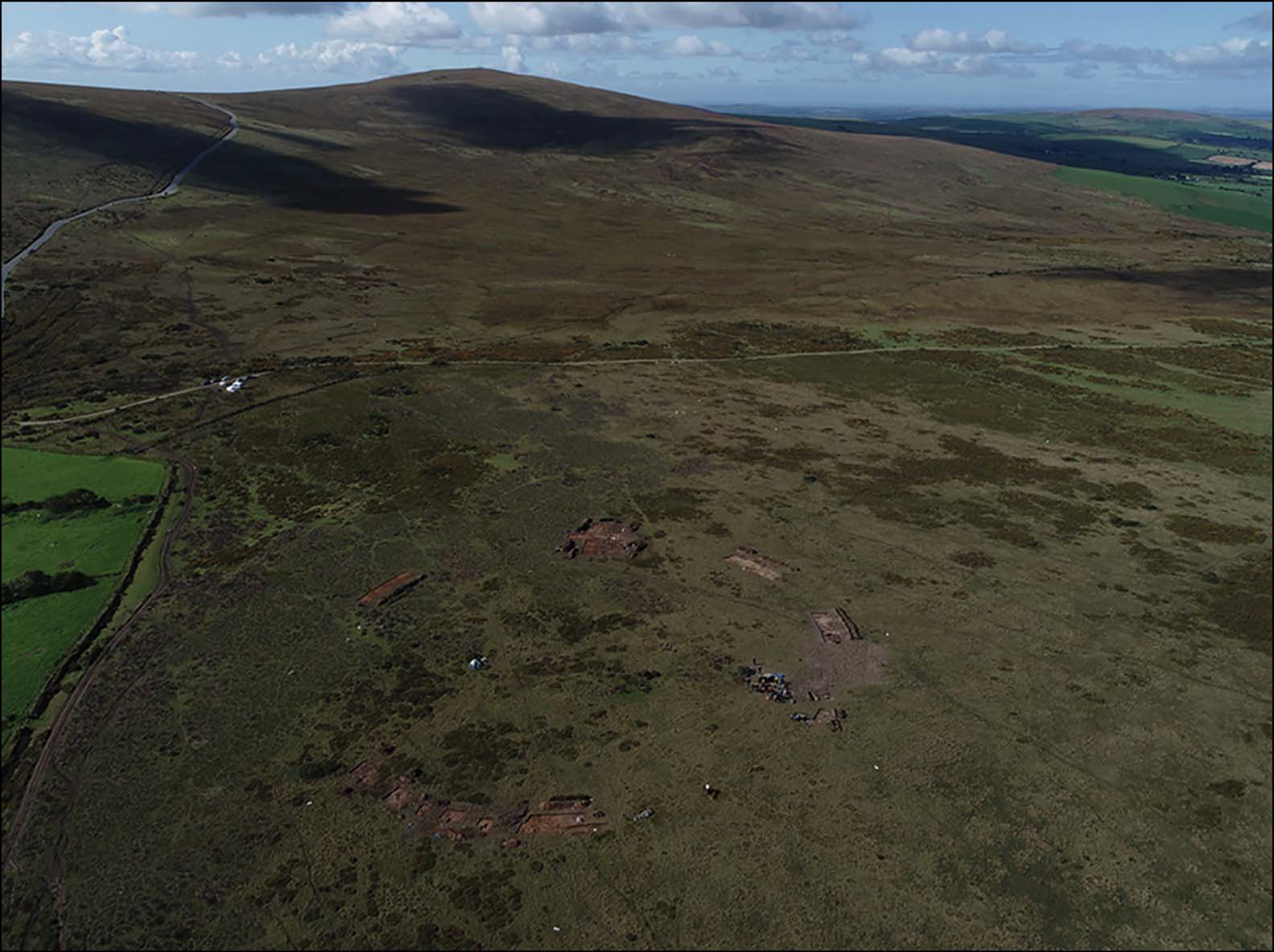
Following a preliminary report in 2017, the Royal Commission for AlUla comissioned the Aerial Archaeology in the Kingdom of Saudi Arabia AlUla project to carry out a survey of the mustatil structures of AlUla County, as part of the Identification and Documentation of the Immovable Heritage Assets of AlUla programme. This was later joined by a second project, Aerial Archaeology in the Kingdom of Saudi Arabia Khaybar, concentrating on the mustatils of Khaybar County. These projects have used publicly available satellite images to identify mustatil structures in remote areas, followed by a series of helicopter surveys, with 1072 mustatils identified from satellite images, 276 photographed from the air, and 39 surveyed from the ground. Several of the mustatils visited were subject to preliminary excavations, revealing features that were not previously known.

In a paper published in the journal Antiquity on 30 April 2021, Hugh Thomas, Melissa Kennedy, Matthew Dalton, Jane McMahon, David Boyer, and Rebecca Repper, all of Classics and Ancient History at the University of Western Australia, present the results of these initial surveys of the mustatils of AlUla and Khaybar counties, Saudi Arabia.

Mustatil distribution across north-western Arabia. Thomas et al. (2021).

Northwestern Saudi Arabia has exposures of three major geological sequences; the Precambrian volcanic and sedimentary sequences of the Arabian Shield, a sequence of Cambrian-Ordovician sandstones, and a series of Cainozoic basalts, associated with the formation of the Red Sea, as the Arabian Peninsula rifted away from Africa. These different rock-types determine the geomorphology of the region, and therefore the distribution of its archaeological sites.

The largest landforms are in areas where the Cambrian-Ordovician sandstones have been eroded by water to form canyons and mesas. In drier areas, the landscape becomes progressively less varied, as wind erosion takes over from water erosion, till in desert areas there is an essentially flat, sandy landscape, with scattered yardangs (wind-eroded rocky outcrops), often with flattened hilltops, and blackened by desert varnish (a coating of fused clay and manganese particles that forms on rock surfaces not subject to water-erosion).

 
A group of three mustatils. Thomas et al. (2021).

The Cainozoic Harrat Basalts also form extensive landscapes, notably the Harrats Khaybar, Kura and Ithnayn lavafields, and the Harrat Uwayrid basalt plateau north-west of AlUla. The oldest of these lavafields are Miocene in age, and have flat or gently undulating flow surfaces with few clay pans, while younger, Pliocene-Early Holocene examples form hummocky, ‘whale-back-style’ terrains, with large clay-filled depressions and localised higher relief around volcanic vents. 

Mustatils are found on all these landscapes, but their placement and form varies with landscape type.

All Mustatils are distinguished by the presence of a head, courtyard, and base, but some also associated with other features, such as orthostats (standing stones) and circular cells.

 
The head of a mustatil, note the chamber in the centre of the platform. Thomas et al. (2021).

The head of a mustatil typically comprises a dry-stone platform, rectangular or sub-rectangular in shape, 10-50 m in length, and 30-120 cm high. These were made from flat slabs of sandstone where these were available, but otherwise chunks of the local rock stacked together. In most of the investigated mustatils, a single oval or rectangular chamber, ranging in size from 2.8 x 2.8 m to 10 x 3 m, was present at the centre of the head. In some cases a doorway, less than 50 cm wide, connected this chamber to the main courtyard. In some instances this doorway had been deliberately blocked off, either with a single capstone or a pile of smaller stones, possibly when the site was decommissioned. Some of the chambers also have other features, notably niches.

 
Features of mustatil: (A) internal niche located in the head of a mustatil; (B) a blocked entranceway in the base of a mustatil; (C)–(D) associated features of a mustatil: cells and orthostats; (E) stone pillar identified on the Harrat Khaybar lava field. Thomas et al. (2021).

The courtyards of mustatils were rectangular, elongate areas, bounded by the head, the base, and the long walls. These appear to have been open spaces when in use; some examples have other structures within the courtyard area, such as smaller enclosures or funerary structures, though these are thought to post-date the original usage.

The long walls comprise two rows of laid stones filled with a rubble core. The laid stones were arranged either horizontally or vertically, with only a single example showing a mixture of horizontal and vertical stones. These walls varied between 50 cm and 3 m in width, and from 30 cm and 120 cm in height.

The base of the mustatils typically had an entrance 30-80 cm in width (sometimes slightly wider), directly opposite the central chamber in the head. Some of these entranceways also appear to have been blocked when the sites were decommissioned, sometimes symbolically with a few stones on either side, sometimes with the entire entrance being infilled.

 
Aerial image of three mustatil bases. Note the associated features (cells and orthostats) and blocked entranceways. Thomas et al. (2021).

Sixty five of the 109 sites surveyed from the ground or air had circular cells in front of their bases. These could be discrete, or interlocking, with each site having between three and eight such structures; although the number may actually be higher, as at many sites these have been partially covered by wind-blown sand. At sites with discrete cells, these cells are 1-2 m in diameter, and tend to all be the same size at any given site. At sites with interlocking cells the outermost cells tend to be 1.0-1.3 m in diameter, with the cells increasing in size progressing inwards, so that the largest, inermost cells are 1.8-2.0 m in diameter. These cells are aranged parallel to the base of the mustatil, with a passageway thus formed between the cells and the entrance to the courtyard. In five of the examined mustatils, these passageways had also been blocked, either deliberately or by collapse of the structures. At seven of the examined sites, the cells contained central orthostats (standing stones), fashioned from local stone and 1-1.5 m in height.

The mustatils surveyed on the Harrat Khaybar lava field differed slightly from mustatils surveyed elsewhere, in that they lacked orthostats, but instead had pillars of carefully stacked local stone, probably relating to a lack of suitable marterial to make true orthostats. These pilars occurred in clusters, with up to 50 seen at a single site.

The initial survey of the mustatil sites noted that many had associated 'I'-shaped structures, which have subsequently been shown to comprise low, rubble-filled platforms with an exterior face. These are quite variable in form, varying from structures that are distinctly 'I'-shaped to simple rectangular forms; the variation in shape in these structures closely aligns with variations in the shape of mustatils, with the two structures sharing a similar distribution range, although 'I'-shaped structures are less common, Similar rectangular structures are also known from southern Jordan, although it is unclear if these are related.

 
(A)–(B) I-type platforms; (C)–(D) rectilinear platforms. Thomas et al. (2021).

A total of 131 'I'-shaped structures have been recorded, of which 73 are adjacent to a larger mustatil. These are typically parallel to the mustatil, and aligned with either the base or a long wall. Up to six 'I'-shaped structures can be associated with a single mustatil, with the 'I'-shaped structures varying in size from 16 x 7 m to 42 x 16 m. These structures never cut across mustatils, and never use stone recycled from them, suggesting that they were in use at the same time, and, therefore, where the two are placed side-by-side, they were somehow functionally related. 

The examined mustatils vary considerably in form and shape, but have some consistent feature. Thomas et al. propose they be subdivided into two broad types; 'simple' mustatils with roughly rectangular shapes defined by a head, a base and two long walls, with may-or-may not have an entranceway in the base, but usually lack it, and 'complex' mustatils, which are similar in form, but always have an entrance, which is associated with other structures, such as circular cells and orthostats or pillars. They further note that the 'I'-shaped structures are only ever found in association with complex mustatils.

 
(A) ‘Simple’ mustatil; (B)–(C) ‘complex’ mustatils, single (B) and double (C). Thomas et al. (2021).

However, variations are present in both types of mustatil. Notably, additional long walls dividing the courtyard may be present in either simple or complex foems, Most mustatils appear to have been built in a single phase of construction, although some show signs of later modification. Bith simple and complex mustatils are found across the entire range of the structures, with their distribution apparently being random within this range.

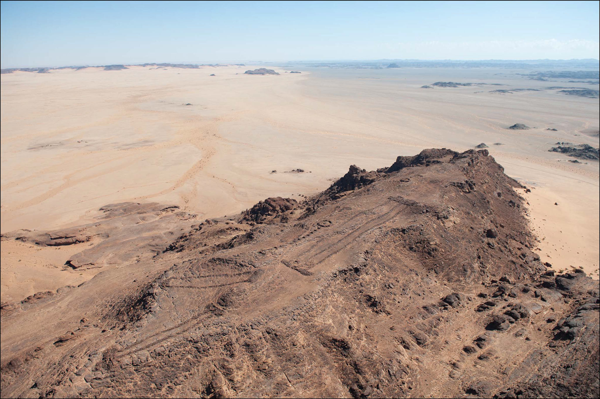
The majority of mustatils are built upon exposed bedrock. They do not appear to be oriented towards any particular object or direction, but instead follow the local topography, somthing that varies greatly across the area, depending on the local geology. Where mustatils are built upon slopes, it is always with their long access perpendicular to the slope, while mustatils located on narrow sandstone ridges are arranged to allow the maximum length. On flat ground mustatils show no preferential orientation.

 
Geographic positioning of different mustatils. Thomas et al. (2021).

Where possible, the head of mustatils appears to have been deliberately places higher than the rest of the structure, something especially true of mustatils located on the rocks of the Precambrian Shield., but less marked on exposed sandstone outcrops, where the entire structure is typically located on a flat mesa surface. Arranging the mustatils in this way would have been more difficult on the younger volcanic terrains, but even hear these structures are often clustered around vents, enabling the head to be highest. emphasising how important this arrangement must have been. The majority of 'I'-shaped structures and rectangular platforms are also built on slopes. Mustatils placed upon hillslopes are visible from a great distance, which may have been the intention of such placement; those placed upon flat mesas above the wider plain are effectively hidden from sight, but themselves command excellent views. It therefore seems likely that visibility of and from the mustatils was important to their builders in some way.

Mustatils are often found clustered together, with up to 19 individual mustatils found in groups where none is further than 500 m from its neighbour. The mustatils of the Harrat Khaybar are more concentrated into groups than elsewhere, but this phenomenon is found across the entire geographical range of these structures. The reasons for this are unclear, though Thomas et al. suggest that a better understanding of the chronology of the sites construction and use might prove enlightening.

Excavations at the IDIHAF-0011081 mustatil site in eastern AlUla County have revealed a central chamber at the head in which a number of horns and skull fragments from Cattle, Sheep, Goats, and Gazelles have been placed around a central upright stone in the centre of the chamber. These remains are dominated by Cattle, and are assumed to have been some form of ritual sacrifice. No Human remains were found at the site, nor any signs of domestic occupation. Radiocarbon dates were obtained from a tooth and horn, which suggests that the animals from which these came were alive in the sixth millennium BC (Late Neolithic).

 
Artefacts recovered during excavation and ground survey: (A) Cattle horn positioned in front of a betyl (standing stone) at IDIHA-F-0011081; (B)–(C) cattle horns recovered from IDIHA-F-0011081; D) Neolithic micro core collected from IDIHA-F-0003301; (E) Neolithic bifacial foliate identified at IDIHA-F-0011394. Thomas et al. (2021).

A sample of charcoal that was obtained from a looted mustatil located to the south of the Nefud Desert produced a late sixth to early fifth millennium BC radiocarbon date, and faunal remains similar to those from the one excavated by Thomas et al. The type, and positioning, of these remains strongly suggests that the mustatils had a ritual purpose, as does the prominence of the mustatils in the landscape. This is supported by the fact that no mustatil investigated to date has produced any sign of occupation, and absence of any indication of any mustatil having ever been roofed. Orthostats have also been found at other sites in Arabia interpreted as having been used for ritual purposes, which again supports the idea that this was the purpose of the mustatils. The narrow entrances and elongate structures of the mustatils suggest that the rituals carried out within them may have been of a processionary nature, with participants moving in single-file from the entrance to the head.

Stone tools were found at four of the 39 mustatils investigated on the ground. These include a flaked micro core, an obsidian bifacial foliate, and some non-diagnostic flakes and debitage. However, most of the courtyards were devoid of any tools or other cultural material.

Mustatils are commonly found in association with other structures, including, funerary monuments and 'kites'. A total of 118 such associations were found in the aerial surveys, with the mustatils often being overbuilt by, or structurally robbed to build, the other structures. This implies that the mustatils are older than these other structures, and apparently the oldest structures in the area. In some cases, one mustatil appears to overlie another.

There are no known Human burials of similar age to the mustatils in northwestern Arabia. However, many later tombs are closely geographically associated with mustatils, including ringed tombs, with and without pendant tails. These 'pendant' tombs have been dated to between the fourth millennium BC and the second century AD, again supporting the idead that these structures were built after the mustatils, and that in some instances material was looted from mustatils to help build them.

Five examples of mustatils being overlain by 'kite' structures, and one, possible example of a mustatil overlying a 'kite'-structure. Kite structures are again thought to be fourth-to-third millennium BC in age, making them Neolithic in age, although more work needs to be done on these structures.

In all cases mustatils have been built from readily available local stone, which has affected the construction methods used, as well as the appearance and durability. Sandstone tends to split along bedding planes due to natural processes, forming a natural flagstone rock. A similar effect can be obtained using metamorphic schists, which are common in parts of the Precambrian Arabian Shield. In both cases the rock can be extracted in sheets by hand or using wooden tools. This will yield both flagstones from which walls can be made and larger rocks which can be placed upright to produce orthostats. Many of the rocks used in the construction of the mustatils are such sheets, with examples exceeding 500 kg in weight not unusual. Where walls are made from such flagstones they can be fitted together tightly, and are resilient to collapse, unlike walls made from more rounded stones, such as those available on basalt terrains.

The largest Mustatil that Thomas et al. surveyed on the ground was located on the Harrat Khaybar lava field, 50km south of the town of Khaybar. This is 525 m long and made from basalt boulders. Assuming that basalt has a density of 2500 kg/m³, Thomas et al. estimate that the construction of this site would have required the moving of 12 000 tonnes of rock, with the individual rocks used weighing from 6 to 500 kg.

Methods of estimating the amount of time and labour needed to construct stone monuments have been developed by archaeologists working on Mayan structures in the New World, and there were applied by Thomas et al. to the mustatils. This led them to conclude that a group of ten people could construct a 150 m mustatil in twe-to-three weeks, and that a 500 m mustatil could be built by a team of fifty people in about two months. Thus, most of the mustatils could have been built by small groups of workers in a relatively short period of time, and even the largest could have been constructed by a family group in a few months, and potentially much less time if several family groups worked together. The construction of mustatils could, therefore, have formed part of a broader Neolithic development of community and power structures, and possibly served as a means of maintaining social cohesion amoungst widely dispersed and/or nomadic pastoralist communities.

Understanding why the mustatils were built requires a wider understanding of the culture that produced them. They appear to date entirely from the Late Neolithic, and possibly represent a new culture moving into the area, as climatic variations in Arabia during the Late Pleistocene and Ealy Holocene are thought to have driven repeated colonisation of, and withdrawal from, areas by different Neolithic peoples, resulting in distinctive regional cultures across the landmass. The relationship between the mustatil-building culture and the Holocene Humid Phase (roughly 8000–4000 BC) is unclear.

The ritually deposited Cattle remains at site IDIHA-F-0011081 appear to represent the oldest known evidence for Cattle on the Arabian Peninsula, and therefore the arrival of an important economic resource for Neolithic pastoralists. Cattle are important in rock art from the Arabian Late Neolic, but the earliest known evidence for Cattle comes from Shi’b Kheshiya in Yemen, where there are a number of structures thought to have been associated with Cattle, and dates to about 4400 BC, making it about 900 years younger than site IDIHA-F-0011081.

The large size of the mustatils, and the way in which their makers were able to construct to a common plan over a very wide area, suggests that these structures were imoportat the their makers, and conveyed some connection with the land, possibly serving as terrirory boundaries, or sites of some ritual right of passage. On other parts of the peninsula, burial structures may have served a similar function,

No structures closely resembling mustatils are known from anywhere else, although a number of large, rectangular, open-air 'sanctuaries' are known from the Negev Desert, and these also date to the sixth millennium BC. However, while these share the same basic form as the mustatils, they show no similarity in placement or building methodology, making it unclear if there is any relationship. What the mustatils do appear to be is one of the first examples of a strictly ritual structure in the Neolithic of the Near East.

Mustatils are found across a wide area of northwestern Arabia, showing a remarkable level of structural conservatism, albeit with adjustments for local geology. Understanding the context in which these structures were built is clearly highly important for understanding the developing cultures of the Middle Holocene in the area, and the number of these monuments may indicate that this landscape may have supported a far higher population at this time than was previously thought.

See also...


Follow Sciency Thoughts on Facebook.

Follow Sciency Thoughts on Twitter


Wednesday, 2 June 2021

Was Stonehenge originally located at Waun Mawn in the Preseli Hills of Wales.

Around 1036 AD, Geoffrey of Monmouth wrote that the stones of Stonehenge came originally from Giants’ Dance on the legendary Mount Killaraus in Ireland, and that they were brought to England by the wizard Merlin, who had defeated the Irish and stolen their stones. Stonehenge itself was erected by an army of 15 000 workers, as a memorial to the Ancient Britons murdered by the treacherous Saxons during peace talks at Amesbury. This version of events is no longer viewed as being completely accurate; the Saxons did not arrive in England until after 300 AD, long after Stonehenge was erected, and none of the stones come from Ireland. However, in Geoffrey of Monmouth's time much of southwest Wales, from where the stones have been shown to originate, was considered to be Irish territory, which has led to some speculation that the story could contain a grain of truth, with the bluestones of Stonehenge having originally stood at a site somewhere in the Preseli Hills of west Wales, and subsequently having been moved to their current position on Salisbury Plain.

In a paper published in the journal Antiquity on 12 February 2021, Mike Parker Pearson of the Institute of Archaeology at University College London, Josh Pollard of the Department of Archaeology at the University of Southampton, Colin Richards of the Archaeology Institute at the University of the Highlands & Islands, Kate Welham of the Department of Archaeology & Anthropology at Bournemouth University, Timothy Kinnaird of the School of Earth and Environmental Sciences at the University of St Andrews, Dave Shaw of Allen Archaeology Ltd, Ellen Simmons of the Department of Archaeology at the University of Sheffield, Adam Stanford of Aerial-Cam Ltd, Richard Bevins of the Department of Natural Sciences at the National Museum of Wales, Rob Ixer, also of the Institute of Archaeology at University College London, Clive Ruggles of the School of Archaeology & Ancient History at the University of Leicester, Jim Rylatt of Past Participate, and Kevan Edinborough of the Faculty of Medicine, Dentistry and Health Sciences at the University of Melbourne, describe the results of the ‘Stones of Stonehenge’ project's attempts to find the Welsh origin of the Stonehenge stones. 

The standing stones of Waun Mawn, in the Preseli Hills of Pembrokeshire, comprise four monoliths, three now recumbent, which originally stood in an arc. These were identified in 1925 as the remains of a stone circle, but subsequently have been seen as ‘doubtful or negative’ and ‘destroyed or unrecognisable’. However, recent excavations have identified bluestone megalith quarries at Craig Rhos-y-felin and Carn Goedog in the Preseli Hills as dating from 3400–3000 BC, making the Waun Mawn site a much more likely candidate for the original site of Stonehenge.

 
Location of the dismantled stone circle of Waun Mawn (red-ringed circle), as well as the bluestone sources of Carn Goedog (spotted dolerite), Craig Rhos-y-felin (rhyolite) and Cerrigmarchogion (unspotted dolerite). The locations of the Neolithic causewayed enclosure of Banc Du and palisaded enclosure of Dryslwyn (black-ringed circles), as well as Early Neolithic portal tombs (black squares), are also shown. Mike Parker Pearson in Parker Pearson et al. (2021).

The Waun Mawn site was first identified as being of interest in 2010, but subsequent magnetometer and earth-resistance surveys carried out in 2011 failed to find any evidence to support this. Thus, Waun Mawn received no further attention at that time, while several other circular monuments in the area were surveyed and excavated between 2012 and 2017, none of these proved to be Neolithic in origin.

In 2017, Parker Pearson et al. returned to Waun Mawn, carrying out excavations at either end of the arc of stones, which revealed two stoneholes without stones which had not been detected by magnetometric investigation. Further surveys using earth resistance, ground-penetrating radar, and electromagnetic induction, also failed to reveal any indication of ancient activity, which led Parker Pearson et al. that, due to the minimally magnetic and conductive properties of the substrate, only physical excavation would be able to reveal further stoneholes in the non-magnetic substrate of glacial drift deposits at the site.

 
The arc of former standing stones at Waun Mawn during trial excavations in 2017, viewed from the east. Only one of them (third from the camera) is still standing. Recumbent stone 13 is in the foreground. Adam Stanford in Parker Pearson et al. (2021).

In September 2018, Parker Pearson et al. began a new series of excavations at Waun Mawn, carrying of further work beyond each end of the arc, and opening up further small trenches to the west, south-west and south, which followed the projected circumference of the circle. The 2017 and 2018 excavations revealed a total of twelve sub-surface features, six of which were identified as stoneholes with emptied sockets from which standing monoliths had been removed, and two as stoneholes of two of the fallen stones at the ends of the arc. These holes suggest a former stone circle with a diameter of 110 m, which may have comprised as many as 30–50 stones.

 
Waun Mawn during excavation in 2018, viewed from the north. The stone circle sits on the side of the hill Cnwc yr Hˆy (‘the hillock of the deer’) at 311m OD, with distant views of Ireland to the west and the mountains of Snowdonia to the north. Adam Stanford in Parker Pearson et al. (2021).

The majority of the stoneholes comprised shallow pits, 0.80–1.20m in diameter and 0.30–0.50m deep, with a shallow ramp up to 0.50m long. These contained stone packing around an emptied socket, which had subsequently filled with sediment following the removal of each standing stone. At the base of each socket an imprint of the monolith that once stood in it can be seen, preserving each stone’s basal shape and size. The largest of these (stonehole 91) preserves a pentagonal imprint, with four of the other holes preserve square of rectangular imprints.

 
(a) Waun Mawn: the excavation trenches (in red) showing the locations of the four remaining standing stones (in red and black), the additional stoneholes (in green and black) and other features (in blue). From the centre of the circle, the midsummer solstice sun rose within the entrance formed by stoneholes 9 and 21; (b) Stonehenge stage one (beginning in 3080–2950 BC and ending in 2865–2755 BC). Stonehenge’s enclosing ditch and bank were constructed in 2995–2900 BC (at 95% probability). Kate Welham & Irene de Luis in Parker Pearson et al. (2021).

Several stone tools were uncovered at Waum Mawn, including a flint scraper, a flint chip and a trimmed, circular mudstone disc. None of this material was directly datable, but the mudstone disc was made from a type of rock accessible within Neolithic levels at the Carn Goedog megalith quarry, which is about 5 km to the east of Waum Mawn. This is fairly typical of stone circles, which can be very hard to date, due to the small amount of associated material, and the fact that what material there is tends to be of types that do not lend themselves to radiometric dating. This problem is particularly acute at Waum Mawn, where the acid soil prevents the preservation of material made from bone. A small amount of charcoal, a material amenable to radiometric dating, was recovered by sediment flotation, was recovered, but the largest of these was under 4 mm long, making it likely that this material could have been moved from its original stratigraphic position by bioturbation. To attempt to remedy this, Parker Pearson et al. combined radiocarbon dating of these samples with optically stimulated luminescence dating of the sediments from which they were recovered. Optically stimulated luminescence dating can reveal the date at which a sample was last exposed to light; this potentially gives the date of burial, but can be reset if an object is subsequently exposed, making it unreliable on its own, but providing a plausible test for radiometric dating results.

 
Stonehole 7, after removal of sediment filling the emptied socket, but with the stone packing still in place (viewed from the east). The packing stones were created from a single boulder, split into pieces before being packed against the side of the monolith. Its imprint in the base of the stonehole reveals that this monolith had a square cross-section. Mike Parker Pearson in Parker Pearson et al. (2021).

Optically stimulated luminescence dating of samples from 11 feature profiles revealed a complex depositional history, with material from several exposures, possibly relating to the emplacement and removal of the megaliths, found within the sockets. Nevertheless, the material good internal stratigraphic coherence, with material likely to have been deposited in the Neolithic or Early Bronze Age.

 
A 3D photogrammetric image of stonehole 91 after excavation of the socket left by the standing stone’s removal, viewed from the north. The imprint of this stone (in the right half of the stonehole) reveals that the base of this stone had a pentagonal cross-section. The ramp, along which the stone was erected and removed, is at the top of the picture. Adam Stanford in Parker Pearson et al. (2021).

The sediments from the holes yielded dates of between 6980 BC and 1900 AD, although the primary fills of the four sampled stoneholes, i.e. the deposits associated with the erection of the stone circle, are likely to have been deposited around 3530 BC, and the secondary fills, associated with the removal of the stones, were probably deposited around 2120 BC, although this date will not reflect the actual date of removal of the stones, but rather material that infilled the holes later, potentially at any time in the subsequent centuries or even millennia.

Radiocarbon dates were obtained from 43 charcoal samples recovered from Waun Maen, 31 from the stoneholes and 12 from other features. Most of these yielded Mesolithic dates, from the the ninth to fifth millennia BC, making them too old to be associated with the site, and were therefore discarded. Several more dates were rejected because they were too young, dating from the second and first millennia BC, i.e. the Bronze and Iron Ages. However, seven charcoal fragments, four of them from the postholes, yielded dates of 3600-3000 BC, i.e. the end of the Early Neolithic and beginning of the Middle Neolithic, dates which could plausibly relate to the construction of the site.

Such a date would place Waun Mawn amongst the earliest stone circles in Britain, alongside Long Meg and her Daughters in Cumbria (109m diameter) and the stone circle beneath the passage tomb of Bryn Celli Ddu on Anglesey (18m diameter). Radiometric dates obtained from a sample of Hazel charcoal recovered from one of the stoneholes of Long Meg and her Daughters dates to 3340–3100 BC, and cremated human remains obtained from pits associated with stoneholes at Bryn Celli Ddu have given radiocarbon dates of 3500–3100 and 3310–2900 BC, As no stone circle in Britain is currently thought to date to more than 3400 BC, Parker Pearson et al. suggest that the Waun Mawr stone circle was probably erected between 3400 and 3200 BC, and most likely towards the end of this range.

The three remaining stones at Waun Mawn are comprised of an unspotted dolerite, which may have come from the outcrops 3km to the south-east at Cerrigmarchogion on the Preseli ridge. A flake of rock left in the hole left by the standing stone with the pentagonal base is also made of this material.

 
(Left) a flake of unspotted dolerite from stonehole 91 was recovered from the junction of the empty socket and the ramp; (top right) stone 62 is one of the three unspotted dolerite pillars at Stonehenge; (bottom right) stone 62’s basal cross-section matches the imprint of the pillar that once stood in stonehole 91 at Waun Mawn. Sophie Laidler & Adam Stanford in Parker Pearson et al. (2021).

Three of the stones of Stonehenge (stones 44, 45 & 62), are also made from unspotted dolerite bluestone, and one of these (stone 62) has a pentagonal cross-section at the turf line, which is similar in shape and dimensions to the imprint in stonehole 91 at Waun Mawn. Stones 44 and 45, which are undressed and form part of the outer circle at Stonehenge, are about 2 m high, similar in size to the single standing stone at Waum Mawn, at 1.20 m, but smaller than the two fallen stones, which are about 3.20 m long; stone 62, which stands about 2 m above the ground, would probably be almost as large as the fallen stones if its full length were exposed. The stones of Waum Mawn are therefore reasonably comparable with the stones of Stonehenge in terms of size.

Two of the stoneholes at Waum Mawn show no signs of having packing stones or ramps. One of these formerly held a short monolith 1.20m long, 0.90m wide and 0.25m thick, which is now recumbent at the east end of the arc, the second holds no stone, and is about 1.3 m to the east of the first. The long sides of these stones would have been perpendicular to the circumference of the circle, rather than parallel with it, forming what Parker Pearson et al. describe as a 'gunsight' on the north-east side of the circle, which possibly served as an entrance. To somebody standing in the centre of the circle during the Neolithic period, the Sun would have risen within this entrance on the Summer Solstice. 

 
(Top) recumbent stone 013 lying beside its stonehole (9), viewed from the west. It formed the west side of the stone circle’s north-east-facing entrance. Although the top of this pillar (left) is broken off, its weathered surface indicates that this probably occurred long before the Neolithic; (bottom) stonehole 21 in half-section, viewed from the east. With its ‘gunsight’ arrangement, perpendicular to the circumference of the stone circle, the removed pillar would once have formed the east side of the north-east-facing entrance. Mike Parker Pearson in Parker Pearson et al. (2021).

With a diameter of 110 m, Waum Mawn is the joint third largest stone circle in Britain (with the outer circle at Stonehenge), behind the outer circle at Avebury, at 331 m, and Stanton Drew, at 113 m, and ahead of Long Meg and her Daughters at 109 m, the Ring of Brodgar at 104 m, and the north and south circles at Avebury, at 104 m each. The inner circle of bluestone monoliths at Stonehenge was 87 m in diameter, with the stones carefully placed 4.5 m apart. This is quite different from the situation at Waum Mawn, where the stones are spaced irregularly, and where there are gaps in the perimeter where no stones were erected, particularly on the northwest side, although whether this was always the intention or whether the circle was not completed for some reason is unclear. Either way, the construction of Waum Mawn and Stonehenge appear to have been carried out with different emphasis and perspectives, with the regularity and homogeneity seen at Stonehenge being an inovation which was not present during the construction of the (older) Waum Mawn.

There are, however, still parallels with Stonehenge, notably the sighting of the putative entrance to Waum Mawn, in line with the Summer Solstice, which corelates with the setting of Stonehenge, which is positioned at the south-west end of a geomorphological landform of parallel ridges that coincidentally align on the solstitial axis. However, Stonehenge also appears to have an entrance aligned broadly with the northernmost major Moonrise, something which does not appear to have been marked at Waum Mawn.

The common diameter of Stonehenge and Waum Mawn, combined with the match between the cross section of stone 62 at Stonehenge and hole 91 at Waum Mawn, as well as the common building material (unspotted dolerite) used at both sites, strongly hints at a connection between the two ancient monuments.

Parker Pearson et al. believe there is a strong case for at least some of the material used at Stonehenge having originated at Waum Mawn, although they doubt that the stone circle at Waum Mawn ever contained 56 standing stones, the number suggested for Stonehenge by the Aubrey Holes. It is thought that about 80 bluestones were brought from Wales to Salisbury Plane in the Neolithic, with 56 going to Stonehenge and about 25 to the nearby Bluestonehenge circle. During Stonehenge stage two (2740–2505 BC) the site is thought to have comprised a double arc of standing stones, which were rearranged into an inner and outer circle at the onset of stage 3 (beginning in about 2400–2220 BC). During this last phase all of the original stones were re-organised, and the stones which had previously stood at Bluestonehenge incorporated into the new monument.

While the geology of the Waum Mawn stones matches that of some of the Stonehenge stones, this is not the case for the majority. Only three of the 44 bluestone stones at Stonehenge today are unspotted dolerite, compared to 27 spotted dolerite stones. Thus, while some of the Stonehenge material may have come from Waum Mawn, it is likely that the majority of the 80 original stones came from elsewhere. The Alter Stone at Stonehenge clearly did not come from Waum Mawn, or anywhere else in Preseli, and is thought most likely to have cone from the Devonian Senni Sandstone, about 100 km to the east. Two other sandstone pillars are thought to be of Palaeozoic origin, and to have come from the area to the north and east of Preseli. It is quite possible that these stones once formed part of other stone circles, which were dismantled in order to provide material for the construction of Stonehenge, as were other stones at the site with different lithologies.

It is unlikely that Waum Mawn is the Giants’ Dance described by Geoffrey of Monmouth. The common features seen at Waum Mawn and Stonehenge are sufficient to suggest that the stones were moved from one site to the other by people with a common purpose, not carried off as trophies of war following a military victory.

Recent strontium isotopic analysis on 25 of the approximately 60 cremation burials from Stonehenge has shown that four of these individuals had probably lived the last decades of their lives on the Ordovician/Silurian rocks of south-west Wales, the area that includes the Preseli Hills, with the remaining remains consistent with the individuals having lived on the chalk of Salisbury Plain or on the surrounding Mesozoic strata. Bone is remodelled repeatedly throughout our lives, with all our bone being replaced over a period of about a decade. This means that it is impossible, using bone as a test material, to detect the difference between a migrant who has lived in an area for more than a decade and a local who has lived their all their lives, so it is impossible to say if any of the other burials represent individuals who had moved to the area more than ten years before dying.

It is notable that the four individuals identified as being of southern Welsh origin have all been radiocarbon dated to around the very beginning of construction at Stonehenge, at about 3000 BC, when it is thought that the Bluestones were first erected, suggesting that these individuals might have relocated to the Salisbury Plain with the stones, while later burials reflect descendants of these migrants living on local chalk. This may even have applied to livestock as well as people. A sample of dentine from the mandible of an elderly Cow found in Stonehenge’s enclosing ditch has been dated to around 3350–2920 BC, and is has a strontium isotope signature consistent with the Animal having been reared in South Wales (unlike bone, dentine is laid down shortly before a tooth erupts, an is not replaced again within an Animal's lifetime.

No material at Waum Mawn has been dated to more recent than about 3000 BC, and very few items from the Preseli region in general. This is in spite of decades of research at Neolithic sites in the area. Waum Mawn did not go on to become the core of a larger monument complex, as happened to older stone circles at sites such as the Ring of Brodgar, Avebury and Stonehenge. Instead, the site seems to have been developed as a major centre in the earlier Neolithic, but then dismantled and abandoned. It is, however, unlikely that the area was completely depopulated, and the remaining stones at the circle may have remained in use in some way.

Stonehenge appears to have been built by Neolithic migrants from South Wales, whether on their own, or in collaboration with the local population. These migrants appear to have brought the large stones of the circle with them, possibly as a physical manifestation of their ancestral identities to be recreated in their new home. This brining of sacred stones to a new, mystically significant location may have helped to unify the people of southern Britain during the first phase of activity at Stonehenge. 

Stonehenge lies upon a north–south line of henges, stone circles and cursuses (elongated parallel-sided enclosures) from the Thames Valley to the south coast of England, which broadly forms a geographic divide between different regional traditions in earlier Neolithic material culture, as well as variations in genetic ancestry between east and west, a location which has previously been cited as evidence for a unifying role for the monument.

 
The location of Stonehenge and other monument complexes of the Middle to Late Neolithic (roughly 3400–2450 BC) that may have formed a neutral zone or territorial boundary between the west and south-east of Britain. Irene de Luis in Parker Pearson et al. (2021).

The discovery of evidence for a potential migration of people and livestock from Wales to Salisbury Plain at the same time as the stones were relocated raises new questions about Stonehenge's origins and purpose. Why did these people move at this time? Was the movement driven by a change in climatic conditions, or was it driven by some economic, social or political change? Did people leave adverse conditions in Wales, or simply take advantage of some new opportunity on Salisbury Plane? Did they take over an older sacred site at Stonehenge? And if they did, was this an act of conquest, or unification (or both)?

See also...


Follow Sciency Thoughts on Facebook.

Follow Sciency Thoughts on Twitter