Showing posts with label South Sandwich Plate. Show all posts

Thursday, 12 May 2016

Eruptions on Mount Sourabaya, Bristol Island.

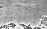
NASA's Landsat 8 satellite has recorded an eruption on Mount Sourabaya, a stratovolcano (cone shaped volcano made up of layers of ash and lava around a central vent) on Bristol Island in the South Sandwich Islands, the first eruption on the volcano detected since 1956. Volcanic eruptions on Bristol Island are seldom directly observed, as the island is uninhabited and largely covered by glaciers, with most historical observations having been made by whaling ships, which no longer ply the waters of the South Atlantic. Even with satellites observing eruptions in the South Sandwich Islands is difficult, as they are often covered by extensive cloud cover around Cape Horn. However the Landsat 8 satellite was able to observe the eruption using its Operational Land Imager instrument, which is able to see into the infrared part of the spectrum, enabling it to detect heat sources through heavy cloud cover. The eruption was first observed on 24 April 2016 when a plume the satellite observed a plume rising above the cloud layer at human visual wavelengths, together with a heat source below the clouds interpreted as flowing lava at infrared wavelengths. A second pass of the island on 1 May showed elongation of the heat source, suggesting lava flowing down the side of the mountain.

Landsat 8 image of eruption on Mount Sourabaya taken on 24 April 2016. Cloud cover and plume are at visible wavelengths, blue outline of Bristol Island and orange representation of heat-source detected at infrared wavelengths are visual enhancements. NASA/Earth Observatory.

The South Sandwich Islands lie along the eastern margin of the South Sandwich Microplate, and are fuelled by the subduction of the tip of the South American Plate beneath the South Sandwich Microplate along the South Sandwich Trench. As material from the South American Plate sinks deeper into the Earth it is melted by the heat of the planet's interior, with some of the melted material rising through the overlying South Sandwich Microplate to form the volcanoes of the South Sandwich Islands.

Second Landsat 8 image of Mount Sourabaya taken on 1 May 2016. Cloud cover is less extensive and heat source has become more elongate. NASA/Earth Observatory.

The South Sandwich Plate is being formed by spreading along the East Scotia Ridge, which separates it from the South Scotia Plate to the west. Along this fracture zone the two plates are being drawn apart and new lithospheric material is being formed by magma upwelling from the Earth's interior. This is thought to have been occurring for about 28.5 million years, and is one of a series of such ridges that have formed between the South American and Antarctic Plates as the two have been drawn apart over the last 40 million years, prior to this they were a single continental block.

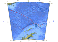
Map of South Sandwich Plate (SAN) shows its position between the Scotia Plate (SCO), South American Plate (SAM) and the Antarctic Plate (ANT). There are also visible The East Scotia Ridge (ESR), South Sandwich Islands (SSI) and the South Sandwich Trench (SST). Rogers et al. (2012).

See also...
http://sciencythoughts.blogspot.co.uk/2012/06/possible-volcanic-activity-on-mount.htmlPossible volcanic activity on Mount Siple, Antarctica.                                                 Mount Siple is one of the world's most remote volcanoes, located on Siple Island, off the coast of Marie Byrd Land, Antarctica. It is a shield volcano...
http://sciencythoughts.blogspot.co.uk/2012/01/series-of-earthquakes-in-south-shetland.htmlSeries of Earthquakes in the South Shetland Islands.                                                          On Sunday 15 January 2012 at approximately 9.40 am local time (1.40 pm GMT) Elephant Island in the South Shetland Islands was shaken by an Earthquake measuring 6.6 on the Richter Scale at a depth...
http://sciencythoughts.blogspot.co.uk/2012/01/new-deep-sea-hydrothermal-vent.htmlNew deep-sea hydrothermal vent ecosystem discovered in the Southern Ocean.        Deep-sea hydrothermal vents (or 'black smokers' are) areas where super-heated, mineral-rich water escape from fissures in the Earth's crust into deep ocean water. They typically occur on divergent plate margins (ocean ridges), where two tectonic plates are moving apart...
Follow Sciency Thoughts on Facebook.

Sourabaya
Sourabaya
Sourabaya

Monday, 9 January 2012

New deep-sea hydrothermal vent ecosystem discovered in the Southern Ocean.

Deep-sea hydrothermal vents (or 'black smokers' are) areas where super-heated, mineral-rich water escape from fissures in the Earth's crust into deep ocean water. They typically occur on divergent plate margins (ocean ridges), where two tectonic plates are moving apart and new ocean crust is being formed, but have also been found at transform margins, where plates are moving past one-another (also volcanically active areas).

A hydrothermal vent on the boundary between the South Scotia and South Sandwich Plates. It gets the nickname 'Black Smoker' from the minerals in the water which turn it opaque. From Rogers et al. (2012) (see bellow).

In 1977 an ecosystem was discovered at a black smoker on the Galapagos Rift, dominated by tube worms which derived their energy not from the sun by photosynthesis, or eating plants that had derived it from the sun by photosynthesis, but by the action of chemotropic (literally 'chemical eating') bacteria within their bodies. This caused a considerable stir among biologists, as it was the first time an ecosystem had ever been discovered that was not dependent on the light of the sun for energy (deep-water and cave communities that had been discovered before were out of the light, but ultimately derived their energy from organisms in it, typically by eating the dead). In addition the environment was particularly strange and hostile seeming; lightless, at very high pressures and very, very hot. Water from hydrothermal vents typically has temperatures of several hundred °C, but is be to remain a liquid due to the very high pressure in the deep ocean.

The tube worms of the Galapagos Vents.

Since this time communities have been found at vents at a number of locations about the world. All have been dependent on chemotropic bacteria for sustenance, but a variety of organisms have been found hosting these bacteria, including mussels, worms, crabs and shrimps. In a paper published in the journal PLoS Biology on 3 January 2012, a team of scientists lead by Alex Rogers of the Department of Zoology at the University of Oxford describe the discovery of a new vent system and accompanying ecological community on the boundary between the South Scotia and South Sandwich Plates in the Southern Ocean, close to the Antarctic Peninsula.

Map of showing the location of the study areas (E2 & E9), on the East Scotia Ridge (ESR) between the South Scotia (SCO) and South Sandwich (SAN) Plates. Other legends are: (ANT) Antarctic Plate, (AP) Antarctic Peninsula, (PF) the Polar Front (the boundary between the polar atmospheric cell and the warmer Ferrel cell), (SACCF) the Southern Antarctic Current Front (a deep-sea current front), (SAF) the Sub-Antarctic Front (the northern boundary of the Antarctic Circumpolar Current), and (SAM) the South American Plate. From Rogers et. al (2012).

Scientists have thought there were probably hydrothermal vents in the area since the area was visited by the Towed Ocean Bottom Instrument (TOBI) in 1999. TOBI is a sonar mapping instrument used to build a three dimensional model of the sea-floor, it is operated by the National Oceanography Centre at the University of Southampton. The new study details the first actual visits to the site, first by a lowered camera system in 2009, then by the ROV Isis submersible in 2010.

The East Scotia Ridge vents produce highly acidic, hydrogen sulphide (H₂S) rich water at temperatures of up to 383 °C. This supports a diverse community of organisms based around a type of Yeti Crab, which cultures filamentous sulphur-oxidizing bacteria on hair-like setae covering its body.

A carpet of Yeti-Crabs at the E9 Hydrothermal Vent. The seaweed-like growths at the top right are Stalked Barnacles. From Rogers et al. (2012).

The vents also supported a number of other organisms, including stalked barnacles, sea anemones, sponges, worms, snails, limpets, starfish, octopus and shrimps. This is similar (but not identical) to the fauna previously described at the Pacific-Antarctic Ridge (and that found at cold seeps off Costa Rica) but very different to the fauna of the Mid-Atlantic Ridge, which is dominated by a species of mussel.

An image of a vent at the E9 site. The white substance on the chimneys is a carpet of Yeti Crabs, while the brown area to the fore is a carpet of Snails.

The Antarctic shallow sea-floor is strange in that it hosts the most diverse community of benthic (bottom-dwelling) invertebrates on the planet; all other ecosystems are at their most diverse in the tropics, and the Arctic is not especially rich in benthic invertebrates. Most of these invertebrates are highly endemic; that is to say they are exclusive to the Antarctic, and not found anywhere else. The similarity between the invertebrate fauna at the East Scotia Ridge and that at the Pacific-Antarctic Ridge, and the dissimilarity of either to those on other hydrothermal vents in the Atlantic and Pacific suggests that this is also the case for these deep-sea hydrothermal vent communities.

Other animals at the East Scotia Ridge site. (A) Sea anemones and Stalked Barnacles, (B) Sea Anemones and Snails, (C) Sea Anemones and Yeti Crabs, (D) Snails, (E) Stalked Barnacles and Starfish, and (F) an Octopus.