Showing posts with label Volcano. Show all posts

Sunday, 13 February 2022

Spectacular eruption on Mount Etna.

Mount Etna underwent a major eruption slightly before midnight on Thursday 10 February 2022, producing a column of ash and gas about 8 km high from its southeasten crater, accompanied by lava flows on its flanks, and triggering a lighting storm, a phenomenon associated with the only the largest eruptions, and is caused by static electricity generated as particles within the ash column colide.

 
An ash column over Mount Etna on Thursday 10 February 2022. Salvatore Allegra/AP.

Etna first erupted about half a million years ago, beneath the sea off the east coast of Sicily, and has been going strong ever since. It now stands 3330 m above sea level, and covers 1200 km³. It is responsible for fertile soils across eastern Sicily. Records of eruptions on Etna go back to 1500 BC. It is Europe's second largest volcano, after Teide in the Canary Islands, and is one of the most active volcanoes in the world.

 
Eruption on Mount Etna early in the morning of Friday 12 Febriaury 2022. Alberto Uccellatore/Volcano Discovery.

Despite all this Etna has only ever caused 77 recorded deaths (the most recent being two tourists caught in a summit explosion in 1987) and relatively little destruction. In 1928 it destroyed the village of Mascali on its northeastern flank, though there were no reported casualties, the village being slowly overrun by a lava flow. In 1669 a much larger lava flow destroyed at least 10 villages, reaching the walls of the city of Catania, 40 km to the south, but again without loss of life. In 122 BC a heavy ash fall covered much of the region, causing several buildings to collapse in Catania. The destruction was deemed so severe by the Roman authorities that they granted the city a 10 year tax holiday. In about 6000 BC a landslide on the eastern flank of the volcano is thought to have caused a tsunami that caused destruction around much of the eastern Mediterranean. 

 
The location of Mount Etna. Google Maps.

Etna is located on the border of the African and European Plates, specifically where Africa is being subducted beneath the European Plate. As it is drawn into the Earth's interior material from the African Plate melts, and the lighter portions rise up through the overlying European Plate, causing a number of volcanoes including Etna and Vesuvius.

 
Map showing the tectonic plates underlying Italy and southern Europe, and the location of the l'Aquila Earthquake. Napoli Unplugged.

See also...


Follow Sciency Thoughts on Facebook.

Follow Sciency Thoughts on Twitter.


Tuesday, 2 May 2017

Shipping warning issued after eruption on Kick 'em Jenny.

A warning has been issued to shipping after the University of the West Indies Seismic Research Centre in Trinidad detected an eruption on Kick 'em Jenny, a submarine volcano about 8 km to the north of Granada at about 5.45 pm local time on Saturday 29 April 2017. The eruption was reportedly felt on northern Granada, and was followed by a number of further events over the following two days, with over 40 events detected on Monday 1 May.  As a precaution a shipping exclusion zone surrounds the volcano to a distance of 1.5 km; due to the heightened risk to shipping during periods of activity this zone has been increased to 5 km until further notice.

Map showing the exclusion zone around Kick 'em Jenny. Caribbean 360.

Kick 'em Jenny rises 1300 m above the surrounding seafoor, but remains 180 m below the surface. It was first discovered in July 1939, when an eruption broke the surface and threw material several hundred meters into the air, as well as generating a tsunami which was observed as far away as Barbados, though it was too small to cause any damage. However Kick 'em Jenny is labled on many earlier maritime charts, indiating that people have been aware there was something here for several centuries, even if they did not know the nature of the feature.

The Lesser Antilles are located at the eastern fringe of the Caribbean Tectonic Plate. The Atlantic Plate (strictly speaking, an extension of the South American Plate which runs to the northeast of the Caribbean) is being subducted beneath this, and as it sinks into the Earth, is melted by the heat of the planets interior. Some of the melted material then rises up through the overlying Caribbean Plate as magma, fuelling Kick 'em Jenny and the other volcanoes of the Lesser Antilles Volcanic Arc. The subduction of the Atlantic Plate beneath the Caribbean Plate is not a smooth process, with the two plates constantly sticking together then breaking apart as the tectonic pressure builds up, causing Earthquakes in the process, though since the boundary between the two plates is some way to the east of the islands, Earthquakes in the Lesser Antilles tend to be both deep and offshore, which lessens their destructive potential.

 The subduction of the Atlantic Plate beneath the Caribbean Plate fuels the volcanoes of the Lesser Antilles Volcanic Arc. George Pararas-Carayannis.

See also...

http://sciencythoughts.blogspot.co.uk/2017/03/magnitude-45-earthquake-to-north-of-st.htmlhttp://sciencythoughts.blogspot.co.uk/2017/02/magnitude-56-earthquake-to-northeast-of.html
http://sciencythoughts.blogspot.co.uk/2016/12/magnitude-59-earthquake-off-coast-of.htmlhttp://sciencythoughts.blogspot.co.uk/2015/10/magnitude-45-earthquake-in-lesser.html
http://sciencythoughts.blogspot.co.uk/2013/12/five-people-killed-by-landslide-in-st.htmlhttp://sciencythoughts.blogspot.co.uk/2012/03/volcanic-activity-on-soufriere-hills.html
Follow Sciency Thoughts on Facebook. 

Tuesday, 18 April 2017

Access to Mount Poás, Costa Rica, closed off following eruptions.

Tourist access to Mount Poás, a stratovolcano (cone-shaped volcano made up of layers of ash and lava) in central Costa Rica, has been closed off following a series of eruptions over the weekend of 15-16 April 2017. The two largest eruptions occurred between 8.40 and 9.00 am on Sunday 16 April, producing an ash column about a kilometre high and throwing rocks over a kilometre from the summit, some falling onto viewpoints from which tourists can observe the volcano.

Rock embedded into the concrete of a viewing point near Mount Poás following the 18 April 2017 eruption. Redy Conejo/Poás Volcano National Park.

Mount Poás rises to 2708 m above sea level, but has gently sloping, forested flanks making the summit easily accessible. The summit consists of two craters, each with a lake. To the south is the cool, clear, Lake Botos, which has not seen an eruption for 7500 years, and to the north is Laguna Caliente, which is thermally heated, extremely acidic (about pH 0), and prone to frequent eruptions. The volcano and its surrounding area form the Poás Volcano National Park.

Ash column over Mount Poás following an eruption on 14 April 2016. Observatorio Vulcanológico y Sismológico de Costa Rica.

Mount Poás forms part of the Cordillera Central, a range of volcanic mountains running through central Costa Rica and forming part of the Central American Arc. These volcanoes are fuelled by the subduction of the Cocos Plate, which underlies part of the east Pacific Ocean, beneath the Caribbean Plate, on which Central America lies, along the Middle American Trench, which lies off the south coast of the country. As the Cocos Plate is subducted it is gradually melted by the heat and pressure of the Earth's interior, with some more volatile minerals rising through the overlying Caribbean Plate as volcanic magma.

Diagram showing the passage of the Cocos Plate beneath Costa Rica (not to scale). Carleton College.

See also...

http://sciencythoughts.blogspot.co.uk/2017/01/eruptions-on-mount-turrialba-costa-rica.htmlhttp://sciencythoughts.blogspot.co.uk/2016/09/airports-closed-after-eruptions-on.html
http://sciencythoughts.blogspot.co.uk/2016/07/magnitude-53-earthquake-in-guanacaste.htmlhttp://sciencythoughts.blogspot.co.uk/2016/05/eruptions-on-mount-turrialba.html
http://sciencythoughts.blogspot.co.uk/2016/05/exclusion-zone-established-around-mount.htmlhttp://sciencythoughts.blogspot.co.uk/2016/03/eruption-on-rincon-de-la-vieja-costa.html
Follow Sciency Thoughts on Facebook.

Sunday, 27 November 2016

Eruptions on Mount Popocatépetl.

The Mexican National Centre for Disaster Prevention has reported a series of  eruption on Mount Popocatépetl, a stratovolcano (cone shaped volcano made up of layers of ash and lava) in the central part of the country, starting on the morning of Friday 25 November 2016. Over 300 individual eruptions were recorded within 24 hours on 25-26 November, with a maximum ash column height of about 5 km observed, and ash falls reported at a number of locations in Puebla State.

Ash coloumn over Mount Popocatépetl slightly after 10.00 am on Friday 25 November 2016. SEGOB.

Major eruptions on Popocatépetl are a cause for concern as the volcano is in a densely populated area, with 30 million people living within the potential hazard zone. The last major eruption, a Plinian (or Vesuvian) event in about 800 AD, triggered a series of pyroclastic flows and lahars that scoured the basins around the volcano.

The location of Popocatépetl. Google Maps.

The volcanoes of the Trans-Mexican Volcanic Belt (including Popocatépetl) are fuelled by the subduction of the Cocos Plate beneath the North American Plate along the Middle American Trench to the south of Mexico. As the subducting plate sinks into the Earth it is melted by the heat and pressure, and volatile minerals liquefy and rise through the overlying North American Plate as magma, fuelling Mexico's volcanoes. 

 The subduction of the Cocos Plate beneath the North American Plate in Mexico, and how it leads to volcanoes and Earthquakes.

See also...

http://sciencythoughts.blogspot.co.uk/2016/06/eruption-on-mount-popocatepetl.html
http://sciencythoughts.blogspot.co.uk/2016/08/landslides-kill-at-least-40-as-tropical.html

http://sciencythoughts.blogspot.co.uk/2016/04/eruption-on-mount-popocatepetl.html
http://sciencythoughts.blogspot.co.uk/2016/06/magnitude-47-earthquake-off-coast-of.html
http://sciencythoughts.blogspot.co.uk/2015/10/eruption-on-mount-popocatepetl.html
http://sciencythoughts.blogspot.co.uk/2015/11/flights-cancelled-after-eruption-on.html

Follow Sciency Thoughts on Facebook.


Thursday, 29 September 2016

Thousands evacuated following eruption on Mount Rinjani, Lombok.

The Pusat Vulkanologi dan Mitigasi Bencana Geologi (which monitors volcanoes and other geohazards in Indonesia) has set up a three kilometer exclusion zone around Mount Rinjani,  an active volcano on northern Lombok island, on Tuesday 27 September 2016. The eruption came without warning, and produced an ash column two kilometers in height from the Gunung Barujari crater, which first erupted in 1994. At the time of the eruption over a thousand tourists were in the Mount Rinjani National Park, which surrounds the volcano, including 639 foreign nationals. Initial reports suggested that some of these were missing and may have been trapped by the eruption, but all have now been found and evacuated, including some who reportedly initially sought to avoid local authorities in order to observe and document the eruption.

The 27 September 2016 eruption on Mount Rinjani. Antara Foto/Reuters.

The Indo-Australian Plate, which underlies the Indian Ocean to the south of Java, Bali and Lombok, is being subducted beneath the Sunda Plate, a breakaway part of the Eurasian Plate which underlies the islands and neighbouring Sumatra, along the Sunda Trench, passing under the islands, where friction between the two plates can cause Earthquakes. As the Indo-Australian Plate sinks further into the Earth it is partially melted and some of the melted material rises through the overlying Sunda Plate as magma, fuelling the volcanoes of Java and neighbouring islands.

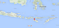
The approximate location of Mount Rinjani. Google Maps.

Subduction along the Sunda Trench beneath Java, Bali and Lombok. Earth Observatory of Singapore.

See also...
 
http://sciencythoughts.blogspot.co.uk/2016/06/flooding-and-landslides-kill-forty.htmlFlooding and landslides kill forty seven in Central Java.                                               Forty seven people have been confirmed dead and another fifteen are missing after a series of landslides and flash floods in Central Java, Indonesia, this week. Landslides are a common problem after severe...
http://sciencythoughts.blogspot.co.uk/2016/02/magnitude-63-earthquake-beneath-palau.htmlMagnitude 6.3 Earthquake beneath Palau Sumba, Indonesia.                               The United States Geological Survey recorded a Magnitude 6.3 Earthquake at a depth of 28 km...
http://sciencythoughts.blogspot.co.uk/2015/11/landslide-believed-to-have-killed-one.htmlLandslide believed to have killed one person in West Java, Indonesia.                              One person is missing and believed to be dead following a landslide that hit the Karangmukti...
Follow Sciency Thoughts on Facebook.

Wednesday, 21 September 2016

Airports closed after eruptions on Mount Turrialba.

Several airports in Costa Rica were forced to close after a pair of eruptions on Mount Turrialba, a stratovolcano (cone shaped volcano made up of layers of ash and lava) in the central part of the country, Monday 19 September 2016. The first eruption occured at about dawn, the second at about noon, this latter event producing an ash column over four kilometers high, and causing ashfalls in the city of Cartago. A third eruption occured on Tuesday 20 September.

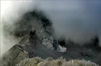
Eruption on Mount Turrialba on Monday 19 September 2016. Red Sismológica Nacional/Universidad de Costa Rica.

Volcanic ash is extremely hazardous to aircraft in a number of ways. At its most obvious it is opaque, both visually and to radar. Then it is abrasive, ash particles physically scour aircraft, damaging components and frosting windows. However the ash is most dangerous when it is sucked into jet engines, here the high temperatures can melt the tiny silica particles, forming volcanic glass which then clogs engine. When this happens the only hope the aircraft has is to dive sharply, in the hope that cold air passing through the engine during the descent will cause the glass to shatter, allowing the engine to be restarted.
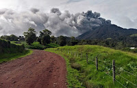
 Residents of Cartago during an ashfall event on Monday 19 September 2016. AFP.

Turrialba forms part of the Cordillera Central, a range of volcanic mountains running through central Costa Rica and forming part of the Central American Arc. These volcanoes are fueled by the subduction of the Cocos Plate, which underlies part of the east Pacific Ocean, beneath the Caribbean Plate, on which Central America lies, along the Middle American Trench, which lies off the south coast of the country. As the Cocos Plate is subducted it is gradually melted by the heat and pressure of the Earth's interior, with some more volatile minerals rising through the overlying Caribbean Plate as volcanic magma.

  Diagram showing the passage of the Cocos Plate beneath Costa Rica (not to scale). Carleton College.

See also...

http://sciencythoughts.blogspot.co.uk/2016/05/exclusion-zone-established-around-mount.htmlExclusion zone established around Mount Turriabla after a series of eruptions on Sunday 1 May 2016.                                    The Costa Rican Comisión Nacional de Emergencias has...
http://sciencythoughts.blogspot.co.uk/2016/05/eruptions-on-mount-turrialba.htmlEruptions on Mount Turrialba                         The Observatorio Vulcanológico y Sismológico de Costa Rica-Universidad Nacional reported a series of eruptions on Mount Turrialba, a stratovolcano (cone shaped volcano made up of layers of ash and lava) in the central part of...
http://sciencythoughts.blogspot.co.uk/2015/12/explosive-eruption-on-mount-turrialba.htmlExplosive eruption on Mount Turrialba. The Observatorio Vulcanológico y Sismológico de Costa Rica-Universidad Nacional reported a short explosive eruption which lasted about ten minutes, beginning slightly after 1.10 pm local time on Monday 7 December 2015...
 
Follow Sciency Thoughts on Facebook. 

Friday, 2 September 2016

Eruptions on Mount Santiaguito triggers lahar.

The Instituto Nacional de Sismologia, Vulcanologia, Meteorologia, e Hidrologia in Guatemala has reported an explosive eruption on Mount Santiaguito on Sunday 28 August 2016, which produced a dense ash column 2.5 km high that drifted to the west. Several pyroclastic flows were sighted on the slopes of the mountain. Ash falls were reported in the communities of San Marcos, Loma Linda, and Palajunoj. Heavy rainfall on the next day, Monday 29 August, triggered a lahar on the southern flanks of the mountain, which carried tree trunks and blocks up to 1.5 m across into the Cabello de Ángel, a tributary of the Nimá. There are no reports of any injuries or damage to property.

 
Lahar on the southern flanks of Mount Santiaguito on 29 August 2016. Conred.

Lahars are ash-laden flash floods associated with volcanoes. They can be caused directly by volcanic eruptions, for example when hot lava encounters a glacial lake rapidly destroying an ice dam, but are also common in areas of high seasonal rainfall, where ash deposits from a volcano can build up during the dry season, creating dams on seasonal waterways, which temporarily halt the flow of water, then give way rapidly leading to dramatic flash floods.

The volcanoes of Guatemala, and Central America in general, are fed by the subduction of the Cocos Plate beneath the Caribbean Plate along the Middle American Trench, which runs roughly parallel to the southwest coast of the isthmus. As the Cocos Plate sinks into the Earth, it passes under Central America, which lies on the western margin of the Caribbean Plate. As this happens it is heated by the friction and the heat of the planet's interior, causing the sinking plate to partially melt. Some of the melted material then rises through the overlying Caribbean Plate as magma, fueling the volcanoes of Central America.

See also...

http://sciencythoughts.blogspot.co.uk/2016/08/explosive-eruptions-on-mount.htmlExplosive eruptions on Mount Santiaguito, Guatemala.                                           The Instituto Nacional de Sismologia, Vulcanologia, Meteorologia, e Hidrologia in Guatemala has reported a series of small eruptions on Mount Fuego...
http://sciencythoughts.blogspot.co.uk/2015/11/eruptions-on-mount-fuego-guatemala.htmlEruptions on Mount Fuego, Guatemala. The Instituto Nacional de Sismologia, Vulcanologia, Meteorologia, e Hidrologia in Guatemala has reported a series of small eruptions on Mount Fuego a stratovolcano (cone shaped volcano made up of...
Twenty-six people have been confirmed dean and another thirty-six people are known to have been injured following a landslide which struck the town of Santa Catarina Pinula in southern Guatemala late...


Follow Sciency Thoughts on Facebook.