Showing posts with label Tajikistan. Show all posts

Tuesday, 16 June 2020

Magnitude 5.7 Earthquake in southern Tajikistan.

The United States Geological Survey recorded a Magnitude 5.7 Earthquake at a depth of 118 km about 72 km to the northeast of the town of  Khorugh in the Gorno-Badakhshan Autonomous Region of southern Tajikistan, at about 6.30 am local time (about 1.30 am GMT) on Tuesday 16 June 2020. There are no reports of any damage or casualties associated with this event, but people have reported feeling across much of the country; which is roughly what would be expected from an Earthquake of this size at this depth; the quake is big enough to be felt over a wide area, but most of its energy has dissipated before the shock-waves reach the surface.

The approximate location of the 16 June 2020 Tajikistan Earthquake. USGS.

Tajikistan lies to the north of the boundary between the Indian and Eurasian tectonic plates, which runs through northern Afghanistan. The Indian Plate is moving northward relative to the Eurasian Plate, causing folding and uplift along this boundary, which has led to the formation of the Hindu Kush Mountains of Afghanistan, The Pamirs in Tajikistan, the Himalayas and the other mountain ranges of Central Asia., and which makes the nations in this boundary zone prone to Earthquakes.

Witness accounts of Earthquakes can help geologists to understand these events, and the structures that cause them. The international non-profit organisation Earthquake Report is interested in hearing from people who may have felt this event; if you felt this quake then you can report it to Earthquake Report here.

See also...

https://sciencythoughts.blogspot.com/2020/05/four-dead-over-100-000-displaced.htmlhttps://sciencythoughts.blogspot.com/2020/05/four-killed-by-flash-flood-in-northern.html
https://sciencythoughts.blogspot.com/2020/03/magnitude-50-earthquake-in-northern.htmlhttps://sciencythoughts.blogspot.com/2020/01/magnitude-64-earthquake-in-western.html
https://sciencythoughts.blogspot.com/2019/12/landslide-kills-six-on-construction.htmlhttps://sciencythoughts.blogspot.com/2019/10/magnitude-50-earthquake-in-badakhshan.html
Follow Scieny Thoughts on Facebook.

Thursday, 26 March 2020

Magnitude 5.0 Earthquake in northern Tajikistan.

The United States Geological Survey recorded a Magnitude 5.0 Earthquake at a depth of 10 km about 17 km to the northeast of the town of Asht in northern Tajikistan, slightly before 9.45 am local time (slightly before 4.45 am GMT) on Thursday 26 March 2020. There are no reports of any damage or casualties associated with this event, but people have reported feeling in Asht, as well as in Tashkent in Uzbekistan.

The approximate location of the 26 March 2020 Tajikistan Earthquake. USGS.

Northern Tajikistan lies to the north of the boundary between the Indian and Eurasian tectonic plates, which runs through northern Afghanistan. The Indian Plate is moving northward relative to the Eurasian Plate, causing folding and uplift along this boundary, which has led to the formation of the Hindu Kush Mountains of Afghanistan, The Pamirs in Tajikistan, the Himalayas and the other mountain ranges of Central Asia., and which makes the nations in this boundary zone prone to Earthquakes.

Witness accounts of Earthquakes can help geologists to understand these events, and the structures that cause them. The international non-profit organisation Earthquake Report is interested in hearing from people who may have felt this event; if you felt this quake then you can report it to Earthquake Report here.
 
See also...

https://sciencythoughts.blogspot.com/2020/01/magnitude-64-earthquake-in-western.htmlhttps://sciencythoughts.blogspot.com/2019/12/landslide-kills-six-on-construction.html
https://sciencythoughts.blogspot.com/2019/10/magnitude-50-earthquake-in-badakhshan.htmlhttps://sciencythoughts.blogspot.com/2019/05/magnitude-44-earthquake-in-badakhshan.html
https://sciencythoughts.blogspot.com/2019/05/magnitude-46-earthquake-in-eastern.htmlhttps://sciencythoughts.blogspot.com/2019/03/flash-floods-kill-at-least-39-in.html
Follow Sciency Thoughts on Facebook.

Sunday, 15 May 2016

Anthracoidea pamiroalaica: A new species of Smut Fungus infecting Sedge Plants in the Pamir Alai Mountins of Tajikistan.

Smut Fungi, Ustilaginales, are parasitic Basidiomycote Fungi infecting a wide range of plants, including many commercial crops. They have a slightly complex life cycle, with wind-blown monokaryotic spores (cells with a single nucleus), which are non-parasitic. These spores settle on potential host plants, and if they encounter other spores fuse to form a dikaryotic phase (phase which in which two cells fuse to form a new cell with two nuclii, but these nuclii do not themselves fuse), which is parasitic forming large galls on the host plant, and which reproduses sexually to form new monokaryotic spores. Many Smut Fungi have been recorded as infecting multiple host plants, but recent molecular studies have suggested that this may be innacurate, with similar looking Smut Fungi on different plants often being cryptic species (species which cannot be separated by physical examination).

In a paper published in the journal Mycological Progress on 28 November 2015, Marcin Piątek of the Department of Mycology at the Władysław Szafer Institute of Botany of the Polish Academy of Sciences, Matthias Lutz of Plant Evolutionary Ecology at the University of Tübingen, Marcin Nobis of the Institute of Botany at Jagiellonian University, and Arkadiusz Nowak of the Department of Biosystematics at Opole University describe a new species of Smut Fungus from the Pamir Alai Mountins of Tajikistan.

The new species is placed in the genus Anthracoidea, which has prevously been found infecting a variety of Sedge species, and given the specific name pamiroalaica, in reference to the Pamir Altai Mountains where it was found. The species infects the wild Sedge Carex koshewnikowii, which grows in river vallies in the mountains.

Anthracoidea pamiroalaica on Carex koshewnikowii: (a) type locality area in the Takob river valley in the Hissar Mountains of Tajikistan, (b–c) general habit of healthy Carex koshewnikowii, (d–e) sori in the ovaries of Carex koshewnikowii. Scale bars: (d–e) = 5 mm. Piątek et al. (2015).

Smut Fungi infecting the Sedge Carex koshewnikowii have previously been recorded from the Pamir Altai Mountains of Tajikistan, but have been assigned to the species Anthracoidea sempervirentis, which has been recorded from twelve different Sedge species from Europe to Japan, and which is therefore thought likely to be a comlex of different, morphologically similar species rather than a single widespread species. Anthracoidea pamiroalaica was found to be only very distantly related to the origanal Anthracoidea sempervirentis specimens, strongly supporting the this idea. Piątek et al. further note that the Smut Fungi of Tajikistan are generally poorly studied, and that a number of other Smut Fungi have been recorded from unlikely hosts, suggesting that considerable cryptic diversity may be present within the group in the country.

Anthracoidea pamiroalaica on Carex koshewnikowii: (a–d) spores seen by light microscopy, median (a, c–d), and superficial (b) views, (e–g) spores seen by scanning electron microscopy, (h)  spore wall ornamentation seen by scanning electron microscopy. Scale bars: (a–d), (f–g) = 10 μm, (e) = 20 μm, (h) = 3 μm. Piątek et al. (2015).

See also...

http://sciencythoughts.blogspot.co.uk/2014/10/the-cause-of-pink-spot-disease-on.html
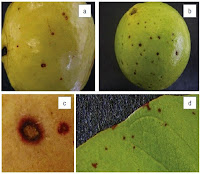
The cause of Pink Spot Disease on Guavas in South Africa.                                                           Guavas, Psidium guajava, are fruit bearing trees in the Myrtle Family, Myrtaceae, closely related to Eucalyptus. They are native to Mexico, Central America and the Caribbean Islands, but have been introduced to many countries as a commercial fruit crop, the largest producers being Mexico, India... 
http://sciencythoughts.blogspot.co.uk/2014/08/a-new-species-of-rust-fungus-from.htmlA new species of Rust Fungus from the Chatham Islands.                                         The Chatham Island Forget-me-not (Myosotidium hortensium) is a robust perennial herbaceous plant found in coastal habitats in the Chatham Islands, a remote group of islands roughly 860 kmeast of Christchurch, New Zealand. The plant of interest to botanists and biogeographers, since its closest known relatives are found in the Mediterranean region...
http://sciencythoughts.blogspot.co.uk/2013/10/two-new-species-of-amphisphaerid-fungi.htmlTwo new species of Amphisphaerid Fungi from southern China.                                   The Amphisphaerid Fungi (Amphisphaeriaceae) are a group of Ascomycetes found In South America, New Zealand and Eurasia. They are predominantly...
Follow Sciency Thoughts on Facebook.


Wednesday, 9 December 2015

Magnitude 7.2 Earthquake kills two in Tajikistan.

The United States Geological Survey recorded a Magnitude 7.2 Earthquake at a depth of 30 km about 50 km in the Pamir Mountains of eastern Tajikistan, slightly after 12.50 pm local time (slightly after 7.50 am GMT) on Monday 7 December 2015.Two people have reportedly died following the event, both as the result of rockfalls striking cars; in one of these incidents three other people in the vehicle were injured. Ten further people were injured in a separate landslide, one of a number that occurred across the region, blocking roads and demolishing buildings; around 237 houses were destroyed in the event and a further 205 damaged. People have reported feeling the quake as far away as New Delhi in India. The initial quake has been followed by a number of aftershocks.

Building damaged by the 7 December 2015 Tajikistan Earthquake. Ozogadon.

The Pamir Mountains lie to the north of the boundary between the Indian and Eurasian tectonic plates, which runs through northern Afghanistan. The Indian Plate is moving northward relative to the Eurasian Plate, causing folding and uplift along this boundary, which has led to the formation of the Hindu Kush Mountains of Afghanistan, The Pamirs in Tajikistan, the Himalayas and the other mountain ranges of Central Asia., and which makes the nations in this boundary zone prone to Earthquakes.

 The approximate location of the 7 December 2015 Tajikistan Earthquake.Google Maps.

Witness accounts of Earthquakes can help geologists to understand these events, and the structures that cause them. The international non-profit organization Earthquake Report is interested in hearing from people who may have felt this event; if you felt this quake then you can report it to Earthquake Report here.
 
See also...
 
http://sciencythoughts.blogspot.co.uk/2015/11/fatalities-confirmed-following.htmlFatalities confirmed following Afghanistan Earthquake.                                                 Two people have been confirmed dead following an Earthquake in Badakhshan Province in north-eastern Afghanistan on Sunday 22 November 2015. The quake was measured as having a Magnitude of...
http://sciencythoughts.blogspot.co.uk/2015/10/hundreds-known-to-have-died-following.htmlHundreds known to have died following massive deep Earthquake in northeast Afghanistan.                                                Four hundred and forty people are known to have died and thousands more are missing or injured following a massive deep Earthquake in Badakhshan Province in north-eastern Afghanistan on Monday 26 October 2015. The quake was measured as having a Magnitude of 7.5 and occurring at a depth of 712 km by the...
http://sciencythoughts.blogspot.co.uk/2015/04/thousands-dead-as-magnitude-78.htmlThousands dead as Magnitude 7.8 Earthquake strikes Nepal.                           Over 4500 people have been confirmed dead after an Earthquake measured as a Magnitude 7.8 event at a depth of 15 km by the United States Geological Survey struck the Lamjung District of Nepal...

Follow Sciency Thoughts on Facebook.


Monday, 14 May 2012

Earthquake in Tajikstan.

On Sunday 13 May 2012, slightly before 4.30 am local time (slightly before 11.30 pm on Saturday 12 May GMT) the Central Asian nation of Tajikistan was shaken by an Earthquake centered about 7 km of the town of Obikhingou in the Pamir Mountains, measured by the United States Geological Survey as occurring at a depth of 10 km and measuring 5.7 on the Richter Scale. This was felt as far away as the capitol, Dushanbe, as well as in the neighboring states of Uzbekistan and Afghanistan. The quake caused a number of landslides and a number of buildings to collapse. So far there has been one recorded human fatality; a large amount of livestock is also believed to have perished.

The location of the 13 May 2012 quake, and the areas where the worst shaking is likely to have been felt. USGS.

Tajikistan is quite prone to Earthquake though most are quite small and do not cause any problems. 90% of the country lies within the Pamir Mountains, which are caused by uplift due to the impact of the Indian Plate into the Eurasian Plate from the south.

An earthquake in souther Tajikistan in July 2006 killed three people and made about 1200 homeless. In 1989 an Earthquake completely destroyed the village of Sharora near Dushanbe, killing between 600 and 1000 people. In 1911 a quake in the east of the country killed about 90 people, and in 1907 a quake near the Uzbekistan border killed at least 12 000 people.


Follow Sciency Thoughts on Facebook.