The Geodynamics Institute of the National Observatory of Athens recorded a Magnitude 5.2 Earthquake at a depth of 12.8 km, beneath the Aegean Sea, about 15 km to the northwest of the island of Samos, at about 1.10 pm local time (about 11.10 am GMT) on Wednesday 31 August 2022. No damage or injuries have been reported following this event, but people have reported feeling the event across much of the Aegean region, the eastern Greek mainland, and western Anatolia.

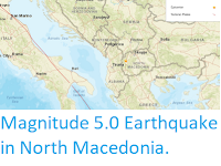
The approximate location of the 31 August 2022 Samos Earthquake. USGS.
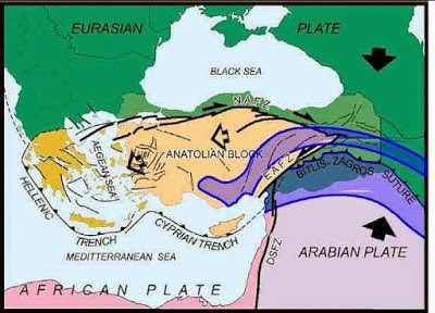
The Aegean Sea is underlain by the Aegean Sea Plate, a small tectonic plate caught between the African Plate to the south, the Anatolian Plate to the east and the Eurasian Plate to the northwest. The Anatolian Plate is being pushed to the west by the northward movement of the Arabian Plate to the east, pushing the Aegean Plate south and west into collision with the northward moving African Plate. Part of the African Plate is being subducted beneath the Aegean Plate along the Hellenic Trench, which runs to the south of the Greek Islands from Cyprus to Crete then northwest under the Ionian sea parallel to the Peloponnesian Coast. This is not a smooth process, as the plates frequently stick together then break apart once the pressure has built up sufficiently, leading to (fairly frequent) Earthquakes.

See also...