Showing posts with label Amurian Plate. Show all posts

Sunday, 6 August 2023

Magnitude 5.5 Earthquake in Shandong Province, China.

The China Earthquake Networks Center recorded a Magnitude 5.5 Earthquake at a depth of about 10 km, beneath Pingyuan County in Shandong Province, slightly after 2.30 am local time on Sunday 6 August 2023 local time (slightly after 6.30 pm on Saturday 5 August GMT). Twenty one people are reported to have been injured by the event, which caused 126 buildings to collapse and rail services in the region to be termporarily halted, but there are no reports of any fatalities. 

Damage to a farmhouse in Pingyuan County, China, caused by an Earthquake on Sunday 6 August 2023. CCTV/AP.

Earthquakes are common in west and southwest China, where the Eurasian Plate is being compressed by the impact of the Indian Plate from the south, but much less common in the east and centre of the country. However southeastern China is in fact dominated by a series of tectonic blocks, annealed onto the Eurasian Plate during the Triassic. Shandong Province lies in northeastern China, on the eastern margin of the North China Block, which is being pushed eastward by the motion of the Tibetan Block, pushing it into the Amurian Plate, which underlies parts of northeast China, the Russian Far East and Korea.

Tectonic map of Asia, showing relationships between the India–Asia collision, escape of Indonesian and South China blocks seaward, and extension from Siberia to the Pacific margin. (Note also the opening of back-arc basins including the Sea of Japan and the South China Sea, and extension in the Bohai Basin and eastern part of the NCC.) The North China Craton is also strongly influenced by Pacific and palaeo-Pacific subduction, perhaps also inducing extension in the eastern NCC. The palaeo Pacific and Pacific subduction zones developed in the Mesozoic, and also contributed to the hydration of the subcontinental lithospheric mantle beneath the NCC. Kusky et al. (2007).

See also...

Follow Sciency Thoughts on Facebook.

Follow Sciency Thoughts on Twitter.


Tuesday, 14 July 2020

Magnitude 5.1 Earthquake in Hebei Province, China,

The China Earthquake Networks Center recorded a Magnitude 5.1 Earthquake at a depth of about 10 km beneath the Guye District of the city of Tangshan in Hebei Province, slightly before 6.40 am local time on Suday 12 July 2020 local time (slightly before 10.40 pm on Saturday 11 July, GMT). This event was felt as far away as Beijing, and there are reports of some damage to buildings in the area, but none of any casualties.

The approximate location of the 12 July 2020 Hebei Earthquake. USGS.

Earthquakes are common in west and southwest China, where the Eurasian Plate is being compressed by the impact of the Indian Plate from the south, but much less common in the east and centre of the country. However southeastern China is in fact dominated by a series of tectonic blocks, annealed onto the Eurasian Plate during the Triassic. Hebei Province lies in northeastern China, on the eastern margin of the North China Block, which is being pushed eastward by the motion of the Tibetan Block, pushing it into the Amurian Plate, which underlies parts of northeast China, the Russian Far East and Korea.

Tectonic map of Asia, showing relationships between the India–Asia collision, escape of Indonesian and South China blocks seaward, and extension from Siberia to the Pacific margin. (Note also the opening of back-arc basins including the Sea of Japan and the South China Sea, and extension in the Bohai Basin and eastern part of the NCC.) The North China Craton is also strongly influenced by Pacific and palaeo-Pacific subduction, perhaps also inducing extension in the eastern NCC. The palaeo Pacific and Pacific subduction zones developed in the Mesozoic, and also contributed to the hydration of the subcontinental lithospheric mantle beneath the NCC. Kusky et al. (2007).

Witness accounts of Earthquakes can help geologists to understand these events, and the structures that cause them. The international non-profit organisation Earthquake Report is interested in hearing from people who may have felt this event; if you felt this quake then you can report it to Earthquake Report here.
 
See also...
 
https://sciencythoughts.blogspot.com/2020/07/bubonic-plague-reported-in-inner.htmlhttps://sciencythoughts.blogspot.com/2020/03/collapse-at-coal-mine-kills-four-in.html
https://sciencythoughts.blogspot.com/2019/11/fifteen-killed-in-explosion-at-coal.htmlhttps://sciencythoughts.blogspot.com/2019/11/third-case-of-plague-reported-in-china.html
https://sciencythoughts.blogspot.com/2018/12/explosion-in-laboratory-kills-three-at.htmlhttps://sciencythoughts.blogspot.com/2018/10/explosion-kills-two-and-traps-twenty-at.html
Follow Sciency Thoughts on Facebook.

Saturday, 18 November 2017

Magnitude 5.4 Earthquake in North Gyeongsang Province, South Korea.

The United States Geological Survey reported a Magnitude 5.4 Earthquake at a depth of 10.0 km about 10 km northwest of the city of Pohang in North Gyeongsang Province, South Korea, slightly before 2.30 pm, local time (slightly before 5.30 am GMT) on Wednesday 15 November 2017. The quake caused extensive damage to buildings in and around Pohang, with over a thousand buildings destroyed or damaged and more than 1500 people made homeless and 57 reported injuries, with ten people hospitalised and two described as being in critical conditions. People have reported feeling the event across South Korea, and it is likely that it was also felt in North Korea. The event was followed by at least 45 aftershocks.

Damage in Pohang, South Korea, following the 15 November 2017 Earthquake. Min Kyung-suck/Newsis/AP.

Korea lies on the southern part of the Amurian Plate, a breakaway section of the Eurasian Plate that also underlies parts of China, Japan, and the Russian Far East. The border with the Eurasian Plate lies to the east of the Korean Peninsula; this is a divergent margin along which new seafloor is being created, pushing the Eurasian and Amurian Plates apart. The Amurian Plate is also moving south relative to the Eurasian Plate, creating extra stresses along the margin between the two plates. Despite this significant Earthquakes in South Korea are not common events, and this is the second largest ever recorded there.

 Map of Plate Framework in the Northeast Asia. Study area is depicted by open red box. Boundaries of the Okhotsk (OK) and Amur (AM) plates are shown. Surrounding plates include Eurasia (EU), North America (NA), Pacific (PA), Philippine Sea (PS), and Yangtze (YA). Black vectors give model velocities (with numbers in mm/a) relative to plate whose identifier is underlined. Black circles are locations of Euler poles. Akira Takeuchi (2013).

Witness accounts of Earthquakes can help geologists to understand these events, and the structures that cause them. The international non-profit organisation Earthquake Report is interested in hearing from people who may have felt this event; if you felt this quake then you can report it to Earthquake Report here.  
 
See also...
 
http://sciencythoughts.blogspot.co.uk/2017/10/magnitide-47-earthquake-in-amur-oblast.htmlhttp://sciencythoughts.blogspot.co.uk/2017/10/eruption-on-mount-shinmoedake-kyushu.html
http://sciencythoughts.blogspot.co.uk/2017/09/eruption-on-mount-zhupanovsky-kamchatka.htmlhttp://sciencythoughts.blogspot.co.uk/2017/09/magnitude-46-earthquake-beneath-saitama.html
http://sciencythoughts.blogspot.co.uk/2017/08/eleven-injured-by-landslide-in-gifu.htmlhttp://sciencythoughts.blogspot.co.uk/2017/08/nine-still-missing-following-flood-at.html
Follow Sciency Thoughts on Facebook.

Saturday, 28 October 2017

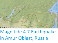
Magnitide 4.7 Earthquake in Amur Oblast, Russia

The United States Geological Survey reported a Magnitude 4.7 Earthquake at a depth of 9.9 km about 87 km northeast of the city of Zeya in Amur Oblast (Amur State) in the Russian Far East, slightly after 1.25 am on Friday 27 October 2017, local time, (slightly after 4.25 pm on Thusday 26 October GNT). There are no reports of any damage or casualties associated with this event, but it was felt locally.

The approximate location of the 27 October 2017 Amur Earthquake. USGS.

The Zeya area lies on the northern part of the Amurian Plate, hich underlies the southwest part of the Russian Far East, as well as northeatern China, the Korean Peninsula and southern Japan. The Amur Plate is moving southeast with regard to the Eurasian Plate, which lies to the north, creating a boundry between the plates which is both transform (i.e. the plates are moving sideways relative to one-another in places, with the Eurasian Plate moving west while the Amurian plate moves east, and divergent (with the plates being drawn apart, with the Eurasian Plate moving northward while the Amurian Plate moves to the south). These processes are not smooth, with the rocks of the two plates continuously sticking together then cracking apart as the pressure caused by the movement of the plates becomes to great, creating shockwaves we experience as Earthquakes.

 Map of Plate Framework in the Northeast Asia. Study area is depicted by open red box. Boundaries of the Okhotsk (OK) and Amur (AM) plates are shown. Surrounding plates include Eurasia (EU), North America (NA), Pacific (PA), Philippine Sea (PS), and Yangtze (YA). Black vectors give model velocities (with numbers in mm/a) relative to plate whose identifier is underlined. Black circles are locations of Euler poles. Akira Takeuchi (2013).

Witness accounts of Earthquakes can help geologists to understand these events, and the structures that cause them. The international non-profit organisation Earthquake Report is interested in hearing from people who may have felt this event; if you felt this quake then you can report it to Earthquake Report here.  

See also...

http://sciencythoughts.blogspot.co.uk/2017/08/understanding-conection-between.htmlhttp://sciencythoughts.blogspot.co.uk/2017/08/nine-still-missing-following-flood-at.html
http://sciencythoughts.blogspot.co.uk/2014/04/one-confirmed-fatality-after-omsk-hit.htmlhttp://sciencythoughts.blogspot.co.uk/2014/01/magnitude-51-earthquake-in-sakha.html
http://sciencythoughts.blogspot.co.uk/2013/11/two-earthquakes-in-jilin-province.htmlhttp://sciencythoughts.blogspot.co.uk/2013/04/deep-magnitude-62-earthquake-in-russian.html
Follow Sciency Thoughts on Facebook.

Thursday, 9 January 2014

Magnitude 5.1 Earthquake in the Sakha Republic of the Russian Far East.

The United States Geological Survey recorded a Magnitude 5.1 Earthquake at a depth of 12.3 km in the southeast of the Sakha Republic in the Russian Far East, slightly before 5.35 am local time on Saturday 5  January 2014 (slightly before 7.35 pm on Friday 4 January, GMT). There are no reports of any damage or injuries associated with this quake, though it is likely to have been felt locally.

The approximate location of the 5 January 2014 Sakha Republic Earthquake. Google Maps.

While not an area notorious for Earthquake activity, the southern Sakha Republic is located on the southeastern fringe of the Eurasian Plate, close to the boundaries with three other tectonic plates, leading to some movement in the area. 

To the south lies the Amurian Plate, which underlies Manchuria, Korea and parts of Japan and the Russian Far East, and which is moving south relative to the Eurasian Plate, while the Eurasian Plate moves west relative to it, creating a transform plate margin (a margin along which two tectonic plates move past one-another.

To the east lies the Okhotsk Plate, which underlies the Sea of Okhotsk and the Kamchatka Peninsula. This is moving to the southeast, the same direction as the Eurasian Plate, though more slowly, creating a divergent plate margin (a margin along which two tectonic plates are moving apart).

Finally, to the northeast lies the North American Plate, which underlies the northeast of Siberia, and which is moving southeast more rapidly than the Eurasian Plate, creating a convergent plate margin (a margin along which two tectonic plates are pressing together).


Follow Sciency Thoughts on Facebook.

Monday, 4 November 2013

Two Earthquakes in Jilin Province, northeast China.

The United States Geological Survey recorded a Magnitude 5.4 Earthquake at a depth of 10.9 km, roughly 75 km southwest of the city of Songyuan, in Jilin Prvince, northeast China (part of the historical region of Manchuria), slightly after 11.00 am local time (slightly after 3.00 am GMT) on Thursday 31 October 2013. This was followed by a second, Magnitude 4.8 quake, 14 km to the southeast, about seven minutes later. There are no reports of any damage or casualties arising from these events, but both quakes were felt locally.

The approximate location of the 31 October 2013 Jilin Province Earthquakes. Google Maps.

Jilin Province lies withn the central part of the Amur Plate, which underlies the southwest part of the Russian Far East, as well as northeatern China, the Korean Peninsula and southern Japan. The central parts of most tectonic plates are not prone to Earthquakes, but the Amur Plate is affected by the subduction of the Pacific Plate to the southeast, wich passes under the narrow Okhotsk Plate and sinks deeper into the Earth beneath the Amur Plate, causing the occasional large, if deep Earthquake. 


Follow Sciency Thoughts on Facebook.

Friday, 5 April 2013

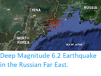
Deep Magnitude 6.2 Earthquake in the Russian Far East.

A few secods after midnight local time on Saturday 6 April 2013 (slightly after 1.00 pm on 5 April, GMT) the United States Geological Survey recorded a Magnitude 6.2 Earthquake at a depth of slightly over 560 km in the Russian Far East, about 80 km southeast of Vladivostok, close to the borders with China and North Korea. This is a big quake, and close to the surface would probably cause a great deal of damage, but at this depth is much less serious, as rock is a good absorber of shock waves, meaning that little of the energy will reach the surface. As it is no damage or casualties have been reported, though it is likely that the quake was felt over a wide region in all three states.

The location of the 6 April Earthquake. RT.

The Vladivostok area lies withn the central part of the Amur Plate, which underlies the southwest part of the Russian Far East, as well as northeatern China, the Korean Peninsula and southern Japan. The central parts of most tectonic plates are not prone to Earthquakes, but the Amur Plate is affected by the subduction of the Pacific Plate to the southeast, wich passes under the narrow Okhotsk Plate and sinks deeper into the Earth beneath the Amur Plate, causing the occasional large, if deep Earthquake.

Follow Sciency Thoughts on Facebook.
 

Sunday, 31 July 2011

Magnitude 6.4 Earthquake off the Coast of Honshu, Japan. 31 July 2011

At 3.54 Japan Standard Time on the 31st July 2011 an earthquake with a magnitude of 6.4 on the Richter scale struck off the east coast of Honshu, Japan, 18 km from the city of Iwaki in Fukushima Coast. The earthquake, which took place at a depth of about 40 km, was felt across eastern Honshu and southern Hokkaido, but does not appear to have caused significant damage to buildings or infrastructure. No tsunami warning has been issued, nor have any deaths been reported. There have been a few reports of minor injuries, mainly to elderly residents of Fukushima Prefecture.

Map of Japan showing areas where the Earthquake was felt.

Japan is particularly prone to earthquakes; the Japan Meteorological Agency reported 21 earthquakes across the country on the 30th of July and another 21 on the 29th. The country has tight building regulations and a long history of planning for earthquakes, so quakes that would cause major problems in other countries often cause only minor damage in Japan. However the Japanese are not immune to earthquake damage, and really big quakes can overwhelm their defenses. On 11 March 2011 a magnitude 9 earthquake and associated tsunami caused widespread devastation, killing over 15 000 people, destroying several cities and causing a meltdown at the Fukushima Daiichi Nuclear Power Plant. The island of Honshu was moved 2.5 m to the east, relative to the rest of Japan.

Aerial footage of the March 2011 Tsunami.

Japan is so prone to earthquakes because it lies on the conjunction of three moving tectonic plates; the Eurasian, Philippine and Pacific. To the northwest the Eurasian Plate is eastward over the Philippine and Pacific Plates. To the south the Philippine plate is moving northward over the Pacific Plate but under the Eurasian Plate. To the east the Pacific Plate is moving west, but being forced under the Eurasian and Philippine Plates.

The movement of the Eurasian, Philippine and Pacific Plates under Japan.

To make matters worse the Eurasian Plate is somewhat fractured under Japan and East Asia. with two small breakaway plates; The Okhotsk Plate, which underlies northeast Honshu, Hokkaido and the Kamchatka Peninsula (Russia) and the Amurian Plate underlying the southwest of Honshu, Korea and Manchuria. The Okhotsk plate is moving southwest relative to the rest of Eurasia, and the Amurian south-southeast.

The Amurian and Okhotsk Plates under Japan.

This also makes Japan particularly prone to volcanic activity. As one plate is forced below another, rocks are melted by the heat of the earth's interior and rise as liquid magma through the overlying plates forming volcanoes. The complicated network of plates underlying japan leads to dozens of volcanoes all over the country, many of which are active.

Volcanoes of Japan.

The Japan Meteorological Agency currently has alerts out on a number of these volcanoes. Kirishimayama and Sakurajima in the southeast are both subject to Level 3 warnings; it is considered unsafe to approach the volcano. Miyakijima in the south and Suwanosejima Satsuma-Iojima in the southeast are subject to Level 2 warnings; it is unsafe to approach the crater. There is also a hazard warning on Ioto and Fukutoku-Oka-no-Ba in the Ogasawara Islands.