Showing posts with label County Durham. Show all posts

Saturday, 1 May 2021

Emergency services rescue two from abandoned mine in County Durham, England.

Emergency services were called to an abandoned mine in Teesdale, in County Durham, England, on Friday 30 April 2021, after two inexperienced cavers became trapped in a disused lead mine. The men entered the mine by wading through a flooded hush (mining trench) on Coldbury Level, then descending into a deep mine-shaft using a rope, but got into trouble within the mine and needed to be rescued. 

 
Emergency rescue workers at the Coldbury lead mine in County Durham, England, on 30 April 2021. Teesdale Mercury.

Hushes are a type of old lead-working found across much of northern England and Wales, the oldest of which date back to the late Bronze Age (about 1000 BC). They comprise an existing ravine or gully through which water has been divered in order to erode away topsoil, exposing a vein of lead, which was then worked with hand tools. The Coldbury Gutter Hush dates back to the eighteenth century, and is about 1700 m long, 50 m wide at its widest point, and about 30 m deep. At one end of this hush is a Victorian deep pit mine, with a number of associated buildings, all of which are protected as scheduled monuments.

 
The Coldbury Gutter Hush in County Durham, England. Helen Wilkinson/Minedat.

See also...


Follow Sciency Thoughts on Facebook.

Follow Sciency Thoughts on Twitter.


Thursday, 23 January 2020

Magnitude 3.0 Earthquake in County Durham, England.

The British Geological Survey recorded a Magnitude 3.0 Earthquake at a depth of 4 km, about 1 km to the north of the town of Stockton-on-Tees in County Durham, England, slightly before 6.00 am GMT on Thursday 23 January 2020. There are no reports of any damage or casualties associated with this event, but people have reported feeling it in Stockton-on-Tees, Billingham, Norton and Middlesborough. 
 
The approximate location of the 23 January 2020 Stockton-on-Tees Earthquake. Google Maps.

Earthquakes become more common as you travel north and west in Great Britain, with the west coast of Scotland being the most quake-prone part of the island and the northwest of Wales being more prone  to quakes than the rest of Wales or most of England. However, while quakes in southern England are less frequent, they are often larger than events in the north, as tectonic pressures tend to build up for longer periods of time between events, so that when they occur more pressure is released.
 
The precise cause of Earthquakes in the UK can be hard to determine; the country is not close to any obvious single cause of such activity such as a plate margin, but is subject to tectonic pressures from several different sources, with most quakes probably being the result of the interplay between these forces.
 
Britain is being pushed to the east by the expansion of the Atlantic Ocean and to the north by the impact of Africa into Europe from the south. It is also affected by lesser areas of tectonic spreading beneath the North Sea, Rhine Valley and Bay of Biscay. Finally the country is subject to glacial rebound; until about 10 000 years ago much of the north of the country was covered by a thick layer of glacial ice (this is believed to have been thickest on the west coast of Scotland), pushing the rocks of the British lithosphere down into the underlying mantle. This ice is now gone, and the rocks are springing (slowly) back into their original position, causing the occasional Earthquake in the process.
 
(Top) Simplified diagram showing principle of glacial rebound. Wikipedia. (Bottom) Map showing the rate of glacial rebound in various parts of the UK. Note that some parts of England and Wales show negative values, these areas are being pushed down slightly by uplift in Scotland, as the entire landmass is quite rigid and acts a bit like a see-saw. Climate North East.
  
Witness accounts of Earthquakes can help geologists to understand these events, and the structures that cause them. If you felt this quake, or were in the area but did not (which is also useful information) then you can report it to the British Geological Survey here. 
 
See also...
 
https://sciencythoughts.blogspot.com/2019/09/humpback-whale-washes-up-on.htmlhttps://sciencythoughts.blogspot.com/2019/07/magnitude-24-earthquake-to-south-of.html
https://sciencythoughts.blogspot.com/2019/03/magnitude-17-earthquake-off-coast-of.htmlhttps://sciencythoughts.blogspot.com/2018/12/magnitude-16-earthquake-in-sunderland.html
https://sciencythoughts.blogspot.com/2018/11/magnitude-17-earthquake-near-barnard.htmlhttps://sciencythoughts.blogspot.com/2018/10/fossil-collector-injured-by-landslide.html
Follow Sciency Thoughts on Facebook.

Tuesday, 20 November 2018

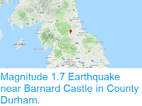
Magnitude 1.7 Earthquake near Barnard Castle in County Durham.

The British Geological Survey recorded a Magnitude 1.7 Earthquake at a depth of 11 km about 2 km to the northeast of Barnard Castle in County Durham, England, slightly before 5.25 am GMT on Monday 19 November 2018. There are no reports of any damage or injuries associated with this event, and nor would they be expected from such a small event, though it is possible it was felt locally.
 
The approximate location of the 19 November 2018 County Durham Earthquake. Google Maps.
 
Earthquakes become more common as you travel north and west in Great Britain, with the west coast of Scotland being the most quake-prone part of the island and the northwest of Wales being more prone  to quakes than the rest of Wales or most of England. However, while quakes in southern England are less frequent, they are often larger than events in the north, as tectonic presures tend to build up for longer periods of time between events, so that when they occur more pressure is released.
 
The precise cause of Earthquakes in the UK can be hard to determine; the country is not close to any obvious single cause of such activity such as a plate margin, but is subject to tectonic pressures from several different sources, with most quakes probably being the result of the interplay between these forces.
 
Britain is being pushed to the east by the expansion of the Atlantic Ocean and to the north by the impact of Africa into Europe from the south. It is also affected by lesser areas of tectonic spreading beneath the North Sea, Rhine Valley and Bay of Biscay. Finally the country is subject to glacial rebound; until about 10 000 years ago much of the north of the country was covered by a thick layer of glacial ice (this is believed to have been thickest on the west coast of Scotland), pushing the rocks of the British lithosphere down into the underlying mantle. This ice is now gone, and the rocks are springing (slowly) back into their original position, causing the occasional Earthquake in the process.
 
(Top) Simplified diagram showing principle of glacial rebound. Wikipedia. (Bottom) Map showing the rate of glacial rebound in various parts of the UK. Note that some parts of England and Wales show negative values, these areas are being pushed down slightly by uplift in Scotland, as the entire landmass is quite rigid and acts a bit like a see-saw. Climate North East.
  
Witness accounts of Earthquakes can help geologists to understand these events, and the structures that cause them. If you felt this quake, or were in the area but did not (which is also useful information) then you can report it to the British Geological Survey here.  
 
See also...
 
https://sciencythoughts.blogspot.com/2018/10/fossil-collector-injured-by-landslide.htmlhttps://sciencythoughts.blogspot.com/2018/08/rockfall-kills-nine-year-old-girl-at.html
https://sciencythoughts.blogspot.com/2018/03/magnitude-32-earthquake-in-cumbria.htmlhttps://sciencythoughts.blogspot.com/2017/04/magnitude-17-earthquake-in-cumbria.html
https://sciencythoughts.blogspot.com/2017/01/magnitude-38-earthquake-beneath.htmlhttps://sciencythoughts.blogspot.com/2016/11/seven-homes-evacuated-after-sinkhole.html
Follow Sciency Thoughts on Facebook.

Saturday, 28 November 2015

Magnitude 1.3 Earthquake in County Durham, England.

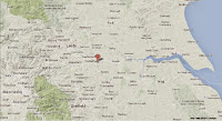
The British Geological Survey recorded a Magnitude 1.3 Earthquake at a depth of 4 km about 5 km to the northeast of Durham in County Durham, England, slightly before 8.40 pm GMT on Monday 23 November 2015. There are no reports of any damage or injuries associated with this event, and nor would they be expected from such a small event, though it is possible it was felt locally.


The approximate location of the 23 November 2015 County Durham Earthquake. Google Maps.

Earthquakes become more common as you travel north and west in Great Britain, with the west coast of Scotland being the most quake-prone part of the island and the northwest of Wales being more prone  to quakes than the rest of Wales or most of England. However, while quakes in southern England are less frequent, they are often larger than events in the north, as tectonic presures tend to build up for longer periods of time between events, so that when they occur more pressure is released.

The precise cause of Earthquakes in the UK can be hard to determine; the country is not close to any obvious single cause of such activity such as a plate margin, but is subject to tectonic pressures from several different sources, with most quakes probably being the result of the interplay between these forces.

Britain is being pushed to the east by the expansion of the Atlantic Ocean and to the north by the impact of Africa into Europe from the south. It is also affected by lesser areas of tectonic spreading beneath the North Sea, Rhine Valley and Bay of Biscay. Finally the country is subject to glacial rebound; until about 10 000 years ago much of the north of the country was covered by a thick layer of glacial ice (this is believed to have been thickest on the west coast of Scotland), pushing the rocks of the British lithosphere down into the underlying mantle. This ice is now gone, and the rocks are springing (slowly) back into their original position, causing the occasional Earthquake in the process.

 
(Top) Simplified diagram showing principle of glacial rebound. Wikipedia. (Bottom) Map showing the rate of glacial rebound in various parts of the UK. Note that some parts of England and Wales show negative values, these areas are being pushed down slightly by uplift in Scotland, as the entire landmass is quite rigid and acts a bit like a see-saw. Climate North East. 

Witness accounts of Earthquakes can help geologists to understand these events, and the structures that cause them. If you felt this quake, or were in the area but did not (which is also useful information) then you can report it to the British Geological Survey here. 

See also...

http://sciencythoughts.blogspot.co.uk/2015/07/magnitude-16-earthquake-in-cumbria.htmlMagnitude 1.6 Earthquake in Cumbria, England.                                                    The British Geological Survey recorded a Magnitude 1.6 Earthquake at a depth of about 5 km about five kilometers to the south of the village of Caldbeck...
http://sciencythoughts.blogspot.co.uk/2015/06/yorkshire-stuck-by-two-earthquakes-in.htmlYorkshire stuck by two Earthquakes in under ninety minutes.                                             The county of North Yorkshire in northern England was struck by two Earthquakes on Saturday 30 May 2015, according to the British Geological Survey, the...
http://sciencythoughts.blogspot.co.uk/2015/03/magnitude-19-earthquake-in-north.htmlMagnitude 1.9 Earthquake in North Yorkshire, England.                                             The British Geological Survey recorded a Magnitude 1.9 Earthquake at an uncertain depth near the village of Wormersley in North...
Follow Sciency Thoughts on Facebook.