Showing posts with label Scottish Borders. Show all posts

Sunday, 15 September 2019

Magnitude 2.0 Earthquake in the Scottish Borders.

The British Geological Survey recorded a Magnitude 2.0 Earthquake at a depth of about 7 km, roughly 2 km to the northwest of the village of Eddleton in the Scottish Borders Region of Scotland, slightly after 4.10 pm British Summertime (slightly after 3.10 pm GMT) on Wednesday 11 September 2019. This was not a major event, and presented no threat to human life or property, but people have reported feeling it in the village of Lyne.

The approximate location of the 11 September Scottish Borders Earthquake. Google Maps.

Earthquakes become more common as you travel north and west in Great Britain, with the west coast of Scotland being the most quake-prone part of the island and the northwest of Wales being more prone  to quakes than the rest of Wales or most of England. 

The precise cause of Earthquakes in the UK can be hard to determine; the country is not close to any obvious single cause of such activity such as a plate margin, but is subject to tectonic pressures from several different sources, with most quakes probably being the result of the interplay between these forces.
 
Britain is being pushed to the east by the expansion of the Atlantic Ocean and to the north by the impact of Africa into Europe from the south. It is also affected by lesser areas of tectonic spreading beneath the North Sea, Rhine Valley and Bay of Biscay. Finally the country is subject to glacial rebound; until about 10 000 years ago much of the north of the country was covered by a thick layer of glacial ice (this is believed to have been thickest on the west coast of Scotland), pushing the rocks of the British lithosphere down into the underlying mantle. This ice is now gone, and the rocks are springing (slowly) back into their original position, causing the occasional Earthquake in the process. 
   
(Top) Simplified diagram showing principle of glacial rebound. Wikipedia. (Bottom) Map showing the rate of glacial rebound in various parts of the UK. Note that some parts of England and Wales show negative values, these areas are being pushed down slightly by uplift in Scotland, as the entire landmass is quite rigid and acts a bit like a see-saw. Climate North East. 

Witness accounts of Earthquakes can help geologists to understand these events, and the structures that cause them. If you felt this quake, or were in the area but did not (which is also useful information) then you can report it to the British Geological Survey here.

See also...

https://sciencythoughts.blogspot.com/2016/03/sinkhole-in-north-lanarkshire-scotland.htmlhttps://sciencythoughts.blogspot.com/2015/10/magnitude-14-earthquake-near-peebles.html
https://sciencythoughts.blogspot.com/2015/09/magnitude-11-earthquake-in-north.htmlhttps://sciencythoughts.blogspot.com/2014/12/magnitude-20-earthquake-in-midlothian.html
https://sciencythoughts.blogspot.com/2013/09/earthquake-near-peebles-in-scottish.html
Follow Sciency Thoughts on Facebook.

Saturday, 31 October 2015

Magnitude 1.4 Earthquake near Peebles, Scottish Borders.

The British Geological Survey recorded a Magnitude 1.4 Earthquake at a depth of about 2 km about 5 km to the south of the town of Peebles in Borders Region of Scotland, slightly after 12.30 pm GMT on Sunday 25 October 2015. This was not a major event, and presented no threat to human life or property, but may have been felt locally.

The approximate location of the 25 October 2015 Peebles Earthquake. Google Maps.

Earthquakes become more common as you travel north and west in Great Britain, with the west coast of Scotland being the most quake-prone part of the island and the northwest of Wales being more prone  to quakes than the rest of Wales or most of England. 

The precise cause of Earthquakes in the UK can be hard to determine; the country is not close to any obvious single cause of such activity such as a plate margin, but is subject to tectonic pressures from several different sources, with most quakes probably being the result of the interplay between these forces.

Britain is being pushed to the east by the expansion of the Atlantic Ocean and to the north by the impact of Africa into Europe from the south. It is also affected by lesser areas of tectonic spreading beneath the North Sea, Rhine Valley and Bay of Biscay. Finally the country is subject to glacial rebound; until about 10 000 years ago much of the north of the country was covered by a thick layer of glacial ice (this is believed to have been thickest on the west coast of Scotland), pushing the rocks of the British lithosphere down into the underlying mantle. This ice is now gone, and the rocks are springing (slowly) back into their original position, causing the occasional Earthquake in the process. 

(Top) Simplified diagram showing principle of glacial rebound. Wikipedia. (Bottom) Map showing the rate of glacial rebound in various parts of the UK. Note that some parts of England and Wales show negative values, these areas are being pushed down slightly by uplift in Scotland, as the entire landmass is quite rigid and acts a bit like a see-saw. Climate North East.

Witness accounts of Earthquakes can help geologists to understand these events, and the structures that cause them. If you felt this quake, or were in the area but did not (which is also useful information) then you can report it to the British Geological Survey here.

See also...

The British Geological Survey recorded a Magnitude 1.1 Earthquake at a depth of about 7 km about 1 km to the southwest of the town of Shotts in North...


The British Geological Survey recorded a Magnitude 2.0 Earthquake at a depth of 6 km in southwest Midlothian, Scotland, about 10 knm to the south of...

The British Geological Survey recorded a Magnitude 1.8 Earthquake at a depth of 4 km beneath the village of Cadrona in the Scottish Borders, roughly 5 km east of...


Follow Sciency Thoughts on Facebook.

Monday, 2 September 2013

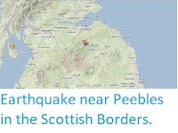
Earthquake near Peebles in the Scottish Borders.

The British Geological Survey recorded a Magnitude 1.8 Earthquake at a depth of 4 km beneath the village of Cadrona in the Scottish Borders, roughly 5 km east of Peebles and 30 km south of Edinburgh slightly before 2.20 am British Summertime (slightly before 1.20 am GMT) on Saturday 31 August 2013. This is not a large quake, and is unlikely to cause any damage or injuries, but people did report feeling it in Peebles.

The approximate location of the 31 August 2013 Cadrona Earthquake. Google Maps.

As a rough rule of thumb, when you travel further to the north and west in Great Britain Earthquakes become more frequent, making Scotland (in particular western Scotland) the most quake prone area of the country. The precise causes of British Earthquakes can be hard to determine, as the country is not close to any active plate boundary, but is subject to tectonic stresses from a number of different sources.

Scotland (along with the rest of Eurasia) is being pushed to the east by the expansion of the Atlantic Ocean and to the north by the impact of Africa into Europe from the South. Closer to home there are lesser centers of expansion beneath the North Sea, the Rhine Valley and the Bay of Biscay, all of which excerpt pressure on Scottish rocks. Finally there is glacial rebound; until about 10 000 years ago much of the UK was covered by a thick layer of ice, pushing the rocks of the lithosphere down into the underlying mantle; this ice is now gone and the rocks are (slowly) rebounding, causing the occasional Earthquake in the process.

Witness accounts of Earthquakes can help geologists to understand these events, and the structures that cause them. If you felt this quake, or were in the area but did not (which is also useful information) then you can report it to the British Geological Survey here.


Follow Sciency Thoughts on Facebook.