
The Centre Seismologique Euro-Méditeranéen
recorded a Magnitude 5.2 Earthquake at a depth of 10 km to the southeast of Madeira Island, Portugal, slightly
before 9.00 pm local time (GMT) on Friday 7 March 2020. There are no reports of any damage or casualties
associated with this event, though it was felt across the Madeira Islands group, as well as in parts of the Canary Islands.

The approximate location of the 7 March 2020 Madeira Earthquake. USGS.
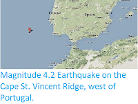
Madeira lies to the south of the Cape St. Vincent Ridge, which runs along the boundary between the African and
European plates to the east of the Mid-Atlantic Ridge. This is currently
an area of expansion, with the two plates moving apart along this part
of the boundary and new seafloor being created by the upwelling of magma
from the mantle and its extrusion as a new area of crustal material,
the Azores Microplate. This is not a smooth process, and can lead to
occasional Earthquakes.
Witness
accounts of Earthquakes can help geologists to understand these events,
and the structures that cause them. The international non-profit
organisation Earthquake Report is interested in hearing from people who may have felt this event; if you felt this quake then you can report it to Earthquake Report here.
See also...


Follow Sciency Thoughts on Facebook.