Showing posts with label Gulf of Aden. Show all posts

Tuesday, 29 May 2018

Landslides kill at least 32 in the Oromia Region of Ethiopia, as Cyclones batter the Horn of Africa and the Arabian Peninsula.

At least 32 people have died in a series of landslides in the Oromia Region of Ethiopia this weekend, with the worst incidents occurring in Gamo Gofa, where a landslide killed nine people and injured seventeen, and Sidama, where a landslide killed 23 people and injured six. The events happened amid heavy rains that have brought widespread flooding and related problems to East Africa, associated with cylones Sagar, which has been attributed with the deaths of 49 people in Somalia (where an ongoing civil conflict has hampered relief efforts) and two in Djibouti (where as much rain fell in 24 hours as usually falls in a year) and Mekunu, which is attributed with seven deaths in the Socotra Islands (Yemen) and six in Oman, with eight sailors still missing on two vessels in the region. Landslides are are a common problem after severe weather events, as excess pore water pressure can overcome cohesion in soil and sediments, allowing them to flow like liquids. Approximately 90% of all landslides are caused by heavy rainfall.

 The aftermath of a landslide at Sidama in the Oromia Region of Ethiopia, which killed 23 people on Saturday 27 May 2018. Atnaf Brhane/Twitter.

Tropical storms are caused by solar energy heating the air above the oceans, which causes the air to rise leading to an inrush of air. If this happens over a large enough area the inrushing air will start to circulate, as the rotation of the Earth causes the winds closer to the equator to move eastwards compared to those further away (the Coriolis Effect). This leads to tropical storms rotating clockwise in the southern hemisphere and anticlockwise in the northern hemisphere.These storms tend to grow in strength as they move across the ocean and lose it as they pass over land (this is not completely true: many tropical storms peter out without reaching land due to wider atmospheric patterns), since the land tends to absorb solar energy while the sea reflects it.

The low pressure above tropical storms causes water to rise there by ~1 cm for every millibar drop in pressure, leading to a storm surge that can overwhelm low-lying coastal areas, while at the same time the heat leads to high levels of evaporation from the sea - and subsequently high levels of rainfall. This can cause additional flooding on land, as well as landslides.

See also...

http://sciencythoughts.blogspot.co.uk/2018/05/seventeen-missing-after-cyclone-mekunu.htmlhttp://sciencythoughts.blogspot.co.uk/2018/03/magnitude-52-earthquake-in-afar-region.html
http://sciencythoughts.blogspot.co.uk/2017/12/german-tourist-killed-on-erte-ale.htmlhttp://sciencythoughts.blogspot.co.uk/2017/04/pair-of-earthquakes-off-coast-of.html
http://sciencythoughts.blogspot.co.uk/2017/03/pirates-release-oil-tanker-seized-off.htmlhttp://sciencythoughts.blogspot.co.uk/2017/03/dozens-dead-following-landlside-at.html


Follow Sciency Thoughts on Facebook.

Thursday, 24 May 2018

Seventeen missing after Cyclone Mekunu sweeps across the Socotra Islands.

Seventeen people are still missing after Cyclone Mekunu swept across the Yemeni Socotra Island group on Wednesday 23-Thursday 24 May 2018. Full details of the missing persons have not been released, but it is understood that four were members of the crew of one of two vessels that sank during the strom, while another three were in a car that was swept away by floodwaters. The storm is expected to make landfall on the southern part of the Arabian Peninsula this weekend, either in eastern Yemen or southern Oman.

Receding floodwaters on Socotra Island (the largest island of the Socotra group) on 24 May 2018. Abdullah Morgan/AP.

Tropical storms are caused by solar energy heating the air above the oceans, which causes the air to rise leading to an inrush of air. If this happens over a large enough area the inrushing air will start to circulate, as the rotation of the Earth causes the winds closer to the equator to move eastwards compared to those further away (the Coriolis Effect). This leads to tropical storms rotating clockwise in the southern hemisphere and anticlockwise in the northern hemisphere.These storms tend to grow in strength as they move across the ocean and lose it as they pass over land (this is not completely true: many tropical storms peter out without reaching land due to wider atmospheric patterns), since the land tends to absorb solar energy while the sea reflects it.

The passage of Cyclone Mekunu till 12.00 GMT on Thursday 24 May 2018 (thick line) with its predicted future path (thin line, circles represent the margin of error on the predictions). Colours indicate the strength of the storm. Tropical Storm Risk.

The low pressure above tropical storms causes water to rise there by ~1 cm for every millibar drop in pressure, leading to a storm surge that can overwhelm low-lying coastal areas, while at the same time the heat leads to high levels of evaporation from the sea - and subsequently high levels of rainfall. This can cause additional flooding on land, as well as landslides, which are are a common problem after severe weather events, as excess pore water pressure can overcome cohesion in soil and sediments, allowing them to flow like liquids. Approximately 90% of all landslides are caused by heavy rainfall.

See also...

http://sciencythoughts.blogspot.co.uk/2017/10/cholera-outbreak-kills-over-2000-in.htmlhttp://sciencythoughts.blogspot.co.uk/2017/04/pair-of-earthquakes-off-coast-of.html
http://sciencythoughts.blogspot.co.uk/2015/11/flooding-in-saudi-arabia-and-qatar.htmlhttp://sciencythoughts.blogspot.co.uk/2015/11/cyclone-chapala-makes-landdall-in-yemen.html
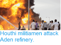
http://sciencythoughts.blogspot.co.uk/2015/06/houthi-militiamen-attack-aden-refinery.htmlhttp://sciencythoughts.blogspot.co.uk/2015/05/magnitude-47-earthquake-in-gulf-of.html
Follow Sciency Thoughts on Facebook.

Saturday, 18 January 2014

Using a Coralline Red Algae as a palaeoclimatic indicator in the Gulf of Aden.

Marine organisms with calcium carbonate skeletons are known to vary both their growth rate, and the chemistry of their shells in response to changes in sea temperature and changes in seawater chemistry. Palaeoclimatologists can such shells to investigate ancient climates, and in particular, can use the shells of long-lived organisms that grow throughout their lives to build up detailed records of climate variability in specific areas. Corals have been widely used to this purpose in tropical seas, and large, slow growing Bivalves in cold Arctic waters, but both groups are somewhat restricted in geographical range. Coralline Red Algae (Corallinales) are found in shallow waters in almost all marine environments from the tropics to the polar oceans, and many species are extremely long lived, which leads to the possibility of using such Algae as palaeoclimatic indicators, although their biology is generally less well known than that of Corals and Bivalves.

In a paper published in the journal Geochimica et Cosmochimica Acta on 1 January 2014, a team of scientists led by Annalisa Caragnano of the Sezione di Scienze Geologiche e Geotecnologie at the Università degli Studi di Milano-Bicocca, describe the results of a study on the Coralline Red Alga Lithophyllum kotschyanum in the Gulf of Aden, and its potential for use as a palaeoclimatic indicator.

A sample of the Coralline Red Alga Lithophyllum kotschyanum from the Gulf of Aden. Caragnano et al. (2014).

Lithophyllum kotschyanum is known to vary the magnesium/calcium ratio in its skeleton in response to changes in temperature and salinity. Brachiopods and some Corals have been shown to vary the ratio of lithium/calcium in their skeletons in response to changes in temperature and salinity, while other Corals and Foraminiferans have been shown not to do this. Foraminiferans and Corals have been shown to vary the barium/calcium ration in their shells in response to nutrient availability. Lithophyllum kotschyanum is also known to have a variable growth rate, though it is not known what drives this. 

Caragnano et al. examined specimens of Lithophyllum kotschyanum collected from the Gulf of Aden to attempt to determine any relationships between magnesium/calcium ratio, lithium calcium ratio, barium/calcium ratio and growth rate, and whether these could be connected to seawater chemistry or temperature.

The Gulf of Aden is located between the Red Sea and the Indian Ocean, and receives waters from both sources. Water from the Red Sea is significantly more saline than water from the Indian Ocean. The amount of water from each source is variable, with more water coming from the Indian Ocean during the winter monsoon (November-March) and more water coming from the Red Sea during the summer monsoon (June-September). The seawater temperature is also variable, at its highest (31–32℃) in May-June, then cooling to 29-30℃ in July-August, rising to about 30℃ in September, and cooling again to 24-25℃ in October-January, before rising slowly from February-April.

The Gulf of Aden. Google Maps.

Caragnano et al. found a strong ratio between magnesium/calcium ratio, lithium/calcium ratio, growth rate and temperature in Lithophyllum kotschyanum. The barium/calcium ratio was variable, but not in response to any environmental factor studied.

Lithophyllum kotschyanum grew fastest in warmer conditions, although the temperature was not the only factor affecting its growth; which is also influenced by light levels, nutrient supply and grazing by herbivores.

Histological section of a sample of Lithophyllum kotschyanum from the Gulf of Aden: (A) longitudinal section of a protuberance showing band periodicity (arrowhead) and three growth stages (black arrows). Note the growth interruption (white arrow); (B) magnification of A showing different cell length along the same filament. (C–F) SEM images of the high-Mg calcite thallus of the sample in longitudinal section: (C) shorter cells and longer cells alternate along the growth direction, from bottom to top; (D) magnification of C showing length variability in cells of the same filament (white arrow to indicate the growth direction of one cell filament). Note the secondary pit-connection (black arrow); (E) magnification of the longest cells showing a thin cell wall; (F) magnification of the smallest cells showing a thick cell wall. The double arrow indicates the cell lumen, and the arrowhead the mineralized cell wall. Caragnano et al. (2014).

The rate at which magnesium is absorbed into calcium carbonate (as a replacement for calcium, forming a small proportion of magnesium carbonate) produced by Lithophyllum kotschyanum has been studied at other (cooler) locations, and has been shown to increase with temperature. This remained true in the warm waters of the Gulf of Aden, though the rate at which the increase occurred was significantly higher than predicted from previous studies. This confirms that magnesium in calcium carbonate in the skeleton of this algae is a good proxy for temperature, but also that a better understanding of this relationship is needed; had the origin and temperature history of the algal skeleton not been known, then based on previous data the temperature at which it had grown would have been significantly overestimated.

The rate at which lithium is incorporated into calcium carbonate (again replacing calcium to form lithium carbonate) formed by Lithophyllum kotschyanum has not previously been studied. In this instance the lithium absorption rate closely followed the magnesium absorption rate, suggesting that this is also controlled by temperature, and that lithium ratios can be used to predict temperature in the same way as magnesium ratios.

The ratio at which barium was absorbed into calcium carbonate appeared to be only weekly related to temperature. It also peaked during the summer monsoon, suggesting that it also rose while there was an increased nutrient supply coming from the Red Sea, however there was also other peaks in absorption
which were less easy to explain, notable a sharp increase in an area of the skeleton believed to have been formed in 2007. This corresponds to a period of building on the Yemeni coast close to where the sample was collected, as well as to dredging activities in the sea close to the site, suggesting that either of these actions could have increased nutrient levels in the water. This high susceptibility to localized events probably makes barium ratios in Lithophyllum kotschyanum skeletons a poor palaeoclimatic tool.

See also A hypercalcified Chaetetid Demosponge from the Late Carboniferous of northwest SpainTwo new species of calcareous Sponge from the Weddell SeaExamining an Ordovician Stromatolite with a tool to look for life on MarsA new species of heavy metal Tolerant Bacterium from the Dabaoshan Mining Area in Guangdong Province, China and Angiosperm-like pollen from the Middle Triassic of Switzerland.

Follow Sciency Thoughts on Facebook.

Thursday, 11 July 2013

Earthquakes beneath the Gulf of Aden.

On Thursday 11 July 2013, at 5.05 am local time (2.05 am, GMT), the United States Geological Survey recorded a Magnitude 5.0 Earthquake at a depth of 16.3 km beneath the Gulf of Aden, which separates Yemen from Somalia. This was followed by a second quake of similar size slightly after 12.45 pm local time (slightly after 9.45 am, GMT). Neither of these quakes is likely to have caused any damage or casualties, indeed they were sufficiently far offshore that it is highly unlikely that anybody noticed them.

The approximate location of the 11 July 2013 Gulf of Aden quakes. Google Maps.

The Red Sea and Gulf of Aden are underlain be areas of rifting where a spreading boundary between two tectonic plates, the African Plate and the Arabian, where new oceanic crust is being formed. Arabia was formerly part of the African Plate, but split away about 30 million years ago. The Great Rift Valley of Africa is a continuation of this rift, that is slowly splitting Africa in two from the north to the south.

Areas of rifting beneath and around the Gulf of Aden. Afar Rift Consortium.


Follow Sciency Thoughts on Facebook.