Showing posts with label La Palma. Show all posts

Monday, 4 October 2021

Eruptions on La Palma, Canary Islands.

Following a marked increase in seismic activity beneath La Palma volcano, on the Canary Island of the same name, authorities on the island began to make plans to evacuate residents from the area in the event of an eruption on 17 September 2021. Two days later, on Sunday 19 September, the volcano began to erupt at about 3.10 pm, with two fissures roughly 200 m long and 200 m apart opening on the flank of the volcano, producing columns of gas and ash that rose to 1.5 and 3.0 km above sealevel respectively, and lava fountains that set fire to nearby forests. Lava began to descend the sides of the volcano at a rate of about 700 m per hour (slow enough to evade at a walking pace), prompting evacuations and causing extensive damage to properties in its path. The volcano produced a vast plume of sulphur dioxide, which reached the coast of Morocco on 20 September, by which time lava flows had reached up to 3 km from the vents and destroyed 166 buildings. Over the next few days, the volcano produced further ash columns, which rose to heights as great as 4.6 km, while the lava spread to cover about 1.54 km², destroying over 350 homes and prompting the evacuation of over 5000 people.

 
Spanish police officers evacuating people from the course of a lava flow on La Palma. Emilio Morenatti/AP.

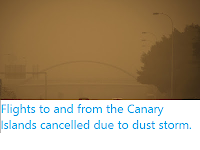
The eruptions continued through the remainder of September, producing ash columns that rose up to 5 km above sealevel and lava flows that reached the west coast of the island at Playa de los Guirres, destroying over 650 buildings and 18.9 km of roads, and sulphur dioxide emissions of up to 25 000 tons per day. 

 
Lava engulphing a residential building on La Palma. AP.

On Friday 1 October 2021 a third vent was discovered to have opened on the side of the volcano, producing two new lava flows, one of which flowed rapidly towards the town of Los Llanos de Aridane, which has been partly evacuated in response. A total of over 6000 people have now been evacuated from their homes on the island, with over 7 km² covered by lava flows and over a thousand homes and other buildings destroyed.

 
Satellite image of a lava flow running through a settlement on the west coast of La Palma. Copernicus Sentinel/European Space Agency/Reuters.

The Canary Islands are a group of volcanic islands fuelled by a mantle plume rising through the African Plate, on which they are situated. The plume is rising from deep within the Earth, and is independent of the movement of the tectonic plates at the Earth's surface. As the plate moves relative to the hotspot new volcanic islands form on its surface, each over the hotspot when it forms, with the oldest islands of the chain in the east (the African Plate is being pushed east by the expansion of the Atlantic Ocean, but the hotspot is relatively motionless).

See also...


Follow Sciency Thoughts on Facebook.

Follow Sciency Thoughts on Twitter.


Wednesday, 11 October 2017

Series of Earthquakes beneath the Canary Islands.

The  Instituto Geográfico Nacional has recorded a series of deep tremor beneath the Canary Islands since Saturday 7 October 2017, with the majority of the tremors beneath the southern part of the island of La Palma. None of these events was large enough to cause any problems in itself, however the islands are volcanic in origin and seismic activity beneath volcanoes can be significant, as they are often caused by the arrival of fresh magma, which may indicate that a volcano is about to undergo an eruptive episode.

Earthquakes in the Canary Islands since 7 October 2017. Instituto Geográfico Nacional. 

The Canary Islands are a group of volcanic islands fuelled by a mantle plume rising through the African Plate, on which they are situated. The plume is rising from deep within the Earth, and is independent of the movement of the tectonic plates at the Earth's surface. As the plate moves relative to the hotspot new volcanic islands form on its surface, each over the hotspot when it forms, with the oldest islands of the chain in the east (the African Plate is being pushed east by the expansion of the Atlantic Ocean, but the hotspot is relatively motionless).
  
See also...

http://sciencythoughts.blogspot.co.uk/2016/03/predicting-eruptions-in-monogenetic.htmlhttp://sciencythoughts.blogspot.co.uk/2013/12/magnitude-54-earthquake-off-coast-of-el.html
http://sciencythoughts.blogspot.co.uk/2013/08/the-floating-stones-of-el-hierro.htmlhttp://sciencythoughts.blogspot.co.uk/2013/03/earthquake-of-coast-of-el-hierro.html
http://sciencythoughts.blogspot.co.uk/2012/07/fresh-volcanic-activity-on-el-hierro.htmlhttp://sciencythoughts.blogspot.co.uk/2011/10/ongoing-volcanic-activity-on-el-hierro.html
Follow Sciency Thoughts on Facebook.

Friday, 11 March 2016

Predicting eruptions in monogenetic volcanic fields.

Seismic activity and fumerol (gas) emissions are well established as predictors of eruptions on stratovolcanoes (volcanic mountains which undergo repeated eruptions), but predicting eruptions in other kinds of volcanoes is more problematic. Monogenetic fields are areas of volcanic activity where sporadic eruptions occur at different locations, rather than at a single site. Most such sites only suffer very irregular eruptions, but the fields are often home to hot spring systems or other features which make them attractive to humans, leading to settlement in potentially hazardous areas, making finding a method for predicting eruptions in these areas a priority.

In a paper publishd in the journal Geology on 5 February 2016, Helena Albert of the Central Geophysical Observatory at the Spanish Geographic Institute, Fidel Costa of the Earth Observatory of Singapore and Asian School of the Environment at the Nanyang Technological University and Joan Martí of the Institute of Earth Sciences Jaume Almera, discuss a number of historic eruptions at a number of different monogentic fields, with a view to understanding the processes driving volcanic activity at these sites and the possibility of predicting future eruptions in such areas.

Albert et al. examined ten historic eruptions at five mongenetic fields; the 1704-05 Tenerife eruption (part of the Canary Islands Volcanic Field), the 1909 Tenerife eruption, the 1949 La Palma eruption (also in the Canaries), the 1971 La Palma eruption, the 2011 El Hierro eruption (again in the Canaries), the 1759 Michoacan eruption (in the Michoacan-Guanajuato region of Mexico), the 1943 Michoacan eruption, the 1943 Goropu Mountains eruption (part of the Owen Stanley Range of Papua New Guinea), the 1973 Heimaey Island eruption (Iceland) and the 1989 Higashi-Izu eruption (on the Izu Peninsula, Japan).

 Emissions from the 2011 El Hierro eruption, which happened offshore to the south of the island. Guardia Civil.

Of these, only the 2011 El Hierro eruption was monitored with high quality modern seismic equipment, with three others having lower quality records available. However witness accounts of earthquakes provide insight into seismic activity in all of these fields prior to the onset of eruptive activity. All of the eruptions were proceded by periods of seismic activity, with the longest such recorded period preceding the 2011 El Hierro eruption, where tremmors were recorded 4-5 years ahead of the eruption, and the shortest being the 1973 Heimay Island eruption, where seismic activity was only noticed 2 days before the main eruption.

Lava flow from the 1973 Heimay Island eruption which entered the town of Vestmannaeyjar, destroying about half of the homes there and causing the population to evacuate to the Icelandic mainland. Will Perry/The Reykjavík Museum of Photography.

Albert et al. next looked at samples of erupted lava from all of the eruptions except the 1943 Goropu Mountains eruption and the 1989 Higashi-Izu eruption. In each case they found that the lavas were mineralogically mixed, that is to say included minerals thought to come from different magmatic intrusions. Magma extruded from deep within the Earth is thought to be more-or-less entirely liquid, however if it becomes trapped in chambers close to the surface (5-15 km underground) it cools foming a mush with crystals suspended in a liquid matrix. Different minerals are formed at different temperatures, and larger crystals form more slowly (implying the mush has remained cool enough for the crystals to form but hot enough for the matrix to remain liquid for a longer period of time), giving each magmatic intrusion its own distinctive makeup. Lavas with mixed compostitions contain crystals which cannot have formed in a single intrusion.

Ruins of the San Juan Parangaricutiro Church which was destroyed by the 1943 Michoacan eruption. Sparks Mexico/Wikipedia.

From this Albert et al. conclude that each of these volcanoc fields is fed by a an extensive shallow plumbing system with an extensive system of dykes at mid-crustal levels recieving intermittent intrusions of deep magma. While a full understanding of the processes behind this is beyond the scope of this study, the majority of these eruptions were preceded by a rise in seismic activity which began months to years before the main eruptive episodes, giving the potential for the prediction of such eruptions using dedicated seismic monitoring networks.

 Possible plumbing system configuration and evolution of events that may occur below monogenetic volcanoes (schematic and not to scale). The depth of the subvolcanic system may vary from 5 to 15 km. The depth of the magma source is also variable but is at least 20 km. (A) Intrusion of magma approximately one or two years prior to the eruption, stalling of magma at 5–15 km due to the loss of buoyancy or freezing of dikes, and mixing processes registered by the crystals. Crustal assimilation occurs in some cases. Seismic activity is felt by the population in some cases. (B) Renewal of magma intrusion, progressive opening of the path between deep and shallow reservoirs, and mixing processes registered by the crystals. Crustal assimilation occurs in some cases. The seismic activity is commonly felt by the population. (C) Continued intrusion of mafic magma leads to easier transfer from deep to shallow reservoirs, and this allows the magma to finally erupt. Magma mixing (and crustal assimilation in some cases) are recorded by the crystals. Seismicity is felt by the population. Also shown the possibility that magma is directly transfer from the mantle to the surface. Albert et al. (2015).

See also...

http://sciencythoughts.blogspot.co.uk/2013/12/magnitude-54-earthquake-off-coast-of-el.htmlMagnitude 5.4 Earthquake off the coast of El Hierro.                                                          The United States Geological Survey recorded a Magnitude 5.4 Earthquake at a depth of 22.8 km roughly 31 km to the northwest of the island of El Hierro in the Canaries, slightly after 5.45 pm local time (which is GMT) on Friday 27 December 2013. There are...
http://sciencythoughts.blogspot.co.uk/2013/08/the-floating-stones-of-el-hierro.htmlThe floating stones of El Hierro.               When volcanic activity began off the south coast of El Hierro, in the Canary Islands, in October 2010, it led to the production of large plumes of pumice-like rocks that floated on the surface of the ocean, producing a distinctive volcanic 'stain'. Pumice is a volcanic rock which contains large vesicles (sealed, gas filled cavities) which cause it to float on the water, which is formed by superheated magma coming...
http://sciencythoughts.blogspot.co.uk/2013/03/earthquake-of-coast-of-el-hierro.htmlEarthquake of the coast of El Hierro.           On Friday 29 March 2013, slightly after 5.00 pm GMT, the United States Geological Survey recorded a Magnitude 4.6 Earthquake at a depth of 17.3 km, roughly 30 km southwest of El Hierro in the Canary Islands...
Follow Sciency Thoughts on Facebook.