Showing posts with label Logan County. Show all posts

Wednesday, 30 March 2016

Magnitude 4.2 Earthquake in Logan County, Oklahoma.

The United States Geological Survey recorded a Magnitude 4.2 Earthquake at a depth of 4 km slightly to the north of Crescent City in Logan County County, Oklahoma, slightly before 11.55 pm local time on Monday 28 March 2016 (slightly before 4.55 am on Tuesday 29 March GMT). There are no reports of any damage or injuries associated with this Earthquake, but it was felt across a large area of north-central Oklahoma.

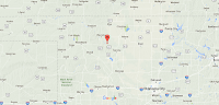
The approximate location of the 15 November 2015 Woods County Earthquake. Google Maps.

Oklahoma is naturally prone to Earthquakes, particularly in the southwest of the state, near the Meers Fault Zone, but since 2009 has suffered a sharp increase in the number of small quakes in the central and northeast parts of the state. While most of these quakes have been quite small, a few have been large enough to potentially cause problems, and any unexplained increase in seismic activity is a cause for concern. 

In a paper published in the journal Geology on 26 March 2013, a team of geologists led by Katie Keranen of the ConocoPhillips School of Geology and Geophysics at the University of Oklahoma linked one of the largest of these quakes, a Magnitude 5.7 event in November 2011 which caused damage locally and was felt across 17 states, to the practice of pumping liquids (usually brine) into injection wells, which is common in the hydrocarbons industry and used to displace oil or gas, which can then be extracted from nearby extraction wells (where this is done in bursts at pressure to intentionally break up rock it is called hydraulic fracturing, or fracking). Significantly they suggested that the practice could lead to quakes years or even decades after the actual injection.

Witness accounts of Earthquakes can help geologists to understand these events, and the structures that cause them. The international non-profit organization Earthquake Report is interested in hearing from people who may have felt this event; if you felt this quake then you can report it to Earthquake Report here.
 
 See also...
http://sciencythoughts.blogspot.co.uk/2015/11/magnitude-43-earthquake-in-woods-county.htmlMagnitude 4.3 Earthquake in Woods County, Oklahoma.                                              The United States Geological Survey recorded a Magnitude 4.3 Earthquake at a depth of 5 km in...
http://sciencythoughts.blogspot.co.uk/2015/08/magnitude-37-earthquake-in-oklahoma.htmlMagnitude 3.7 Earthquake in Oklahoma County, Oklahoma.                                     The United States Geological Survey recorded a Magnitude 3.7 Earthquake at a depth of 5 km in northern Noble County, Oklahoma, before 7.20 am local...
One man has died and at least 24 other have been injured following an outbreak of tornadoes across Oklahoma and parts of Arkansas on Thursday 26 March 2015. The dead man is reported to have died while trying to aid his injured father at the River...
Follow Sciency Thoughts on Facebook.

Saturday, 9 August 2014

Magnitude 3.4 Earthquake in southern Logan County, Oklahoma.

The United States Geological Survey recorded a Magnitude 3.4 Earthquake at a depth of 3.5 km in southern Logan County, Oklahoma, slightly after 3.20 pm local time (slightly after 8.20 pm GMT) on Friday 8 August 2014. There are no reports of any damage or casualties associated with this event, but it was felt across much of central Oklahoma.

The approximate location of the 8 August 2014 Oklahoma Earthquake. Google Maps.

Oklahoma is naturally prone to Earthquakes, particularly in the southwest of the state, near the Meers Fault Zone, but since 2009 has suffered a sharp increase in the number of small quakes in the central and northeast parts of the state. While most of these quakes have been quite small, a few have been large enough to potentially cause problems, and any unexplained increase in seismic activity is a cause for concern. 

In a paper published in the journal Geology on 26 March 2013, a team of geologists led byKatie Keranen of the ConocoPhillips School of Geology and Geophysics at the University of Oklahoma linked one of the largest of these quakes, a Magnitude 5.7 event in November 2011 which caused damage locally and was felt across 17 states, to the practice of pumping liquids (usually brine) into injection wells, which is common in the hydrocarbons industry and used to displace oil or gas, which can then be extracted from nearby extraction wells (where this is done in bursts at pressure to intentionally break up rock it is called hydraulic fracturing, or fracking). Significantly they suggested that the practice could lead to quakes years or even decades after the actual injection.

Witness accounts of quakes can help geologists to understand these events and the rock structures that cause them. If you felt this quake (or if you were in the area but did not, which is also useful information) you can report it to the USGS here.

See also...


The United States Geological Survey recorded a Magnitude 3.2 Earthquake at a depth of 4.5 km in northeast Payne County...


The United States Geological Survey recorded a Magnitude 3.1 Earthquake at a depth of 2.4 km in southern Grant County...


The United States Geological Survey recorded a Magnitude 3.3 Earthquake at a depth of 4.4 km in southwest Grant County...


Follow Sciency Thoughts on Facebook.

Monday, 7 April 2014

Magnitude 4.0 Earthquake in Logan County, Oklahoma.

The United States Geological Survey recorded a Magnitude 4.0 Earthquake at a depth of 5.2 km in eastern Logan County, Oklahoma, slightly after 11.00 am local time (slightly after 4.00 pm GMT) on Monday 7 April 2014. There are no reports of any damage or casualties associated with this event, but it was felt across much of northern and central Oklahoma.

The approximate location of the 7 April 2014 Logan County Earthquake. Google Maps.

Oklahoma is naturally prone to Earthquakes, particularly in the southwest of the state, near the Meers Fault Zone, but since 2009 has suffered a sharp increase in the number of small quakes in the central and northeast parts of the state. While most of these quakes have been quite small, a few have been large enough to potentially cause problems, and any unexplained increase in seismic activity is a cause for concern. 

In a paper published in the journal Geology on 26 March 2013, a team of geologists led by Katie Keranen of the ConocoPhillips School of Geology and Geophysics at the University of Oklahoma linked one of the largest of these quakes, a Magnitude 5.7 event in November 2011 which caused damage locally and was felt across 17 states, to the practice of pumping liquids (usually brine) into injection wells, which is common in the hydrocarbons industry and used to displace oil or gas, which can then be extracted from nearby extraction wells (where this is done in bursts at pressure to intentionally break up rock it is called hydraulic fracturing, or fracking). Significantly they suggested that the practice could lead to quakes years or even decades after the actual injection.

Witness accounts of quakes can help geologists to understand these events and the rock structures that cause them. If you felt this quake (or if you were in the area but did not, which is also useful information) you can report it to the USGS here.

See also...


Follow Sciency Thoughts on Facebook.

Sunday, 30 March 2014

Magnitude 4.5 Earthquake in Logan County, Oklahoma.

The United States Geological Survey recorded a Magnitude 4.5 Earthquake at a depth of 3.8 km in the northwest of Logan County, Oklahoma, slightly before 9.10 am local time (slightly before 2.10 pm GMT) on Sunday 30 March 2014. This is a fairly large quake, and was felt across much of central, eastern and northern Oklahoma, as well as southern Kansas, although there are no reports of any damage or injuries.

The approximate location of the 30 March 2014 Logan County Earthquake. Google Maps.

Oklahoma is naturally prone to Earthquakes, particularly in the southwest of the state, near the Meers Fault Zone, but since 2009 has suffered a sharp increase in the number of small quakes in the central and northeast parts of the state. While most of these quakes have been quite small, a few have been large enough to potentially cause problems, and any unexplained increase in seismic activity is a cause for concern. 

In a paper published in the journal Geology on 26 March 2013, a team of geologists led by Katie Keranen of the ConocoPhillips School of Geology and Geophysics at the University of Oklahoma linked one of the largest of these quakes, a Magnitude 5.7 event in November 2011 which caused damage locally and was felt across 17 states, to the practice of pumping liquids (usually brine) into injection wells, which is common in the hydrocarbons industry and used to displace oil or gas, which can then be extracted from nearby extraction wells (where this is done in bursts at pressure to intentionally break up rock it is called hydraulic fracturing, or fracking). Significantly they suggested that the practice could lead to quakes years or even decades after the actual injection.

Witness accounts of quakes can help geologists to understand these events and the rock structures that cause them. If you felt this quake (or if you were in the area but did not, which is also useful information) you can report it to the USGS here.

See also...

Wednesday, 12 March 2014

Magnitude 3.0 Earthquake in Logan County, Oklahoma.

The United States Geological Survey recorded a Magnitude 3.0 Earthquake at a depth of 5.0 km in northern Logan County, Oklahoma, slightly before 12.50 pm local time (slightly before 5.50 pm GMT) on Tuesday 11 March 2014. An Earthquake of this size is unlikely to have caused any damage or injuries, though this event was felt as far away as Shawnee, 70 km to the southeast of the quake's epicenter.

The approximate location of the 11 March 2014 Logan County Earthquake. Google Maps.

Oklahoma is naturally prone to Earthquakes, particularly in the southwest of the state, near the Meers Fault Zone, but since 2009 has suffered a sharp increase in the number of small quakes in the central and northeast parts of the state. While most of these quakes have been quite small, a few have been large enough to potentially cause problems, and any unexplained increase in seismic activity is a cause for concern. 

In a paper published in the journal Geology on 26 March 2013, a team of geologists led by Katie Keranen of the ConocoPhillips School of Geology and Geophysics at the University of Oklahoma linked one of the largest of these quakes, a Magnitude 5.7 event in November 2011 which caused damage locally and was felt across 17 states, to the practice of pumping liquids (usually brine) into injection wells, which is common in the hydrocarbons industry and used to displace oil or gas, which can then be extracted from nearby extraction wells (where this is done in bursts at pressure to intentionally break up rock it is called hydraulic fracturing, or fracking). Significantly they suggested that the practice could lead to quakes years or even decades after the actual injection.

Witness accounts of quakes can help geologists to understand these events and the rock structures that cause them. If you felt this quake (or if you were in the area but did not, which is also useful information) you can report it to the USGS here.


Follow Sciency Thoughts on Facebook.