
The United States Geological Survey
recorded a Magnitude 4.5 Earthquake at a depth of 137.4 km in Takhar Province, Afghanistan, slightly after 10.45 pm local time (slightly after
6.15 pm GMT) on Monday 11 March 2019. Quakes at this depth are
seldom dangerous, but are
often felt over a wide area, and this one was reportedly felt from Panjshir Province in the south, as far north as Dushanbe in Tajikistan.

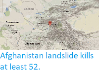
The approximate location of the 11 March 2019 Takhar Earthquake. USGS.
The boundary between the Indian and Eurasian
tectonic plates runs through northern Afghanistan. The Indian
Plate is moving northward relative to the Eurasian Plate, causing
folding and uplift along this boundary, which has led to the formation
of the Hindu Kush Mountains of Afghanistan, the Himalayas and the other
mountain ranges of Central Asia., and which makes the nations in this
boundary zone prone to Earthquakes.

Plate boundaries and movements beneath southern Pakistan, Iran and the Arabian Sea. University of Southampton.
Witness
accounts of Earthquakes can help geologists to understand these events,
and the structures that cause them. The international non-profit
organisation Earthquake Report is interested in hearing from people who may have felt this event; if you felt this quake then you can report it to Earthquake Report here.
See also...


Follow Sciency Thoughts on Facebook.