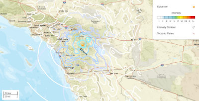
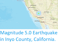
The United States Geological Survey recorded a Magnitude 5.2 Earthquake at a depth of about 11.7 km roughly 23 km to the southwest of Lamont in Kern County, California, slightly before 9.10 pm local time on Tuesday 6 August 2024 (slightly before 4.10 am on Wednesday 7 August, GMT). There are no reports of any damage or injuries relating to this quake, but people have reported feeling it across much of southern California.

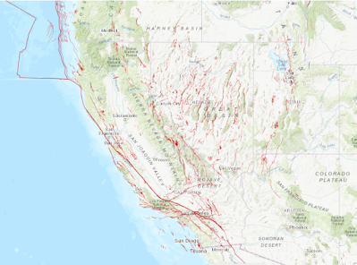
California is extremely prone to Earthquakes due to the presence of the San Andreas Fault, a tectonic plate margin that effectively bisects the state. The west of California, including Santa Barbara and Los Angeles, is located on the Pacific Plate, and is moving to the northwest. The east of California, including Fresno and Bakersfield is on the North American Plate, and is moving to the southeast. The plates do not move smoothly past one-another, but constantly stick together then break apart as the pressure builds up. This has led to a network of smaller faults that criss-cross the state, so that Earthquakes can effectively occur anywhere.

Witness accounts of Earthquakes can help geologists to understand these events and the underlying structures that cause them. If you felt this quake (or if you were in the area but did not, which is also useful information) then you can report it to the United States Geological Survey here.
See also...


%20(1)%20(1).png)