Showing posts with label San Diego County. Show all posts

Friday, 26 December 2025

Three dead as California hit by a series of storms over Christmas period.

Three people have died and many others have been affected by flooding as California has been hit by a series of storms over the Christmas period. A 74-year-old man from Redding, in Shasta County, died on the weekend of 20-21 December 2025, after his car became trapped in floodwaters, despite efforts by local police officers to rescue him. On Monday 22 December a woman in her 70s died after being swept into the sea by a large wave at MacKerricher State Park in Mendocino County. On Wednesday 24 December a 64-year-old man from San Diego was struck by a falling tree.

A car partially buried by a mudslide in San Bernadino County, California. CBS News.

Many areas have been affected by flooding, with some communities in San Bernadino County facing evacuation orders in order to keep them safe. Several flash floods have been reported in Los Angeles County, where 27 cm of rainfall was recorded on Wednesday 24 December, with a large landslip reported in Altadena, on a slope which had been stripped of vegetation by wildfires in January this year. Around 130 households were evacuated due to concerns about flooding and landslides in Los Angeles, mostly in the Pacific Palisades neighbourhood, which was also hit by wildfires in January. Windspeeds gusting in excess of 100 km per hour have been recorded in San Francisco, where waves more than 7 m high have been reported. More than 100 000 people have been left without power due to the storms, mostly in the central part of the state.

The storms have been driven by a phenomenon called an atmospheric river, in which a narrow band of saturated air carries large volumes of moisture for long distances. Such streams typically originate in tropical regions, and typically travel along the boundaries between diverging weather systems. As with other storm systems, once they pass over land they lose momentum, and can be forced upwards by hills or mountains, causing them to cool and deposit their moisture as precipitation, causing high rainfall and often flooding.

A diagrammatic representation of an atmospheric river. National Weather Service/National Atmospheric and Oceanic Organization/Wikimedia Commons.

Atmospheric rivers are a common phenomenon on the west coast of the United States, and a significant driver of local weather conditions. However, these systems are becoming both more common and more severe as a result of the warming climate, which has led to rising temperatures over the tropical Pacific, and subsequently higher levels of atmospheric moisture, combined with a tendency form storm systems and other weather events to form and move much more quickly, making it harder for meteorologists to make long term predictions about where and when such storms will hit.

See also...

Sunday, 30 January 2022

Magnitude 4.1 Earthquake in San Diego County, California.

The United States Geological Survey recorded a Magnitude 4.1 Earthquake at a depth of about 13.3 km roughly 5 km to the west of the Palomar Observatory in San Diego County, California, slightly after 9.45 am local time (slightly before 5.45 pm GMT) on Sunday 30 January 2022. There are no reports of any damage or injuries relating to this quake, but people have reported feeling it across much of southern California, and in parts of northwest Mexico.

 
The approximate location of the 30 January 2022 San Diego County Earthquake. USGS.

California is extremely prone to Earthquakes due to the presence of the San Andreas Fault, a tectonic plate margin that effectively bisects the state. The west of California, including Santa Barbara and Los Angeles, is located on the Pacific Plate, and is moving to the northwest. The east of California, including Fresno and Bakersfield is on the North American Plate, and is moving to the southeast. The plates do not move smoothly past one-another, but constantly stick together then break apart as the pressure builds up. This has led to a network of smaller faults that criss-cross the state, so that Earthquakes can effectively occur anywhere.

 
Tectonic boundaries and faults in California and the surrounding area. USGS.

Witness accounts of Earthquakes can help geologists to understand these events and the underlying structures that cause them. If you felt this quake (or if you were in the area but did not, which is also useful information) then you can report it to the United States Geological Survey here.

See also...


Follow Sciency Thoughts on Facebook.

Follow Sciency Thoughts on Twitter


Sunday, 4 August 2019

Rockfall kills three on Californian beach.

Three women have died and two other people have been injured following a rockfall onto a beach in southern California. The incident happened at about 3.00 pm local time on Friday 2 August 2019, when several tons of sandstone from the Leucadia Cliffs collapsed onto the Grandview Beach, where a beach party was celebrating the recovery of one of the victims, Elizabeth Cox, who had been diagnosed as clear of breast cancer. The dead are reported to be Cox herself, plus her sister Julie Davis, 65, and niece, Anne Clave, 35. The identities of the injured parties have not been given, though the San Diego County Sheriff's Department  has confirmed they were members of the same family and were not children. The area of beach where the incident happened remains closed due to concerns about the stability of the cliffs.

 Rescue workers at the scene of the 2 August 2019 San Diego County cliff collapse. AP.

The Leucadia Cliffs are comprised of poorly consolidated sandstones, and are often undermined by the action of waves on the bottom of the cliffs, which wash away the lower layers, which leads to the rocks above coming down, often in large vertical sheets, due to the low structural strength of the rocks.

See also...

https://sciencythoughts.blogspot.com/2019/07/second-major-earthquake-hits-kern.htmlhttp://sciencythoughts.blogspot.com/2019/07/magnitude-64-earthquake-in-kern-county.html
https://sciencythoughts.blogspot.com/2019/06/cloud-of-ladybird-beetles-confuese-us.htmlhttps://sciencythoughts.blogspot.com/2019/01/mercury-and-selenium-levels-in.html
https://sciencythoughts.blogspot.com/2018/11/humpback-whale-washes-up-on-californian.htmlhttps://sciencythoughts.blogspot.com/2018/11/wildfires-kill-at-least-nine-in.html
Follow Sciency Thoughts on Facebook.

Sunday, 10 December 2017

Magnitude 4.0 Earthquake in San Diego County, California.

The United States Geological Survey recorded a Magnitude 4.0 Earthquake at a depth of about 11.1 km roughly 14 km to the northeast of the town of Julian in San Diego County, California, slightly after 4.30 pm local time on Wednesday 6 December 2017 (slightly after 0.30 am on Thursday 7 December GMT). There are no reports of any damage or injuries relating to this quake, but people have reported feeling it across much of southern California and parts of northeastern Baja California, Mexico.
 
The approximate location of the 6 December 2017  San Diego County Earthquake. USGS.

California is extremely prone to Earthquakes due to the presence of the San Andreas Fault, a tectonic plate margin that effectively bisects the state. The west of California, including Santa Barbara and Los Angeles, is located on the Pacific Plate, and is moving to the northwest. The east of California, including Fresno and Bakersfield is on the North American Plate, and is moving to the southeast. The plates do not move smoothly past one-another, but constantly stick together then break apart as the pressure builds up. This has led to a network of smaller faults that criss-cross the state, so that Earthquakes can effectively occur anywhere.

 The extent of and movement on the San Andreas Fault. Geology.

Witness accounts of Earthquakes can help geologists to understand these events and the underlying structures that cause them. If you felt this quake (or if you were in the area but did not, which is also useful information) then you can report it to the United States Geological Survey here.

See also...

http://sciencythoughts.blogspot.co.uk/2017/12/thousands-evacuated-overnight-as.htmlhttp://sciencythoughts.blogspot.co.uk/2017/12/californian-student-recovering-after.html
http://sciencythoughts.blogspot.co.uk/2017/10/wildfires-kill-at-least-40-in-california.htmlhttp://sciencythoughts.blogspot.co.uk/2017/10/sewage-spill-closes-beaches-in-orange.html
http://sciencythoughts.blogspot.co.uk/2017/09/british-tourist-killed-by-rockfall-on.htmlhttp://sciencythoughts.blogspot.co.uk/2017/09/state-of-emergency-declared-in-san.html
Follow Sciency Thoughts on Facebook.

Sunday, 3 September 2017

State of emergency declared in San Diego after Hepatitis A outbreak kills fifteen.

A state of emergency has been declared in San Diego County, California, on Friday 1 September, where an outbreak of Hepatitis A has killed fifteen people since November 2016 and hospitalised around four hundred more. The liver disease, which is spread through feaces, is not usually fatal in healthy individuals, but has caused a high number of fatalities in recent Californian outbreaks, when it has become established among populations of homeless people, who are often malnourished and/or immunocomprimised, making them particularly vulnerable. The declaration enebles San Diego to request assistance from the state authorities in California, and to enforce new sanitation measures. The city intends to provide new washing facilities in areas with high concentrations of homeless people, and to aquire specialist high-pressure cleaning equipment for removing blood and other bodily fluids from contaminated surfaces (measures that proved effectinve during a similar outbreak in Los Angeles), on top of a vaccination and education program already in place. These measures are likely to be adopted by neighbouring measures in South California in the near future.

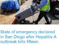
A contractor installing a publich wash station in San Diego on 1 September 2017. Eduardo Contreras/The San Diego Union-Tribune/AP.

Hepatitis A is cuased by Hepatovirus A, a form of Picornavirales, non-enveloped isohedral RNA viruses about 30 nanometers in diameter, which are known to infect a variety of Vertebrates, Insects, Plants and Algae.

Electron microgaph of a Hepatovirus A Virus. Centers for Disease Control and Prevention/Wikimedia Commons.

Hepatitis A infects the Human liver, and often causes no symptoms in young, healthy individuals (though these can still pass the disease on). Individuals that do develop symptoms will typically suffer fever, nausea, vomiting, jaundice and abdominal pain, which can last for up to about eight weeks. Weaker individuals may suffer repeated bouts of symptoms, and in the worst cases acute liver failure, which is fatal without extreme medical intervention, such as a liver transplant.

See also...

http://sciencythoughts.blogspot.co.uk/2016/12/first-case-of-locally-transmitted-zika.html
http://sciencythoughts.blogspot.co.uk/2016/12/smallpox-virus-recovered-from.html

http://sciencythoughts.blogspot.co.uk/2016/08/florida-state-department-of-health.html
http://sciencythoughts.blogspot.co.uk/2016/11/determining-origin-of-august-2016.html
http://sciencythoughts.blogspot.co.uk/2016/01/sierra-leone-reports-new-case-of-ebola.html
http://sciencythoughts.blogspot.co.uk/2016/02/estimating-role-of-temperature-in-sea.html

Follow Sciency Thoughts on Facebook.

Thursday, 15 January 2015

Two new species of Carnivoraform Mammals from the Middle Eocene of San Diego County, California.


The Order Carnivora includes the majority of modern carnivorous Mammals, including Dogs (Canids), Cats (Felids), Hyenas (Hyenids), Bears (Ursids), Racoons (Procyonids) Weasels, Badgers and Otters (Mustids) and Seals (Pinipeds). Most of these groups are thought to have appeared in the Middle Eocene, making this period of particular time interval of particular interest to palaeontologists studying the group, and slowly rose to dominate terrestrial ecosystems, replacing earlier groups of predatory Mammals, Carnivoran and non-Carnivoran.

In a paper published in the journal Palaeontologica Electronica in June 2013, Susumu Tomiya of the Museum of Paleontology, Museum of Vertebrate Zoology, and Department of Integrative Biology at the University of California, Berkeley, describes two new species of Carnivoraform Mammals from the Middle Eocene of San Diego County, California, as well as additional specimens of several previously described species.

The first new species described is named Ceruttia sandiegoensis, where ‘Ceruttia’ honours Richard Cerutti of the San Diego Natural History Museum for his work on vertebrate palaeontology, and ‘sandiegoensis’ means ‘from San Diego’. The species is based upon fragmentary cranial material including the right and left maxilla and left premaxila (upper jaw elements) from the Mission Valley Formation at El Cajon, plus additional material including isolated teeth and fragments of several maxilla and dentaries (lower jaws) from the Santiago Formation at Oceanside.

Dentition of Ceruttia sandiegoensis. Left premaxilla and maxilla in ventral view (1); left P4-M2 in occlusal view (2); left dentary fragment of in labial view (3); left dentary fragment in labial (4), occlusal (5), and lingual (6) views; right dentary fragment (7) and right m2 (8) in occlusal view. Two white triangles in (1) point to possiblealveoli for M3. Black triangle in(5) points to alveolus for m3. Same scale bar applies to Figure (1) and (4-7). Abbreviation: if, incisor foramen. Tomiya (2013).

Ceruttia sandiegoensis closely resembles two previously described species, ‘Miacissylvestris and ‘Miacishargeri, though recent studies have suggested the placement of the species in Miacis is erroneous, so Tomiya avoids placing them it in the same genus, pending a review of the group. The auditory region resembles that of Miacis parvivorus and ‘Miacis’ sylvestris, with all three being apparently ‘primitive’ to the earliest known members of all extant Carnivoran groups (i.e. it they had not yet developed features seen in all these groups from their onset), suggesting that they do not belong to any of the these living groups (i.e. all modern Carnivorans are more closely related to one-another than any of them is to Ceruttia sandiegoensis, Miacis parvivorus or ‘Miacis’ sylvestris).

The second new species described is named Walshius pacificus, where ‘Walshius’ honours the late Stephen Walsh of the San Diego Natural History Museum for his work on the Eocene Mammals of San Diego County, and ‘pacificus’ refers to the proximity of the area where the fossils from which the species is described to the Pacific Ocean. The species is described from two fragmentary right maxilla from the Friars Formation in San Diego, plus a fragmentary right dentary that probably belongs to the same species.

Dentition of Walshius pacificus. Right maxillary fragment of first specimen in occlusal view (1); right maxillary fragment of second specimen in lingual view (2), inverted; right dentary fragment of possible third specimen in labial (3), lingual (4), and occlusal (5) views. Tomiya (2013).

See also…

http://sciencythoughts.blogspot.co.uk/2014/10/mammal-remains-from-early-eocene-of_30.htmlMammal remains from the Early Eocene of northern British Columbia.                                   The Early Eocene was a time of high species turnover among Mammals (and other groups), driven by two periods of extreme global warming, the...
http://sciencythoughts.blogspot.co.uk/2013/12/a-new-species-of-leptictid-mammal-from.htmlA new species of Leptictid Mammal from the Late Eocene of South Dakota.                                      Leptictid Mammals appeared early in the post-Cretaceous radiation of Mammals, and persisted till the Oligocene. They may have been distant relatives of the Rodents and Primates, though some authors regard them as being the earliest group to break of from the other Placental Mammals. They were small Mammals, the largest reaching about 90 cm, and appear to have been primarily insectivorous in diet. Many...
 
Follow Sciency Thoughts on Facebook.

Friday, 27 September 2013

Magnitude 2.5 Earthquake on the San Diego/Riverside County boundary, southern California.

The United States Geological Survey recorded a Magnitude 2.5 Earthquake at a depth of 8.5 km on the boundary between San Diego and Riverside Counties slightly before 9.40 am local time (slightly before  4.40 pm GMT) on Thursday 26 September 2013. This is not a large quake, and is unlikely to have caused any damage or injuries, but is likely to have been felt locally.

The approximate location of the 26 September 2013 San Diego/Riverside County boundary Earthquake. Google Maps.


California is extremely prone to Earthquakes due to the presence of the San Andreas Fault, a tectonic plate margin that effectively bisects the state. The west of California, including Santa Barbara and Los Angeles, is located on the Pacific Plate, and is moving to the northwest. The east of California, including Fresno and Bakersfield is on the North American Plate, and is moving to the southeast. The plates do not move smoothly past one-another, but constantly stick together then break apart as the pressure builds up. This has led to a network of smaller faults that criss-cross the state, so that Earthquakes can effectively occur anywhere.

Witness accounts of Earthquakes can help geologists to understand these events and the underlying structures that cause them. If you felt this quake (or if you were in the area but did not, which is also useful information) then you can report it to the United States Geological Survey here.


Follow Sciency Thoughts on Facebook.

Thursday, 5 September 2013

Magnitude 3.2 Earthquake in southern California.

The United States Geological Survey recorded a Magnitude 3.2 Earthquake at a depth of 14.5 km, 5 km northwest of Borrego Springs in San Diego County, southern California, slightly before 9.05 pm local time on Tuesday 3 September 2013 (slightly before 4.05 am on Wednesday 4 September, GMT). There are no reports of any damage or casualties from this quake, but it was reportedly felt over a wide area.

The approximate location of the 3 September 2013 Borrego Springs Earthquake. Google Maps.

California is extremely prone to Earthquakes due to the presence of the San Andreas Fault, a tectonic plate margin that effectively bisects the state. The west of California, including Santa Barbara and Los Angeles, is located on the Pacific Plate, and is moving to the northwest. The east of California, including Fresno and Bakersfield is on the North American Plate, and is moving to the southeast. The plates do not move smoothly past one-another, but constantly stick together then break apart as the pressure builds up. This has led to a network of smaller faults that criss-cross the state, so that Earthquakes can effectively occur anywhere.

Witness accounts of Earthquakes can help geologists to understand these events and the underlying structures that cause them. If you felt this quake (or if you were in the area but did not, which is also useful information) then you can report it to the United States Geological Survey here.


Follow Sciency Thoughts on Facebook.