Showing posts with label Yellowstone Hotspot. Show all posts

Tuesday, 1 September 2020

Giantess Geyser errupts in Yellowstone National Park for the first time in six years.

The Giantess Geyser in Yellowstone National Park errupted on Tuesday 25 August 2020, producing a jet of water about 60 m high. This is the first time the geyser has errupted in six and a half years. This is an long pause between eruptions for Giantess, which typically erupts 2-6 times per year, but not unusually so; the geyser is known to have periodic multi-year hiatuses with the last having happened in the 1980s. Giantess is the second largest in the Yellowstone National Park, after the Steamboat Geyser, whih is the largest in North America and the second largest in the world.

Erruption of Giantess Geyser on 25 August 2020. Yellowstone National Park.

The Yellowstone National Park lies on top of the caldera of an active volcano. The geysers and hot springs are fuelled by water from the surface peculating through the ground until it encounters hot rocks or magma, which heats it rapidly. This hot water then rises back to the surface to fuel the geysers and fill the volcanic pools of the park. As it passes through the rocks the water absorbs chemicals from the surrounding minerals, with water with different mineral properties in different parts of the park, creating a variety of brightly coloured pools.

 
Yellowstone is home to one of the world’s largest active volcanic systems. Cataclysmic eruptions in the past few million years created huge volcanic depressions called “calderas.” The youngest, the Yellowstone Caldera, was formed 640 000 years ago. Since then, about 80 eruptions of rhyolite (thick, sticky lava) and basalt (more-fluid lava) have occurred. The caldera’s interior is largely covered by rhyolites, most erupted in the past 160 000 years. Large hydrothermal (steam)-explosion craters formed in the past 14 000 years are located near Yellowstone Lake and in major geyser basins. Recent earthquakes (1973 to 2002) were concentrated between Hebgen Lake and the Norris Geyser Basin and along faults. USGS.
 

See also...


Follow Sciency Thoughts on Facebook.


Wednesday, 1 April 2020

Magnitude 6.5 Earthquake in Custer County, Idaho.

The United States Geological Survey recorded a Magnitude 6.5 Earthquake at a depth of 10.0 km about 72 km to the west of Challis in Custer County, Idaho, slightly after 4.50 pm local time (slightly after 11.50 pm GMT) on Tuesday 31 March 2020. There are no reports of any serious damage or injuries associated with this event, but it was felt across much of western North America, from Vancouver and Calgary in the north to Las Vegas and Los Angeles in the south.

A rockfall on Highway 21 near Lowman, Idaho, following a Magnitude 6.5 Earthquake on 31 March 2020. Tyler Boyer/The Spokesman Review.

The quake took part in an area known as the Central Idaho Seismic Zone, which is bisected by six active faults, the Madison, Centennial, Beaverhead, Lemhi, Lost River, and Sawtooth. These faults are associated with the Yellowstone Magma Chamber in the northeast of Wyoming, an area that suffers more-or-less constant small tremors due to the movement of magma beneath the surface, but which seldom experiences larger quakes. The constant small movements around Yellowstone can lead to stress building up in rocks further away, leading to Earthquakes as the rocks release the strain by readjusting their positions, which can affect Wyoming as well as neighbouring Idaho and Montana. The same faults also suffer stress due to more distant rock movements, notably on the subduction zone on the American west coast.

 The approximate location of the 31 March 2020 Custer County Earthquake. USGS.

Witness accounts of Earthquakes can help geologists to understand these events and the underlying structures that cause them. If you felt this quake (or if you were in the area but did not, which is also useful information) then you can report it to the United States Geological Survey here.

See also...

https://sciencythoughts.blogspot.com/2018/10/looking-for-connection-between-columbia.htmlhttps://sciencythoughts.blogspot.com/2018/02/idaho-man-killed-in-avalanche.html
https://sciencythoughts.blogspot.com/2017/09/magnitude-53-earthquake-in-caribou.htmlhttps://sciencythoughts.blogspot.com/2015/01/magnitude-49-earthquake-in-custer.html
https://sciencythoughts.blogspot.com/2014/04/magnitude-49-earthquake-in-custer.htmlhttps://sciencythoughts.blogspot.com/2014/03/two-cars-swallowed-by-sinkhole-in.html
Follow Sciency Thoughts on Facebook.

Sunday, 29 April 2018

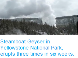
Steamboat Geyser in Yellowstone National Park, erupts three times in six weeks.

The Steamboat Geyser in the Yellowstone National Park, Wyoming, erupted on Friday 27 April 2018, the third such eruption this year, following events on 19 April and 15 March. This is the first time the geyser has erupted since September 2014, and the first time it has erupted three times within a year since 2003. This has led to some speculation that these events may indicate a forthcoming eruption on the Yellowstone Supervolcano (a popular idea with some elements of the media), but no such inference can be made, with scientists at the Yellowstone Volcano Observatory pointing out that these eruptions have been considerably smaller than the largest known events at the Geyser, which cab produce water spouts reaching over 90 m in the air and lasting for up to 40 minutes.

Eruption on the Steamboat Geyser on 27 April 2018. Yellowstone National Park/Twitter.

The Yellowstone National Park lies on top of the caldera of an active volcano. The geysers and hot springs are fuelled by water from the surface peculating through the ground until it encounters hot rocks or magma, which heats it rapidly. This hot water then rises back to the surface to fuel the geysers and fill the volcanic pools of the park. As it passes through the rocks the water absorbs chemicals from the surrounding minerals, with water with different mineral properties in different parts of the park, creating a variety of brightly coloured pools.

  Yellowstone is home to one of the world’s largest active volcanic systems. Cataclysmic eruptions in the past few million years created huge volcanic depressions called “calderas.” The youngest, the Yellowstone Caldera, was formed 640 000 years ago. Since then, about 80 eruptions of rhyolite (thick, sticky lava) and basalt (more-fluid lava) have occurred. The caldera’s interior is largely covered by rhyolites, most erupted in the past 160 000 years. Large hydrothermal (steam)-explosion craters formed in the past 14 000 years are located near Yellowstone Lake and in major geyser basins. Recent earthquakes (1973 to 2002) were concentrated between Hebgen Lake and the Norris Geyser Basin and along faults. USGS.

The Steamboat Geyser is the world's second largest, after the Waimangu Geyser in New Zealand, which erupts even less frequently (it last erupted in 1908), and even small eruptions like those seen this year are much larger than those seen on the nearby Old Faithful Geyser, which erupts sever times a day with water reaching 30-40 m above the ground. The size of a water spout related to how much water pressure (caused by water expanding as it is heated and some of it turns to vapour) builds up before there is a release. Therefore the more frequent, smaller, eruptions seen this year are a symptom of water escaping at a lower pressure, rather than a symptom of increasing volcanic activity within the caldera.

See also...

http://sciencythoughts.blogspot.co.uk/2018/02/avalanche-kills-skier-near-jackson-hole.htmlhttp://sciencythoughts.blogspot.co.uk/2017/03/the-down-side-of-animal-tagging-in.html
http://sciencythoughts.blogspot.co.uk/2016/11/tourist-dies-after-falling-into-hot.htmlhttp://sciencythoughts.blogspot.co.uk/2016/08/magnitude-48-earthquake-in-southern.html
http://sciencythoughts.blogspot.co.uk/2015/10/mysterious-crack-on-wyoming-hillside.htmlhttp://sciencythoughts.blogspot.co.uk/2014/06/magnitude-34-earthquake-in-yellowstone.html
Follow Sciency Thoughts on Facebook.

Monday, 4 September 2017

Magnitude 5.3 Earthquake in Caribou County, Idaho.

The United States Geological Survey recorded a Magnitude 5.3 Earthquake at a depth of 9.2 km about 17 km to the east of Soda Springs in Caribou County, Idaho, slightly after 11.40 am local time (slightly after 5.40 pm GMT) on Sunday 3 September 2017. There are no reports of any serious damage or injuries associated with this event, but it was felt across much of Idaho as well as parts of Montana, Wyoming, Utah and Oregon.

The approximate location of the 3 September 2017 Idaho Earthquake. USGS.

The quake took place close to the Yellowstone Magma Chamber in the northeast of Wyoming, an area that suffers more-or-less constant small tremors due to the movement of magma beneath the surface, but which seldom experiences larger quakes. The constant small movements around Yellowstone can lead to stress building up in rocks further away, leading to Earthquakes as the rocks release the strain by readjusting their positions, which can affect Wyoming as well as neighbouring Idaho and Montana. The same faults also suffer stress due to more distant rock movements, notably on the subduction zone on the American west coast.
 
 Yellowstone is home to one of the world’s largest active volcanic systems. Cataclysmic eruptions in the past few million years created huge volcanic depressions called “calderas.” The youngest, the Yellowstone Caldera, was formed 640,000 years ago. Since then, about 80 eruptions of rhyolite (thick, sticky lava) and basalt (more-fluid lava) have occurred. The caldera’s interior is largely covered by rhyolites, most erupted in the past 160,000 years. Large hydrothermal (steam)-explosion craters formed in the past 14,000 years are located near Yellowstone Lake and in major geyser basins. Recent earthquakes (1973 to 2002) were concentrated between Hebgen Lake and the Norris Geyser Basin and along faults. USGS.
 
Witness accounts of Earthquakes can help geologists to understand these events and the underlying structures that cause them. If you felt this quake (or if you were in the area but did not, which is also useful information) then you can report it to the United States Geological Survey here.
 
See also...
 
http://sciencythoughts.blogspot.co.uk/2015/01/magnitude-49-earthquake-in-custer.htmlhttp://sciencythoughts.blogspot.co.uk/2014/04/magnitude-49-earthquake-in-custer.html
http://sciencythoughts.blogspot.co.uk/2014/03/two-cars-swallowed-by-sinkhole-in.htmlhttp://sciencythoughts.blogspot.co.uk/2013/12/magnitude-31-earthquake-in-eastern-idaho.html
Follow Sciency Thoughts on Facebook.

Friday, 18 November 2016

Tourist dies after falling into hot spring at Yellowsone National Park.

A man has died after falling into a hot spring at Yellowstone National Park in Wyoming, USA. The incident happened in June this year, but details of the event have only become clear following a Freedom of Information Act request by a local radio station. Colin Scott, 23, of Oregon was reportedly visiting the park with his sister on 7 June when he left a designated boardwalk in the Norris Geyser Basin in order to investigate the temperature of a pool, apparently with the intention of  'hot-potting' (getting into the pool and soaking), a practise strictly forbidden in the park. However he slipped and fell into the pool, possibly after being scalded by the water, and was rapidly killed by the hot and acidic water. Attempts to recover his body that day were unsuccessful, in part due to a large thunderstorm in the area, and by the next day little was left of the body.

Boardwalk across the Norris Geyser Basin in the Yellowstone National Park. InSapphoWeTrust/Wikimedia Commons.

The Yellowstone National Park lies on top of the caldera of an active volcano. The hot springs are fuelled by water from the surface peculating through the ground until it encounters hot rocks or magma, which heats it rapidly. This hot water then rises back to the surface to fuel the geysers and fill the volcanic pools of the park. As it passes through the rocks the water absorbs chemicals from the surrounding minerals, with water with different mineral properties in different parts of the park, creating a variety of brightly coloured pools. 

  Yellowstone is home to one of the world’s largest active volcanic systems. Cataclysmic eruptions in the past few million years created huge volcanic depressions called “calderas.” The youngest, the Yellowstone Caldera, was formed 640 000 years ago. Since then, about 80 eruptions of rhyolite (thick, sticky lava) and basalt (more-fluid lava) have occurred. The caldera’s interior is largely covered by rhyolites, most erupted in the past 160 000 years. Large hydrothermal (steam)-explosion craters formed in the past 14 000 years are located near Yellowstone Lake and in major geyser basins. Recent earthquakes (1973 to 2002) were concentrated between Hebgen Lake and the Norris Geyser Basin and along faults. USGS.

Many of these pools are alkaline in nature, but the pools of  the Norris Geyser Basin are acid, with a typical pH of about 3.5. This is not immediately dangerous, being roughly as acidic as vinegar, Lemon juice or some fizzy drinks. However the water in the pool was about 100°C (i.e. boiling), hot enough to quickly kill anyone falling in. Once immersed in such a pool the acid would rapidly attack the body, as, like most chemical reactions, acids act more strongly at higher temperatures.

See also...

http://sciencythoughts.blogspot.co.uk/2015/06/understanding-current-flows-in.html
http://sciencythoughts.blogspot.co.uk/2016/08/magnitude-48-earthquake-in-southern.html


http://sciencythoughts.blogspot.co.uk/2015/01/magnitude-49-earthquake-in-custer.html
http://sciencythoughts.blogspot.co.uk/2015/05/tryonia-infernalis-new-species-of.html


https://blogger.googleusercontent.com/img/b/R29vZ2xl/AVvXsEi3ZvSKVrMlmUiKxRt5RryD84ig0dXkvECJVHXv0Mllvko7qli75GOf2hDowhxdA3VldLv7IpU5slV3Zawv9On6JSFRfW8JLoSJWG2uqyCHLWHSk3mtrdFrO9B43S0zdkMFNRLdzoKxKXM/s1600/Yellowstone+Earthquake.jpg
http://sciencythoughts.blogspot.co.uk/2014/08/two-dead-and-one-missing-after.html


Follow Sciency Thoughts on Facebook.

Sunday, 28 August 2016

Magnitude 4.8 Earthquake in southern Teton County, Wyoming.

The United States Geological Survey recorded a Magnitude 4.8 Earthquake at a depth of 10 km in southern Teton County in northwest Wyoming, slightly after 2.45 pm local time (slightly after 8.45 pm GMT) on Saturday 27 August 2016. There are no reports of any damage or casualties associated with this event, though people have reported feeling it across much of northwest Wyoming and southeast Idaho.

 The approximate location of the 27 August 2016 Teton County Earthquake. Google.

Wyoming typically suffers two or three moderate sized Earthquakes per year, though quakes large enough to cause significant damage are rare. The mountainous areas of the west of the state have a number of deeply buried faults where occasional movement occurs. This can be caused by movement around the Yellowstone Magma Chamber in the northeast of the state, an area that suffers more-or-less constant small tremors due to the movement of magma beneath the surface, but which seldom experiences larger quakes. The constant small movements around Yellowstone can lead to stress building up in rocks further away, leading to Earthquakes as the rocks release the strain by readjusting their positions, which can affect Wyoming as well as neighbouring Idaho and Montana. The same faults also suffer stress due to more distant rock movements, notably on the subduction zone on the American west coast.

 Yellowstone is home to one of the world’s largest active volcanic systems. Cataclysmic eruptions in the past few million years created huge volcanic depressions called “calderas.” The youngest, the Yellowstone Caldera, was formed 640,000 years ago. Since then, about 80 eruptions of rhyolite (thick, sticky lava) and basalt (more-fluid lava) have occurred. The caldera’s interior is largely covered by rhyolites, most erupted in the past 160,000 years. Large hydrothermal (steam)-explosion craters formed in the past 14,000 years are located near Yellowstone Lake and in major geyser basins. Recent earthquakes (1973 to 2002) were concentrated between Hebgen Lake and the Norris Geyser Basin and along faults. USGS.

Witness accounts of Earthquakes can help geologists to understand these events and the underlying structures that cause them. If you felt this quake (or if you were in the area but did not, which is also useful information) then you can report it to the United States Geological Survey here.

See also...

http://sciencythoughts.blogspot.co.uk/2015/10/mysterious-crack-on-wyoming-hillside.html'Mysterious' crack on Wyoming hillside linked to slow-moving landslip.                                 A group of hunters in Washakie County in northern Wyoming reported finding an apparently...
http://sciencythoughts.blogspot.co.uk/2014/06/magnitude-34-earthquake-in-yellowstone.htmlMagnitude 3.4 Earthquake in the Yellowstone National Park, northwest Wyoming.                                                    The United States Geological Survey recorded a Magnitude 3.4...
http://sciencythoughts.blogspot.co.uk/2014/06/worker-killed-at-north-antelope.htmlWorker killed at North Antelope Rochelle Mine, Wyoming.                                              A worker has been killed at the Peabody Energy operated North Antelope Rochelle Mine in Campbell County, Wyoming, on Wednesday 4 June 2014. The incident happened at about 6.00 a, when a crushing...
Follow Sciency Thoughts on Facebook.
Sunday, 4 January 2015

Magnitude 4.9 Earthquake in Custer County, Idaho.

The United States Geological Survey recorded a Magnitude 4.9 Earthquake at a depth of 8.2 km about 7.9 km to the east of Chalis in Custer County, Idaho, slightly before 10.45 am local time (slightly before 5.45 pm GMT) on Saturday 3 January 2015. There are no reports of any serious damage or injuries associated with this event, but it was felt across much of Idaho and southeastern Montana, and the area has been shaken by several large Earthquakes since the main event.

The approximate location of the 3 January 2014 Custer County Earthquake. Google Maps.

The quake took part in an area known as the Central Idaho Seismic Zone, which is bisected by six active faults, the Madison, Centennial, Beaverhead, Lemhi, Lost River, and Sawtooth. These faults are associated with the Yellowstone Magma Chamber in the northeast of Wyoming, an area that suffers more-or-less constant small tremors due to the movement of magma beneath the surface, but which seldom experiences larger quakes. The constant small movements around Yellowstone can lead to stress building up in rocks further away, leading to Earthquakes as the rocks release the strain by readjusting their positions, which can affect Wyoming as well as neighbouring Idaho and Montana. The same faults also suffer stress due to more distant rock movements, notably on the subduction zone on the American west coast.

Witness accounts of Earthquakes can help geologists to understand these events and the underlying structures that cause them. If you felt this quake (or if you were in the area but did not, which is also useful information) then you can report it to the United States Geological Survey here.


See also...

The United States Geological Survey recorded a Magnitude 4.9 Earthquake at a depth of 5.0 km, roughly 15 km north of Chalis City in Custer County, Idaho...

Two cars travelling in opposite directions were swallowed by a sinkhole that opened up to the north of...


The United States Geological Survey recorded a Magnitude 3.1 Earthquake at a depth of 4.4 km beneath the city of Driggs in  Teton County in eastern Idaho, slightly before 5.05 pm local time on...


Follow Sciency Thoughts on Facebook.

Thursday, 5 June 2014

Magnitude 3.4 Earthquake in the Yellowstone National Park, northwest Wyoming.

The United States Geological Survey recorded a Magnitude 3.4 Earthquake at a depth of 9.2 km in the Yellowstone National Park in northwest Wyoming, slightly after 3.20 pm local time (slightly after 9.20 pm GMT) on Wednesday 4 June 2014. There are no reports of any damage or casualties associated with this event, though it is likely to have been felt locally.

The approximate location of the 4 June 2014 Yellowstone Park Earthquake. Google Maps.

The quake occurred on the northwestern fringe of the Yellowstone Caldera, a vast hotspot volcano that covers an area of roughly 55 by 75 km. Eruptions on the volcano are rare (the last happened around 70 000 years ago) and explosive eruptions even more so (the last happened around 150 000  years ago), but movement is common in the magma chamber beneath the caldera, leading to frequent, if generally rather small, Earthquakes. Magma entering a chamber beneath a volcano does not necessarily erupt as lava at the surface; it can be emplaced in structures such as sills and dykes, igneous rock formations formed entirely beneath the surface.

Witness accounts of quakes can help geologists to understand these events and the rock structures that cause them. If you felt this quake (or if you were in the area but did not, which is also useful information) you can report it to the USGS here.

See also...


The United States Geological Survey recorded a Magnitude 2.7...


The United States Geological Survey recorded a Magnitude 3.1 Earthquake at a depth of 4.4 km beneath the city of Driggs in  Teton County in eastern Idaho, slightly before 5.05 pm local time on...


The United States Geological Survey recorded a Magnitude 4.2...


Follow Sciency Thoughts on Facebook.