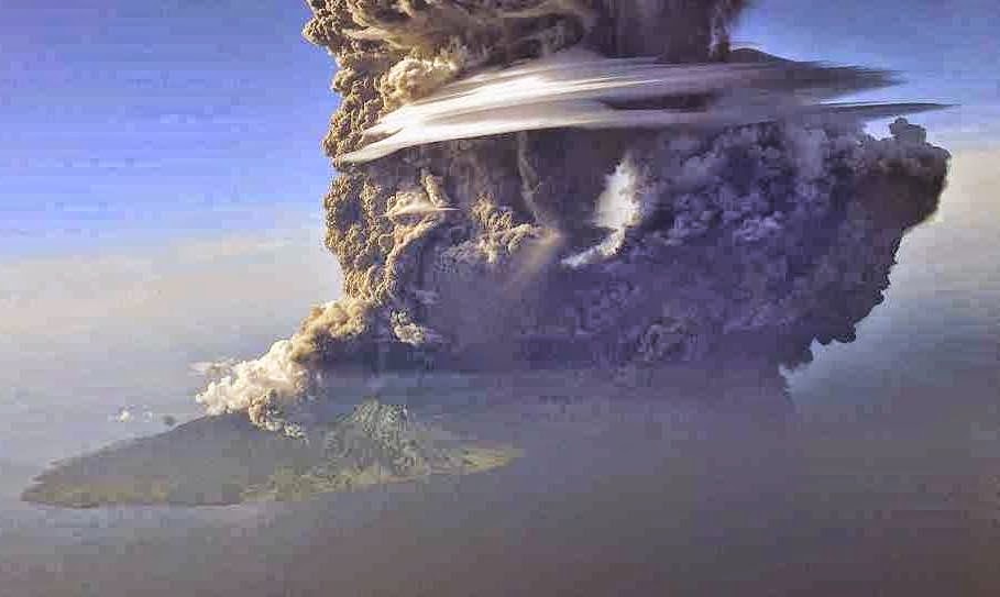
On 7 April 2015 the Darwin Volcanic Ash Advisory Centre reported an ash cloud rising 7 km above the island, which then drifted to the northwest. This is the first eruptive activity on the volcano reported since the end of November 2013. Batu Tara is a small island volcano rising 748 m above the Flores Sea in
Indonesia, about 50 km north of Lembata. It is the tip of a
stratovolcano (cone-shaped volcano made up of layers of ash and lava)
which rises from the seafloor 3000 m below.
The approximate location of Batu Tara. Google Maps.
Batu Tara is located to the north of the Flores Thrust, where the Timor
Microplate is being subducted beneath the Banda Sea Plate (part of the
collisional area between the Australian and Eurasian Plates). As this
happens the Timor Plate is forced down into the Earth's interior, where
it is partially melted by the heat. Melted material then rises through
the overlying Banda Sea Plate, fueling the volcanoes located upon it.
The nature and frequency of eruptions on Batu Tare, combined with its
position directly between Jakarta and Sidney, means that it frequently
causes problems for aircraft, which need to be diverted around any ash
clouds. This can add significantly to flight times, and therefore costs.
See also...
Flights from Australia to Indonesia and Southeast Asia have been
severely disrupted and several...
 Magnitude 5.2 Earthquake on west Timor. The United States Geological Survey
recorded a Magnitude 5.2 Earthquake at a depth of 27.2 km, 9 km to the
northeast of the city of Kupang on the western (Indonesian) half of the
Island of Timor, at the...
 Eruption on Batu Tara. The Darwin Volcanic Ash Advisory Centre
reports an eruption on the island volcano Batu Tara, one of the Lesser
Sunda Islands in the Flores Sea, producing a 2.1 km ash column on the
morning of Friday 13 September 2013. This follows a series of eruptions
over the previous two days, which...
Follow Sciency Thoughts on Facebook.


