
The United States Geological Survey
recorded a Magnitude 6.5 Earthquake at a depth of 91.9 km under the district of Cipatujah in West Java, Indonesia, slightly after 11.45 pm local time (slightly after 4.45 pm GMT) on Friday 15 December March 2017. The event was felt
across most of Java, as well as on Bali and Christmas Island. The event is reported to have caused a number of building collapses and several deaths, though the extent of the damage is as yet unclear.

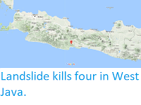
The approximate location of the 15 December 2017 West Java Earthquake. USGS.
The
Indo-Australian Plate, which underlies the Indian Ocean to the south of
Java, Bali and Lombok, is being subducted beneath the Sunda Plate, a
breakaway part of the Eurasian Plate which underlies the islands and
neighbouring Sumatra, along the Sunda Trench, passing under the islands,
where friction between the two plates can cause Earthquakes. As the
Indo-Australian Plate sinks further into the Earth it is partially
melted and some of the melted material rises through the overlying Sunda
Plate as magma, fuelling the volcanoes of Java and neighbouring
islands.

Subduction along the Sunda Trench beneath Java, Bali and Lombok. Earth Observatory of Singapore.
Witness
accounts of Earthquakes can help geologists to understand these events,
and the structures that cause them. The international non-profit
organisation Earthquake Report is interested in hearing from people who may have felt this event; if you felt this quake then you can report it to Earthquake Report here.
See also...


Follow Sciency Thoughts on Facebook.