Showing posts with label Granada. Show all posts

Tuesday, 16 June 2020

Alert level around Kick 'em Jenny raised after sharp rise in seismic activity.

The Granadan National Disaster Management Agency has raised the alert level around Kick 'em Jenny, a submarine volcano about 8 km to the north of Granada, following an abrupt rise in seismic activity in the area. A total of 1384 Earthquakes with a Magnitude greater than 1.0 were recorded in the week 5-12 June 2020, compared to only 29 in the whole of April and May. Such tremors are often caused by the movement of hot water and volcanic gas beneath a volcano, which could indicate that the volcano is about to erupt. As a precaution a shipping exclusion zone surrounds the Kick 'em Jenny to a distance of 1.5 km; this zone has been increased to 5 km until further notice, due to the heightened risk to shipping during periods of activity.

 Map showing the exclusion zone around Kick 'em Jenny. Caribbean 360.

Kick 'em Jenny rises 1300 m above the surrounding seafoor, but remains 180 m below the surface. It was first discovered in July 1939, when an eruption broke the surface and threw material several hundred meters into the air, as well as generating a tsunami which was observed as far away as Barbados, though it was too small to cause any damage. However Kick 'em Jenny is labled on many earlier maritime charts, indiating that people have been aware there was something here for several centuries, even if they did not know the nature of the feature.

5 m lateral resolution digital terrain model  of the Kick ‘em Jenny current edifice. Robertson et al. (2015).

The Lesser Antilles are located at the eastern fringe of the Caribbean Tectonic Plate. The Atlantic Plate (strictly speaking, an extension of the South American Plate which runs to the northeast of the Caribbean) is being subducted beneath this, and as it sinks into the Earth, is melted by the heat of the planets interior. Some of the melted material then rises up through the overlying Caribbean Plate as magma, fuelling Kick 'em Jenny and the other volcanoes of the Lesser Antilles Volcanic Arc. The subduction of the Atlantic Plate beneath the Caribbean Plate is not a smooth process, with the two plates constantly sticking together then breaking apart as the tectonic pressure builds up, causing Earthquakes in the process, though since the boundary between the two plates is some way to the east of the islands, Earthquakes in the Lesser Antilles tend to be both deep and offshore, which lessens their destructive potential.

The subduction of the Atlantic Plate beneath the Caribbean Plate fuels the volcanoes of the Lesser Antilles Volcanic Arc. George Pararas-Carayannis.

See also...

https://sciencythoughts.blogspot.com/2020/04/magnitude-52-earthquake-between-tobago.htmlhttps://sciencythoughts.blogspot.com/2018/09/magnitude-54-earthquake-to-northeast-of.html
https://sciencythoughts.blogspot.com/2018/04/magnitude-47-earthquake-beneath-western.htmlhttps://sciencythoughts.blogspot.com/2018/03/warning-issued-to-shipping-after.html
https://sciencythoughts.blogspot.com/2018/02/magnitude-52-earthquake-to-north-of.htmlhttps://sciencythoughts.blogspot.com/2017/12/magnitude-52-earthquake-to-northeast-of.html
Follow Sciency Thoughts on Facebook. 

Tuesday, 13 March 2018

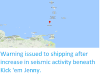
Warning issued to shipping after increase in seismic activity beneath Kick 'em Jenny.

A warning has been issued to shipping after the University of the West Indies Seismic Research Centre in Trinidad detected an an increase in seismic activity beneath Kick 'em Jenny, a submarine volcano about 8 km to the north of Granada this week. Such tremors are often caused by the movement of hot water and volcanic gas beneath a volcano, which could indicate that the volcano is about to erupt. As a precaution a shipping exclusion zone surrounds the Kick 'em Jenny to a distance of 1.5 km; this zone has been increased to 5 km until further notice, due to the heightened risk to shipping during periods of activity.

The approximate location of Kick 'em Jenny. Google Maps.

 Kick 'em Jenny rises 1300 m above the surrounding seafloor, but remains 180 m below the surface. It was first discovered in July 1939, when an eruption broke the surface and threw material several hundred meters into the air, as well as generating a tsunami which was observed as far away as Barbados, though it was too small to cause any damage. However Kick 'em Jenny is labelled on many earlier maritime charts, indicating that people have been aware there was something here for several centuries, even if they did not know the nature of the feature.

The Lesser Antilles are located at the eastern fringe of the Caribbean Tectonic Plate. The Atlantic Plate (strictly speaking, an extension of the South American Plate which runs to the northeast of the Caribbean) is being subducted beneath this, and as it sinks into the Earth, is melted by the heat of the planets interior. Some of the melted material then rises up through the overlying Caribbean Plate as magma, fuelling Kick 'em Jenny and the other volcanoes of the Lesser Antilles Volcanic Arc. The subduction of the Atlantic Plate beneath the Caribbean Plate is not a smooth process, with the two plates constantly sticking together then breaking apart as the tectonic pressure builds up, causing Earthquakes in the process, though since the boundary between the two plates is some way to the east of the islands, Earthquakes in the Lesser Antilles tend to be both deep and offshore, which lessens their destructive potential.

The subduction of the Atlantic Plate beneath the Caribbean Plate fuels the volcanoes of the Lesser Antilles Volcanic Arc. George Pararas-Carayannis.

See also...
http://sciencythoughts.blogspot.co.uk/2018/02/magnitude-52-earthquake-to-north-of.htmlhttp://sciencythoughts.blogspot.co.uk/2017/12/magnitude-52-earthquake-to-northeast-of.html
http://sciencythoughts.blogspot.co.uk/2017/09/magnitude-46-earthquake-to-northeast-of.htmlhttp://sciencythoughts.blogspot.co.uk/2017/05/shipping-warning-issued-after-eruption.html
http://sciencythoughts.blogspot.co.uk/2017/03/magnitude-45-earthquake-to-north-of-st.htmlhttp://sciencythoughts.blogspot.co.uk/2017/02/magnitude-56-earthquake-to-northeast-of.html
Follow Sciency Thoughts on Facebook.

Tuesday, 2 May 2017

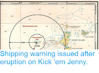
Shipping warning issued after eruption on Kick 'em Jenny.

A warning has been issued to shipping after the University of the West Indies Seismic Research Centre in Trinidad detected an eruption on Kick 'em Jenny, a submarine volcano about 8 km to the north of Granada at about 5.45 pm local time on Saturday 29 April 2017. The eruption was reportedly felt on northern Granada, and was followed by a number of further events over the following two days, with over 40 events detected on Monday 1 May.  As a precaution a shipping exclusion zone surrounds the volcano to a distance of 1.5 km; due to the heightened risk to shipping during periods of activity this zone has been increased to 5 km until further notice.

Map showing the exclusion zone around Kick 'em Jenny. Caribbean 360.

Kick 'em Jenny rises 1300 m above the surrounding seafoor, but remains 180 m below the surface. It was first discovered in July 1939, when an eruption broke the surface and threw material several hundred meters into the air, as well as generating a tsunami which was observed as far away as Barbados, though it was too small to cause any damage. However Kick 'em Jenny is labled on many earlier maritime charts, indiating that people have been aware there was something here for several centuries, even if they did not know the nature of the feature.

The Lesser Antilles are located at the eastern fringe of the Caribbean Tectonic Plate. The Atlantic Plate (strictly speaking, an extension of the South American Plate which runs to the northeast of the Caribbean) is being subducted beneath this, and as it sinks into the Earth, is melted by the heat of the planets interior. Some of the melted material then rises up through the overlying Caribbean Plate as magma, fuelling Kick 'em Jenny and the other volcanoes of the Lesser Antilles Volcanic Arc. The subduction of the Atlantic Plate beneath the Caribbean Plate is not a smooth process, with the two plates constantly sticking together then breaking apart as the tectonic pressure builds up, causing Earthquakes in the process, though since the boundary between the two plates is some way to the east of the islands, Earthquakes in the Lesser Antilles tend to be both deep and offshore, which lessens their destructive potential.

 The subduction of the Atlantic Plate beneath the Caribbean Plate fuels the volcanoes of the Lesser Antilles Volcanic Arc. George Pararas-Carayannis.

See also...
http://sciencythoughts.blogspot.co.uk/2017/03/magnitude-45-earthquake-to-north-of-st.htmlhttp://sciencythoughts.blogspot.co.uk/2017/02/magnitude-56-earthquake-to-northeast-of.html
http://sciencythoughts.blogspot.co.uk/2016/12/magnitude-59-earthquake-off-coast-of.htmlhttp://sciencythoughts.blogspot.co.uk/2015/10/magnitude-45-earthquake-in-lesser.html
http://sciencythoughts.blogspot.co.uk/2013/12/five-people-killed-by-landslide-in-st.htmlhttp://sciencythoughts.blogspot.co.uk/2012/03/volcanic-activity-on-soufriere-hills.html
Follow Sciency Thoughts on Facebook.