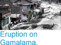
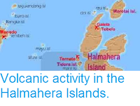
Authorities in North Maluku Province, Indonesia, have ordered the evacuation of six villages close to Mount Ibu, a 1325 m stratovolcano on the northwest coast of Halmahera Island, following a series of eruptions in the first two weeks of 2025. Mount Ibu began its current eruptive cycle in June 2024, but January has seen a significant rise in activity, with more than a thousand eruptions have been recorded on the volcano this year, with the largest producing ash columns reaching as high as 4 km over the summit of the volcano. However, to date only one village, with a population of 517 people, has been evacuated, with about 2500 people in the remaining five villages reluctant to leave without first harvesting crops.

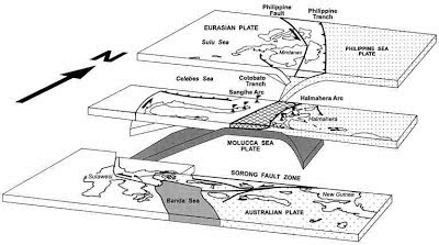
The Halmahera Island chain is a volcanic arc formed where the Halmahera Plate, a northeaster extension of the Molucca Sea Plate is being subducted beneath Philippine Plate from the east and the Eurasian Plate from the west, with the underlying plate being melted by the heat of the Earth's interior, and lighter minerals bubbling up through the overlying plate to form volcanoes. The Halmahera volcanoes are located where the Philippine Plate is overriding the Molucca Sea Plate; to the west the Sangihe Islands lie where the Molucca Sea Plate is being overridden by the Eurasian Plate.
See also...


%20(1).png)


.png)