Showing posts with label Kabaw Fault. Show all posts

Sunday, 23 November 2025

At least ten dead and more than 100 injured following Magnitude 5.5 Earthquake in central Bangladesh.

The United States Geological Survey recorded a Magnitude 5.5 Earthquake at a depth of about 10 km, roughly 30 km to the northeast of the Bangladeshi capital, Dhaka, slightly after 10.35 local time (slightly after 4.35 am GMT) on Saturday 22 November 2025. At least ten people, including at least one child, have died as a result of the event, with more than 100 injured. Most of those killed or injured appear to have been struck by debris falling from buildings in densely populated urban areas; three people were reportedly killed in a single incident when they were struck by a falling balcony. The event was felt across Bangladesh, as well as neighbouring areas of India.

Debris which fell from buildings into a crowded street in Dhaka, Bangladesh, during an Earthquake on 22 November 2025. Reuters.

Earthquake activity in northern Bangladesh is influenced by the uplift of the Tibetan Plateau, due to the impact of India into Eurasia to the south. The Indian Plate is moving northwards at a rate of 5 cm per year, causing it to impact into Eurasia, which is also moving northward, but only at a rate of 2 cm per year. The collision of the Indian and Eurasian plates has led to the formation of the Himalayan Mountains, the Tibetan Plateau, and the mountains of southwest China, Central Asia and the Hindu Kush.

Block diagram showing how the impact of the Indian Plate into Eurasia is causing uplift on the Tibetan Plateau. Jayne Doucette/Woods Hole Oceanographic Institution.

Eastern Bangladesh is also in an area particularly prone to Earthquakes; much of nearby Myanmar lies on the Burma Plate, a small tectonic plate caught between  the Eurasian Plate to the northeast, the Indian Plate to the west and southwest and the Sunda Plate to the southeast. As these larger plates move together the Burma Plate is being squeezed and fractured, with a major fault line, the Kabaw Fault, having formed across much of the north of the country, along which the Burma Plate is slowly splitting. Most Earthquakes in the region are caused by movement on this fault.

The movement of the Burma and surrounding plates. Sheth et al. (2011).

The central part of Bangladesh is potentially affected by both tectonic systems, but is rather less prone to earthquake events, with only six Earthquakes of Magnitude 5.5 or greater since 1950. This may help to explain the level of deaths and injuries associated with this event, although building safety has been a long standing political issue in Bangladesh, marked by events such as the Tazreen Factory Fire in 2012, in which at least 112 people died in a fire at a nine-story factory building with insufficient fire escapes, and the Rana Plaza collapse in 2013, in which an eight story commercial building collapsed, killing 1134 people. Since 2013, the Bangladesh Accord on Fire and Building Safety2018 Transition Key Accord, and most recently the Readymade Sustainability Council, have sort to get international garment manufacturing companies operating in Bangladesh to sign up to fire and building safety protocols, but there remains little general building regulation.

See also...

Sunday, 1 September 2019

Magnitude 5.5 Earthquake in the Sagaing Region of Myanmar.

The United States Geological Survey recorded a Magnitude 5.5 Earthquake at a depth of 10.0 km in Sagaing Region, Myanmar, about 26 km to the northwest of the city of Shwebo, slightly before 9.40 pm local time (slightly before 3.10 am GMT) on Saturday 31 August 2019. There are no reports of any injuries following this event, though some damage to buildings has occurred. People have reported felling the quake across northern Myanmar, as well as in parts of northeastern India, and Yunnan Province, China.
 
Damage to a pagoda in YayU following an Earthquake in the Sagaing Region of Myanmar on 31 August 2019. Yarza Dhamma Htantapin/Eleven Media.
 
Myanmar is an area fairly prone to Earthquakes; much of the country lies on the Burma Plate, a small tectonic plate caught between  the Eurasian Plate to the northeast, the Indian Plate to the west and southwest and the Sunda Plate to the southeast. As these larger plates move together the Burma Plate is being squeezed and fractured, with a major fault line, the Kabaw Fault, having formed across much of the north of the country, along which the Burma Plate is slowly splitting. Most Earthquakes in the region are caused by movement on this fault.
   
The movement of the Burma and surrounding plates. Sheth et al. (2011).

Witness accounts of Earthquakes can help geologists to understand these events, and the structures that cause them. The international non-profit organisation Earthquake Report is interested in hearing from people who may have felt this event; if you felt this quake then you can report it to Earthquake Report here.
 
See also...
 
https://sciencythoughts.blogspot.com/2019/08/landslide-kills-at-least-61-in-mon.htmlhttps://sciencythoughts.blogspot.com/2019/07/landslide-kills-at-least-nineteen-at.html
https://sciencythoughts.blogspot.com/2019/05/magnitude-51-earthquake-in-sagaing.htmlhttps://sciencythoughts.blogspot.com/2019/04/collapse-at-myanmar-ruby-mine-kills-two.html
https://sciencythoughts.blogspot.com/2019/04/mudslide-at-myanmar-jade-mine-kills.htmlhttps://sciencythoughts.blogspot.com/2018/11/magnitude-52-earthquake-in-chine-state.html
Follow Sciency Thoughts on Facebook.

Monday, 12 November 2018

Magnitude 5.2 Earthquake in Chine State, Myanmar.

The United States Geological Survey recorded a Magnitude 5.2 Earthquake at a depth of 50.4 km in Chin State, Myanmar, about 47 km to the southwest Indian border, at about 11.45 pm local time (about 5.15 pm GMT) on Saturday 10 November 2018. There are no reports of any damage or injuries following this event, though a large number of people have reported feeling it across much of northeastern India and in parts of Bangladesh.

The approximate location of the 10 November 2018 Chin State Earthquake. USGS.

Myanmar is an area fairly prone to Earthquakes; much of the country lies on the Burma Plate, a small tectonic plate caught between  the Eurasian Plate to the northeast, the Indian Plate to the west and southwest and the Sunda Plate to the southeast. As these larger plates move together the Burma Plate is being squeezed and fractured, with a major fault line, the Kabaw Fault, having formed across much of the north of the country, along which the Burma Plate is slowly splitting. Most Earthquakes in the region are caused by movement on this fault.
 
Witness accounts of Earthquakes can help geologists to understand these events, and the structures that cause them. The international non-profit organisation Earthquake Report is interested in hearing from people who may have felt this event; if you felt this quake then you can report it to Earthquake Report here.

See also...

https://sciencythoughts.blogspot.com/2018/10/eruptions-on-barren-island.htmlhttps://sciencythoughts.blogspot.com/2018/07/fifteen-confirmed-deaths-following.html
https://sciencythoughts.blogspot.com/2018/07/landslide-kills-nin-in-manipur-india.htmlhttps://sciencythoughts.blogspot.com/2018/06/landslide-kills-four-in-arunachal.html
https://sciencythoughts.blogspot.com/2018/06/thirteeen-people-killed-in-series-of.htmlhttps://sciencythoughts.blogspot.com/2018/06/flooding-kills-23-in-northeastern-india.html
Follow Sciency Thoughts on Facebook.

Monday, 13 March 2017

Magnitude 5.1 Earthquake in the Bago Region of Myanmar.

The United States Geological Survey recorded a Magnitude 5.1 Earthquake at a depth of 10 km about 33 km to the southeast  of the town of Tharyarwady in the Bago Region of Myanmar, slightly before 8.50 pm local time (slightly before 2.20 pm GMT) on Monday 13 March 2017. There are no reports of any damage or injuries following this event, though a large number of people have reported feeling it around the city of Yangon, as well as as far away as northern Thailand.

The approximate location of the 13 March 2017 Tharyawady Earthquake. USGS.

Myanmar is an area fairly prone to Earthquakes; much of the country lies on the Burma Plate, a small tectonic plate caught between  the Eurasian Plate to the northeast, the Indian Plate to the west and southwest and the Sunda Plate to the southeast. As these larger plates move together the Burma Plate is being squeezed and fractured, with a major fault line, the Kabaw Fault, having formed across much of the north of the country, along which the Burma Plate is slowly splitting. Most Earthquakes in the region are caused by movement on this fault.

Witness accounts of Earthquakes can help geologists to understand these events, and the structures that cause them. The international non-profit organization Earthquake Report is interested in hearing from people who may have felt this event; if you felt this quake then you can report it to Earthquake Report here.

See also...
 
http://sciencythoughts.blogspot.co.uk/2016/12/lanslide-at-myanmar-jade-mine-may-have.html
http://sciencythoughts.blogspot.co.uk/2017/02/nine-killed-in-landslide-at-myanmar.html

http://sciencythoughts.blogspot.co.uk/2016/08/magnitude-68-earthquake-in-magway.html
http://sciencythoughts.blogspot.co.uk/2016/11/myanmar-jade-mine-struck-by-possible.html
http://sciencythoughts.blogspot.co.uk/2015/12/landslide-kills-at-least-five-at-mine.html
http://sciencythoughts.blogspot.co.uk/2016/05/landslide-at-myanmar-jade-mine-kills-at.html

Follow Sciency Thoughts on Facebook.

Thursday, 25 August 2016

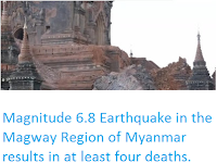
Magnitude 6.8 Earthquake in the Magway Region of Myanmar results in at least four deaths.


The United States Geological Survey recorded a Magnitude 6.8 Earthquake at a depth of 84 km about 25 km to the north of the town of Chauk in the Magway Region of Myanmar, slightly before 5.05 pm local time (slightly before 10.35 am GMT) on Wednesday 24 August 2016. The event was felt across most of northern and central Myanmar, and is reported to have resulted in at least four deaths, as well as damage to a large number of buildings. A Tobacco factory is reported to have collapsed in the town of Pakkoku, while damage has been reported to numerous pagodas and other religious structures across several regions as well as to the parliament building in Nay Pyi Taw.

Damage to a temple structure in Myanmar following the 24 August 2016 Earthquake. Arirang News.

Northern Myanmar is an area fairly prone to Earthquakes Much of Myanmar lies on the Burma Plate, a small tectonic plate caught between  the Eurasian Plate to the northeast, the Indian Plate to the west and southwest and the Sunda Plate to the southeast. As these larger plates move together the Burma Plate is being squeezed and fractured, with a major fault line, the Kabaw Fault, having formed across much of the north of the country, along which the Burma Plate is slowly splitting. Most Earthquakes in the region are caused by movement on this fault.

 The approximate location of the 24 August 2016 Magway Earthquake. Earthquake Report/Google Maps.

Witness accounts of Earthquakes can help geologists to understand these events, and the structures that cause them. The international non-profit organization Earthquake Report is interested in hearing from people who may have felt this event; if you felt this quake then you can report it to Earthquake Report here.

See also...

Landslide at Myanmar jade mine kills at least twelve.

Twelve people have been confirmed dead and another eleven have been injured following a landslide at a jade mine at Hpakant in Kachin State, Myanmar, on Tuesday 24 May 2016. It is feared that many more people may...


Landslide kills at least five at mine in Kachin State, Myanmar.                                         Five people have been confirmed dead and as many as fifty more may be missing following a landslide at a jade mine at Hpakant in Kachin State, Myanmar, on Friday 25 December 2015. The precise number of people involved is unclear because the...


Magnitude 5.5 Earthquake in Sagaing Region, Myanmar.

The United States Geological Survey recorded a Magnitude 5.5 Earthquake at a depth of 22 km about 50 km to the north of Monywa in the Sagaing...


Follow Sciency Thoughts on Facebook.

Sunday, 29 November 2015

Magnitude 5.5 Earthquake in Sagaing Region, Myanmar.

The United States Geological Survey recorded a Magnitude 5.5 Earthquake at a depth of 22 km about 50 km to the north of Monywa in the Sagaing Region, Myanmar, slightly before 3.05 pm local time (slightly before 8.35 am GMT) on Friday 27 November 2015. There are no reports of any casualties arising from this event,but damage to numerous pagodas (religious shrines) has been reported in the area.

Damage to a pagoda in Sagaing Region, Myanmar, following the 27 November 2015 Earthquake. Earthquake Report.

Northern Myanmar is an area fairly prone to Earthquakes Much of Myanmar lies on the Burma Plate, a small tectonic plate caught between  the Eurasian Plate to the northeast, the Indian Plate to the west and southwest and the Sunda Plate to the southeast. As these larger plates move together the Burma Plate is being squeezed and fractured, with a major fault line, the Kabaw Fault, having formed across much of the north of the country, along which the Burma Plate is slowly splitting. Most Earthquakes in the region are caused by movement on this fault.

 The approximate location of the 27 November 2015 Sagaing Earthquake. Google Maps.

Witness accounts of Earthquakes can help geologists to understand these events, and the structures that cause them. The international non-profit organization Earthquake Report is interested in hearing from people who may have felt this event; if you felt this quake then you can report it to Earthquake Report here.

See also...

http://sciencythoughts.blogspot.co.uk/2015/11/hundreds-feared-dead-following.htmlHundreds feared dead following landslide at Myanmar jade mine                                     One hundred and five people have now been confirmed dead and over a hundred are still thought to be missing following a landslide at a jade mine at Hpakant in Kachin State, Myanmar on Saturday 21 November 2015...
http://sciencythoughts.blogspot.co.uk/2015/10/landslide-injures-four-in-magwe-region.htmlLandslide injures four in Magwe Region, Myanmar.                                                    Four people have been injured following a landslide at the Ayeyarwady Bridge in the Magwe Region of Myanmar on Thursday 15 October. The incident happened at about 10.00 am local time on the Minbu...
http://sciencythoughts.blogspot.co.uk/2015/06/eruption-on-barren-island.htmlEruption on Barren Island.                   The Darwin Volcanic Ash Advisory Center issued a warning to aviation after an ash column was spotted over Barren Island, an active volcano in the Andaman Islands, by the Japan Meteorological Agency's MTSAT-2 satellite on Saturday 6 June 2015. The ash column rose about 3 km above the volcano and drifted about 35 km to the east. Observations in infra-red also spotted a hotspot on the island, which may indicate hot lava on...
Follow Sciency Thoughts on Facebook.