Showing posts with label La Horqueta Volcanic Complex. Show all posts

Saturday, 6 May 2023

Over 1000 people evacuated from nearby communities as Mount Fuego erupts in Guatemala.

Over 1000 people have been evacuated from five communities close to Mount Fuego, a 3768 m high stratovolcano (cone shaped volcano made up of layers of ash and lava) that forms part of La Horqueta volcanic complex in the southern part of Guatemala, after a sudden increase in volcanic activity on Thursday 4 May 2023. The volcano produced a column of ash which reached about 5800 m above sealevel (about 2000 m above the summit of the volcano) as well as several pyroclastic flows (avalanches of hot ash and gas). A number of flights had to be diverted away from the region as a precaution, and communities within 7 km of the volcano have been evacuated as a precaution.

An eruption on Mount Fuego, Guatemala, on 4 May 2023. Reuters.

Fuego has been more-or-less constantly active at some level since records in the area began (circa 1524). It forms part of La Horqueta volcanic complex, which also includes the Acatenango volcano to the north, a complex volcano with at least five separate vents, the complex siting on the site of the ancient Meseta volcano, which is thought to have collapsed following a major volcanic episode about 8500 years ago, causing a debris flow that reached the sea, 50 km away.

An ash column over Mount Fuego on 4 May 2023. Reuters.

The volcanoes of Guatemala, and Central America in general, are fed by the subduction of the Cocos Plate beneath the Caribbean Plate along the Middle American Trench, which runs roughly parallel to the southwest coast of the isthmus. As the Cocos Plate sinks into the Earth, it passes under Central America, which lies on the western margin of the Caribbean Plate. As this happens it is heated by the friction and the heat of the planet's interior, causing the sinking plate to partially melt. Some of the melted material then rises through the overlying Caribbean Plate as magma, fueling the volcanoes of Central America.

Diagrammatic representation of the subduction of the Cocos Plate beneath the Caribbean Plate along the Middle American Trench. VCS Mining.

See also...

Follow Sciency Thoughts on Facebook.

Follow Sciency Thoughts on Twitter.


Thursday, 17 September 2020

Eruptions on Mount Fuego, Guatemala.

The Instituto Nacional de Sismologia, Vulcanologia, Meteorologia, e Hidrologia in Guatemala has reported a series of eruptions on Mount Fuego, a stratovolcano (cone shaped volcano made up of layers of ash and lava) that forms part of La Horqueta volcanic complex in the southern part of the country. Between 26 August and 1 September 2020, the volcano produced small explosions 6-12 times per hour, and generated a series of ash columns that rose to as high as 1.1 km above its summit, and drifted for up to 20 km, combined with incandescent material being thrown 100-300 m into the air. Avalanches of blocky debris were observed on the west and southwest sides of the volcano, some reaching as far as the vegetation line. Communities to the west, southwest, and northwest of the volcano reported ashfalls at distances of up to 12 km. On 10 September a lava flow was observed on the southwest flank of the volcano, which by 12 September had elongated to 700 m in length. This was again accompanied by explosive eruptions producing ash columns up to 1.1 km high, though the activity subsequently subsided, and by 15 September the active part of the lava flow was only about 100 m in length.

An ash plume over Mount Fuego, Guatemala, on 1 September 2020. Instituto Nacional de Sismologia, Vulcanologia, Meteorologia, e Hidrologia.

Fuego has been more-or-less constantly active at some level since records in the area began (circa 1524). It forms part of La Horqueta volcanic complex, which also includes the Acatenango volcano to the north, a complex volcano with at least five separate vents, the complex siting on the site of the ancient Meseta volcano, which is thought to have collapsed following a major volcanic episode about 8500 years ago, causing a debris flow that reached the sea, 50 km away.

 
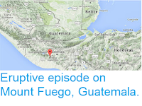
The approximate location of Mount Fuego. Google Maps.

 The volcanoes of Guatemala, and Central America in general, are fed by the subduction of the Cocos Plate beneath the Caribbean Plate along the Middle American Trench, which runs roughly parallel to the southwest coast of the isthmus. As the Cocos Plate sinks into the Earth, it passes under Central America, which lies on the western margin of the Caribbean Plate. As this happens it is heated by the friction and the heat of the planet's interior, causing the sinking plate to partially melt. Some of the melted material then rises through the overlying Caribbean Plate as magma, fuelling the volcanoes of Central America.

 
Diagrammatic representation of the subduction of the Cocos Plate beneath the Caribbean Plate along the Middle American Trench. VCS Mining.

See also...


Follow Sciency Thoughts on Facebook.


Tuesday, 5 June 2018

Eruption on Mount Fuego, Guatemala, kills at least 62.

Sixty two people have now been confirmed dead and many more are missing following a sudden eruption on the volcano on Sunday 3 June 2018 that produced an ash column 10 km high and sent a series of pyroclastic flows (avalanches of hot rock, ash and gas) down the flanks of the mountain scouring local communities. Ashfalls have been reported up to 20 km from the volcano, and over 3000 people have been evacuated from the area. Rescue workers have yet to reach communities that were closest to the caldera of the volcano, where drone footage shows no buildings standing and what appears to be large numbers of bodies. The eruption is now considered to have ended, but vulcanonogists are very concerned about the large amounts of loose ash that have been deposited by it, that could be dislodged by any future eruption, or mix with rain to form lahars - ash-laden flash floods associated with volcanoes, that can be caused directly by volcanic eruptions, for example when hot lava encounters a glacial lake rapidly destroying an ice dam, but are also common in areas of high seasonal rainfall, where ash deposits from a volcano can build up during the dry season, creating dams on seasonal waterways, which temporarily halt the flow of water, then give way rapidly leading to dramatic flash floods. 

The community of San Miguel Las Lotes on Monday 4 June 2018, the day after it was hit by a pyroclastic flow from Mount Fuego. Luis Echeverria/Reuters.

Mount Fuego is a 3763 m stratovolcano (cone shaped volcano made up of layers of ash and lava) that forms part of La Horqueta volcanic complex in the southern part of Guatemala, which has been more-or-less constantly active at some level since records in the area began (circa 1524). It forms part of La Horqueta volcanic complex, which also includes the Acatenango volcano to the north, a complex volcano with at least five separate vents, the complex siting on the site of the ancient Meseta volcano, which is thought to have collapsed following a major volcanic episode about 8500 years ago, causing a debris flow that reached the sea, 50 km away.

 The approximate location of Mount Fuego. Google Maps.

The volcanoes of Guatemala, and Central America in general, are fed by the subduction of the Cocos Plate beneath the Caribbean Plate along the Middle American Trench, which runs roughly parallel to the southwest coast of the isthmus. As the Cocos Plate sinks into the Earth, it passes under Central America, which lies on the western margin of the Caribbean Plate. As this happens it is heated by the friction and the heat of the planet's interior, causing the sinking plate to partially melt. Some of the melted material then rises through the overlying Caribbean Plate as magma, fuelling the volcanoes of Central America.

 Diagrammatic representation of the subduction of the Cocos Plate beneath the Caribbean Plate along the Middle American Trench. VCS Mining.

See also...

http://sciencythoughts.blogspot.com/2018/02/mount-fuego-guatemala-erupts-for-first.htmlhttp://sciencythoughts.blogspot.co.uk/2017/12/strombolian-eruptions-on-mount-pacaya.html
http://sciencythoughts.blogspot.co.uk/2017/06/magnitude-68-earthquake-off-south-coast.htmlhttp://sciencythoughts.blogspot.co.uk/2017/05/warnings-issued-after-eruptions-on-mout.html
http://sciencythoughts.blogspot.co.uk/2017/02/eruptive-episode-on-mount-fuego.htmlhttp://sciencythoughts.blogspot.co.uk/2017/02/eruptive-episode-on-mount-fuego.html
Follow Sciency Thoughts on Facebook.

Sunday, 11 February 2018

Mount Fuego, Guatemala, erupts for the first time in 2018.

The Instituto Nacional de Sismologia, Vulcanologia, Meteorologia, e Hidrologia in Guatemala has reported a new eruptive episode on Mount Fuego, a stratovolcano (cone shaped volcano made up of layers of ash and lava) that forms part of La Horqueta volcanic complex in the southern part of the country, the first such event in 2018. The eruption began on Wednesday 31 January, with a series of explosions that produced an ash column that rose 1.5 km above the summit of the volcano, and drifted 20 km to the southwest. This was accompanied by a series of lava fountains that rose 300-500 m above the summit, and which fed lave flows that descended 800 m down the west flank of the volcano and 600 m down the southeast and east flanks. On Thursday 1 February these eruptions continued, producing a series of ash columns that rose as high as 3.2 km above the volcano and drifted to the northeast, southwest and west, with ash falls recorded in communities up to 18 km from the volcano, prompting the evacuation of 2800 people from communities close to Fuego. This activity fell off sharply at about 4.30 pm local time, though the volcano continued to undergo smaller eruptions for the next five days, producing ash columns up to 750 m high and showers of incandescent material that rose up to 200 m above the summit. 

Eruption on Mount Fuego, Guatemala, on 1 February 2018. Jiuwit Rosas.

Fuego has been more-or-less constantly active at some level since records in the area began (circa 1524). It forms part of La Horqueta volcanic complex, which also includes the Acatenango volcano to the north, a complex volcano with at least five separate vents, the complex siting on the site of the ancient Meseta volcano, which is thought to have collapsed following a major volcanic episode about 8500 years ago, causing a debris flow that reached the sea, 50 km away.

 The approximate location of Mount Fuego. Google Maps.

The volcanoes of Guatemala, and Central America in general, are fed by the subduction of the Cocos Plate beneath the Caribbean Plate along the Middle American Trench, which runs roughly parallel to the southwest coast of the isthmus. As the Cocos Plate sinks into the Earth, it passes under Central America, which lies on the western margin of the Caribbean Plate. As this happens it is heated by the friction and the heat of the planet's interior, causing the sinking plate to partially melt. Some of the melted material then rises through the overlying Caribbean Plate as magma, fuelling the volcanoes of Central America.

 Diagrammatic representation of the subduction of the Cocos Plate beneath the Caribbean Plate along the Middle American Trench. VCS Mining.

See also...

http://sciencythoughts.blogspot.co.uk/2017/12/strombolian-eruptions-on-mount-pacaya.htmlhttp://sciencythoughts.blogspot.co.uk/2017/06/magnitude-68-earthquake-off-south-coast.html
http://sciencythoughts.blogspot.co.uk/2017/05/warnings-issued-after-eruptions-on-mout.htmlhttp://sciencythoughts.blogspot.co.uk/2017/02/eruptive-episode-on-mount-fuego.html
http://sciencythoughts.blogspot.co.uk/2017/02/eruptive-episode-on-mount-fuego.htmlhttp://sciencythoughts.blogspot.co.uk/2016/08/explosive-eruptions-on-mount.html
Follow Sciency Thoughts on Facebook.