Showing posts with label Pyroclastic Flows. Show all posts

Monday, 10 October 2022

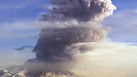
Eruption triggers partial crater collapse and pyroclastic flow on Mount Stromboli, Italy.

An eruption on Mount Stromboli, a volcanic island off the coast of Italy, has caused part of the volcano's crater to collapse, triggering a pyroclastic flow (avalanche of hot ash and gas) which reached the sea, triggering a phreatic explosion (explosion caused by superheated volcanic material coming into contact with water). The incident, which caused no injuries or damage to property, happened slightly after 9.20 am local time on Sunday 9 October 2022, and was part of a cycle of volcanic activity which began on Thursday 29 September.

Pyroclastic flow on Mount Stromboli, Italy, on Sunday 9 October 2022. Italy News Online.

Stromboli has been in more-or-less constant eruption since at least Roman times, and is thought to be about 5000 years old, though it is not generally considered dangerous if not approached closely; there are three settlements on the island, all less than three kilometres from the summit. Stromboli is noted for frequent small explosive eruptions, which through lava bombs, ash and incandescent rock fragments out of the crater, a type of eruption known by vulcanologists around the world as 'strombolian'. The summit rises 924 m above sea level.

The approximate location of Mount Stromboli. Google Maps.

Southeastern Italy lies on the edge of the Eurasian Plate, close to its margin with Africa. The African Plate is being subducted beneath Italy on along a margin that cuts through the island of Sicily. The African plate is being subducted beneath Italy, and as it sinks is melted by the friction and heat of the Earth's interior. Some of the melted material then rises through the overlying plate fuelling the volcanoes of southern Italy.

Map showing the tectonic plates underlying Italy and southern Europe, and the location of the l'Aquila Earthquake. Napoli Unplugged.

See also...

Follow Sciency Thoughts on Facebook.

Follow Sciency Thoughts on Twitter.


Saturday, 9 February 2019

Eruption on Mount Karangetang triggers pyroclasitc flow.

Authorities on the Indonesian island of Siau, in the Sangihe Archipelago to the north of Sulawesi, have extended an exclusion zone around Mount Karangetang, a 1784 m high stratovolcano (cone-shaped volcano) on the northern end of the island, following a pyroclastic flow (flow of heavy superheated gas containing large amounts of hot ash, rocks and debris) on Tuesday 5 February 2019, which blocked a road on the island. Mount Karangetang is one of Indonesia's most active volcanoes, typically erupting several times per year, with the current phase of eruptions having begun in November 2018, after several months of inactivity.

Pyroclastic flow blocking a road on Siau Island, Indonesia on 5 February 2019. 3 alacarta.

Siau Island is quite densely populated with around 22 000 permanent residents, and Mount Karangetang frequently causes problems for the islanders, having most recently caused fatalities in August 2010. The Sangihe Island Arc is a chain of volcanic islands running between the northern tip of Sulawesi and the southern tip of Mindanao. The chain marks the boundary between the Molucca Plate to the east and the Sangihe Plate to the west, with the Molucca Plate being subducted beneath the Sangihe Plate. As the Molucca Plate sinks into the Earth it is heated by the friction and the heat of the planet's interior, causing it to partially melt. Some of the melted material then rises through the overlying Sangihe Plate as magma, fuelling the volcanoes of the Sangihe Arc.

 The subduction zones beneath Sulawesi and the surrounding islands. Hall & Spakman (2015).

See also...

https://sciencythoughts.blogspot.com/2018/12/eruption-on-mount-soputan-sulawesi.htmlhttps://sciencythoughts.blogspot.com/2018/09/thousands-feared-dead-after-earthquake.html
https://sciencythoughts.blogspot.com/2014/09/eruptions-on-mount-lokon-sulawesi.htmlhttps://sciencythoughts.blogspot.com/2013/10/eruptions-on-mount-dukono-on-halmahera.html
https://sciencythoughts.blogspot.com/2013/09/magnitude-57-earthquake-of-north-coast.htmlhttps://sciencythoughts.blogspot.com/2013/09/explosive-eruption-on-mount-lokon.html
Follow Sciency Thoughts on Facebook.

Tuesday, 5 June 2018

Eruption on Mount Fuego, Guatemala, kills at least 62.

Sixty two people have now been confirmed dead and many more are missing following a sudden eruption on the volcano on Sunday 3 June 2018 that produced an ash column 10 km high and sent a series of pyroclastic flows (avalanches of hot rock, ash and gas) down the flanks of the mountain scouring local communities. Ashfalls have been reported up to 20 km from the volcano, and over 3000 people have been evacuated from the area. Rescue workers have yet to reach communities that were closest to the caldera of the volcano, where drone footage shows no buildings standing and what appears to be large numbers of bodies. The eruption is now considered to have ended, but vulcanonogists are very concerned about the large amounts of loose ash that have been deposited by it, that could be dislodged by any future eruption, or mix with rain to form lahars - ash-laden flash floods associated with volcanoes, that can be caused directly by volcanic eruptions, for example when hot lava encounters a glacial lake rapidly destroying an ice dam, but are also common in areas of high seasonal rainfall, where ash deposits from a volcano can build up during the dry season, creating dams on seasonal waterways, which temporarily halt the flow of water, then give way rapidly leading to dramatic flash floods. 

The community of San Miguel Las Lotes on Monday 4 June 2018, the day after it was hit by a pyroclastic flow from Mount Fuego. Luis Echeverria/Reuters.

Mount Fuego is a 3763 m stratovolcano (cone shaped volcano made up of layers of ash and lava) that forms part of La Horqueta volcanic complex in the southern part of Guatemala, which has been more-or-less constantly active at some level since records in the area began (circa 1524). It forms part of La Horqueta volcanic complex, which also includes the Acatenango volcano to the north, a complex volcano with at least five separate vents, the complex siting on the site of the ancient Meseta volcano, which is thought to have collapsed following a major volcanic episode about 8500 years ago, causing a debris flow that reached the sea, 50 km away.

 The approximate location of Mount Fuego. Google Maps.

The volcanoes of Guatemala, and Central America in general, are fed by the subduction of the Cocos Plate beneath the Caribbean Plate along the Middle American Trench, which runs roughly parallel to the southwest coast of the isthmus. As the Cocos Plate sinks into the Earth, it passes under Central America, which lies on the western margin of the Caribbean Plate. As this happens it is heated by the friction and the heat of the planet's interior, causing the sinking plate to partially melt. Some of the melted material then rises through the overlying Caribbean Plate as magma, fuelling the volcanoes of Central America.

 Diagrammatic representation of the subduction of the Cocos Plate beneath the Caribbean Plate along the Middle American Trench. VCS Mining.

See also...

http://sciencythoughts.blogspot.com/2018/02/mount-fuego-guatemala-erupts-for-first.htmlhttp://sciencythoughts.blogspot.co.uk/2017/12/strombolian-eruptions-on-mount-pacaya.html
http://sciencythoughts.blogspot.co.uk/2017/06/magnitude-68-earthquake-off-south-coast.htmlhttp://sciencythoughts.blogspot.co.uk/2017/05/warnings-issued-after-eruptions-on-mout.html
http://sciencythoughts.blogspot.co.uk/2017/02/eruptive-episode-on-mount-fuego.htmlhttp://sciencythoughts.blogspot.co.uk/2017/02/eruptive-episode-on-mount-fuego.html
Follow Sciency Thoughts on Facebook.

Monday, 23 May 2016

Pyroclastic flow kills at least seven on Mount Sinabung, North Sumatra.

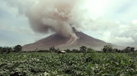
Seven people have been confirmed dead and an unknown number are still missing following a pyroclastic flow (avalanche of hot rock, ash and gas) that swept through farms and villages on the slopes of Mount Sinabung in North Sumatra on Sunday 22 May 2016. A number of other people are being treated for extensive burns following the event, with rescue teams still scouring the mountain.

Rescue workers searching a ash-covered village near Mount Sinabung, North Sumatra. Dedi Sinuhaji/EPA.

Mount Sinabung, a 2460 m stratovolcano (cone shaped volcano made up of layers of ash and lava) in the Karo Regency; it is potentially a very dangerous volcano, as a large number of people live in its immediate vicinity. The last major eruption prior to the twenty-first century happened in about 1600, with small eruptions occurring in 1889 and 1912. However the volcano returned to life in late August 2010, erupting throughout September and causing about 12 000 people to flee their homes.
 
 The location of Mount Sinabung. Google Maps.
 
The Indo-Australian Plate, which underlies the Indian Ocean to the west of Sumatra, is being subducted beneath the Sunda Plate, a breakaway part of the Eurasian Plate which underlies Sumatra and neighboring Java, along the Sunda Trench, passing under Sumatra, where friction between the two plates can cause Earthquakes. As the Indo-Australian Plate sinks further into the Earth it is partially melted and some of the melted material rises through the overlying Sunda Plate as magma, fueling the volcanoes of Sumatra.
 
 The Subduction zone beneath Sumatra. NASA/Earth Observatory.
 
The two plates are not directly impacting one-another, as occurs in the subduction zones along the western margins of North and South America, but at a steeply oblique angle. This means that as well as the subduction of the Indo-Australian plate beneath the Sunda, the two plates are also moving past one-another. This causes rifting within the plates, as parts of each plate become stuck to the other, and are dragged along in the opposing plate's direction. The most obvious example of this is the Sumatran Fault, which runs the length of Sumatra, with the two halves of the island moving independently of one-another. This fault is the cause of most of the quakes on the island, and most of the island's volcanoes lie on it.

The movement of the tectonic plates around Sumatra. NASA/Earth Observatory.

See also...
 
http://sciencythoughts.blogspot.co.uk/2016/05/seventeen-students-confirmed-dead-after.htmlSeventeen students confirmed dead after flash flood and landslide at popular Sumatran tourist spot.                                          Seventeen students have been confirmed dead and another...
http://sciencythoughts.blogspot.co.uk/2016/03/magnitude-78-earthquake-to-southwest-of.htmlMagnitude 7.8 Earthquake to the southwest of Sumatra triggers small tsunami.              The United States Geological Survey recorded a Magnitude 7.8 Earthquake at a depth of 10 km...
http://sciencythoughts.blogspot.co.uk/2016/02/eruption-on-mount-sinabung.htmlEruption on Mount Sinabung.                 Residents of villages close to Mount Sinabung on North Sumatra have been forced to evacuate their homes following two eruptions on the volcano on Thursday 25 February 2016. The first eruption...

Follow Sciency Thoughts on Facebook.
 

Saturday, 12 December 2015

Eruptions on Mount Zhupanovsky.

The Kamtchatka Volcanic Eruption Response Team reported explosive eruptions on Mount Zhupanovsky on Friday 27 and Monday 30 November 2015, with ash columns reaching 6-7 km above the summit of the volcano and  drifted about 300 km to the east and southeast, as well as a pyroclastic flow (avalanche of hot gas and ash) on the 30th which reached 15.5 km along the southern flank of the volcano.

Ash column over Mount Zhupanovsky on 30 November 2015. N Timonkina/Institute of Volcanology and Seismology at the Far Eastern Branch of the Russian Academy of Sciences.

Zhupanovsky is an elongated volcanic complex on the southeast of the Kamchatka Peninsula in the Russian Far East, comprising four overlapping stratovolcanoes (cone shaped volcanoes) in a line running roughly east to west. Three of these volcanoes date from the Pleistocene, with the easternmost being a Holocene structure upon which all recorded historical eruptions have occurred. This volcano probably began erupting between 7000 and 5000 years ago. The current phase of eruptive activity began in October 2013, prior to which it had been inactive since the 1950s.

The approximate location of Mount Zhupanovsky. Google Maps.

The Kamchatka Peninsula lies on the eastern edge of the Okhotsk Plate, close to its margin with the Pacific and North American Plates. The Pacific Plate is being subducted along the margin, and as it does so it passes under the southern part of the Kamchatka Peninsula, and as it does so is partially melted by the friction and the heat of the Earth's interior. Some of the melted material then rises through the overlying Okhotsk Plate as magma and fueling the volcanoes of southern Kamchatka.

See also...

http://sciencythoughts.blogspot.co.uk/2014/08/two-dead-and-one-missing-after.htmlTwo dead and one missing after avalanche on Russian volcano.                                         Two people are known to have died and a third is missing after an avalanche on...
http://sciencythoughts.blogspot.co.uk/2014/05/eruption-on-shivaluch-produces-10-km.htmlEruption on Shivaluch produces a 10 km high ash column.                                                 Mount Shivluch, a 3.283 km high volcano on the eastern Kamchatka Peninsula, underwent a major eruption on Tuesday 27 May 2014, producing an ash column...
http://sciencythoughts.blogspot.co.uk/2014/04/eruption-on-mount-karymsky-produces-21.htmlEruption on Mount Karymsky produces 2.1 km ash column.                                          Mount Karymsky, a stratovolcano (cone-shaped volcano) on the Kamchatka Peninsula considered to be Russia's most active volcano, underwent a series of...
Follow Sciency Thoughts on Facebook.

Saturday, 6 June 2015

Kuchinoerabu Island evacuated following eruption on Shindake Volcano.

Shindake Volcano, on the island of Kuchinoerabu in the northern Ryukyu Islands, began to erupt suddenly slightly before 10.00 am local time on Friday 29 May 2015, when a loud explosion, thought to be a phreatic event (explosion caused by hot magma coming into contact with liquid water and vaporizing it instantly) was heard, followed by the production of a 9 km high ash plume that drifted to the southeast. A number of small pyroclastic flows (avalanches of hot gas and ash) were detected on the southwest and northwest flanks of the volcano, with those on the northwest observed to reach the sea. Local authorities ordered the evacuation of all 141 people present on the island at the time (about a hundred locals and a few visitors) as a precaution, and only a single injury was reported, an elderly man who received minor burns (it is unclear if this was caused directly by the volcano or some accident during the evacuation). Following the evacuations the volcano has been monitored closely, with a 1.2 km ash column observed on 30 May and several small pyroclastic flows on the northwest, southwest and southeastern flanks of the volcano.

Ash column over Kuchinoerabu Island on 29 May 2015, observed from the neighbouring island of Yakushima. Itaru Takaku/Kyodo News.

Japan has a complex tectonic environment with four plates underlying parts of the Islands; the Pacific in the east and the Othorsk in the North, there are the Philipine Plate to the south and the Eurasian Plate to the West. All of these plates are moving in different directions, and some subducting beneath the islands, leaning to a complex tectonic situation where earthquakes and volcanoes are common.

The location of Kuchinoerabu Island. Google Maps.

Kuchinoerabujima lies at the northeast end of the Ryukyu Island Arc, which sits on top of the boundary between the Eurasian and Philippine Plates. The Philippine Plate is being subducted beneath the Eurasian Plate, in the Ryukyo Trench, to the Southeast of the Islands. As it is drawn into the interior of the Earth, the tectonic plate is partially melted by the heat of the Earth's interior, and liquid magma rises up through the overlying Eurasian Plate to form the volcanos of the Ryukyu Islands and KyÅ«shÅ«.

See also...

The Japan Meteorological Agency recorded an eruption on Mount Furudake on Kuchinoerabujima, an island about 130 km south of Kagoshima, at about 12.25 pm local time on Sunday 3 August 2014. The eruption consisted of a single powerful explosion followed by...


On 9 August 2013 the Japan Meteorological Agency reported a 50 minute eruption on Sakurajima Volcano, which is one of Japan's most active and sits on an island in Kagoshima Bay, Kyushu Island, which produced a 3.5 km high ash column, as well as...


The Tokyo Volcanic Ash Advisory Center reported that a 1.5 km ash plume was sighted over Suwanosejima on 3 July 2013. Such events are frequent on Suwanosejima, a sparsely inhabited 8 km...


Follow Sciency Thoughts on Facebook.

Sunday, 8 February 2015

Evacuations ordered after violent eruptions on Mount Fuego in Guatemala.

The Instituto Nacional de Sismologia, Vulcanologia, Meteorologia, e Hidrologia in Guatemala has ordered an evacuation of communities close to Mount Fuego, an active volcano in the south of the country, sharply increased its level of activity on Saturday 7 February 2015. The volcano began its current active phase in 2002, and has had a number of small eruptive episodes already this year, but this is he first time that Guatemalan authorities have felt the need to order an evacuation since September 2012. A number of explosions have been reported as well as an ash column rising 4.8 km above the summit of the volcano (5.6 km above sea level) and drifting to the southwest. Ash falls have been reported over a wide area, and the Dirección General de Aeronautica Civil has temporarily ordered a closure of the countries main airport. Small pyroclastic flows have also been reported near the summit of the volcano.

Falling ash from Fuego on a street market in Guatemala. Prensa Libre.

Fuego has been more-or-less constantly active at some level since records in the area began (circa 1524). It forms part of La Horqueta volcanic complex, which also includes the Acatenango volcano to the north, a complex volcano with at least five separate vents, the complex siting on the site of the ancient Meseta volcano, which is thought to have collapsed following a major volcanic episode about 8500 years ago, causing a debris flow that reached the sea, 50 km away.

The approximate location of Mount Fuego. Google Maps.

The volcanoes of Guatemala, and Central America in general, are fed by the subduction of the Cocos Plate beneath the Caribbean Plate along the Middle American Trench, which runs roughly parallel to the southwest coast of the isthmus. As the Cocos Plate sinks into the Earth, it passes under Central America, which lies on the western margin of the Caribbean Plate. As this happens it is heated by the friction and the heat of the planet's interior, causing the sinking plate to partially melt. Some of the melted material then rises through the overlying Caribbean Plate as magma, fueling the volcanoes of Central America.

See also...

The United States Geological Survey Recorded a Magnitude 5.0 Earthquake at a depth of 74.2 km in the east of Esculinta Department in southern Guatemala...


Six people are known to have died, three more are missing and seven are being treated for a variety of injuries following a landslide in the village of Joya Grande in the Department of Huehuetenango in...


Around 3000 people may need to evacuated from villages close to...


Follow Sciency Thoughts on Facebook.

Tuesday, 5 August 2014

Eruption and pyroclastic flow on Mount Furudake.

The Japan Meteorological Agency recorded an eruption on Mount Furudake on Kuchinoerabujima, an island about 130 km south of Kagoshima, at about 12.25 pm local time on Sunday 3 August 2014. The eruption consisted of a single powerful explosion followed by the generation of a 1.5 km high ash plume. This ash column lasted for about 10 minutes, then collapsed forming a pyroclastic flow (avalanche of hot gas and ash), but fortunately leading to no injuries or damage. The nearby town of Yakushima has been partially evacuated as a precaution. This is the first eruption on the volcano since 1980.

Pyroclastic flow on Kuchinoerabujima on 3 August 2014. Volcanic News Eruptions.


Japan has a complex tectonic environment with four plates underlying parts of the Islands; the Pacific in the east and the Othorsk in the North, there are the Philipine Plate to the south and the Eurasian Plate to the West. All of these plates are moving in different directions, and some subducting beneath the islands, leaning to a complex tectonic situation where earthquakes and volcanoes are common.

Kuchinoerabujima lies at the northeast end of the Ryukyu Island Arc, which sits on top of the boundary between the Eurasian and Philippine Plates. The Philippine Plate is being subducted beneath the Eurasian Plate, in the Ryukyo Trench, to the Southeast of the Islands. As it is drawn into the interior of the Earth, the tectonic plate is partially melted by the heat of the Earth's interior, and liquid magma rises up through the overlying Eurasian Plate to form the volcanos of the Ryukyu Islands and KyÅ«shÅ«.

The location of Kuchinoerabujima Island. Google Maps.

See also


On 20 December 2013 the Japan Meteorological Agency detected an increase in seismic activity beneath Aso (or Asosan) a volcanic caldera on central Kyūshū Island, Japan. This grew steadily for the next week, prompting the agency to raise the alert level on the...


The Sakurajima Volcano, situated on an island in Kagoshima Bay, Kyushu, underwent a large explosive eruption on the morning of Friday 4 October 2013, producing a 4 km high ash column and...


On 9 August 2013 the Japan Meteorological Agency reported a 50 minute eruption on Sakurajima Volcano, which is one of Japan's most active and sits on an island in Kagoshima Bay, Kyushu Island, which produced a 3.5 km high ash column, as well as throwing...


Follow Sciency Thoughts on Facebook.