Showing posts with label Mid-Atlanic Ridge. Show all posts

Monday, 26 August 2024

Magnitude 5.4 Eearthquake off the coast of Portugal.

The Centre Seismologique Euro-Méditeranéen  recorded a Magnitude 5.4 Earthquake at a depth of 16 km off the west coast  of Portugal, about 68 km to the west of the town of Sines, slightly after  5.10 am local time (slightly after 4.10 am GMT) on Monday 26 August 2024. There are no reports of any damage or casualties associated with this event, though it was felt across the Madeira Islands group, as well as in parts of the Canary Islands.

The approximate location of the 26 August 2024 Earthquake. USGS.

The Earthquake occurred close to the Cape St. Vincent Ridge, which runs along the boundary between the African and European plates to the east of the Mid-Atlantic Ridge. This is currently an area of expansion, with the two plates moving apart along this part of the boundary and new seafloor being created by the upwelling of magma from the mantle and its extrusion as a new area of crustal material, the Azores Microplate. This is not a smooth process, and can lead to occasional Earthquakes.

The location of the Cape St. Vincent Ridge relative to the Mid-Atlantic Ridge. Martins et al. 2008.

Witness accounts of Earthquakes can help geologists to understand these events, and the structures that cause them. If you felt this event you can report it to the Centre Seismologique Euro-Méditeranéen here.

See also...

Thursday, 30 May 2024

Town of Grindavik evacuated again as new eruption begins on the Reykjanes Peninsula, Iceland.

Eruptive activity on the Reykjanes Peninsula, Iceland began again on 29 May 2024, according to the Icelandic Met Office, the first such eruption since activity on a fissure which opened in March petered out three weeks ago. The activity is thought to have started when magma flowing from the magma reservoir beneath Svartsengi into the area beneath the Sundhnúkur crater row. At about 4.00 pm on 29 May the magma encountered groundwater penetrating through a fissure from a previous eruption, leading to a phreatic explosion as a large volume of the water was turned into steam instantly. This led to the formation of a new fissure running southwest to northeast (parallel to previous fissures on the peninsula) for about 2.4 km. This fissure has produced lava fountains up to 50 m high, and is extruding lava at a rate of about 1500-2000 m³ per second. The eruption has prompted the evacuation of the town of Grindavik, and the nearby Blue Lagoon Geothermal Spa. The fissure is further from the town than the eruption in January which saw lava entering the streets of the settlement and several buildings destroyed, but is also significantly larger, and is evolving significant amounts of toxic gasses.

A volcanic fssure on the Reykjanes Peninsula, Iceland, which opened on 29 May 2024. Marco Di Marco/AP.

Although dramatic, lava flows are not usually considered particularly dangerous, as their advancing fronts are quite slow and can quickly be outpaced by an able-bodied Human being. The more deadly volcanic events are pyroclastic flows, such as the one which engulphed the Roman town of Pompeii, in which clouds of superheated gas and ash move downhill at high speeds in an avalanche-like motion, and phreatic explosions, caused by bodies of lava encountering bodies of water, which evaporate almost instantly, causing huge explosions.

The size and position of the new fissure on the Reykjanes Peninsula, Iceland. Icelandic Met Office/BBC.

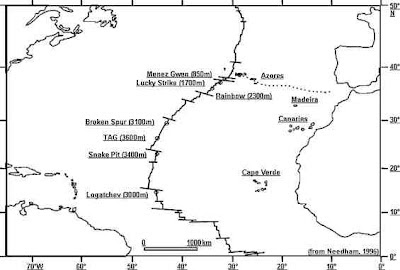
Iceland lies directly upon the Mid-Atlantic Ridge, a chain of (mostly) submerged volcanoes running the length of the Atlantic Ocean along which the ocean is splitting apart, with new material forming at the fringes of the North American and European Plates beneath the sea (or, in Iceland, above it). The Atlantic is spreading at an average rate of 25 mm per year, with new seafloor being produced along the rift volcanically, i.e. by basaltic magma erupting from below. The ridge itself takes the form of a chain of volcanic mountains running the length of the ocean, fed by the upwelling of magma beneath the diverging plates. In places this produces volcanic activity above the waves, in the Azores, on Iceland and on Jan Mayen Island. All of this results in considerable Earth-movement beneath Iceland, where Earthquakes are a frequent event.

The passage of the Mid-Atlantic Ridge beneath Iceland. NOAA National Geophysical Data Center.

See also...

Sunday, 14 January 2024

Lava from new volcanic fissure reaches the town of Grindavik, Iceland.

A flow of lava from a new fissure associated with the Fagradalsfjall Volcano on the Reykjanes Peninsula has reached the town of Grindavik, following a new erruption on Sunday 14 January 2024. The town was evacuated when the fissuere first opened in November 2023, so the lava flows are thought to present no threat to Human life, but at least one property has been destroyed, and it is likely that the lava will keep flowing for some time, doing further damage to the town's infrastructure.

A flow od lava entering the town of Grindavik. Eggert Jóhannesson/Morgunbladid.

Although dramatic, lava flows are not usually considered particularly dangerous, as their advancing fronts are quite slow and can quickly be outpaced by an able-bodied Human being. The more deadly volcanic events are pyroclastic flows, such as the one which engulphed the Roman town of Pompeii, in which clouds of superheated gas and ash move downhill at high speeds in an avalanche-like motion, and phreatic explosions, caused by bodies of lava encountering bodies of water, which evaporate almost instantly, causing huge explosions.

An aerial photograph of the 14 January 2024 eruption, showing its proximity to the town of Grindvik. Iceland Civil Protection/Reuters.

Iceland lies directly upon the Mid-Atlantic Ridge, a chain of (mostly) submerged volcanoes running the length of the Atlantic Ocean along which the ocean is splitting apart, with new material forming at the fringes of the North American and European Plates beneath the sea (or, in Iceland, above it). The Atlantic is spreading at an average rate of 25 mm per year, with new seafloor being produced along the rift volcanically, i.e. by basaltic magma erupting from below. The ridge itself takes the form of a chain of volcanic mountains running the length of the ocean, fed by the upwelling of magma beneath the diverging plates. In places this produces volcanic activity above the waves, in the Azores, on Iceland and on Jan Mayen Island. All of this results in considerable Earth-movement beneath Iceland, where Earthquakes are a frequent event.

The passage of the Mid-Atlantic Ridge beneath Iceland. NOAA National Geophysical Data Center.

See also...


Tuesday, 11 July 2023

Eruption on Mount Fagradalsfjall, Iceland.

The Icelandic Meteorological Office has reported an eruption on Mount Fagradalsfjall, part of the Krýsuvík-Trölladyngja Volcanic System, on the Reykjanes Peninsula, to the southwest of Reykjavik. The eruption began on Monday 10 July 2023, following about a week of intense seismic activity, with lava and smoke issuing from a fissure on one of the volcano's flanks. Small fissure eruptions of this kind are not unusual on Mount Fagradalsfjall, and the event is unlikely to cause any wider disruption.

Lava and smoke issuing from a fissure on the side of the Fagradalsfjall volcano. Reuters.

The Krýsuvík-Trölladyngja Volcanic System comprises a composite fissure swarm about 50 km in length, with no central volcano, but several small shields (i.e. volcanic structures made up largely of overlapping lava deposits that resemble upturned bowls rather than a cone) including Mount Fagradalsfjall. The system was quiet for about 800 years before re-activating in 2021, since when small fissure eruptions of the type seen this week have happened several times.

Iceland lies directly upon the Mid-Atlantic Ridge, a chain of (mostly) submerged volcanoes running the length of the Atlantic Ocean along which the ocean is splitting apart, with new material forming at the fringes of the North American and European Plates beneath the sea (or, in Iceland, above it). The Atlantic is spreading at an average rate of 25 mm per year, with new seafloor being produced along the rift volcanically, i.e. by basaltic magma erupting from below. The ridge itself takes the form of a chain of volcanic mountains running the length of the ocean, fed by the upwelling of magma beneath the diverging plates. In places this produces volcanic activity above the waves, in the Azores, on Iceland and on Jan Mayen Island. All of this results in considerable Earth-movement beneath Iceland, where Earthquakes are a frequent event.

The passage of the Mid-Atlantic Ridge beneath Iceland. NOAA National Geophysical Data Center.

See also...

Follow Sciency Thoughts on Facebook.

Follow Sciency Thoughts on Twitter.


Sunday, 12 January 2020

Magnitude 3.9 Earthquake in Southern Iceland.

The Icelandic Met Office recorded a Magnitude 3.9 Earthquake at a depth of 8.9 km roughly 4.9 km to the southeast of the town of Hveragerði in Southern Iceland, at about 1.10 pm GMT on Friday 10 January 2020. This is not a large Earthquake, and there is no danger of any damage or casualties, but it is likely to have been felt locally.

The approximate location of the 10 January 2020 Southern Iceland Earthquake. Google Maps.

Iceland lies directly upon the Mid-Atlantic Ridge, a chain of (mostly) submerged volcanoes running the length of the Atlantic Ocean along which the ocean is splitting apart, with new material forming at the fringes of the North American and European Plates beneath the sea (or, in Iceland, above it). The Atlantic is spreading at an average rate of 25 mm per year, with new seafloor being produced along the rift volcanically, i.e. by basaltic magma erupting from below. The ridge itself takes the form of a chain of volcanic mountains running the length of the ocean, fed by the upwelling of magma beneath the diverging plates. In places this produces volcanic activity above the waves, in the Azores, on Iceland and on Jan Mayen Island. All of this results in considerable Earth-movement beneath Iceland, where Earthquakes are a frequent event.

 The passage of the Mid-Atlantic Ridge beneath Iceland. NOAA National Geophysical Data Center.

Witness accounts of Earthquakes can help geologists to understand these events, and the structures that cause them. The international non-profit organisation Earthquake Report is interested in hearing from people who may have felt this event; if you felt this quake then you can report it to Earthquake Report here.
 
See also...
 
https://sciencythoughts.blogspot.com/2019/06/icelandic-fishermen-fired-for-cruelty.htmlhttps://sciencythoughts.blogspot.com/2015/10/glacial-outburst-flood-from-grimsvotns.html
https://sciencythoughts.blogspot.com/2015/10/sulphur-dioxide-emissions-from-2014-15.htmlhttps://sciencythoughts.blogspot.com/2014/11/magnitude-54-earthquake-beneath.html
https://sciencythoughts.blogspot.com/2014/09/magnitude-54-earthquake-beneath.htmlhttps://sciencythoughts.blogspot.com/2014/08/eruptions-in-holuhraun-lava-field.html
Follow Sciency Thoughts on Facebook.

Sunday, 28 October 2018

Tosanoides aphrodite: A new species of Anthia from the St. Paul’s Rocks in the Mid Atlantic.

Anthias (Anthiinae), or  are small brightly coloured fish belonging to the Grouper Family (Serranidae) in the Perch Order (Perciformes). They are found in large numbers on many coral reefs, and tend to be highly endemic (i.e. species tend to have limited ranges), leading to a large number of different species. The variety, bright colouration and sociable nature of Anthias make them popular in the aquarium trade. All Anthias are born female, and join the harem of a male that controls a section of reef upon reaching maturity. Anthias grow throughout their lives, and when a male dies the largest female in his harem will  change sex, becoming male and taking over the harem.

In a paper published in the journal ZooKeys on 25 September 2018, Hudson Pinheiro, Claudia Rocha, and Luiz Rocha of the California Academy of Sciences describe a new species of Anthia from the St. Paul's Rocks, an uninhabited volcanic archipelago on the Mid Atlantic Ridge belonging to Brazil.

The new species is placed in the genus Tosanoides, and given the specific name aphrodite, in reference to the ancient Greek love goddess. The species is described from three adult males, two adult females and two juvenile females. The juveniles are 46.2 and 52.5 mm in length, the adult females 63.9 and 73.4 mm in length, and the males 74.1, 78.3 and 86.9 mm in length. The females and juveniles are a reddish orange in colour, darker above, with faint yellow and red stripes on the body. The males are more brightly coloured, pink and white, with well defined stripes. The species was found living in crevices on a mesophotic Coral reef (i.e. a Coral reef in an area where some light is present, but not enough to allow much photosynthesis) at depths of between 100 and 130 m.

Tosanoides aphrodite in its natural environment, photographed at a depth of 120 m in St. Paul’s Rocks, Brazil. Luiz Rocha in Pinheiro et al. (2018).

See also...

https://sciencythoughts.blogspot.com/2018/02/epinnula-pacifica-new-species-of-snake.htmlhttp://sciencythoughts.blogspot.co.uk/2018/02/chrysiptera-burtjonesi-new-species-of.html
https://sciencythoughts.blogspot.com/2017/12/parapercis-altipinnis-new-species-of.htmlhttps://sciencythoughts.blogspot.com/2017/11/navigobius-kaguya-new-species-of.html
https://sciencythoughts.blogspot.com/2016/11/opistognathus-ensiferus-new-species-of.htmlhttps://sciencythoughts.blogspot.com/2016/10/grammatonotus-brianne-new-species-of.html
Follow Sciency Thoughts on Facebook.