Showing posts with label South Kivu Province. Show all posts

Sunday, 7 May 2023

More than 200 dead in flash flooding in South Kivu Province, Democratic Republic of Congo.

At least 227 people have died, with many more missing and dozens injured, after the villages of Bushushu and Nyamukubi in Kalehe Territory, South Kivu Province, Democratic Republic of Congo, on Thursday 2 May 2023. The flooding was caused by a river bursting its banks after weeks of heavy rain in the area, and swept away homes and civic buildings across the area.

Damage caused by a flash flood in the village of Nyamukubi in Kalehe Territory, South Kivu Province, Democratic Republic of Congo, on Thursday 2 May 2023. Moses Sawasawa/AP.

South Kivu Province has a wet montane climate, with a long rainy season which lasts from mis-September to mid-May, with two peaks in rainfall in October-November and March to April. Such a double Rainy Season is common close to the equator, where the Sun is highest overhead around the equinoxes and lowest on the horizons around the solstices, making the solstices the coolest part of the year and the equinoxes the hottest. Like other areas of East Africa, South Kivu has suffered from exceptionally high levels of rainfall this year, driven by unusually warm weather over the Indian Ocean, which means that much of the ground is now waterlogged, and cannot absorb any more water, with the effect that any further rain is likely to run over the surface leading to flooding.

Devastation caused by a flash flood in the village of Nyamukubi in Kalehe Territory, South Kivu Province, Democratic Republic of Congo, on Thursday 2 May 2023. Moses Sawasawa/AP.

The high temperatures and exceptional rainfall are thought to be associated with a developing el Niño weather-system over the South Pacific. The El Niño is the warm phase of a long-term climatic oscillation affecting the southern Pacific, which can influence the climate around the world. The onset of El Niño conditions is marked by a sharp rise in temperature and pressure over the southern Indian Ocean, which then moves eastward over the southern Pacific. This pulls rainfall with it, leading to higher rainfall over the Pacific and lower rainfall over South Asia. This reduced rainfall during the already hot and dry summer leads to soaring temperatures in southern Asia, followed by a rise in rainfall that often causes flooding in the Americas and sometimes Africa. Worryingly climatic predictions for the next century suggest that global warming could lead to more frequent and severe El Niño conditions, extreme weather conditions a common occurrence.

Movements of air masses and changes in precipitation in an El Niño weather system. Fiona Martin/NOAA.

The development of an el Niño weather-system this year is considered particularly alarming by climate scientists, as the world has had several consecutive years in which average global sea-surface temperatures have equaled or slightly surpassed the hottest previous average temperatures recorded, despite the climate being in a la Niña phase. As sea surface temperatures are typically significantly warmer during an el Niño phase than a la Niña phase, the development of such a phase could push temperatures into areas not previously encountered on Earth since Modern Humans first appeared, potentially triggering or accelerating other climatic problems, such as glacial melting, droughts in tropical forests, and changes in ocean circulation, which might in turn take us further into unfamiliar climatic territory.

See also...


Follow Sciency Thoughts on Facebook.

Follow Sciency Thoughts on Twitter.


Wednesday, 24 March 2021

Magnitude 4.6 Earthquake in South Kivu Province, Democratic Republic of Congo.

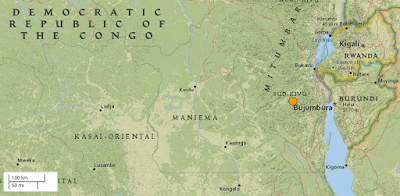
The United States Geological Survey Recorded a Magnitude 4.6 Earthquake at a depth of 10.0 km about 91 km to the west of the city of Uvira in South Kivu Province, Democratic Republic of Congo, slightly after 1.30 pm local time (slightly after 11.30 am GMT) on Wednesday 24 March 2021. There are no reports of any damage or casualties associated with this event at this time, but is likely to have been felt locally.

 
The approximate location of the 24 March 2021 South Kivu Earthquake. USGS.

South Kivu lies within the the of the Great Rift Valley, which is slowly splitting the African Plate in two along a line from the Red Sea through Ethiopia, and which includes the great lakes and volcanoes of east-central Africa. This has the potential to open into a new ocean over the next few tens of millions of years, splitting Africa into two new, smaller, continents; Nubia to the west and Somalia to the east.

 
Movement on the African Rift Valley, with associated volcanoes. Rob Gamesby/Cool Geography.

See also...


Follow Sciency Thoughts on Facebook.

Follow Sciency Thoughts on Twitter.


Saturday, 12 September 2020

Collapse at gold mine kills at least fifty in the Democratic Republic of Congo.

At least fifty people have died following a collapse at a gold mine near the town of Kamituga in South Kivu Province, Democratic Republic of Congo, on Friday 11 September 2020. The incident happened at an artisanal mine (mine worked by local people using traditional tools) outside the Kamituga Mining Concession, the largest 'official' mining concession in the area, which is operated by the Canadian mining giant Banro Corporation. The collapse is believed to have been triggered by heavy rainfall in the area, associated with the onset of the annual rainy season. Landslides are a common problem after severe weather events, as excess pore water pressure can overcome cohesion in soil and sediments, allowing them to flow like liquids. Approximately 90% of all landslides are caused by heavy rainfall. On this occasion the collapse has covered three pits within the mining site, Nivelle, Kubota and Tendi, with all those trapped inside thought to have drowned.

 
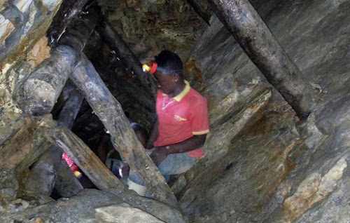
A miner in a pit at the Detroit mining site. Reuters.

The Democratic Republic of Congo is one of Africa's poorest nations, and like many other countries has granted concessions to mining companies in areas where small-scale artisanal mining has traditionally helped to supplement the incomes of subsistence farmers. The country has suffered years of political instability and has extremely poor infrastructure, is heavily indebted and has a chronic corruption problem, which means that little of the wealth generated from the industry makes it into government coffers, and that which does is unlikely to be spent on development or other projects likely to benefit the population. These problems are made worse by a series of conflicts in the area, which plays host to rebel groups opposed to the Congolese government and militiamen that fled the 1994 conflict in Rwanda and have never returned. In addition, the area has suffered incursions from several neighbouring countries, mostly with an official purpose of defending borders against Congo's instability, but with a strong interest in the mining industry. Militia groups linked to neighbouring states also operate in the area, and again are said to be involved in illegal mining.

 
Local people attempting to rescue miners trapped by a collapse at an artisanal gold mine in South Kivu Province on 11 September 2020. Maisha RDC/Twitter.

The incidents occurred after heavy rains associated with the onset of the area's two annual rainy seasons. This two-rainy-seasons-per-year pattern is typical in equatorial countries, with rainy seasons around the equinoxes and dry seasons around the solstices. Upland areas of East Africa have always been prone to landslides, but the problem has become worse in recent years as a rising population has led to more agriculture on hill-slopes, in many areas replacing open woodland where tree roots served to stabilise slopes, and also to more people living in harms ways.

See also...


Follow Sciency Thoughts on Facebook.


Thursday, 31 October 2019

Magnitude Earthquake in South Kivu Province, Democratic Republic of Congo.

The United States Geological Survey Recorded a Magnitude 5.3 Earthquake at a depth of 10.0 km about 52 km to the southwest of the town of Kabaré in South Kivu Province, Democratic Republic of Congo, at about 10.55 pm local time (about 8.55 pm GMT) on Wednesday 30 October 2019. There are no reports of any damage or casualties associated with this event at this time, but it was felt  across much of the Lake Kivu Basin and Rwanda.

The approximate location of the 30 October 2019 South Kivu Earthquake. USGS.

South Kivu lies within the the of the Great Rift Valley, which is slowly splitting the African Plate in two along a line from the Red Sea through Ethiopia, and which includes the great lakes and volcanoes of east-central Africa. This has the potential to open into a new ocean over the next few tens of millions of years, splitting Africa into two new, smaller, continents; Nubia to the west and Somalia to the east.

 Movement on the African Rift Valley, with associated volcanoes. Rob Gamesby/Cool Geography.

Witness accounts of Earthquakes can help geologists to understand these events, and the structures that cause them. The international non-profit organisation Earthquake Report is interested in hearing from people who may have felt this event; if you felt this quake then you can report it to Earthquake Report here.
See also...
https://sciencythoughts.blogspot.com/2019/07/clash-between-villagers-and-park.htmlhttps://sciencythoughts.blogspot.com/2018/04/around-40-killed-in-collapse-at-gold.html
https://sciencythoughts.blogspot.com/2017/12/magnitude-51-earthquake-in-south-kivu.htmlhttps://sciencythoughts.blogspot.com/2017/09/magnitude-50-earthquake-in-south-kivu.html
https://sciencythoughts.blogspot.com/2015/12/tantalum-mining-in-twenty-first-century.html
Follow Sciency Thoughts on Facebook.

Saturday, 20 July 2019

Clash between villagers and park wardens leaves one dead and several injured near Gorilla Sanctuary in the Democratic Republic of Congo.

One person has died and several more have been injured in a clash between park wardens and villagers belonging to the Miti ('Pygmy') group near the Kahuzi Biega National Park, an important Gorilla Sanctuary in South Kivu Province, Democratic Republic of Congo, on Wednesday 17 July 2019. The park wardens were reportedly following a group of suspected poachers leaving the park, when they were ambushed by villagers armed with bows and machetes. Several people were injured on both sides, with one warden loosing several fingers to a machete blow and a villager called lwaboshi Simba being shot dead.

An anti-poaching patrol in the Kahuzi Biega National Park. /Mongabay.

This is the latest in a series of clashes between the Miti people and the authorities over access to the park, which forms part of their traditional land but to which they now claim they are denied access, a dispute which led to the death of a park warden in April this year. Park authorities accuse the Miti and other forest dwelling communities of damaging the park by deforestation, principally the cutting down of trees for charcoal production, while local communities claim the park authorities have reneged on commitments to involve them in the management of the park.

Miti villagers at Buyungule village, just outside the Kahuzi Biega National Park. Primate Expertise.

The Kahuzi Biega Nationl Park is home to a population of about 125 Eastern Lowland Gorillas, Gorilla beringei graueri, and is one of the few places where tourists can visit Gorillas in the wild. At 6000 square kilometres the park is also one of the largest in the Democratic Republic of Congo, roughly the same size as Delaware or The Gambia. This makes the park a significant source of income for the Democratic Republic of Congo, but a significant loss of available land to local populations, who have been intermittently excluded from the park since its creation in 1970 by the Belgian photographer and conservationist Adrien Deschryver. The park authorities claim that local populations are major beneficiaries of the park, citing 350 children currently receiving schooling in the area, as well as two people from local communities attending universities, as well as jobs created in the tourism industry, and projects promoting Bee Keeping and Goat Breeding, though many people in the area complain this does not equate to the loss of access to traditional resources represented by the park.

Aerial view of the Kahuzi Biega National Park. Forest Service/US Department of Agriculture/Wikimedia Commons.

See also...

https://sciencythoughts.blogspot.com/2018/05/virunga-national-park-guide-killed.htmlhttps://sciencythoughts.blogspot.com/2018/04/eleven-lions-poisoned-in-ugandan.html
https://sciencythoughts.blogspot.com/2018/04/poaching-in-kakum-conservation-area-of.htmlhttps://sciencythoughts.blogspot.com/2017/10/unsustainable-chocolate-production.html
https://sciencythoughts.blogspot.com/2017/02/loxodonta-cyclotis-african-forest.htmlhttps://sciencythoughts.blogspot.com/2016/10/gorilla-beringei-graueri-grauers.html
Follow Sciency Thoughts on Facebook.

Saturday, 14 April 2018

Around 40 killed in collapse at gold mine in South Kivu Province, Democratic Republic of Congo.

Around 40 miners are thought to have died and another ten have been injured in a landslip in an open pit gold mine in the village of Makuku, near Nyange, in South Kivu Province, Democratic Republic of Congo. The incident is reported to have happened on Friday 13 April 2018, following heavy rain in the area. Landslides are a common problem after severe weather events, as excess pore water pressure can overcome cohesion in soil and sediments, allowing them to flow like liquids. Approximately 90% of all landslides are caused by heavy rainfall, and mining spoil tips and exposed open pit mines in soft sediments are particularly vulnerable to such problems.

The approximate location of the Makuku mine. Google Maps.

The Democratic Republic of Congo one of the world's largest producer of precious metals, but benefits little from the industry. The country has suffered years of political instability and has extremely poor infrastructure, is heavily indebted and has a chronic corruption problem, which means that little of the wealth generated from the industry makes it into government coffers, and that which does is unlikely to be spent on development or other projects likely to benefit the population. These problems are made worse by a series of conflicts in the area, which plays host to rebel groups opposed to the Congolese government and militiamen that fled the 1994 conflict in Rwanda and have never returned. In addition the area has suffered incursions from several neighboring countries, mostly with an official purpose of defending borders against Congo's instability, but with a strong interest in the coltan industry. Militia groups linked to neighboring states also operate in the area, and again are said to be involved in illegal mining.

The lack of government control of the area, and low regard for human life held by many of the groups operating in the area, means that safety precautions at mines in the area are almost non-existent, with many mines simply being large holes dug into poorly consolidated sediments. The area suffers extremely high levels of rainfall (it is the source from which the Congo, Nile and Zambesi rivers originate), and mines can rapidly turn into death-traps as their sides turn to mud and collapse upon the miners.

See also...

http://sciencythoughts.blogspot.co.uk/2017/12/magnitude-51-earthquake-in-south-kivu.htmlhttp://sciencythoughts.blogspot.co.uk/2017/09/magnitude-50-earthquake-in-south-kivu.html
http://sciencythoughts.blogspot.co.uk/2017/08/over-100-feared-dead-after-landslide-in.htmlhttp://sciencythoughts.blogspot.co.uk/2017/07/magnitude-53-earthquake-beneath-lake.html
http://sciencythoughts.blogspot.co.uk/2017/05/kidnapped-mineworkers-released-in.htmlhttp://sciencythoughts.blogspot.co.uk/2016/10/gorilla-beringei-graueri-grauers.html
Follow Sciency Thoughts on Facebook.