
The University of the West Indies Seismic Research Centre recorded
a Magnitude 4.6 Earthquake at a depth of about 40 km roughly 40 km to the north of of Port of Spain, the capital of Trinidad and Tobago, slightly after 10.30 am
local time (slightly after 2.30 pm GMT) on Friday 4 January 2019.
This was a large quake, but at some
depth as well as some way offshore, and there are no reports of any
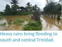
casualties or serious damage, though the quake was felt across most of Trinidad.

The approximate location of the 4 January 2018 Trinidad Earthquake. Google Maps.
Trinidad and Tobago form part of the southern margin of the Caribbean Plate, which is moving eastward compared to the South American Plate to the south. This is not a smooth process, the two plates constantly stick together, then break apart as the pressure builds up, causing Earthquakes in the process.
Witness
accounts of Earthquakes can help geologists to understand these events,
and the structures that cause them. The University of the West Indies Seismic Research Centre is interested in hearing from people who may have felt this event; if you felt this quake then you can report it to Earthquake Report here.
See also...


Follow Sciency Thoughts on
Facebook.