The United States Geological Survey
recorded a Magnitude 7.5 Earthquake at a depth of 56.7 km, to the southeast of the Kuril Archipelago in the Russian Far East, slightly
before 1.50 pm local time (slightly before 2.50 am GMT) on Wednesday 25
March 2020. There are no reports of any casualties or damage associated with this event, but it was felt in the northern Kurils and on the southern Kamchatka Peninsula, and prompted a tsunami warning which led to the temporary evacuation of low lying areas on nearby islands.
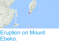
The approximate location of the 25 March 2020 Kuril Archipelago Earthquake. USGS.
The event happened on the Kuril-Kamchatka Trench, which runs to the east of the Kuril Islands and Kamchatka Peninsula. The Kuril Archipelago runs from the northwestern tip of Hokkaido to the
southern tip of the Kamtchatka Peninsula. It marks the southern margin
of the Okhotsk Plate, which underlies the Sea of Okhotsk, the Kamchatka
Peninsula, Sakhalin Island and Tōhoku and Hokkaidō in Japan. Along this
southern margin the Pacific Plate is being subducted beneath the Okhotsk
Plate in the Kuril Trench. As the Pacific Plate sinks under the Okhotsk
Plate it is partial melted by the resultant friction and the heat of
the Earth's interior. Some of the melted material then rises up through
the overlying Okhotsk Plate as magma, fuelling the volcanoes of the Kuril
Archipelago.
Simple diagram showing the subduction of the Pacific Plate beneath the Okhotsk Plate along the Kuril Trench. Auburn University.
Witness
accounts of Earthquakes can help geologists to understand these events,
and the structures that cause them. The international non-profit
organisation Earthquake Report is interested in hearing from people who may have felt this event; if you felt this quake then you can report it to Earthquake Report here.
See also...
Follow Sciency Thoughts on Facebook.


