Showing posts with label Kuril Archipelago. Show all posts

Friday, 18 September 2020

Eruptions on Mount Ebako on Paramushir Island in the Russian Far East.

The Kamchatkan Volcanic Eruption Response Team has reported a series of explosive eruptions on Mount Ebako, a 1156 m volcano on the northern end of Paramushir Island in the Kuril Archipelago in the Russian Far East, on 4-5 and 10 September 2020. These produced a series of ash columns that reached up to 3.5 km above sealevel, and drifted to the east and southeast.

 
An ash column over Mount Ebako on 5 September 2020. Deprem Raporu/Twitter.

The Kuril Archipelago runs from the northwestern tip of Hokkaido to the southern tip of the Kamtchatka Peninsula. It marks the southern margin of the Okhotsk Plate, which underlies the Sea of Okhotsk, the Kamchatka Peninsula, Sakhalin Island and Tōhoku and Hokkaidō in Japan. Along this southern margin the Pacific Plate is being subducted beneath the Okhotsk Plate in the Kuril Trench. As the Pacific Plate sinks under the Okhotsk Plate it is partial melted by the resultant friction and the heat of the Earth's interior. Some of the melted material then rises up through the overlying Okhotsk Plate as magma, fuelling the volcanoes of the Kuril Archipelago.

 
Simple diagram showing the subduction of the Pacific Plate beneath the Okhotsk Plate along the Kuril Trench. Auburn University.

See also...


Follow Sciency Thoughts on Facebook.


Wednesday, 25 March 2020

Magnitude 7.5 Earthquake to the southeast of the Kuril Archipelago in the Russian Far East.

The United States Geological Survey recorded a Magnitude 7.5 Earthquake at a depth of 56.7 km, to the  southeast of the Kuril Archipelago in the Russian Far East, slightly before 1.50 pm local time (slightly before 2.50 am GMT) on Wednesday 25 March 2020. There are no reports of any casualties or damage associated with this event, but it was felt in the northern Kurils and on the southern Kamchatka Peninsula, and prompted a tsunami warning which led to the temporary evacuation of low lying areas on nearby islands.

The approximate location of the 25 March 2020 Kuril Archipelago Earthquake. USGS.

The event happened on the Kuril-Kamchatka Trench, which runs to the east of the Kuril Islands and Kamchatka Peninsula. The Kuril Archipelago runs from the northwestern tip of Hokkaido to the southern tip of the Kamtchatka Peninsula. It marks the southern margin of the Okhotsk Plate, which underlies the Sea of Okhotsk, the Kamchatka Peninsula, Sakhalin Island and Tōhoku and Hokkaidō in Japan. Along this southern margin the Pacific Plate is being subducted beneath the Okhotsk Plate in the Kuril Trench. As the Pacific Plate sinks under the Okhotsk Plate it is partial melted by the resultant friction and the heat of the Earth's interior. Some of the melted material then rises up through the overlying Okhotsk Plate as magma, fuelling the volcanoes of the Kuril Archipelago.

Simple diagram showing the subduction of the Pacific Plate beneath the Okhotsk Plate along the Kuril Trench. Auburn University.

Witness accounts of Earthquakes can help geologists to understand these events, and the structures that cause them. The international non-profit organisation Earthquake Report is interested in hearing from people who may have felt this event; if you felt this quake then you can report it to Earthquake Report here.

See also...

https://sciencythoughts.blogspot.com/2019/06/raikoke-volcano-erupts-for-first-time.htmlhttps://sciencythoughts.blogspot.com/2018/11/eruption-on-mount-ebeko-produces-35-km.html
https://sciencythoughts.blogspot.com/2018/02/eruption-on-mount-ebeko.htmlhttps://sciencythoughts.blogspot.com/2015/02/eruption-on-mount-chikurachki.html
https://sciencythoughts.blogspot.com/2012/10/volcanic-activity-on-mount-alaid.htmlhttps://sciencythoughts.blogspot.com/2012/08/eruption-on-ivan-grozny.html
Follow Sciency Thoughts on Facebook.

Tuesday, 25 June 2019

Raikoke volcano erupts for the first time in almost a century.

Raikoke, a volcanic island in the Kuril Archipelago, erupted at about 4.00 am local time on Saturday 22 June 2019 (about 5.00 pm on Friday 21 June GMT), the first eruption on the island since 1924, and only the third eruption recorded, the first having been in 1778. The eruption produced a volcanic plume that rose to between 13 and 17 km above sea level, which was observed by several satellites, as well as by astronauts on the International Space Station.

 Eruption on Raikoke, seen from the International Space Station. Earth Observatory/NASA.

The Kuril Archipelago runs from the northwestern tip of Hokkaido to the southern tip of the Kamtchatka Peninsula. It marks the southern margin of the Okhotsk Plate, which underlies the Sea of Okhotsk, the Kamchatka Peninsula, Sakhalin Island and Tōhoku and Hokkaidō in Japan. Along this southern margin the Pacific Plate is being subducted beneath the Okhotsk Plate in the Kuril Trench. As the Pacific Plate sinks under the Okhotsk Plate it is partial melted by the resultant friction and the heat of the Earth's interior. Some of the melted material then rises up through the overlying Okhotsk Plate as magma, fuelling the volcanoes of the Kuril Archipelago.

Simple diagram showing the subduction of the Pacific Plate beneath the Okhotsk Plate along the Kuril Trench. Auburn University.

See also...

https://sciencythoughts.blogspot.com/2018/11/eruption-on-mount-ebeko-produces-35-km.htmlhttps://sciencythoughts.blogspot.com/2018/02/eruption-on-mount-ebeko.html
https://sciencythoughts.blogspot.com/2015/02/eruption-on-mount-chikurachki.htmlhttps://sciencythoughts.blogspot.com/2012/10/volcanic-activity-on-mount-alaid.html
https://sciencythoughts.blogspot.com/2012/08/eruption-on-ivan-grozny.html
Follow Sciency Thoughts on Facebook.

Sunday, 4 November 2018

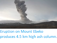
Eruption on Mount Ebeko produces 4.5 km high ash column.

The Russian Emergencies Ministry's department in the Far Eastern Sakhalin Region has reported an eruption on Mount Ebeko, a 1156 m volcano on the northern end of Paramushir Island in the Kuril Archipelago, on Saturday 3 October 2018. The eruption produced an ash column about 4.5 km high, which drifted about 5 km to the northeast. A warning has been issued to aviation in the area. Ebeko is one of the most active volcanoes in the Kuril group, with frequent small eruptions and lava flows, though large eruptions are unusual.

 Ash column over Mount Ebeko on Paramushir Island on 3 September 2018. Russian Academy of Sciences/Geophysical Survey/Kamchatka Branch.

The Kuril Archipelago runs from the northwestern tip of Hokkaido to the southern tip of the Kamtchatka Peninsula. It marks the southern margin of the Okhotsk Plate, which underlies the Sea of Okhotsk, the Kamchatka Peninsula, Sakhalin Island and Tōhoku and Hokkaidō in Japan. Along this southern margin the Pacific Plate is being subducted beneath the Okhotsk Plate in the Kuril Trench. As the Pacific Plate sinks under the Okhotsk Plate it is partial melted by the resultant friction and the heat of the Earth's interior. Some of the melted material then rises up through the overlying Okhotsk Plate as magma, fuelling the volcanoes of the Kuril Archipelago.

 Simple diagram showing the subduction of the Pacific Plate beneath the Okhotsk Plate along the Kuril Trench. Auburn University.

See also...

https://sciencythoughts.blogspot.com/2018/02/eruption-on-mount-ebeko.htmlhttp://sciencythoughts.blogspot.co.uk/2015/02/eruption-on-mount-chikurachki.html
https://sciencythoughts.blogspot.com/2012/10/volcanic-activity-on-mount-alaid.htmlhttps://sciencythoughts.blogspot.com/2012/08/eruption-on-ivan-grozny.html
Follow Sciency Thoughts on Facebook.

Sunday, 25 February 2018

Eruption on Mount Ebeko.

The Kamchatkan Volcanic Eruption Response Team has reported an eruption on Mount Ebeko, a 1156 m volcano on the northern end of Paramushir Island in the Kuril Archipelago, on Saturday 24 February 2018. The eruption produced an ash column about 2 km high, and led to ashfalls in the town of Severo-Kurilsk. A warning has been issued to aviation in the area. Ebeko is one of the most active volcanoes in the Kuril group, with frequent small eruptions and lava flows, though large eruptions are unusual.

The approximate location of Mount Ebeko. Google Maps.

The Kuril Archipelago runs from the northwestern tip of Hokkaido to the southern tip of the Kamtchatka Peninsula. It marks the southern margin of the Okhotsk Plate, which underlies the Sea of Okhotsk, the Kamchatka Peninsula, Sakhalin Island and Tōhoku and Hokkaidō in Japan. Along this southern margin the Pacific Plate is being subducted beneath the Okhotsk Plate in the Kuril Trench. As the Pacific Plate sinks under the Okhotsk Plate it is partial melted by the resultant friction and the heat of the Earth's interior. Some of the melted material then rises up through the overlying Okhotsk Plate as magma, fuelling the volcanoes of the Kuril Archipelago.

 Simple diagram showing the subduction of the Pacific Plate beneath the Okhotsk Plate along the Kuril Trench. Auburn University.

See also...

http://sciencythoughts.blogspot.co.uk/2015/02/eruption-on-mount-chikurachki.htmlhttp://sciencythoughts.blogspot.co.uk/2012/10/volcanic-activity-on-mount-alaid.html
http://sciencythoughts.blogspot.co.uk/2012/08/eruption-on-ivan-grozny.html
Follow Sciency Thoughts on Facebook.

Thursday, 19 February 2015

Eruption on Mount Chikurachki.

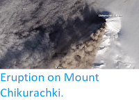
The Tokyo Volcanic Ash Advisory Center reported an eruption on Mount Chikurachki, a 1816 m high volcano on Paramishir Island in the northern Kuril Archipelago, beginning at about 10.00 am local time on Monday 16 February 2014. Satellite monitoring revealed that this produced a series of plumes rising 7-7.5 km about the volcano and drifting up to 80 km to the west. Activity continued onto Tuesday 17 February, with a series of eruptions producing plumes that rose to 3-3.5 km with ash drifting up to 230 km to the southwest. This is the first recorded eruption on Mount Chikurachki since 2007.

Ash plume issuing from Mount Chikurachki on 17 February 2015, imaged by the  Operational Land Imager on Landsat 8. NASA/Earth Observatory.

The Kuril Archipelago runs from the northwestern tip of Hokkaido to the southern tip of the Kamtchatka Peninsula. It marks the southern margin of the Okhotsk Plate, which underlies the Sea of Okhotsk, the Kamchatka Peninsula, Sakhalin Island and Tōhoku and Hokkaidō in Japan. Along this southern margin the Pacific Plate is being subducted beneath the Okhotsk Plate in the Kuril Trench. As the Pacific Plate sinks under the Okhotsk Plate it is partial melted by the resultant friction and the heat of the Earth's interior. Some of the melted material then rises up through the overlying Okhotsk Plate as magma, fueling the volcanoes of the Kuril Archipelago.

Simple diagram showing the subduction of the Pacific Plate beneath the Okhotsk Plate along the Kuril Trench. Auburn University.

See also...

Volcanic activity on Mount Alaid.
Alaid is the northernmost volcano of the Kurile Islands, a volcanic archipelago that stretches from the northeastern tip of Hokkaido in Japan to the tip of the Kamchatka Peninsula. It is a stratovolcano (cone shaped volcano made up of layers of ash and lava...


Eruption on Ivan Grozny.
On 16 August 2012 the Itar-Tass news agency reported an eruption on the Ivan Grozny (Ivan the Terrible) volcano on Iturup Island in the Kuril Archipelago to the northeast of Hokkaido, producing ash-falls up to 25 km from the caldera. Ivan Grozny forms a caldera 3 × 3.5 km, open to the south. Their are several Holocene (less than 10 000 year old) lava domes to the northeast of this caldera, and a single large dome to the south, which is...


Follow Sciency Thoughts on Facebook.

Tuesday, 23 October 2012

Volcanic activity on Mount Alaid.

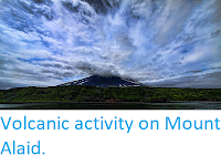
Alaid is the northernmost volcano of the Kurile Islands, a volcanic archipelago that stretches from the northeastern tip of Hokkaido in Japan to the tip of the Kamchatka Peninsula. It is a stratovolcano (cone shaped volcano made up of layers of ash and lava, the kind of volcano most often seen in films) with a breached crater open to the south. It rises 2339 m above sea level, making it the highest volcano in the Kuriles.

(Top) Mount Alaid photographed from sea level. Travel Doyenne. (Bottom) Mount Alaid photographed from the International Space Station. NASA/Earth Observatory.

On 5 October 2012 residents of Paramushir Island, roughly 20 km to the southeast, reported seeing a plume of gas and steam rising 200 m above the summit of Mount Alaid, and on 6 October satellites reported a thermal anomaly (hotspot) on the volcano that persisted at least 7.5 hours, causing the Kamchatkan Volcanic Eruption Response Team to raise the aviation alert level near Alaid. Such thermal anomalies, when detected by satellites using infra-red imaging, may represent heat from within a volcano or hot lava on the surface. The thermal anomaly was observed again on 15 October.

Despite occasional steam plumes and bouts of seismic activity, Alaid has not erupted in ernest since 1981, when an explosive eruption threw ash 15 km into the air, and covered an estimated 150 000 km³ (much of it at sea) in ash up to 30 cm thick, causing severe disruption to the town of Severokurilsk on Paramushir Island.

Map showing the relationship between Mount Alaid (top left) and Paramushir Island (centre). Google Maps.

The Kurile Archipelago is a volcanic island arc on the boundary of the Okhotsk and Pacific Plates. The Pacific Plate is being subducted beneath the Okhotsk Plate. As the Pacific Plate sinks into the Earth it is partially melted by the friction and the heat of the Earth's interior. Some of the melted material then rises through the overlying Okhotsk Plate, fueling the volcanoes of the Kurile Archipelago, Hokkaido and south Kamchatka.


Follow Sciency Thoughts on Facebook.
Friday, 24 August 2012

Eruption on Ivan Grozny.

On 16 August 2012 the Itar-Tass news agency reported an eruption on the Ivan Grozny (Ivan the Terrible) volcano on Iturup Island in the Kuril Archipelago to the northeast of Hokkaido, producing ash-falls up to 25 km from the caldera. Ivan Grozny forms a caldera 3 × 3.5 km, open to the south. Their are several Holocene (less than 10 000 year old) lava domes to the northeast of this caldera, and a single large dome to the south, which is called the Grozny Dome (Terrible Dome). To the east lies a second volcano, Tebenkov, and south of this the Machekh Crater, which frequently produces fumaroles (gas emissions).

The location of Ivan Grozny. Google Maps.

The first recorded eruption on Ivan Grozny occurred in February 1968, when a small explosive eruption occurred. Similar events happened in 1970, January 1973 and May 1973. In 1989 a series of small eruptions lasted from May to August, triggering several lahars (mud flows), since when the volcano has been quiet.

The Kuril Archipelago runs from the northwestern tip of Hokkaido to the southern tip of the Kamtchatka Peninsula. It marks the southern margin of the Okhotsk Plate, which underlies the Sea of Okhotsk, the Kamchatka Peninsula, Sakhalin Island and Tōhoku and Hokkaidō in Japan. Along this southern margin the Pacific Plate is being subducted beneath the Okhotsk Plate in the Kuril Trench. As the Pacific Plate sinks under the Okhotsk Plate it is partial melted by the resultant friction and the heat of the Earth's interior. Some of the melted material then rises up through the overlying Okhotsk Plate as magma, fueling the volcanoes of the Kuril Archipelago.

Simple diagram showing the subduction of the Pacific Plate beneath the Okhotsk Plate along the Kuril Trench. Auburn University.


Follow Sciency Thoughts on Facebook.