Showing posts with label Jalisco. Show all posts

Friday, 13 October 2023

One person dead after Hurricane Lidia makes landfall in Jalisco State, Mexico.

One person has died and two more have been injured after Hurrican Lidia made landfall close to the resort town of Puerto Vallarta in Jalisco State, Mexico, at about 6.00 pm, local time, on Tuesday 10 October 2023, bringing with it wind speeds of up to 220 km per hour. The storm made landfall on the sparsely populated Cabo Corrientes Peninsula to the south of the city, and rapidly disapated after making landfall, causing little damage outside of Puerto Vallarta, where several houses had roofs blown off by high winds. The person who died was reportedly driving a van in the northern outskirts of the city.

Damage caused by Hurricane Lidia in the resort town of Puerto Vallarta in Jalisco State, Mexico. Oscar Almeida/Out and About Puerto Vallarta.

Tropical storms are caused by the warming effect of the Sun over tropical seas. As the air warms it expands, causing a drop in air pressure, and rises, causing air from outside the area to rush in to replace it. If this happens over a sufficiently wide area then the inrushing winds will be affected by centrifugal forces caused by the Earth's rotation (the Coriolis effect). This means that winds will be deflected clockwise in the northern hemisphere and anti-clockwise in the southern hemisphere, eventually creating a large, rotating Tropical Storm. They have different names in different parts of the world, with those in the northwest Atlantic and eastern Pacific being referred to as hurricanes.

The formation of a tropical cyclone. Natural Disaster Management.

Despite the obvious danger of winds of this speed, which can physically blow people, and other large objects, away as well as damaging buildings and uprooting trees, the real danger from these storms comes from the flooding they bring. Each drop millibar drop in air-pressure leads to an approximate 1 cm rise in sea level, with big tropical storms capable of causing a storm surge of several meters. This is always accompanied by heavy rainfall, since warm air over the ocean leads to evaporation of sea water, which is then carried with the storm. These combined often lead to catastrophic flooding in areas hit by tropical storms.

The formation and impact of a storm surge. eSchoolToday.

See also...


Follow Sciency Thoughts on Facebook.

Follow Sciency Thoughts on Twitter. 


Tuesday, 1 October 2019

Tropical Storm Narda kills two after making landfall in Oaxaca.

Tropical Storm Narda made landfall in Oaxaca State, Mexico, on Saturday 28 September 2019, passing over a coastal regions of Guerrero, Michoácan, Colima, Jalisco, and Nayarit, before passing back out to sea over the Gulf of California. The storm caused two fatalities in Ozxaca, a 26-year-old man in San Pedro Mixtepec, and a 17-year-old boy in San Jeronimo, both of whom were swept away by swollen rivers. A landslide in the town of Santa Catarina Juquila, also in Oaxaca, buried two shops, but nobody was hurt in that incident. In Jalisco State the Cuale River overflowed its banks in Puerto Vallarta, causing damage to 248 houses. Flooding was also reported in the city of Mazatlan in Sinaloa State.

 Flooding caused by Tropical Storm Narda in the city of Mazatlan in Sinaloa State. The Mazatlan Post.

Tropical storms are caused by the warming effect of the Sun over tropical seas. As the air warms it expands, causing a drop in air pressure, and rises, causing air from outside the area to rush in to replace it. If this happens over a sufficiently wide area then the inrushing winds will be affected by centrifugal forces caused by the Earth's rotation (the Coriolis effect). This means that winds will be deflected clockwise in the northern hemisphere and anti-clockwise in the southern hemisphere, eventually creating a large, rotating Tropical Storm. They have different names in different parts of the world, with those in the northwest Atlantic and eastern Pacific being referred to as hurricanes.

 The path and strength of Tropical Storm Narda. Thick line indicates the past path of the storm (till 3.00 pm GMT on Tuesday 1 October 2019). Colour indicated the severity of the storm. Tropical Storm Risk.

Despite the obvious danger of winds of this speed, which can physically blow people, and other large objects, away as well as damaging buildings and uprooting trees, the real danger from these storms comes from the flooding they bring. Each drop millibar drop in air-pressure leads to an approximate 1 cm rise in sea level, with big tropical storms capable of causing a storm surge of several meters. This is always accompanied by heavy rainfall, since warm air over the ocean leads to evaporation of sea water, which is then carried with the storm. These combined often lead to catastrophic flooding in areas hit by tropical storms. 

See also...
https://sciencythoughts.blogspot.com/2019/03/second-sinkhole-opens-up-in-troubled.htmlhttps://sciencythoughts.blogspot.com/2019/01/magnitude-58-earthquake-off-coast-of.html
https://sciencythoughts.blogspot.com/2018/10/propane-gas-truck-swallowed-by-sinkhole.htmlhttps://sciencythoughts.blogspot.com/2018/07/magnitude-57-earthquake-in-oaxaca-state.html
https://sciencythoughts.blogspot.com/2018/06/magnitude-60-earthquake-off-coast-of.htmlhttps://sciencythoughts.blogspot.com/2018/02/magnitude-72-earthquake-in-oaxaca-state.html
Follow Sciency Thoughts on Facebook.

Sunday, 28 October 2018

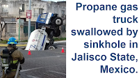
Propane gas truck swallowed by sinkhole in Jalisco State, Mexico.

A truck carrying highly dangerous propane gas became trapped in a near-vertical position after a sinkhole opened up beneath its rear end in the Conjunto Patria neighborhood of Zapopan City in Jalisco State, Mexico, on Friday 26 October 2018. Nobody was injured in the incident, but the truck's load had to be pumped into another vehicle before it could be extracted, a potentially hazardous operation, which required the evacuation of all buildings within 250 m.

Gas truck trapped in a sinkhole in Zapopan, Mexico, on 26 October 2018. Mexico News Daily.

Sinkholes are generally caused by water eroding soft limestone or unconsolidated deposits from beneath, causing a hole that works its way upwards and eventually opening spectacularly at the surface. Where there are unconsolidated deposits at the surface they can infill from the sides, apparently swallowing objects at the surface, including people, without trace.

However in this occasion the sinkhole is believed to have been caused by a ruptured water main, which washed away unconsolidated sediments beneath the road, leading to the collapse.

See also...

https://sciencythoughts.blogspot.com/2018/06/magnitude-60-earthquake-off-coast-of.htmlhttps://sciencythoughts.blogspot.com/2018/07/magnitude-57-earthquake-in-oaxaca-state.html

https://sciencythoughts.blogspot.com/2018/06/seven-dead-in-mexico-flooding.htmlhttps://sciencythoughts.blogspot.com/2018/02/magnitude-72-earthquake-in-oaxaca-state.html
https://sciencythoughts.blogspot.com/2018/02/landslide-destroys-almost-hundred-homes.htmlhttps://sciencythoughts.blogspot.com/2017/11/striking-miners-killed-in-clash-with.html
Follow Sciency Thoughts on Facebook.

Thursday, 30 August 2018

Kinosternon vogti: A new species of Mud Turtle from Jalisco State, Maxico.

Mud Turtles, Kinosternon spp., are small freshwater Turtles found throughout the Americas. They reach their maximum diversity in Mexico, where there are currently seventeen described species, compared to only three in the whole of South America. Unfortunately, despite Turtles being one of the most endangered groups of Tetrapod Vertebrates, they have often been overlooked in surveys of Vertebrates in Mexico, which have concentrated on other groups such as Mammals, Birds and Amphibians, with some parts of the country having almost no records of Turtle populations.

In a paper published in the journal Chelonian Conservation and Biology in June 2018, Marco López-Luna of the División Académica de Ciencias Biolôgicas at the Universidad Juárez Autónoma de Tabasco, Fabio Cupul-Magña and Armando Escobedo-Galván of the Centro Universitario de la Costa at the Universidad de Guadalajara, Adriana González-Hernández and Eric Centenero-Alcalá of the Colección Nacional de Anfibios y Reptiles at the Ciudad Universitaria de México, Judith Rangel-Mendoza, also of the División Académica de Ciencias Biolôgicas at the Universidad Juárez Autónoma de Tabasco, Mariana Ramírez-Ramírez of the División de Ciencias Naturales y Exactas at the Universidad de Guanajuato, and Erasmo Cazares-Hernández of the Instituto Tecnológico Superior de Zongolica, describe a new species of Mud Turtle from the area around the city of Puerto Vallarta in Jalisco State, Mexico.

The new species is named Kinosternon vogti, in honour of Richard Vogt of the National Institute of Amazonian Research, for his work on the freshwater Turtles of the Americas, and mentoring of many younger scientists. The species is described from a series of specimens collected from artificial and disturbed waterways around the city of Puerto Vallarta, its natural habitat is unclear. The species is small for the genus, with the largest known specimen measuring only 101.5 mm in length. The shell of these Turtles is olive-brown with black rims to the scutes (individual plates of the shell) and an orange or yellow underside, the head and limbs are brown and lighter below. The tail is prehensile with a clawed tip.

Kinosternon vogti. (A) Dorsal view. (B) Ventral view. Black line represents 10 mm. Marco López-Luna in López-Luna et al. (2018).

See also...

https://sciencythoughts.blogspot.com/2018/07/hundreds-of-sea-turtles-washing-up-dead.htmlhttps://sciencythoughts.blogspot.com/2018/03/lepidochelys-olivacea-olive-ridley.html
http://sciencythoughts.blogspot.co.uk/2017/12/trachemys-medemi-new-species-of-slider.htmlhttp://sciencythoughts.blogspot.co.uk/2017/11/hundreds-of-green-sea-turtles-found.html
http://sciencythoughts.blogspot.co.uk/2017/10/tasbacka-danica-pigment-preservation-in.htmlhttp://sciencythoughts.blogspot.co.uk/2016/10/mendozachelys-wichmanni-new-species-of.html
Follow Sciency Thoughts on Facebook.

Saturday, 30 June 2018

Magnitude 6.0 Earthquake off the coast of Jalisco State, Mexico.

The United States Geological Survey recorded a Magnitude 6.0 Earthquake at a depth of 24.8 km, approximately 44 km off the coast of Jalisco State, Mexico, slightly before 4.00 am local time on Saturday 30 June 2018 (slightly before 11.00 pm on Friday 29 June, GMT). There are no reports of any damage or casualties associated with this event, it was felt inland as far as Guadalajara.

The approximate location of the 30 June 2018 Jalisco Earthquake. USGS.

Mexico is located on the southernmost part of the North American Plate. To the south, along the Middle American Trench, which lies off the southern coast off Mexico, the Cocos Plate is being subducted under the North American Plate, passing under southern Mexico as it sinks into the Earth. This is not a smooth process, and the plates frequently stick together then break apart as the pressure builds up, causing Earthquakes on the process.

The Cocos Plate is thought to have formed about 23 million years ago, when the Farallon Plate, an ancient tectonic plate underlying the East Pacific, split in two, forming the Cocos Plate to the north and the Nazca Plate to the south. Then, roughly 10 million years ago, the northwesternmost part of the Cocos Plate split of to form the Rivera Plate, south of Beja California.

 he position of the Cocos, Nazca and Rivera Plates. MCEER/University at Buffalo.

In a paper published in the Journal of Geophysical Research, in 2012, a team led by Igor Stubailo of the Department of Earth and Space Sciences at the University of California Los Angeles, published a model of the subduction zone beneath Mexico using data from seismic monitoring stations belonging to the Mesoamerican Seismic Experiment, the Network of Autonomously Recording Seismographs, the USArray, Mapping the Rivera Subduction Zone and the Mexican Servicio Sismologico Nacional.

The seismic monitoring stations were able to monitor not just Earthquakes in Mexico, but also Earthquakes in other parts of the world, monitoring the rate at which compression waves from these quakes moved through the rocks beneath Mexico, and how the structure of the rocks altered the movement of these waves.

Based upon the results from these monitoring stations, Stubailo et al. came to the conclusion that the Cocos Plate was split into two beneath Mexico, and that the two plates are subducting at different angles, one steep and one shallow. Since the rate at which a plate melts reflects its depth within the Earth, the steeper angled plate melts much closer to the subduction zone than the shallower angled plate, splitting the Trans-Mexican Volcanic Belt into sections above the different segments of the Cocos Plate, and causing it to apparently curve away from the subduction zone.

Top the new model of the Cocos Plate beneath Mexico, split into two sections (A & B) subducting at differing angles. (C) Represents the Rivera Plate, subducting at a steeper angle than either section of the Cocos Plate. The Split between the two has been named the Orozco Fracture Zone (OFZ) which is shown extended across the Cocos Plate; in theory this might in future split the Cocos Plate into two segments (though not on any human timescale). Bottom Left, the position of the segments on a map of Mexico. Darker area is the Trans-Mexican Volcanic Belt, orange circles are volcanoes, brown triangles are seismic monitoring stations, yellow stars are major cities. Bottom Right, an alternative model showing the subducting plate twisted but not split. This did not fit the data. Stubailo et al. (2012).
  
Witness accounts of Earthquakes can help geologists to understand these events, and the structures that cause them. The international non-profit organisation Earthquake Report is interested in hearing from people who may have felt this event; if you felt this quake then you can report it to Earthquake Report here.

See also...

http://sciencythoughts.blogspot.com/2018/06/seven-dead-in-mexico-flooding.htmlhttp://sciencythoughts.blogspot.com/2018/02/magnitude-72-earthquake-in-oaxaca-state.html
http://sciencythoughts.blogspot.com/2018/02/landslide-destroys-almost-hundred-homes.htmlhttp://sciencythoughts.blogspot.com/2017/11/striking-miners-killed-in-clash-with.html
http://sciencythoughts.blogspot.com/2017/11/increase-in-volcanic-activity-on-mount.htmlhttp://sciencythoughts.blogspot.com/2017/09/magnitude-61-earthquake-in-oaxaca-state.html
Follow Sciency Thoughts on Facebook.

Monday, 10 April 2017

Aroramyces balanosporus & Aroramyces herrerae: Two new species of Truffle-like Fungi from Mexico.

Members of the genus Aroramyces are obligate ectomycorrhizal Fungi (Fungi that form mutualistic associations with the roots of Vascular Plants, providing the Plants with nutrients obtained from the soil in return for sugars that the Plants produce by photosynthesis) with Truffle-like fruiting bodies, known from tropical and subtropical regions of Central Africa and northern Queensland, Australia. To date a single species has been described from each continent, though a number of other species are known from Australia and still awaiting formal description.

In a paper published in the journal IMA Fungus on 11 October 2016, Gonzalo Guevara-Guerrero of the Instituto Tecnológico de Ciudad Victoria, Michael Castellano of the USDA Forest Service, Northern Research Station, and Victor Gómez-Reyes of the Facultad de Biología at the Universidad Michoacana de San Nicolás de Hidalgo, describe two new species of Aroramyces from Jalisco and Michoacán States in Mexico, the first members of the genus described from the Americas.

The first new species described is named Aroramyces balanosporus, meaning ‘Acorn-shaped spores’, in reference to the shape of its spores. This species was found in Jalisco and Michoacán states at altitudes of about 1730 m above sea level, in association with the trees Carpinus (Hornbeam), Quercus (Oak), and Styrax (Snowbell). The Basidiomes (fruiting bodies) of this species are subglobose, white and often covered by patches of cottony hyphae, and reach up to 12 mm across. The spores are brownish and ellipsoid with embedded spines and can reach about 10.7 μm. 

Aroramyces balanosporus. (A) Basidiomes, (B)–(D) Basidiospores with spines and equatorial lines. (E) Caespitose groups of erect, branched, setal hyphae. (F) Subcutis and mesocutis of pseudoparechymatous cells. Scale bars: (A) = 1 cm; (B)–(D) = 10 μm; (E)–(F) not to scale. Guevara-Guerrero et al. (2017). 

The second new species described is named Aroramyces herrerae, in honour of the pioneering Mexican mycologist Teófilo Herrera Suárez. This species was found in the mountains of the Trans-Mexican Volcanic belt in Michoacán State, at altitudes of about 2160 m, in association with trees of the genus Quercus (Oak) and Pinus (Pine). The Basidiomes of this species are subglobose, white or brown and often mottled, and can reach 15 μm across. The spores are shaped like grains of rice, with wing-like appendages and can reach 12.5 μm.

Aroramyces herrerae. (G) Crosssection of basidiome. (H)–(I) Basidiospores with inflated utricule. (J) Inner peridium cells, occasionally with inflated hyphae. (K) Clamp connections on encrusted hyphae adherent on the outer peridium. (L) Tramal plate. Scale bars: (G) = 1 cm; (H)–(I) = 10 μm; (J)–(L) not to scale. Guevara-Guerrero et al. (2017).

See also...

http://sciencythoughts.blogspot.co.uk/2017/03/strigula-acuticonidiarum-strigula.htmlhttp://sciencythoughts.blogspot.co.uk/2016/10/identifying-cause-of-2016-bangladesh.html
http://sciencythoughts.blogspot.co.uk/2016/09/psora-altotibetica-new-species-of-high.htmlhttp://sciencythoughts.blogspot.co.uk/2016/08/chrysosporium-guizhouense-chrysosporium.html
http://sciencythoughts.blogspot.co.uk/2016/07/unravelling-diversity-of-podaxis-fungi.htmlhttp://sciencythoughts.blogspot.co.uk/2016/05/truncospora-wisconsinensis-new-species.html
Follow Sciency Thoughts on Facebook.

Friday, 30 October 2015

Hurricane Patricia: The most severe storm ever recorded causes widespread flooding but relatively few casualties.

Hurricane Patricia formed as a tropical depression over the eastern Pacific Basin in mid-October 2015, before increasing rapidly in intensity on 22 October, increasing to an Category 5 hurricane (a hurricane with sustained winds of more than 252 kilometers per hour) within 24 hours. On 23 October the storm was recorded as having sustained winds of 325 kilometers per hour and a low pressure of 879 millibars shortly before making landfall in Jalisco State, Mexico, on 23 October. This was the fastest drop in pressure and growth in wind-speed ever recorded for a tropical storm, and matched the highest sustained wind speed ever recorded for such a storm, set by Typhoon Nancy in 1961 (a record thought likely to be inaccurate as the methods used to record wind-speeds in the early 1960s tended to produce over-estimations). 

 Animation of Hurricane Patricia making landfall on the southern coast of Mexico on 23 October 2015, based upon images from the GOES-15 Satellite. Rosenstiel School of Marine and Atmospheric Science/University of Miami/National Oceanic and Atmospheric Administration.
  
The extreme severity of Hurricane Patricia prompted authorities in Mexico to evacuate around 50 000 people from coastal areas in Colima, Jalisco, and Nayarit states. Fortunately the hurricane dropped in intensity as rapidly as it grew, and while still a Category 5 storm when it made landfall (the first Category 5 storm ever to make landfall on the southern coast of Mexico), it has dropped back to a tropical depression (storm with sustained winds of less than 61 kilometers per hour) within 24 hours of making landfall.

 Damage caused by Hurricane Patricia at Chamela in Jalisco State, Mexico. AP.

The hurricane made landfall in an area of Jalisco with a low population density, which combined with the program of evacuations has been credited with a very low loss of life for a storm of this size. Six fatalities were reported in the state, two people killed by a falling tree and four more in an automobile accident associated with the storm. However damage caused by the storm was still severe with over 9000 homes destroyed, including the entire town of Chamela, and extensive damage to crops across much of the state.

Damage caused by Hurricane Patricia in Barra de Navidad in Jalisco State, Mexico. Omar Torres/AFP/Getty Images.

In neighbourig Colima State around 400 homes were destroyed, and severe damage has been recorded to infrastructure, with damage recorded to schools, medical centers and roads, as well as flooding again causing extensive damage to crops and agricultural land. Extensive crop damages were also recorded in Michoacán and Nyarit states, while Quintana Roo state received a record breaking 502 mm of rain within 24 hours and suffering extensive flood damage, particularly in the city of Chetumal, where about 1500 homes were affected. Flooding was also recorded in Veracruz, Tabasco, Oaxaca, Chiapas, Guerrero and Tapachula States.

A banana plantation destroyed by Hurricane Patricia in Colima State, Mexico. Getty Images.

In Central America flooding was recorded in Guatemala, El Salvador, Honduras and Nicaragua, with numerous landslides, and extensive damage to homes and crops. Four people died in flooding in El Salvador and one in Guatemala, while in Nicaragua one person was killed and three injured in a landslide at a mine.

 Flooding in El Progreso, Honduras. Bomberos de Honduras.

In the United States flooding caused by Hurricane Patricia affected many parts of southern Texas, causing severe disruption around Houston. In Navarro County in the north of the State a flash flood washed away rail tracks causing a freight train to derail, though fortunately nobody was hurt in the incident. Heavy rains associated with the remnants of the storm caused a levee to breach south of New Orleans in Louisiana, and caused disruption up the east coast of North America as far as Quebec, where power outages were attributed to the effects of the storm.

Train derailment in Navarro County, Texas, caused by Hurricane Patricia. KGO-TV.

Tropical storms are caused by the warming effect of the Sun over tropical seas. As the air warms it expands, causing a drop in air pressure, and rises, causing air from outside the area to rush in to replace it. If this happens over a sufficiently wide area then the inrushing winds will be affected by centrifugal forces caused by the Earth's rotation (the Coriolis effect). This means that winds will be deflected clockwise in the northern hemisphere and anti-clockwise in the southern hemisphere, eventually creating a large, rotating Tropical Storm. They have different names in different parts of the world, with those in the northwest Atlantic being referred to as hurricanes.

 Photograph of Hurricane Patricia crossing the Mexican coast taken from the International Space Station. Scott Kelly/NASA.

Despite the obvious danger of winds of this speed, which can physically blow people, and other large objects, away as well as damaging buildings and uprooting trees, the real danger from these storms comes from the flooding they bring. Each drop millibar drop in air-pressure leads to an approximate 1 cm rise in sea level, with big tropical storms capable of causing a storm serge of several meters. This is always accompanied by heavy rainfall, since warm air over the ocean leads to evaporation of sea water, which is then carried with the storm. These combined often lead to catastrophic flooding in areas hit by tropical storms.

 Vehicle swept from a road during a flash flood in Texas associated with Hurricane Patricia. International Business Times.

It has been suggested that the exceptional severity of Hurricane Patricia may be the beginning of a much wetter climate phase associated with this years El Niño weather system over the southern Pacific Ocean, a phenomenon that typically brings high levels of rainfall to the southwest United States, though if this is the case then the weather has arrived dramatically early, as the increase in storm activity associated with El Niño does not usually begin in the Americas until December.

 Hotel rooms exposed after Hurricane Patricia ripped the roof off the building in Morelos State, Mexico. Rebecca Blackwell/AP.

The El Niño is the warm phase of a long-term climatic oscillation affecting the southern Pacific, which can influence the climate around the world. The onset of El Niño conditions is marked by a sharp rise in temperature and pressure over the southern Indian Ocean, which then moves eastward over the southern Pacific. This pulls rainfall with it, leading to higher rainfall over the Pacific and lower rainfall over South Asia. This reduced rainfall during the already hot and dry summer leads to soaring temperatures in southern Asia, followed by a rise in rainfall that often causes flooding in the Americas and sometimes Africa. Worryingly climatic predictions for the next century suggest that global warming could lead to more frequent and severe El Niño conditions, extreme weather conditions a common occurrence.

See also...

http://sciencythoughts.blogspot.co.uk/2013/09/landslide-kills-twelve-bus-passengers.htmlLandslide kills twelve bus passengers as Hurricane Ingrid makes landfall in Veracruz State, Mexico.                                               Twelve people have died when a mudslide buried a bus in Altotonga in Veracruz State, Mexico, on Monday 16 September 2013. The event happened as Hurricane...

http://sciencythoughts.blogspot.co.uk/2013/05/two-people-killed-as-hurricane-barbara.htmlTwo people killed as Hurricane Barbara makes landfall on Mexican south coast.         Hurricane Barbara made landfall on the southern coast of Oaxaca State in Mexico at around noon local time on Wednesday 29 May 2013, with sustained wind...
 Follow Sciency Thoughts on Facebook.