
The Tokyo Volcanic Ash Advisory Center and Kamtchatka Volcanic Eruption Response Team reported a major eruption on Mount Bezymianny, a 2882 m stratovolcano (cone shaped volcano made up of layers of ash and lava) on the central part of the Kamchatka Peninsula, which started slightly after 8.20 am local time on Thursday 22 October 2020, which produced an ash column about 9 km high, and formed a cloud roughly 100 km x 200 km in extent. This split into two parts, one of which drifted to the northwest and the other the southeast, travelling over 800 km before dispersing. The following day a satellite passing over the volcano detected a thermal anomaly which is thought likely to be the result of a lava dome forming, but there have been no further eruptions.

Mount Bezymianny was thought to be extinct until 1955, when it began a volcanic cycle that ended in 1956 with an explosive eruption caused the summit to collapse and created a large horseshoe-shaped crater. This has subsequently been filled in by further eruptive episodes on Bezymianny. The current summit is 2882 m high, but it is overshadowed by the nearby Kamen and Kluchevskaya volcanoes at 4579 m and 4750 m respectively. Bezymianny is thought to have formed about 4700 years ago, on the remains on an older, Pleistocene, volcano active between 11 000 and 7000 years ago. It has undergone three periods of intense activity since its formation, but was apparently inactive for about a thousand years prior to its 1955 reactivation.
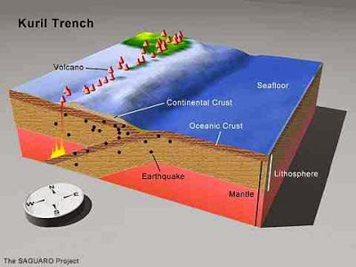
Mount Bezymianny is part of the Klyuchevskoi Volcano Group in the Ust-Kamchatka (East Kamchatka) District, along with mounts Klyuchevskoi and Kamen. The Kamchatka Peninsula lies on the eastern edge of the Okhotsk Plate, close to its margin with the Pacific and North American Plates. The Pacific Plate is being subducted along the margin, and as it does so it passes under the southern part of the Kamchatka Peninsula, and as it does so is partially melted by the friction and the heat of the Earth's interior. Some of the melted material then rises through the overlying Okhotsk Plate as magma and fuelling the volcanoes of southern Kamchatka.
See also...


Follow Sciency Thoughts on Facebook.
Follow Sciency Thoughts on Twitter.


